The northwest quarter of Arizona includes the state's two most popular hiking areas, Sedona and the Grand Canyon, both with dozens of trails. Other NPS units with trails are Lake Mead, Sunset Crater, Walnut Canyon and Wupatki; Lees Ferry is also a popular destination.
Map shows trailhead locations
1. AB Young Trail, Sedona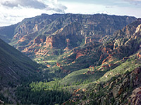 Length 2.5 miles (4 km) Elevation change 2000 feet (610 meters) Difficulty Moderate to strenuous - rather steep Rating (1-5) ★★★★★ This short but very steep trail ascends the west side of Oak Creek Canyon, leading to the East Pocket Knob look-out tower on a wooded plateau at 7,200 feet, a site which may also be accessed from the top of the plateau by a long drive on forest road 231. Excellent views down the canyon and across to Verde Valley. |
2. Airport Loop, Sedona Length 3.2 miles (5.1 km); or 4.2 miles including the Table Top spur Elevation change 150 feet (46 meters) Difficulty Easy Rating (1-5) ★★★★★ Mostly shadeless loop path that circles the flat summit of Table Top Mountain, site of Sedona Airport; a little way below the rim, with spectacular, ever-changing views of the city and its red rock surroundings |
3. Allens Bend Trail, Sedona Length 0.5 miles (0.8 km) Elevation change 0 feet (0 meters) Difficulty Easy Rating (1-5) ★★★★★ This is one of the few trails right beside Oak Creek, a short path that links the Grasshopper Point picnic area (2 miles north of Sedona on AZ 89A) with the trailhead for Casner Canyon, passing by nice red rocks of the Supai formation on one side and the fast flowing waters of the creek close by on the other, though mostly obscured by trees. |
4. Antelope Canyon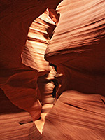 Length 0.1 miles (0.2 km) Elevation change 0 feet (0 meters) Difficulty Easy Rating (1-5) ★★★★★ Beautiful but commercialized slot canyon, visited by hundreds of people on a typical day in summer. Two sections are open to visitors; the 600 foot long upper narrows, south of AZ 98, and the deeper lower narrows to the north. Years ago visitors could walk the 2 miles to the upper slot but now all must be driven. |
5. Arizona Hot Springs, Lake Mead National Recreation Area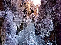 Length 3.1 miles (5 km) Elevation change 760 feet (232 meters) Difficulty Easy to moderate; just a little scrambling near the end Rating (1-5) ★★★★★ Warm springs in a short, unusually colorful slot canyon bordering Lake Mohave along the Colorado River, reached by the White Rock Canyon Trail starting from US 93. This meets the lake after following a deepening, quite narrow ravine through dark volcanic rocks. The canyon also contains cascades and a 20 foot waterfall, climbed using a metal ladder |
6. Atoko Point, Grand Canyon National Park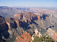 Length 1.4 miles (2.3 km) Elevation change 220 feet (67 meters) Difficulty Easy Rating (1-5) ★★★★★ Off-trail walk through thin woodland close to the rim of a little-visited part of the Grand Canyon, ending at a narrow promontory. Views are of the canyon around the junction with the Little Colorado River, backed by the unbroken flat expanse of the Painted Desert and the Navajo Indian Reservation. |
7. Badger Canyon, Lees Ferry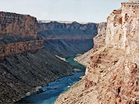 Length 2.2 miles (3.5 km) Elevation change 250 feet (76 meters) Difficulty Moderate, if exploring the canyon; easy if just walking at rim level Rating (1-5) ★★★★★ Off trail hike a little way down a narrow Colorado River tributary, as far as an impassable pour-off, followed by a level walk along the canyon rim to a viewpoint of the river, at the start of the Grand Canyon. |
8. Bear Mountain Trail, Sedona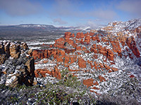 Length 2.4 miles (3.9 km) Elevation change 1800 feet (549 meters) Difficulty Moderate to strenuous Rating (1-5) ★★★★★ The relatively short but quite challenging hike to the top of Bear Mountain is one of many paths reached along Dry Creek Road (FR 152) and later Boynton Pass Road, starting from AZ 89A 3.2 miles west of the AZ 179 junction. The narrow, steep, sometimes rocky trail climbs up the side of the mountain and has ever improving, panoramic views, especially to the south. |
9. Birthing Cave, Sedona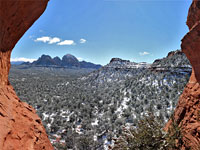 Length 0.9 miles (1.4 km) Elevation change 250 feet (76 meters) Difficulty Easy Rating (1-5) ★★★★★ Photogenic alcove in the Schnebly Hill sandstone at the edge of Mescal Mountain, reached by a path across level, bushy terrain, followed by a short, steep ascent |
10. Black Canyon, Black Canyon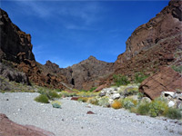 Length 2.9 miles (4.7 km) Elevation change 360 feet (110 meters) Difficulty Easy Rating (1-5) ★★★★★ Riparian desert drainage, a tributary of Burro Creek, that for 2 miles is lined by rugged cliffs of dark-colored lava. Easily accessed from US 93 |
11. Bonelli Spring Route, Vermilion Cliffs National Monument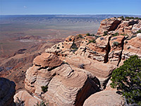 Length 3.2 miles (5.1 km) Elevation change 1840 feet (561 meters) Difficulty Moderate to strenuous Rating (1-5) ★★★★★ Cross-country route from House Rock Valley to the top of the Vermilion Cliffs, via a historic spring - across flat land for 1.5 miles then over steepening, sandy hills, up alongside cliffs and through a narrow gully to the plateau rim. |
12. Boynton Canyon Trail, Sedona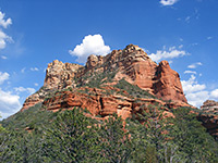 Length 3 miles (4.8 km) Elevation change 500 feet (152 meters) Difficulty Easy to moderate Rating (1-5) ★★★★★ The hike along red walled Boynton Canyon is very popular - it is easily reached by the paved Dry Creek Road, and has no difficult spots or steep climbs apart from a short uphill section at the very end, to a viewpoint with high red cliffs on three sides. The main path is 3 miles long, but the canyon has several branches and all day could be spent exploring it. |
13. Bridge Canyon, Grand Canyon National Park Length 5 miles (8 km); to the junction on the ridge; another 4.5 miles to the Colorado Elevation change 800 feet (244 meters) Difficulty Long but easy going to the ridge and viewpoint; difficult down to the Colorado Rating (1-5) ★★★★★ Very remote route, partly along a disused vehicle track, down a wide valley and up a ridge into a Grand Canyon tributary. |
14. Bright Angel Point Trail, Grand Canyon National Park Length 0.4 miles (0.6 km) Elevation change 100 feet (30 meters) Difficulty Easy Rating (1-5) ★★★★★ Starting beside the historic Bright Angel Lodge, a paved trail descends a short distance to the southern tip of a narrow promontory for excellent views over the Grand Canyon, from The Transept in the west to Bright Angel Canyon in the east. Every visitor to the north rim walks the path at least once. |
15. Bright Angel Trail, Grand Canyon National Park Length 9.5 miles (15.3 km); to Phantom Ranch Elevation change 4550 feet (1387 meters) Difficulty Long, steep and strenuous, though drinking water is available along the way Rating (1-5) ★★★★★ Bright Angel is a long, steep trail leading to the Colorado River and Phantom Ranch, but the path is well-used, with water at intervals and one campsite (plus ranger station) half way along, at Indian Garden (4.6 miles). This is the most popular of the longer trails in the park, though most people walk only a short distance. |
16. Brins Mesa Trail, Sedona Length 3.8 miles (6.1 km) Elevation change 600 feet (183 meters) Difficulty Easy to moderate Rating (1-5) ★★★★★ This easy trail climbs up a shallow canyon to the flat-topped Brins Mesa, a spur of Wilson Mountain, then continues down the far side. All of the trail has expansive views in most directions. It has two trailheads - south access is at the end of Jordan Road, starting from Highway 89A just north of the AZ 179 junction, while the north access is 3 miles along the unpaved section of Dry Creek Road. |
17. Broken Arrow Trail, Sedona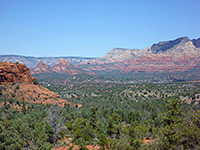 Length 1.5 miles (2.4 km) Elevation change 300 feet (91 meters) Difficulty Easy Rating (1-5) ★★★★★ The Broken Arrow Trail offers a quick route into red rock landscape, starting at the end of Morgan Road, which meets AZ 179 one mile south of the AZ 89A junction. The path is easy and well used, and climbs gradually to a slickrock pass between two high buttes (Chicken Point), giving good, elevated views over the surroundings. The Little Horse trail continues from here, providing an alternative route back to the highway. |
18. Cape Final Trail, Grand Canyon National Park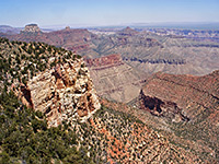 Length 2 miles (3.2 km) Elevation change 150 feet (46 meters) Difficulty Easy Rating (1-5) ★★★★★ A long disused vehicle track provides an easy route across the edge of the Walhalla Plateau to the easternmost viewpoint on the North Rim, 7,916 foot Cape Final, which overlooks a vast area of lesser-known formations centered around Chuar Valley and Unkar Creek. The trail begins at a clearing in the tall pine woods, 2.5 miles before the end of the paved the road to Cape Royal. |
19. Cape Royal Trail, Grand Canyon National Park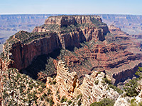 Length 0.3 miles (0.5 km) Elevation change 40 feet (12 meters) Difficulty Easy Rating (1-5) ★★★★★ Competing with Cape Final to be the best North Rim viewpoint, Cape Royal is reached by an easy, paved, wheelchair-accessible footpath starting right at the end of the paved side road across the Walhalla Plateau. En route is Angels Window, an oft-photographed natural arch in the Kaibab limestone. |
20. Casner Canyon Trail, Sedona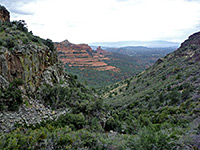 Length 2.6 miles (4.2 km) Elevation change 1500 feet (457 meters) Difficulty Moderate Rating (1-5) ★★★★★ There are only three trails on the east side of Oak Creek Canyon, where the cliffs are more sheer than on the west side - one is along Casner Canyon, at first following close to the streambed then climbing steadily up the side of the ravine, right to the forested plateau. A short walk through the woodland reaches the Schnebly Hill Road. There is limited parking at the trailhead, or more space at Grasshopper Point picnic area, which is linked to Casner Canyon by the Allen's Bend trail. |
21. Cathedral Rock Trail, Sedona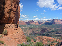 Length 0.7 miles (1.1 km) Elevation change 600 feet (183 meters) Difficulty Easy to moderate; rather steep, and exposed, so very hot in summer Rating (1-5) ★★★★★ This short hike leads to the base of one of Sedona's most famous red rock buttes, starting from the Back of Beyond Road on the west side of AZ 179, 3.4 miles south of the AZ 89A junction. The popular path climbs a steep slickrock hillside and has spectacular views all around. |
22. Cathedral Wash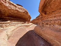 Length 1.5 miles (2.4 km) Elevation change 300 feet (91 meters) Difficulty Easy - only a few small obstructions Rating (1-5) ★★★★★ Short, curving tributary of Marble Canyon, 4 miles south of Lees Ferry. Photogenic narrow passageways through potmarked, multilayered rocks. |
23. Cedar Mountain Trail, Grand Canyon National Park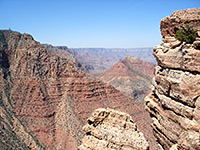 Length 1.7 miles (2.7 km); to the canyon viewpoints Elevation change 630 feet (192 meters) Difficulty Easy; small descent but mostly along the level canyon rim Rating (1-5) ★★★★★ Flat-topped Cedar Mountain is clearly visible looking east from Desert View, and may be reached by a 4WD track that continues for many miles across rough lands towards the canyon of the Little Colorado River. The first couple of miles makes for a good day hike, giving good views of Tanner Canyon and the Colorado River, while the road is also used to reach the trailhead for the 13 mile hike to Cape Solitude. |
24. Cliff Spring Trail, Grand Canyon National Park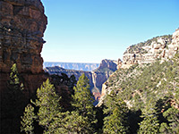 Length 0.5 miles (0.8 km) Elevation change 150 feet (46 meters) Difficulty Easy Rating (1-5) ★★★★★ This short path descends a wooded ravine, past a small Anasazi ruin and along the side of a deepening canyon to an elongated dripping spring, where water seeps from the rocks above and supports hanging gardens of ferns and moss. The trailhead is along the main road half a mile before Cape Royal. The spring is not particularly special but the view down the canyon is quite nice. |
25. Comanche Point, Grand Canyon National Park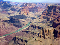 Length 6.2 miles (10 km) Elevation change 670 feet (204 meters) Difficulty Moderate; long, but somewhat difficult only towards the end, for the off-trail section Rating (1-5) ★★★★★ Remote, rarely traveled route, mostly along a disused 4WD track, to a trailless overlook on the east side of the Grand Canyon, in the middle of the Palisades of the Desert. Clear views of nine miles of the Colorado River. |
26. Cookstove and Harding Springs Trails, Sedona, Sedona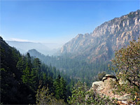 Length 2.6 miles (4.2 km); round trip Elevation change 800 feet (244 meters) Difficulty Moderate - steep in places Rating (1-5) ★★★★★ Two short but steep and little-used routes to the eastern rim of Oak Creek Canyon, near its northern end, linked by a path alongside a wooded section of the creek; good views from the top, and an interesting variety of plant species |
27. Cottonwood Wash, Lake Mead National Recreation Area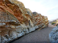 Length 1.8 miles (2.9 km); to the confluence of two upper tributaries Elevation change 350 feet (107 meters) Difficulty Easy Rating (1-5) ★★★★★ Shallow drainage through a geologically-varied area near the north shore of Lake Mead; rocks of many colors and forms, including some short sections of narrows |
28. Courthouse Butte Trail, Sedona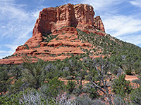 Length 3.4 miles (5.5 km); loop Elevation change 200 feet (61 meters) Difficulty Easy Rating (1-5) ★★★★★ Loop around the famous Sedona landmarks of Bell Rock and Courthouse Butte. The rock is very busy but not so many people walk all around the butte, along a sometimes rocky path that gives ever-changing views of the red rock surroundings, and in spring encounters many wildflower species. |
29. Crescent Moon Ranch and Red Rock Crossing, Sedona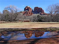 Length 0.5 miles (0.8 km) Elevation change 0 feet (0 meters) Difficulty Easy Rating (1-5) ★★★★★ Easy path beside Oak Creek, across meadows and through cottonwood groves, past red rocks, old buildings, and reflective pools, plus views of Cathedral Rock |
30. Devils Bridge Trail, Sedona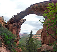 Length 1.9 miles (3.1 km) Elevation change 300 feet (91 meters) Difficulty Easy, though steep towards the end Rating (1-5) ★★★★★ The bridge is actually a large natural arch in the red Supai sandstone cliffs on the north side of Capitol Butte, and reached by a short hike from Dry Creek Road (FR 152). The best views are obtained from the top of the bridge, which overlooks a large area of canyons and mesas in the Red Rock Secret Mountain Wilderness. |
31. Doe Mountain Trail, Sedona Length 0.7 miles (1.1 km) Elevation change 400 feet (122 meters) Difficulty Easy Rating (1-5) ★★★★★ Doe Mountain is an isolated, 450 foot high mesa with a perfectly flat top. The trailhead is the same as for the Bear Mountain Trail, and although the path ascends quickly to the summit in less than a mile, it is worth walking all around the edge (about another mile), to see views in all directions, including higher mountains in the north, Capitol Butte and downtown Sedona to the south, and the Verde Valley to the west. |
32. Doney Mountain Trail, Wupatki National Monument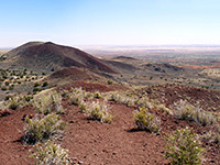 Length 0.5 miles (0.8 km) Elevation change 210 feet (64 meters) Difficulty Easy Rating (1-5) ★★★★★ All paths to ruins in Wupatki NM are very short; the only slightly longer trail in the area (just south of the monument) is to a secondary summit on the south side of Doney Mountain, an extinct volcano whose rounded slopes are composed of red and black ash. The views from the summit are excellent, and include the San Francisco Peaks, the Painted Desert and the Little Colorado River valley. |
33. Dripping Spring Trail, Grand Canyon National Park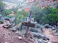 Length 3.1 miles (5 km) Elevation change 1400 feet (427 meters) Difficulty Moderate; first part of trail is steep, and hot in summer Rating (1-5) ★★★★★ At Dripping Spring, water drips slowly from a huge overhanging sandstone cliff at the head of a side canyon. The path to the spring combines the first 1.6 miles of the Hermit Trail with a mostly level traverse around the two very deep upper forks of Hermit Creek, and then a short way up the side valley. Past the falls, a fainter path continues back up the cliffs to a little-used trailhead on the rim. |
34. Fall Creek and the Echo Pass Trail, Glen Canyon National Recreation Area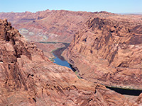 Length 11 miles (17.7 km); round trip Elevation change 1150 feet (351 meters) Difficulty Moderate; route is exposed, and navigation is sometimes difficult Rating (1-5) ★★★★★ Fall Creek is a rarely explored tributary of Glen Canyon on the Navajo Reservation, containing some shallow narrows, and ending with a dramatic pour-off (Echo Peaks Fall). The drainage links with the disused Echo Pass Trail that climbs to a saddle in the Echo Peaks, high above Marble Canyon on the Colorado River. Navajo permit required. |
35. Fay Canyon Trail, Sedona Length 1 mile (1.6 km) Elevation change 250 feet (76 meters) Difficulty Easy Rating (1-5) ★★★★★ Fay is a short red rock box canyon containing a natural arch, a seasonal stream, and a collection of desert plants typical of the lower elevations around Sedona. The trailhead is along Dry Creek Road then Boynton Pass Road. |
36. Ferry Swale Canyon, Glen Canyon National Recreation Area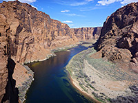 Length 4.6 miles (7.4 km); to the end of the canyon Elevation change 500 feet (152 meters) Difficulty Moderate; route is exposed, and most is over soft sand Rating (1-5) ★★★★★ Red-walled, west-side tributary of the intact section of Glen Canyon (below the dam); forms a short narrows section at the lower end, and gives a fine view of the Colorado River. |
37. Goldstrike Canyon, Lake Mead National Recreation Area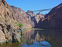 Length 2.5 miles (4 km) Elevation change 940 feet (287 meters) Difficulty Moderate to strenuous; requires scrambling and climbing up/down obstacles Rating (1-5) ★★★★★ Deep, twisting ravine that meets the Colorado River (Lake Mohave) one mile below the Hoover Dam, containing various pools, waterfalls and hot springs, and also many obstructions formed by chutes and boulders. Short ropes are installed in at least five places. |
38. Grandview Trail, Grand Canyon National Park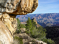 Length 3 miles (4.8 km); to Horseshoe Mesa Elevation change 2500 feet (762 meters) Difficulty Strenuous; no water sources along the trail Rating (1-5) ★★★★★ This path starts at Grandview Point, descends very steeply, follows a ridge then drops quite sharply again down to Horseshoe Mesa, which has excellent views up and down the Grand Canyon, and is the site of some old copper mines. Grandview Trail then meets the Tonto Trail, allowing for continuation hikes east or west, though unlike most long-distance routes that descend from the South Rim, the Grandview Trail does not reach the Colorado River. |
39. Granite Mountain Trail, Granite Mountain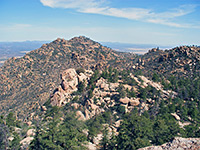 Length 4 miles (6.4 km) Elevation change 1600 feet (488 meters) Difficulty Moderate to strenuous Rating (1-5) ★★★★★ Granite Mountain is a prominent peak covered by granite cliffs and boulders, at the center of a large wilderness area northwest of Prescott; the summit is within range of an enjoyable day hike that follows a wash, ascends steeply via many switchbacks then traverses back south to a viewpoint. |
40. Grapevine Canyon, Lake Mead National Recreation Area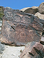 Length 0.3 miles (0.5 km); to the petroglyphs - canyon continues Elevation change 50 feet (15 meters) Difficulty Easy to the petroglyphs; moderate beyond Rating (1-5) ★★★★★ Relatively shallow ravine through the Newberry Mountains northwest of Laughlin, containing springs and a small (seasonal) stream, which sustains varied, riparian vegetation. Rocks around the mouth of the canyon are adorned with numerous petroglyphs. |
41. Hance Creek, Grand Canyon National Park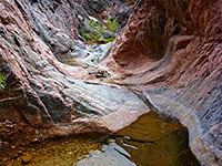 Length 8.5 miles (13.7 km) Elevation change 4860 feet (1481 meters) Difficulty Strenuous; three obstacles require climbing high above the canyon floor, traversing steep and unstable slopes Rating (1-5) ★★★★★ Rarely traveled, off-trail route to the Colorado River down a narrow, twisting canyon containing a permanent stream, which forms many pools, cascades and waterfalls. Accessed by the Grandview Trail and a short section of the Tonto Trail. |
42. Havasu Canyon, Grand Canyon National Park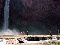 Length 10.5 miles (16.9 km); to Mooney Falls Elevation change 3600 feet (1097 meters) Difficulty Moderate to strenuous - steep only at the beginning, easier thereafter, but very long, for a day hike Rating (1-5) ★★★★★ In the remote Havasupai Indian Reservation, this famous trail descends Hualapai and Havasu Canyons to the Colorado River, past Supai village, Havasu Falls, Mooney Falls and many other beautiful cascades and waterfalls. Many people camp for at least one night, but day trips are possible, Mooney Falls being the usual turn-around point. The route starts in a wide, exposed canyon but the cliffs soon close in and most of the remainder is confined. |
43. Hermit Trail, Grand Canyon National Park Length 9 miles (14.5 km) Elevation change 4340 feet (1323 meters) Difficulty Strenuous and steep in places, but drinking water is available at 2 locations (needs treatment) Rating (1-5) ★★★★★ A mostly unmaintained but popular hike from Hermits Rest at the end of the West Rim Drive, the Hermit Trail winds steeply down the cliffs on the east side of Hermit Creek, then, after a short section of the Tonto Trail, continues descending to the Colorado. The round trip can be done by experienced hikers in one long day, but for overnight trips, backcountry camping is available either beside the Colorado or at the Hermit Creek campsite, about 1.5 miles from the river. |
44. Hindu Canyon Length 6 miles (9.7 km); from the trailhead to the drop off at the end of the narrows Elevation change 1200 feet (366 meters) Difficulty Easy, though long Rating (1-5) ★★★★★ A wide, shallow, grassy drainage that eventually forms a short slot, through thin-layered, light-colored rocks stained black in places - an unusual and scenic narrows section. Located in a very remote area of the Hualapai Reservation, an area that may currently be closed to hiking. |
45. Honan Point, Grand Canyon National Park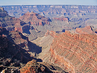 Length 2 miles (3.2 km) Elevation change 350 feet (107 meters) Difficulty Easy, but route-finding necessary Rating (1-5) ★★★★★ Honan Point is the easiest reached of five named promontories at the edge of the Walhalla Plateau on the North Rim of the Grand Canyon; a cross-country, off trail hike mostly through open woodland, ending by crossing a limestone plateau to the viewpoint. The edge of the plateau is formed of flat blocks of white Kaibab limestone beyond which the land falls away vertically, without any vegetation to block the amazing views over a huge area of the canyon. |
46. Horseshoe Bend, Glen Canyon National Recreation Area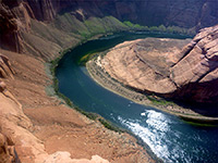 Length 0.5 miles (0.8 km) Elevation change 150 feet (46 meters) Difficulty Easy Rating (1-5) ★★★★★ Horseshoe Bend, one of the most photographed places in Arizona, is a deeply entrenched meander of the Colorado River, part of the short section of Glen Canyon that remains intact; most is submerged beneath Lake Powell. The popular trail to the overlook climbs slightly to a low summit then crosses a mix of slickrock and dunes to the canyon rim, 1,100 feet above the river. |
47. Humphreys Peak Trail, San Francisco Peaks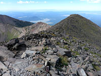 Length 4.8 miles (7.7 km) Elevation change 3360 feet (1024 meters) Difficulty Moderate - steep at times, but relatively short Rating (1-5) ★★★★★ Well-used path to a 12,633 foot summit, the highest point in Arizona; across a floral meadow, up through extensive pine woods, then along a narrow, rocky ridge above the treeline |
48. Island Trail, Walnut Canyon National Monument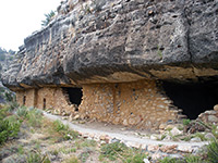 Length 0.9 miles (1.4 km); (loop) Elevation change 185 feet (56 meters) Difficulty Relatively easy, though with a short, steep descent/ascent Rating (1-5) ★★★★★ The better and more popular of the 2 trails in Walnut Canyon NM descends steeply via a series of 240 steps, then circles the 'island', a narrow promontory containing the main group of Anasazi ruins; the path passes alongside the remains of about 20 separate dwellings, a few of which are quite intact. |
49. Jackass Creek Length 2.4 miles (3.9 km); to the Colorado River Elevation change 800 feet (244 meters) Difficulty Easy, apart from a steep 30 foot drop for which a rope may be needed Rating (1-5) ★★★★★ East-side Colorado tributary with two main forks, both quite narrow in places and containing shallow pools after rains. The lower gorge deepens considerably, becoming partly overgrown and filled with large boulders. Navajo hiking permit required. |
50. Jacob Pools Trail, Vermilion Cliffs National Monument Length 1.6 miles (2.6 km) Elevation change 1600 feet (488 meters) Difficulty Moderate; steep, but relatively short Rating (1-5) ★★★★★ Very few routes ascend the spectacular Vermilion Cliffs, the 2,000 foot high escarpment on the west side of Marble Canyon that forms the east edge of the large, little-visited Paria Plateau; the main path is the Jacobs Pool Trail, which starts from the remains of an old settlement, switchbacks up the foothills then climbs more steeply, to a short, narrow ravine (Sand Hill Crack) that leads to the plateau. Views from the top encompass countless square miles of the Colorado River valley and the more distant Kaibab Plateau. |
51. James Canyon Length 3.4 miles (5.5 km) Elevation change 750 feet (229 meters) Difficulty Strenuous; wading, route-finding, scrambling Rating (1-5) ★★★★★ Deep, mostly cliff-lined canyon, a tributary of Pumphouse Wash, containing falls, pools and sections of narrows. Most obstacles can be bypassed, otherwise exploration requires swimming and rappelling |
52. Kaiser Spring Canyon, Kaiser Spring Canyon and Burro Creek Length 7 miles (11.3 km); total, for the round trip Elevation change 500 feet (152 meters) Difficulty Moderate Rating (1-5) ★★★★★ A narrow canyon which leads to a wider, deeper gorge containing a warm spring, and then to the permanent stream of Burro Creek, which forms deep pools in springtime. All around are steep, volcanic rocks bearing many cacti. No trail, but easily explored by walking up and down the streambed. |
53. Lava Falls Trail, Grand Canyon National Park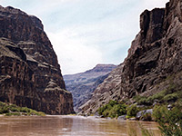 Length 1.5 miles (2.4 km) Elevation change 2540 feet (774 meters) Difficulty Relatively short but very strenuous, owing to the steep gradient and the unstable ground Rating (1-5) ★★★★★ The Lava Falls Trail offers an extremely steep, difficult hike across loose scree and lava blocks, from the rim to the Colorado River. But the route is quite short, and makes an excellent half day hike. The trailhead is located at the end of a rather rough 2 mile track branching off the road to Toroweap overlook - and about 60 miles from a paved highway, along the Mnt Trumbull loop road. |
54. Lava Flow Trail, Sunset Crater Volcano National Monument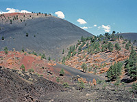 Length 1 mile (1.6 km); (loop) Elevation change 40 feet (12 meters) Difficulty Easy - partly paved Rating (1-5) ★★★★★ The popular Lava Flow Trail loops around volcanic formations at the foot of Sunset Crater, passing features such as an ice cave (a former lava tube), several spatter cones (subsidiary lava vents), lava ravines and examples of the less common pahoenoe lava. A quarter mile section is paved, accessible to wheelchairs. |
55. Lenox Crater Trail, Sunset Crater Volcano National Monument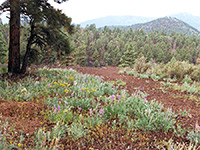 Length 0.5 miles (0.8 km) Elevation change 280 feet (85 meters) Difficulty Easy Rating (1-5) ★★★★★ This trail climbs steeply through pine woods to the top of a small cinder cone, a short distance west of the larger Sunset Crater. From the summit, numerous other cinder cones can be seen in all directions, especially towards the south. |
56. Little Horse Trail, Sedona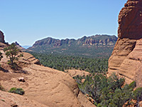 Length 1.5 miles (2.4 km) Elevation change 300 feet (91 meters) Difficulty Easy Rating (1-5) ★★★★★ A gentle route leading through open land towards high red buttes, this trail begins beside AZ 179, 3.6 miles south of the AZ 89A junction, and ends at Chicken Point, where the Broken Arrow trail continues northwards. |
57. Long Canyon, Sedona Length 3.7 miles (6 km); including an unmaintained section at the end Elevation change 1000 feet (305 meters) Difficulty Moderate Rating (1-5) ★★★★★ Long Canyon is a large and increasingly overgrown drainage enclosed by high red and brown cliffs, southeast of Secret Mountain. Not often explored, especially the upper end where the trail steepens, climbing up to a viewpoint above the woodland |
58. Margs Draw Trail, Sedona Length 2 miles (3.2 km) Elevation change 200 feet (61 meters) Difficulty Easy Rating (1-5) ★★★★★ Lesser-used route at the foot of the dramatic red cliffs of Munds Mountain, on the east side of Sedona, crossing sandy flats, patches of trees and several minor drainages; links Schnebly Hill Road with Morgan Road |
59. Meriwhitica Canyon, Grand Canyon National Park Length 5 miles (8 km); to Indian Gardens Elevation change 2150 feet (655 meters) Difficulty Moderate. Drinking water available at Indian Gardens Rating (1-5) ★★★★★ Very little-traveled route along a disused trail down a remote Grand Canyon tributary, to a spring and oasis (Indian Gardens), or all the way to the Colorado River, via Spencer Canyon. |
60. Milkweed Canyon Length 8.5 miles (13.7 km); to the end of the narrowest section Elevation change 1000 feet (305 meters) Difficulty Moderate - steep scrambling in a few places; wading of pools Rating (1-5) ★★★★★ Several short sections of limestone narrows, containing flooded potholes, and later a permanent stream with rather deeper pools. Part of a long, remote Grand Canyon tributary, which is relatively wide for most of its length. Located in the Hualapai Reservation, an area that may currently be closed to hiking. |
61. Mimbreno, Mescalero, Jicarilla and Piute Points, Grand Canyon National Park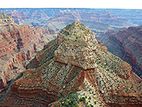 Length 15 miles (24.1 km); loop Elevation change 400 feet (122 meters) Difficulty Moderate; not difficult, but long. Requires cross-country navigation through woodland Rating (1-5) ★★★★★ Four remote promontories along the south rim of the Grand Canyon, west of Hermits Rest, reached by off-trail hiking across the forested plateau, starting from road FR 328. The views include several remote gorges, including the exotically-named Turquoise, Sapphire, Agate and Topaz canyons, many features on the opposite side of the river, and the Colorado itself, which is clearly visible from several locations. |
62. Munds Canyon, Sedona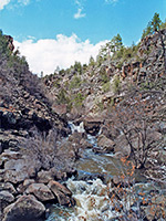 Length 2 miles (3.2 km); or more Elevation change 500 feet (152 meters) Difficulty Moderate Rating (1-5) ★★★★★ Off trail route across a forested plateau and into a boulder-filled, basalt-walled gorge containing a permanent stream. The full length of the canyon is 6 miles but just the upper few miles make a (relatively) good short hike. The lower end of the gorge contains some private land. |
63. Naji Point, Grand Canyon National Park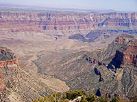 Length 1.4 miles (2.3 km) Elevation change 250 feet (76 meters) Difficulty Easy to moderate Rating (1-5) ★★★★★ Naji is one of the trailless Grand Canyon North Rim viewpoints, but it lies just 1.5 miles from the Cape Royal Road, and is quite easily accessed by walking through the thick pine/fir forest for about 40 minutes. The route is through generally open woodland that in a few places becomes quite overgrown, over several gullies, then up to the narrow promontory at the point. |
64. New Hance Trail, Grand Canyon National Park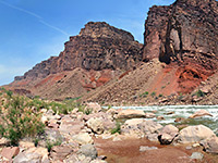 Length 8 miles (12.9 km) Elevation change 4530 feet (1381 meters) Difficulty Strenuous, steep, remote, no water sources along the trail Rating (1-5) ★★★★★ Also known as Red Canyon Trail, this is a lesser used path that starts from an unmarked trailhead on the rim half a mile southwest of Moran Point, and descends gradually down colorful Red Canyon to the Colorado. The route was constructed by a miner (John Hance) in the 1880s, to replace an older trail in this area, down Hance Creek. New Hance is a difficult hike - vying with the Boucher Trail to be the most strenuous on the South Rim - but still one that can be done as a round trip in one day. |
65. North Kaibab Trail, Grand Canyon National Park Length 14 miles (22.5 km) Elevation change 5780 feet (1762 meters) Difficulty Long, steep at the top and strenuous, though water is available en route Rating (1-5) ★★★★★ The relatively popular North Kaibab Trail is a well used route down Bright Angel Canyon to Phantom Ranch and the Colorado River - the only maintained route to the river from the North Rim. For a day hike, one good target is Roaring Springs after 5 miles, while for those making the full trip, the Cottonwood Campground after 7 miles is a good place to break the journey. Water is available at several places en route, though the distance and elevation change still make the journey a difficult undertaking. The 3 mile section to Supai Tunnel is also used by mules. |
66. North Wilson Trail, Sedona Length 2.1 miles (3.4 km) Elevation change 1800 feet (549 meters) Difficulty Strenuous Rating (1-5) ★★★★★ Starting at the Encinoso picnic area on AZ 89A, 2 miles north of Sedona, the North Wilson Trail climbs half way up Wilson Mountain where it links with another trail that leads to the summit, 2 miles further. Not many trails ascend the walls of Oak Creek Canyon, so this is a popular route, despite its strenuous nature. |
67. O'Leary Peak Trail, Sunset Crater Volcano National Monument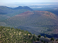 Length 5.1 miles (8.2 km) Elevation change 1980 feet (604 meters) Difficulty Moderate - not too steep, but rather long Rating (1-5) ★★★★★ Forest track that skirts the edge of the Bonito Lava Flow then climbs steeply up partly wooded, partly open slopes to a fire lookout tower on a volcanic summit just north of the national monument. Good views of the San Francisco Peaks and other mountains. |
68. Papago Point, Grand Canyon National Park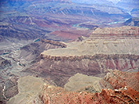 Length 1.1 miles (1.8 km) Elevation change 100 feet (30 meters) Difficulty Easy Rating (1-5) ★★★★★ Papago Point (also known as Hollenback Point) is a narrow promontory along the South Rim of the Grand Canyon, at the edge of a projecting section of the plateau one mile from the park road. There is no trail to the overlook, but it may be reached by walking cross-country through pine woodland, up a gentle gradient. Papago Point ends with two semi-detached rocks, gradually being eroded away from the main rim, and for the best views it is worth climbing to the top of the furthest one. |
69. Parsons Trail, Sycamore Canyon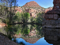 Length 3.7 miles (6 km); to the spring Elevation change 200 feet (61 meters) Difficulty Easy to moderate - mostly level, with several stream crossings Rating (1-5) ★★★★★ Well maintained trail along the riparian lower end of Sycamore Canyon, beside a permanent creek that forms many large pools, beneath sheer, red rock cliffs. The path ends at Parsons Spring, the source of the water, though the usually dry canyon can be followed further upstream |
70. Pinal Point, Grand Canyon National Park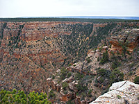 Length 1 mile (1.6 km) Elevation change 80 feet (24 meters) Difficulty Easy. Route finding needed Rating (1-5) ★★★★★ Like nearby Papago Point, Pinal is an unmarked, trailless overlook along the South Rim of the Grand Canyon, at the northeast corner of a square promontory west of the better-known Lipan Point. It can be reached by a cross-country hike either along the east edge of the plateau, or all through woodland. |
71. Plateau Point Trail, Grand Canyon National Park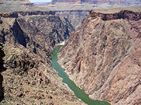 Length 1.5 miles (2.4 km) Elevation change 80 feet (24 meters) Difficulty Easy, though the approach is quite strenuous Rating (1-5) ★★★★★ Forking off the Bright Angel Trail at the north side of Indian Garden, this nearly level route crosses the Tonto Bench to a viewpoint at the edge of the inner canyon gorge, 1,300 feet above the Colorado River. The point is 6.3 miles from the Bright Angel trailhead, and so reachable on a day hike. |
72. Point Imperial Trail, Grand Canyon National Park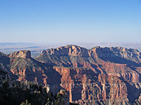 Length 2 miles (3.2 km) Elevation change 0 feet (0 meters) Difficulty Easy Rating (1-5) ★★★★★ From the end of the paved road to the highest overlook on the North Rim, 8,803 foot Point Imperial, this easy, level trail follows an old track (closed to private vehicles) northwards to the park boundary, where it meets the end of forest road 610, and the start of the Nankoweap Trail. Most of the 2 mile route is close to the plateau edge, and has fine views over upper Nankoweap Creek. |
73. Pumphouse Wash Length 2.9 miles (4.7 km); to the large pool Elevation change 450 feet (137 meters) Difficulty Relatively easy Rating (1-5) ★★★★★ Scenic narrows, cascades, pools and extensive flooded slot-like channels along an upper tributary of Oak Creek, all enclosed by high, cream-colored Coconino sandstone. The hike involves hopping over boulders, wading a few pools and walking on benches to avoid some of the deeper channels. |
74. Red Mountain, Red Mountain Length 1.5 miles (2.4 km) Elevation change 300 feet (91 meters) Difficulty Easy Rating (1-5) ★★★★★ Part of the San Francisco Volcanic Field; a 1,000 foot high cinder cone, the northeast side of which has been eroded to form a natural amphitheater, containing a variety of red and grey formations, reached by an easy 1.5 mile trail. |
75. Rim Trail, Walnut Canyon National Monument Length 0.7 miles (1.1 km) Elevation change 0 feet (0 meters) Difficulty Easy Rating (1-5) ★★★★★ This path traverses flat land along the rim of Walnut Canyon and ends at a viewpoint on the edge, from where the island (location of the cliff dwellings) can be seen to the west. A branch of the path passes a few scattered ruins including a restored pit house, protected beneath an oversized wooden canopy, and the walls from a two-room pueblo dwelling. |
76. Salt Trail, Little Colorado River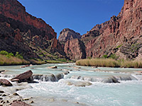 Length 3 miles (4.8 km) Elevation change 2740 feet (835 meters) Difficulty Steep and strenuous Rating (1-5) ★★★★★ Ancient Hopi route that descends a rugged, remote side canyon to the beautiful lower gorge of the Little Colorado River, filled with brilliant turquoise water. The contrast between the deep red rocks, the bright green vegetation and the aquamarine waters make the lower canyon exceptionally beautiful, and a trip here is one of the highlights of the Southwest. |
77. Schuerman Mountain Trail, Sedona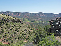 Length 2.2 miles (3.5 km); between the trailheads Elevation change 360 feet (110 meters) Difficulty Easy Rating (1-5) ★★★★★ At 4,899 feet, Scheurman Mountain is one of Sedona's lesser summits but the short trail to the top still gives nice views over the town, and the Oak Creek valley in Red Rock State Park to the south. The trailhead is along the top part of the Red Rock Loop road, and this meets AZ 89A 4 miles west of the junction with AZ 179. A longer trail continues past the summit and joins the south part of the loop road. |
78. Secret Canyon Trail, Sedona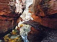 Length 4.4 miles (7.1 km) Elevation change 800 feet (244 meters) Difficulty Moderate Rating (1-5) ★★★★★ Rewarding hike along one of Sedona's longer canyons, the upper stretches of which are wooded, quite enclosed, and contain a permanent stream flowing through pools, cascades and short narrows sections. Continuation hikes are possible further up the canyon, beyond the end of the official trail |
79. Shoshone Point Trail, Grand Canyon National Park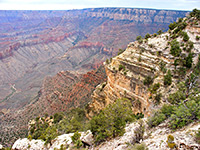 Length 1 mile (1.6 km) Elevation change 0 feet (0 meters) Difficulty Easy - short, level and shaded Rating (1-5) ★★★★★ One of the least-visited of the named overlooks of the South Rim, Shoshone Point may be reached by an unpaved forest road though vehicular access requires special permission from the NPS. The road is open without restrictions for hikers, who reach the rim after a gentle 20 minute stroll through airy woodland of ponderosa pines. At road's end, the cliffs form a narrow promontory, jutting out from the plateau, and affording views of more than 180° of the Grand Canyon |
80. Soap Creek, Lees Ferry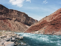 Length 4.1 miles (6.6 km) Elevation change 1250 feet (381 meters) Difficulty Moderate Rating (1-5) ★★★★★ This Colorado tributary meets the river beside an impressive series of rapids, and may be explored by mostly easy hike along the streambed, with just one significant obstacle, a 25 foot drop over a dryfall, which may be bypassed or climbed. The drainage is not very narrow but quite scenic. |
81. Soldier Pass Trail, Sedona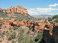 Length 2 miles (3.2 km) Elevation change 450 feet (137 meters) Difficulty Easy Rating (1-5) ★★★★★ An easy route up to Brins Mesa via the wooded canyon of Soldier Creek, this path enters the wilderness area near the end, and links with the Brins Mesa Trail. |
82. South Coyote Buttes, Coyote Buttes Length 5 miles (8 km); round trip, to see all areas Elevation change 200 feet (61 meters) Difficulty Easy to moderate Rating (1-5) ★★★★★ Extensive formations in the southern section of Coyote Buttes, centered on Cottonwood Cove, a sandy valley on the east side of the main ridge. Reached by sandy tracks that generally need a 4WD vehicle, and explored by relatively easy cross-country hiking, over slickrock and dunes. |
83. South Kaibab Trail, Grand Canyon National Park Length 6.5 miles (10.5 km) Elevation change 4820 feet (1469 meters) Difficulty Steep, strenuous and lacking any water sources, though there are restrooms and an emergency phone along the way Rating (1-5) ★★★★★ Another busy but strenuous rim to river route, with no water along the way, the South Kaibab Trail runs for much of its length along a narrow ridge, so views in all directions are quite unobstructed. This is the best (and shortest) trail for an all day, round trip hike to the Colorado River - but for fit hikers only; it involves the greatest elevation change of any south rim route. The path begins near Yaki Point, a location only reachable by the park shuttlebus. |
84. Spencer Trail, Lees Ferry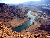 Length 2.1 miles (3.4 km) Elevation change 1600 feet (488 meters) Difficulty Fairly strenuous; route is exposed and rocky Rating (1-5) ★★★★★ Relatively short but steep path that climbs the red Kayenta and Navajo sandstone cliffs forming the lower end of Glen Canyon, just north of Lees Ferry; long distance views up and down the Colorado River. All this region is within Glen Canyon National Recreation Area. |
85. Spooky Canyon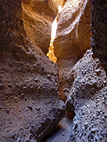 Length 0.9 miles (1.4 km) Elevation change 50 feet (15 meters) Difficulty Easy - no major obstructions Rating (1-5) ★★★★★ Minor drainage through the conglomerate hills bordering US 93, on the east side of Lake Mohave; contains a third of a mile of pretty passageways, with overhanging rocks in some sections, and a natural bridge. |
86. Stateline Canyon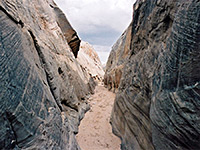 Length 2 miles (3.2 km); to the high water mark of Lake Powell Elevation change 300 feet (91 meters) Difficulty Easy. One dryfall to bypass Rating (1-5) ★★★★★ Short, shallow but quite photogenic and easily explored slot canyon, reached by a short walk from US 89, and ending at Lake Powell. |
87. Sterling Pass Trail, Sedona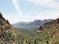 Length 2.4 miles (3.9 km) Elevation change 1100 feet (335 meters) Difficulty Moderate Rating (1-5) ★★★★★ The Sterling Pass route leads steeply up the side of Oak Creek Canyon and over a ridge into the upper end of Sterling Canyon, then descends this ravine as far as an overlook of Vultee Arch. From here, the Vultee Arch Trail continues downstream, linking with FR 152. |
88. Stud Horse Point , Glen Canyon National Recreation Area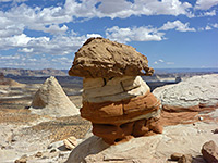 Length 5 miles (8 km); round trip Elevation change 600 feet (183 meters) Difficulty Easy to moderate; some route finding up and down the cliffs Rating (1-5) ★★★★★ Cliff-lined mesa overlooking the west end of Lake Powell, with hoodoos and other eroded rock formations along the rim, and short slot canyons at the base. Explorable by off-trail hiking. |
89. Sycamore Canyon Overlook Trail, Sycamore Canyon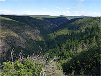 Length 1.8 miles (2.9 km) Elevation change 100 feet (30 meters) Difficulty Easy Rating (1-5) ★★★★★ Lightly-used route that follows part of the shoreline of White Horse Lake then crosses open pine woodland to a viewpoint on the rim of Sycamore Canyon, on a promontory separating the main drainage from a short side ravine |
90. Sycamore Falls Loop, Sycamore Canyon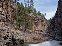 Length 2 miles (3.2 km); round trip Elevation change 400 feet (122 meters) Difficulty Strenuous - climbing, scrambling Rating (1-5) ★★★★★ Off-trail loop along the upper end of the west fork of Sycamore Canyon, also passing a crater on the rim. Descending via a steep, bouldery side drainage and climbing up the north fork of Sycamore Falls |
91. Sycamore Rim Trail, Sycamore Canyon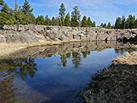 Length 11 miles (17.7 km); round trip Elevation change 800 feet (244 meters) Difficulty Moderate - no great difficulties, but relatively long Rating (1-5) ★★★★★ Loop across the upper reaches of Sycamore Canyon, starting at the dramatic drop-offs of Sycamore Falls (Paradise Forks); also including the deep, basalt pools of Pomeroy Tanks, and the wooded summit of KA Hill. About half is along the rims of the two upper forks of the canyon, the remainder through wooded terrain |
92. Tanner Trail, Grand Canyon National Park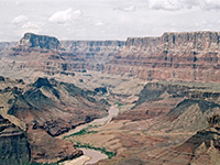 Length 9 miles (14.5 km) Elevation change 4600 feet (1402 meters) Difficulty Steep, strenuous and lacking any water sources, though the path is in good condition and easy to follow Rating (1-5) ★★★★★ Unmaintained, very steep near the start, and lacking any water, the Tanner Trail starts at Lipan Point, descends a side canyon, passes around two large mesas (Escalante and Cardenas buttes), drops steeply again through the Redwall layer around Tanner Canyon then becomes more moderate, passing through open, undulating land to the Colorado River, joining it opposite Unkar Creek. |
93. Tanner Wash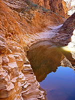 Length 4.4 miles (7.1 km); to the dryfall Elevation change 700 feet (213 meters) Difficulty Easy; no major obstacles before the dryfall, which may be passed by climbing around on the south side Rating (1-5) ★★★★★ Long canyon, at first enclosed but relatively shallow, deepening via unusual staircase-like passages through thin-layered sandstone, followed by a 50 foot dryfall and a much wider lower gorge. Navajo hiking permit required. |
94. The Wave, Coyote Buttes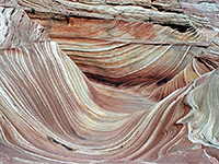 Length 2.5 miles (4 km) Elevation change 200 feet (61 meters) Difficulty Easy to moderate Rating (1-5) ★★★★★ The Wave is a stripy gully between several conical mounds, rivalling Antelope Canyon to be the most photographed feature of south Utah. Access is restricted to 20 people per day, chosen via a permit system. The cairned, cross-country route is mostly over exposed, slickrock slopes. |
95. Thomas Point Trail, Sedona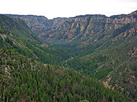 Length 1 mile (1.6 km) Elevation change 900 feet (274 meters) Difficulty Easy to moderate; steep and overgrown in places; hot and exposed in summer Rating (1-5) ★★★★★ This short but steep path climbs the east side of Oak Creek Canyon, initially through pine forest then mostly across open, bushy sandstone slopes with good views up and down the ravine, ending in wooded surrounds once more, on the rim. |
96. Tonto Trail, Grand Canyon National Park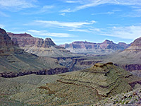 Length 92 miles (148 km) Elevation change feet ( meters) Difficulty Easy, being level overall, but remote and very hot in summer Rating (1-5) ★★★★★ By far the longest trail in Grand Canyon National Park, Tonto begins at the lower end of the New Hance Trail in the east and follows the gorge all the way to Garnet Canyon near Pasture Point in the west, along a bench at a fairly constant elevation of 3,000 feet - mostly over the Tapeats sandstone component of the Tonto group. Few people walk the entire route, but Tonto intersects many other paths allowing for hikes along certain sections; the main junctions are with the South Bass, Boucher, Hermit, Bright Angel, South Kaibab, Grandview and New Hance trails. The Tonto Trail winds in and out of many tributary canyons, and its 92 miles equates to less than 40 miles along the river. |
97. Transept Trail, Grand Canyon National Park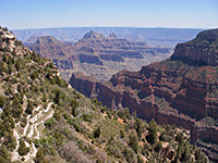 Length 1.5 miles (2.4 km) Elevation change 150 feet (46 meters) Difficulty Easy Rating (1-5) ★★★★★ The Transept is a deep, sheer walled tributary of Bright Angel Canyon, on the west side of Bright Angel Point. A short trail follows the rim between the North Rim campground and Bright Angel Lodge, staying right by the edge apart from where it bends inwards to curve around several small ravines. The path is always quite busy owing to the large number of people visiting this area. A 3 mile loop hike is possible via the Bridle Trail, which parallels the main road and links the same two points, continuing a little way beyond to the North Kaibab trailhead. |
98. Uncle Jim Trail, Grand Canyon National Park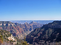 Length 5 miles (8 km); (loop) Elevation change 100 feet (30 meters) Difficulty Easy Rating (1-5) ★★★★★ This loop trail across the forested plateau leads to a viewpoint on the rim that overlooks Roaring Springs Canyon, some of Bright Angel Canyon and the upper part of the North Kaibab Trail. The trailhead for both paths is along the main road 2 miles north of Grand Canyon Lodge. |
99. Vultee Arch Trail, Sedona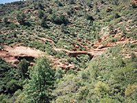 Length 1.6 miles (2.6 km) Elevation change 400 feet (122 meters) Difficulty Easy Rating (1-5) ★★★★★ An easy hike, climbing gently along Sterling Canyon to a viewpoint of a large, graceful sandstone arch, on the far side of a forested ravine - starting from the north end of Dry Creek Road (FR 152). |
100. Water Holes Canyon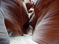 Length 1 mile (1.6 km); lower canyon, to the first rappel point Elevation change 300 feet (91 meters) Difficulty Easy - there are few obstacles in the upper forks. The lower canyon eventually requires rappelling and difficult downclimbing Rating (1-5) ★★★★★ Branched drainage that forms several beautiful sections of slot canyon, separated by wide, sandy washes; short, pretty very narrow slots in the upper forks and a deeper, more extended gorge lower down. Only one section (immediately east of US 89) is currently open to unaccompanied hikers; all other areas are closed, though some parts may be visited on guided tours. |
101. Water Pockets, Vermilion Cliffs National Monument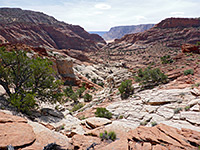 Length 10 miles (16.1 km); round trip Elevation change 1170 feet (357 meters) Difficulty Moderate Rating (1-5) ★★★★★ Remote, rocky drainage containing potholes often filled with water - an east-side tributary of the Paria River, reached by a partly off-trail walk across the sandy plain of Ferry Swale and through undulating land along the main canyon rim. Fine views over the lower Paria canyon. |
102. West Approach to South Coyote Buttes, Coyote Buttes Length 3.5 miles (5.6 km); or less, depending on the route Elevation change 900 feet (274 meters) Difficulty Moderate to strenuous; route finding, scrambling Rating (1-5) ★★★★★ Cross-country routes to South Coyote Buttes from House Rock Valley Road in the west, passing a variety of interesting sites including Top Rock Spring, Cottonwood Cove, stripy badlands, a narrow ravine and a hidden arch. |
103. West Fork of Oak Creek Length 11.7 miles (18.8 km); for the full length Elevation change 1300 feet (396 meters) Difficulty Moderate - pools to wade, boulders and fallen trees to pass Rating (1-5) ★★★★★ Deep, forested canyon with red rock cliffs and other eroded formations, enclosing a permanent stream that forms numerous cascades and pretty pools, explored by a combination of wading pools and walking on benches or slickrock beside the creek |
104. West Fork of Oak Creek Trail, Sedona Length 3.1 miles (5 km) Elevation change 160 feet (49 meters) Difficulty Easy to moderate; 13 creek crossings Rating (1-5) ★★★★★ Perhaps the best hike in the Sedona area, along a deep, narrow, forested canyon with a permanent though usually relatively shallow stream bordered by dramatic red rocks, in places forming photogenic, subway-like channels |
105. White Pocket, Vermilion Cliffs National Monument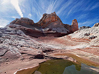 Length 2 miles (3.2 km); round trip Elevation change 200 feet (61 meters) Difficulty Easy Rating (1-5) ★★★★★ Remote region of the Paria Plateau; swirling, multicolored formations of Navajo sandstone, including domes, hoodoos, gullies and potholes. Reached by a long drive on unpaved roads, some requiring a high clearance 4WD vehicle. White, or light grey is the dominant rock color, in contrast to the red of the better-known Coyote Buttes, but the general features are similar - swirling, thin-layered strata, adjacent layers of contrasting color, and curious erosive features. |
106. Widforss Trail, Grand Canyon National Park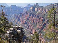 Length 5 miles (8 km) Elevation change 400 feet (122 meters) Difficulty Easy Rating (1-5) ★★★★★ Start point for the Widforss Trail is a short distance along a side road that forks west one mile before the North Rim visitor complex. The trail has two distinct parts; the first few miles stay close to the canyon rim and pass many viewpoints into the depths of The Transept, then the path moves away into the forest, ending at a much more far-reaching viewpoint where many miles of the main Colorado gorge can be seen. |
107. Wilson Canyon Trail, Sedona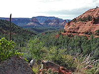 Length 1.2 miles (1.9 km) Elevation change 300 feet (91 meters) Difficulty Easy Rating (1-5) ★★★★★ Popular route into a box canyon; alongside a wooded streamway, past occasional, seasonal pools and small cascades, then up above the trees to a grand viewpoint enclosed by red and white cliffs on three sides. |
108. Wilson Mountain Trail, Sedona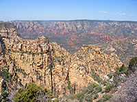 Length 4.5 miles (7.2 km) Elevation change 2450 feet (747 meters) Difficulty Strenuous Rating (1-5) ★★★★★ This is the most strenuous trail in the Sedona area, and with the highest elevation gain, but of course the views at the top of the mountain are excellent. The first 2 miles of the trail is steepest - the remainder is mostly level, as it follows the flat top of Wilson Mountain northwards, ending at a promontory overlooking Sterling Canyon. Starting point is near Midgely Bridge, 2 miles north of the AZ 89A/AZ 179 junction. |
109. Woods Canyon Trail, Sedona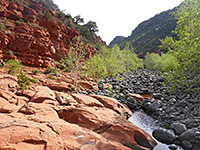 Length 4.9 miles (7.9 km); to the big pool Elevation change 450 feet (137 meters) Difficulty Easy to moderate Rating (1-5) ★★★★★ Easy but relatively long walk up a low elevation canyon containing permanent pools and red rock outcrops - in the Munds Mountain Wilderness south of Sedona. The canyon can be followed beyond the official trail; up to 6 miles further. There are plenty of wildflowers in the canyon, reflecting the varied habitats of meadows, sandy flats, mixed woodland and riparian. |
110. Yuma Point, Grand Canyon National Park Length 6 miles (9.7 km) Elevation change 1,500 feet (457 meters) Difficulty Strenuous Rating (1-5) ★★★★★ Remote viewpoint of the Grand Canyon west of Hermit's Rest, reached by a rather difficult hike of which the last 2 miles is cross-country, off trail, up a rocky ravine and across a lightly wooded plateau. The Colorado River is just two miles distant, closer than at any other point to the east. The first part of the route is along the Dripping Spring Trail, starting with a steep descent into upper Hermit Creek. |
111. Zuni Point, Grand Canyon National Park Length 0.5 miles (0.8 km) Elevation change 20 feet (6 meters) Difficulty Easy Rating (1-5) ★★★★★ Quick, cross-country hike along the edge of the canyon rim through pine woodland to a named overlook, overlooking Papago Creek and Red Canyon. As well as trees the plateau is dotted with various species of cacti, all bearing beautiful flowers in summer |
All Contents © Copyright The American Southwest | Comments and Questions | Contribute | Affiliate Marketing Disclosure | Site Map