The American Southwest
Home | Parks | Trails | Plants | Canyons
Maps | Landscapes | Site Map | Whats New? |
More...
Follow americansouthwest.net on Facebook
×
General Pages
Home
Parks
Trails
Plants
Slot Canyons
Maps
Landscapes
Itineraries
Site Map
What's New?
More pages...

States
Arizona
California
Colorado
Idaho
Nevada
New Mexico
Oregon
Texas
Utah
Wyoming


ARIZONA
CALIFORNIA
COLORADO
IDAHO
NEVADA
NEW MEXICO
OREGON
TEXAS
UTAH
WYOMING
ARIZONA
MAPS | PARKS | TRAILS | HOTELS

Pinal Point, Grand Canyon National Park


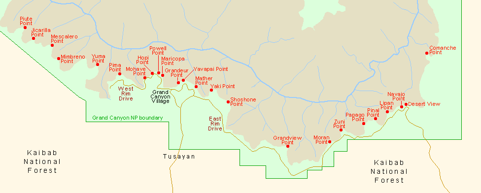
Arizona > Grand Canyon National Park > South Rim > Viewpoints > Pinal Point
The view southeast
Pinal and nearby Papago are two of the unmarked, trailless points along the South Rim of the Grand Canyon, about a mile apart at either side of a square promontory west of Lipan Point (which like Pinal is named after a tribe of Apache Indians). Both can be visited on a round trip walk through the woods of about an hour, not counting time spent admiring the view.

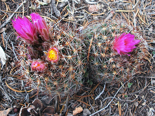
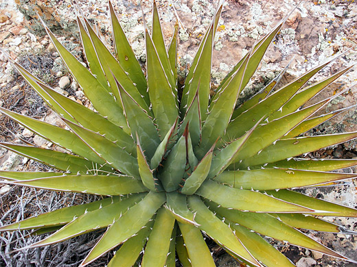
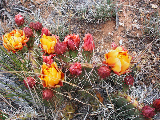
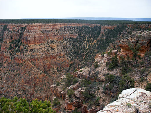
One suitable parking place for the hike is on the south side of the East Rim Drive between mileposts 259 and 260, shortly before a bend to the south, and just west of a junction with a national forest track. After crossing the road, Pinal Point is reached by walking northeast for 1.2 miles, initially along a shallow drainage then up a gradual slope, through low pine woodland to the edge of the cliffs. The trees fade away near the rim, replaced by clusters of spiky agave and flowering cacti, so there is nothing to block the vista. From here, Papago Point is an easy walk west.

Escobaria cactus
Pink flowering escobaria vivipara cactus, in the woods near Lipan Point
Agave
Kaibab agave (agave utahensis var kaibabensis) on the limestone plateau at Pinal Point


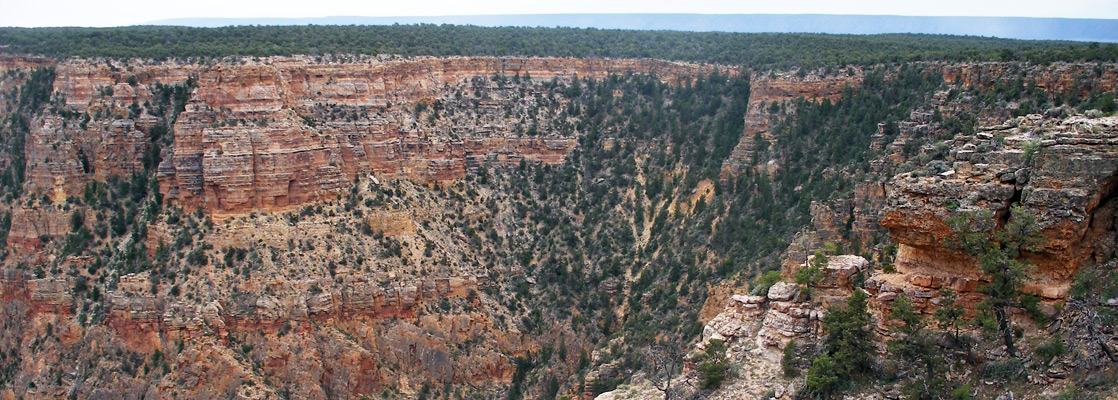
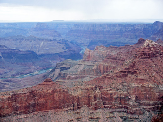
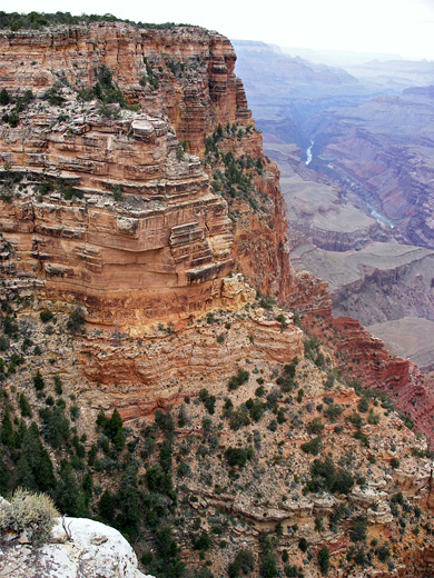
Several miles of the Colorado are in view; to the north, on the far side of a ridge extending from Escalante Butte, are the Unkar Creek Rapids and several wide bends in the river, then 2 miles beyond are the Tanner Rapids. Directly below Pinal Point, the straight canyon of Seventyfive Mile Creek runs from east to west starting from beneath Lipan Point, while further west, the top of the Desert View watchtower is just visible above the forested plateau. Solomon Temple and the Tabernacle are the most prominent peaks on the North Rim, below which is more of the river including Hance and Sockdolager Rapids, where the inner granite gorge begins to deepen, making the Colorado harder to spot from the rim viewpoints further west.

Opuntia cactus
Opuntia phaeacantha cactus in flower, in the woods near Pinal Point

Pinterest


The distant Colorado

Cliff edge to the west of Pinal Point
The cliff edge to the west of Pinal Point

The view southeast
The view southeast

Next Points
West: Papago Point
East: Lipan Point

South Rim Grand Canyon Viewpoints

Piute Point Jicarilla Point Mescalero Point Mimbreno Point Yuma Point Pima Point Mohave Point Hopi Point Powell Point Maricopa Point Grandeur Point Yavapai Point Mather Point Yaki Point Shoshone Point Grandview Point Moran Point Zuni Point Papago Point Pinal Point Lipan Point Navajo Point Desert View Comanche Point
Back to Top
Arizona | California | Colorado | Idaho | Nevada | New Mexico | Oregon | Texas | Utah | Wyoming | Slot Canyons | Travelogue | SOUTHWEST

All Contents © Copyright The American Southwest | Comments and Questions | Contribute | Affiliate Marketing Disclosure | Site Map