The American Southwest
Home | Parks | Trails | Plants | Canyons
Maps | Landscapes | Site Map | Whats New? |
More...
Follow americansouthwest.net on Facebook
×
General Pages
Home
Parks
Trails
Plants
Slot Canyons
Maps
Landscapes
Itineraries
Site Map
What's New?
More pages...

States
Arizona
California
Colorado
Idaho
Nevada
New Mexico
Oregon
Texas
Utah
Wyoming


ARIZONA
CALIFORNIA
COLORADO
IDAHO
NEVADA
NEW MEXICO
OREGON
TEXAS
UTAH
WYOMING
ARIZONA
MAPS | PARKS | TRAILS | HOTELS

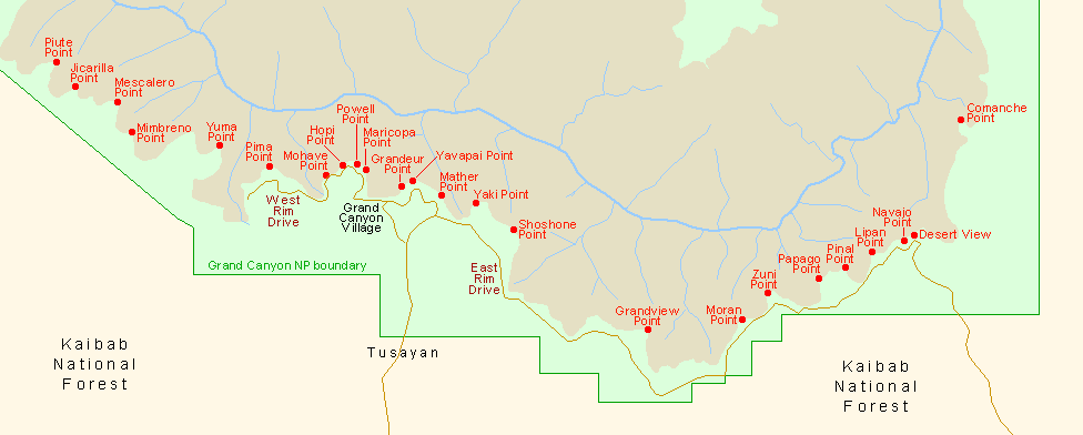
Papago Point, Grand Canyon National Park


Arizona > Grand Canyon National Park > South Rim > Viewpoints > Papago Point
Ridge above the end of Seventymile Creek
The walk westwards from Pinal Point to Papago (also known as Hollenback) Point could either be along the cliff edge or (slightly shorter) cross-country through the woodland, passing by a small limestone summit at 7,367 feet then on to the far northwest corner of the plateau. Papago Point ends with two semi-detached rocks, gradually being eroded away from the main rim, and for the best views it is worth climbing to the furthest one. This requires first scrambling over a narrow neck below two steep ravines that drop away to north and south, then descending the cliffs at the far side, to the base of an isolated flat-topped pillar about 10 meters across, then finally scaling the left side to the summit.

Cliffs to the west
Cliffs to the west of Papago Point, including Zuni Point

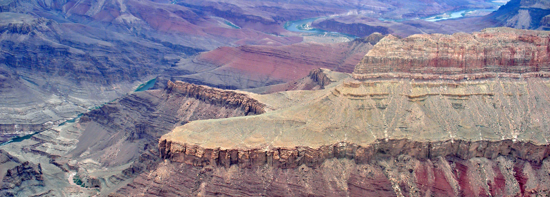
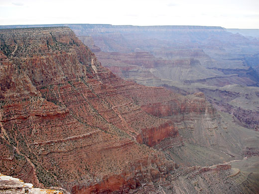
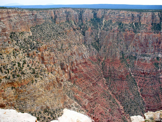
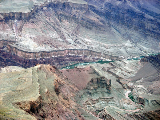
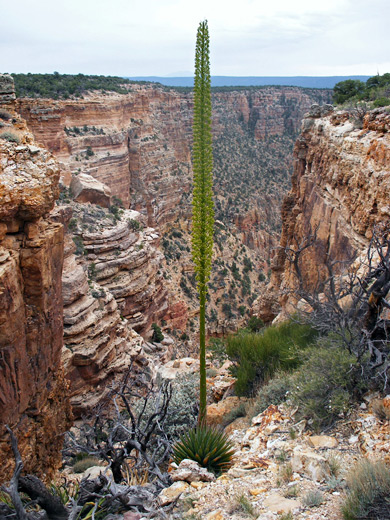
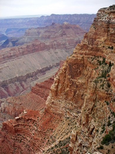
Papago has some of the best views anywhere on the South Rim, all the better for having no-one else around. As with Pinal Point, many miles of the Colorado are visible - west towards Bright Angel Creek, due north across Hance & Nevills Rapids, and, in the east, over Unkar Creek, Tanner Canyon, and all the way to the straight section of the river beneath the Palisades of the Desert. Directly below the point are the two large drainages of Papago Creek and Seventyfive Mile Creek, with many other ravines to the west including colorful Red and Mineral canyons. The North Rim has a group of large buttes beneath Cape Royal, centered on Krishna Shrine and Vishnu Temple.

View to the southwest
View from Papago Point to the southwest
Nevills Rapids
Nevills Rapids, at the end of Seventyfive Mile Creek - view north from Papago Point


The walk from Papago Point back to the parking area (see the description for Pinal Point) is just less than a mile, across level ground along the west rim of the plateau then veering east as the road approaches.

This remote section of the canyon rim was originally known as Hollenbeck Point, on account of sisters Amelia and Josephine Hollenback from New York, who visited here in 1897, but was renamed Papago Point in 1906. In 1985, following a petition to the Board on Geographic Names (by author Mary J. Straw Cook while writing a history of the family; 'The Immortal Summer'), the promontory reverted to its original name, with corrected spelling, of Hollenback Point.


Pinterest


Agave flower
Agave flower

Antler
Antler

View east
View east

Next Points
West: Zuni Point
East: Pinal Point

South Rim Grand Canyon Viewpoints

Piute Point Jicarilla Point Mescalero Point Mimbreno Point Yuma Point Pima Point Mohave Point Hopi Point Powell Point Maricopa Point Grandeur Point Yavapai Point Mather Point Yaki Point Shoshone Point Grandview Point Moran Point Zuni Point Papago Point Pinal Point Lipan Point Navajo Point Desert View Comanche Point
Back to Top
Arizona | California | Colorado | Idaho | Nevada | New Mexico | Oregon | Texas | Utah | Wyoming | Slot Canyons | Travelogue | SOUTHWEST

All Contents © Copyright The American Southwest | Comments and Questions | Contribute | Affiliate Marketing Disclosure | Site Map