The American Southwest
Home | Parks | Trails | Plants | Canyons
Maps | Landscapes | Site Map | Whats New? |
More...
Follow americansouthwest.net on Facebook
×
General Pages
Home
Parks
Trails
Plants
Slot Canyons
Maps
Landscapes
Itineraries
Site Map
What's New?
More pages...

States
Arizona
California
Colorado
Idaho
Nevada
New Mexico
Oregon
Texas
Utah
Wyoming


ARIZONA
CALIFORNIA
COLORADO
IDAHO
NEVADA
NEW MEXICO
OREGON
TEXAS
UTAH
WYOMING
ARIZONA
MAPS | PARKS | TRAILS | HOTELS

Zuni Point, Grand Canyon National Park


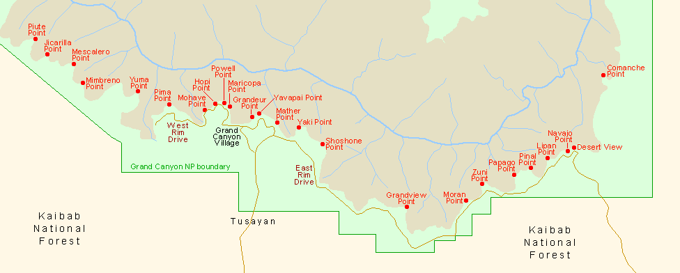
Arizona > Grand Canyon National Park > South Rim > Viewpoints > Zuni Point
Red Canyon and the western Colorado
Zuni is one of the few points along the south rim of the Grand Canyon that has no road, trail or signpost, though it is easy enough to reach, by walking through the open pine forest for half a mile, staying close to the canyon edge. Vehicles can be parked on the south side of the highway between mileposts 257 and 258, near where the rim is just a few yards away through the trees but begins to curve northwards, away from the road. As well as trees the plateau is dotted with various species of cacti, all bearing beautiful flowers in summer.

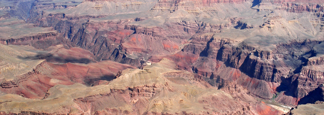
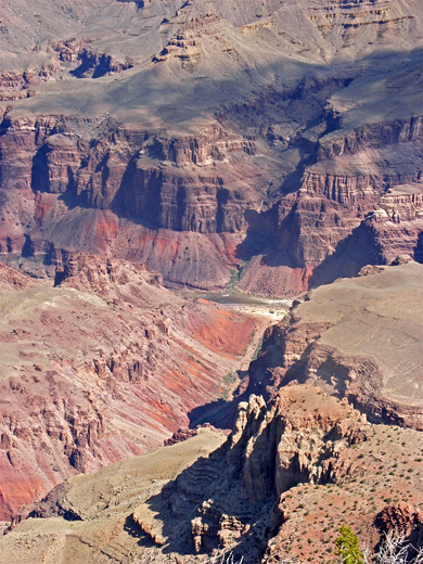
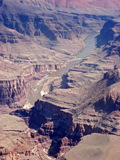
Zuni Point is located at the northwest corner of a wooded promontory overlooking Red Canyon, its exact position indicated by a USGS bench mark - elevation 7,278 feet. To the east of Red Canyon, on the far side of a short ridge, are the two forks of Papago Creek, which join then meet the Colorado between Hance and Nevills rapids, both visible from Zuni Point together with over a mile of the river upstream. As with Moran Point, a mile west, Zuni has impressive views of the colorful strata at the lower end of Red Canyon (course of the New Hance Trail), and the equally deep red rocks along adjacent Mineral and Asbestos canyons, and the inner Colorado gorge to the west.

Yellow opuntia
Yellow flowered opuntia engelmannii, in the woods near Zuni Point
Pink opuntia
Pink flowering opuntia, in the woods near Zuni Point


On the North Rim, the panorama ranges from Unkar Creek in the east, across Vishnu Temple, Krishna Shrine and other nearby Hindu-inspired features, then over countless other buttes and canyons for 30 miles westwards. In the early days of Grand Canyon tourism, when the main guest facilities were at Grandview, tours would quite often stop at Zuni Point but now it is rarely visited, despite having better views than popular Moran Point, the next main overlook to the west.

Claret cup
Claret cup cactus near Zuni Point - echinocereus triglochidiatus

Pinterest


End of Red Canyon
End of Red Canyon

Orange opuntia
Orange opuntia

Nevills Rapids
Nevills Rapids

Next Points
West: Moran Point
East: Papago Point

South Rim Grand Canyon Viewpoints

Piute Point Jicarilla Point Mescalero Point Mimbreno Point Yuma Point Pima Point Mohave Point Hopi Point Powell Point Maricopa Point Grandeur Point Yavapai Point Mather Point Yaki Point Shoshone Point Grandview Point Moran Point Zuni Point Papago Point Pinal Point Lipan Point Navajo Point Desert View Comanche Point
Back to Top
Arizona | California | Colorado | Idaho | Nevada | New Mexico | Oregon | Texas | Utah | Wyoming | Slot Canyons | Travelogue | SOUTHWEST

All Contents © Copyright The American Southwest | Comments and Questions | Contribute | Affiliate Marketing Disclosure | Site Map