Parsons Trail #144
Well maintained trail along the riparian lower end of Sycamore Canyon, beside a permanent creek that forms many large pools, beneath sheer, red rock cliffs. The path ends at Parsons Spring, the source of the water, though the usually dry canyon can be followed further upstream
Length: 3.7 miles, to the spring
Elevation change: 200 feet
Difficulty: Easy to moderate - mostly level, with several stream crossings
Type: One way
Usage: Low to medium
Season: All year
Trailhead: End of an unpaved track, 10 miles north of Clarkdale
Rating (1-5): ★★★★★
Elevation change: 200 feet
Difficulty: Easy to moderate - mostly level, with several stream crossings
Type: One way
Usage: Low to medium
Season: All year
Trailhead: End of an unpaved track, 10 miles north of Clarkdale
Rating (1-5): ★★★★★

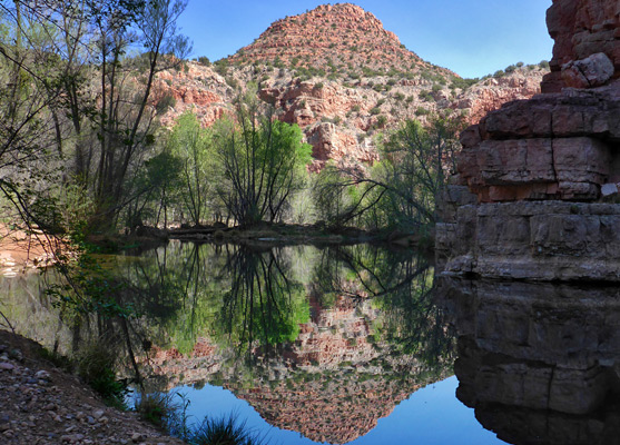
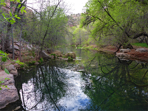
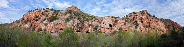
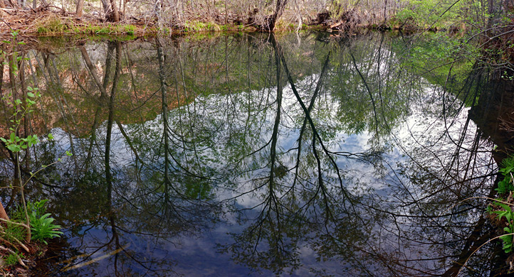
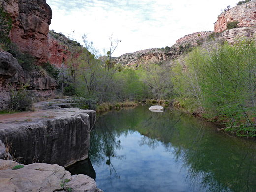
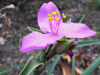
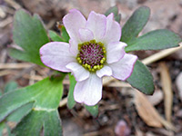
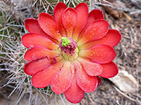
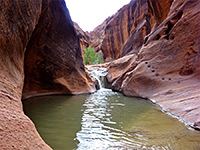
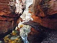
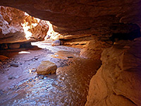
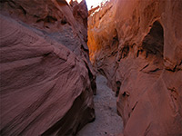
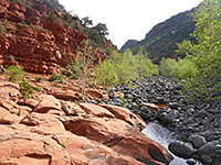
Most of Sycamore Canyon is usually dry, as the stream flows above ground only after heavy rains and during the spring snowmelt. The exception is the lowest four miles, since here Sycamore Creek persists all year, originating from Parsons Spring, a large source that creates many deep, clear-water pools, some over a hundred feet long, bordered by dense, riparian vegetation, including sycamore, willow, ash and cottonwood trees, and many species of shrubs and wildflowers, mixed with cacti and yucca. The beauty of the scene is enhanced by the tall, enclosing cliffs, which have three components; reddish sandstone at creek level, a thicker band of jagged, orange limestone higher up, topped by a narrow, intermittent band of black, columnar basalt.
The creek is followed by a well maintained trail that descends 200 feet at the start then stays relatively level, crossing the stream five times while gaining only 200 feet over the 3.7 mile distance to the spring. The hike is quite popular, at least for the generally very remote Sycamore Canyon region, perhaps seeing a few dozen groups on some days, though this is of course far less than the much busier trails around Sedona to the east, many of which encounter similar scenery.
Parsons Trail is not much publicized, and is reached only by an unpaved road, the last mile of which is rather rocky, and may require a high clearance vehicle, though not 4WD. The shady conditions and plentiful water mean the walk is suitable all times of the year, even in summer when temperatures can be well above 100°F; away from the creek the surroundings are rather barren and desert-like, reflecting the relatively low elevation, of 3,600 feet. No permit is needed, and primitive camping is permitted at the trailhead. Camping is also allowed once after the final creek crossing, close to the spring; there are about half a dozen recognized sites, in clearings below the cliffs, all very close to the water.
Sycamore Canyon overview map, Parsons Trail topographic map.
29 views along the trail.
The driving route to the Parsons trailhead (Sycamore Canyon Road) forks north off the road to Tuzigoot National Monument just after the bridge over the Verde River, on the east side of Clarkdale. This is paved for 4.6 miles, up to the boundary of the Coconino National Forest, and then gravel, running close to the river along the floor of a wide canyon, later climbing slightly once the enclosing cliffs recede, and crossing open, treeless land (Duff Flat) past one major intersection, with Buckboard Road, FR 258, and several minor junctions. The surface stays good for another 3 miles, but then deteriorates, becoming uneven, bumpy and stony, while crossing one wash, climbing over a minor ridge, dropping down to a second wash, crossing a saddle and descending to a flat, bushy area, overlooking Sycamore Creek, a short distance upstream of the Verde River confluence. The trailhead is on the north side of the plateau, while to the south are several lesser tracks, with plenty of camping places. A rougher track descends to creek level and continues upstream along the river. This location is very quiet and peaceful, the only faint noise at night coming from cascades on the creek below.
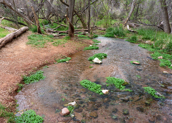
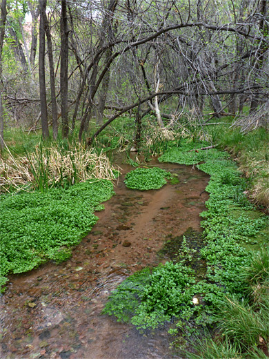
The trail descends an exposed, rocky slope, past a sign marking the edge of the Sycamore Canyon Wilderness and down into the wide band of trees and bushes on the valley floor, where it divides, beside the dry bed of a tributary creek; left is a long, little-used route to Packard Mesa while right is to Parsons Spring. Nearby is the first of many big pools - the creek itself does not usually have a particularly large flow, but there is enough water to create numerous deep pools, constrained by the impermeable bedrock. The main path stays on the east side of the canyon, moving northwards through a mix of grassland and deciduous woodland, passing a few basalt boulders, one particularly large. The creek stays out of sight initially, one branch coming close for the first time after half a mile; a shallow channel, trickling gently through dense trees lined by grass and water cress. The first crossing is soon after, at a wider section of the creekbed sprinkled with many boulders. Flood debris several feet up the tree trunks show that on rare occasions the drainage carries a huge amount of water. Near here the flow is augmented by Summers Spring, off-trail to the east.
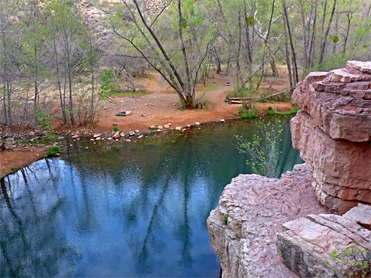
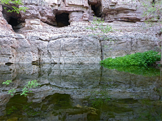
The path moves away from the creek to the west, rising to cut off a bend, climbing a little and returning to the floor at a shady place shielded by vertical, west-facing cliffs, with a ledge at the base and a particularly deep pool below, a popular location for swimming and cliff jumping - reached by a short diversion. On the far side is a sandy flat beneath tall cottonwoods, sometimes used for overnight stays despite several No Camping and No Fire notices. The limestone cliffs contain several small caves, and more are found at intervals all along the canyon.
The trail crosses a little ridge to bypass a second bend, winds through bushes and trees then traverses a ledge and drops down to another big pool, beyond which the gorge is a bit wider, and has red rocks above on both sides. The next section is along sandbanks at a base of a cliff, then out along a lengthy grey ridge above a deep pool, another very photogenic place. The path climbs for a while, giving good views of even more extensive, red orange cliffs on the west side of the canyon - otherwise, the canyon walls are usually obscured by the trees - and crosses the stream again just below a tranquil, tree-lined pool. Two more creek crossings follow in quick succession before the path, on the west side, rises above the trees again until the final descent, and runs alongside more pools to the spring, an elongated feature enclosed by low cliffs. Here the path fades away, continuing sporadically a few hundred feet, past the uppermost pool and out to a dry, open section of the canyon, with small bushes lining a wide streambed covered with pink and grey pebbles.
The creek is followed by a well maintained trail that descends 200 feet at the start then stays relatively level, crossing the stream five times while gaining only 200 feet over the 3.7 mile distance to the spring. The hike is quite popular, at least for the generally very remote Sycamore Canyon region, perhaps seeing a few dozen groups on some days, though this is of course far less than the much busier trails around Sedona to the east, many of which encounter similar scenery.
Parsons Trail is not much publicized, and is reached only by an unpaved road, the last mile of which is rather rocky, and may require a high clearance vehicle, though not 4WD. The shady conditions and plentiful water mean the walk is suitable all times of the year, even in summer when temperatures can be well above 100°F; away from the creek the surroundings are rather barren and desert-like, reflecting the relatively low elevation, of 3,600 feet. No permit is needed, and primitive camping is permitted at the trailhead. Camping is also allowed once after the final creek crossing, close to the spring; there are about half a dozen recognized sites, in clearings below the cliffs, all very close to the water.
Maps
Sycamore Canyon overview map, Parsons Trail topographic map.
Photographs
29 views along the trail.
Access Road
The driving route to the Parsons trailhead (Sycamore Canyon Road) forks north off the road to Tuzigoot National Monument just after the bridge over the Verde River, on the east side of Clarkdale. This is paved for 4.6 miles, up to the boundary of the Coconino National Forest, and then gravel, running close to the river along the floor of a wide canyon, later climbing slightly once the enclosing cliffs recede, and crossing open, treeless land (Duff Flat) past one major intersection, with Buckboard Road, FR 258, and several minor junctions. The surface stays good for another 3 miles, but then deteriorates, becoming uneven, bumpy and stony, while crossing one wash, climbing over a minor ridge, dropping down to a second wash, crossing a saddle and descending to a flat, bushy area, overlooking Sycamore Creek, a short distance upstream of the Verde River confluence. The trailhead is on the north side of the plateau, while to the south are several lesser tracks, with plenty of camping places. A rougher track descends to creek level and continues upstream along the river. This location is very quiet and peaceful, the only faint noise at night coming from cascades on the creek below.

Start of the Trail
The trail descends an exposed, rocky slope, past a sign marking the edge of the Sycamore Canyon Wilderness and down into the wide band of trees and bushes on the valley floor, where it divides, beside the dry bed of a tributary creek; left is a long, little-used route to Packard Mesa while right is to Parsons Spring. Nearby is the first of many big pools - the creek itself does not usually have a particularly large flow, but there is enough water to create numerous deep pools, constrained by the impermeable bedrock. The main path stays on the east side of the canyon, moving northwards through a mix of grassland and deciduous woodland, passing a few basalt boulders, one particularly large. The creek stays out of sight initially, one branch coming close for the first time after half a mile; a shallow channel, trickling gently through dense trees lined by grass and water cress. The first crossing is soon after, at a wider section of the creekbed sprinkled with many boulders. Flood debris several feet up the tree trunks show that on rare occasions the drainage carries a huge amount of water. Near here the flow is augmented by Summers Spring, off-trail to the east.
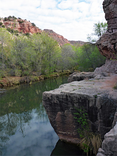
The Largest Pool
The path moves away from the creek to the west, rising to cut off a bend, climbing a little and returning to the floor at a shady place shielded by vertical, west-facing cliffs, with a ledge at the base and a particularly deep pool below, a popular location for swimming and cliff jumping - reached by a short diversion. On the far side is a sandy flat beneath tall cottonwoods, sometimes used for overnight stays despite several No Camping and No Fire notices. The limestone cliffs contain several small caves, and more are found at intervals all along the canyon.
Parsons Spring
The trail crosses a little ridge to bypass a second bend, winds through bushes and trees then traverses a ledge and drops down to another big pool, beyond which the gorge is a bit wider, and has red rocks above on both sides. The next section is along sandbanks at a base of a cliff, then out along a lengthy grey ridge above a deep pool, another very photogenic place. The path climbs for a while, giving good views of even more extensive, red orange cliffs on the west side of the canyon - otherwise, the canyon walls are usually obscured by the trees - and crosses the stream again just below a tranquil, tree-lined pool. Two more creek crossings follow in quick succession before the path, on the west side, rises above the trees again until the final descent, and runs alongside more pools to the spring, an elongated feature enclosed by low cliffs. Here the path fades away, continuing sporadically a few hundred feet, past the uppermost pool and out to a dry, open section of the canyon, with small bushes lining a wide streambed covered with pink and grey pebbles.
Parsons Trail - Similar Hikes
All Contents © Copyright The American Southwest | Comments and Questions | Contribute | Affiliate Marketing Disclosure | Site Map