Highlights:
Large, low relief Sinagua Indian ruin on a small hill, with good views over the Verde River valley. All can be toured in just half an hour
Nearby town:
Cottonwood, 4 miles
Management:
Location:
Seasons:
All year
Rating (1-5):
★★★★★
Weather:


Tuzigoot NM is part of the Indian Lands itinerary
Featured Hotel
Best Western Cottonwood Inn
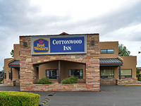 Just 3 miles from Tuzigoot, the Best Western is an AAA Three Diamond-rated hotel close to shops and restaurants in the center of Cottonwood
Check Rates
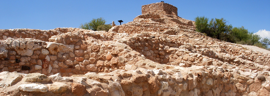
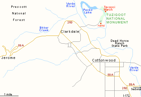
Tuzigoot is a small national monument, one of several sites south of Flagstaff where the remains of dwellings of the 12th century Sinagua Indians are preserved. Unlike the single cliff house of Montezuma Castle 20 miles southeast, Tuzigoot comprises a cluster of buildings, on top of a small sandstone ridge close to the Verde River valley near the towns of Clarkdale and Cottonwood.
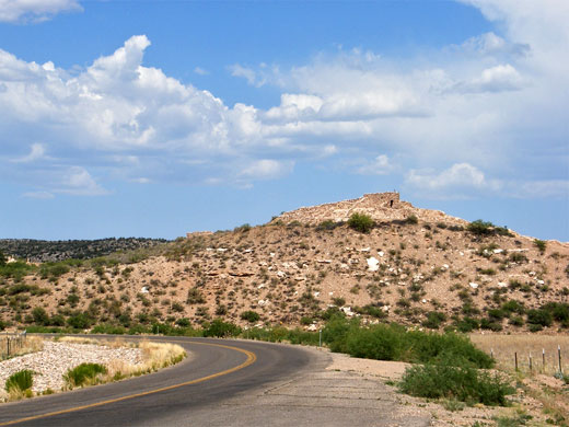
The approach road off Hwy 260 is badly signposted and a little difficult to find; it does however pass through an expanse of reeds and bushes around the wide, sandy river bed, crosses a field and then climbs a short distance to the site of the monument. The river plain is home to several unusual species of birds, including the great horned owl.
The approach road off Hwy 260 is badly signposted and a little difficult to find; it does however pass through an expanse of reeds and bushes around the wide, sandy river bed, crosses a field and then climbs a short distance to the site of the monument. The river plain is home to several unusual species of birds, including the great horned owl.
Tuzigoot Table of Contents
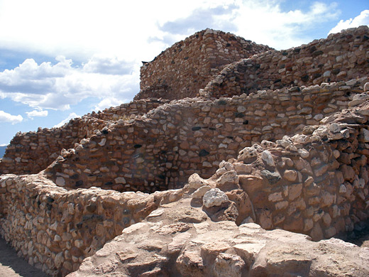
The Ruin at Tuzigoot
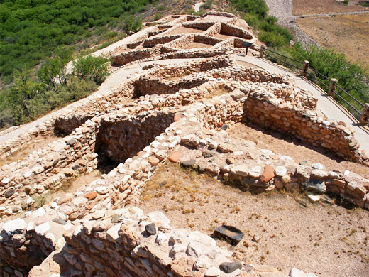
Tuzigoot National Monument has a small visitor center that seems rather over-staffed, built in a similar style to the ruins, and containing a fine display of Indian artefacts, most of which have been found on-site. Outside are the usual examples of local cacti and shrubs, and a short wheelchair-accessible loop path that leads up the hill, round some of the ruins to the summit and then back to the carpark. Most of the rooms are just crumbling, partly-preserved walls a few feet high although the largest dwelling, on top of the hill, is complete - with a reconstructed ceiling plus a ladder up to the roof, and it provides a cool refuge in summer. At one time the settlement was home to around 250 people and had up to 80 rooms, some on two storeys, but all were abandoned sometime in the fifteenth century.
Views from the Ruins
Tuzigoot is interesting enough, but it is perhaps the least exciting of the ancient NPS sites in Arizona. It is also quite difficult to photograph effectively. The best aspect is the view from the summit, which is extensive, looking out over layered cliffs and ridges in all directions, the lower end of Sycamore Canyon to the north, and a long stretch of the Verde River running northwest to south. Five miles west, large colorful spoil heaps are clearly visible, from old copper mines in the Black Hills around the historic town of Jerome. In the north, the view includes Tavasci Marsh, at the east end of Pecks Lake - this is one of the largest areas of marshland in Arizona and was added to the national monument in the spring of 2006, as a part of a land exchange deal between the BLM and Phelps Dodge Corporation. The marsh is an important location for migratory bird gatherings, and may be viewed by a quarter mile overlook trail that begins at the visitor center.
Tuzigoot - Nearby Places
- Dead Horse Ranch State Park (4 miles) - wooded stretch of the Verde River
- Montezuma Castle National Monument (20 miles) - impressive Indian cliff dwelling
- Sedona (22 miles) - popular town surrounded by red rock wilderness
Tuzigoot - Similar Places
- Salinas Pueblo Missions National Monument, New Mexico - ruins of ancient pueblos and 17th century Spanish missions
- Wupatki National Monument, Arizona - many ruins scattered over a large area of desert northeast of Flagstaff
All Contents © Copyright The American Southwest | Comments and Questions | Contribute | Affiliate Marketing Disclosure | Site Map