Fay Canyon Trail
#53
#53
Fay is a short box canyon containing a large red rock arch, a seasonal stream, and a collection of desert plants typical of the lower elevations around Sedona; it may be visited by an easy and quite popular trail
Length: 1 mile
Elevation change: 250 feet
Difficulty: Easy
Type: One way
Usage: Medium to high
Season: All year
Trailhead: Along Boynton Pass Road
Rating (1-5): ★★★★★
Elevation change: 250 feet
Difficulty: Easy
Type: One way
Usage: Medium to high
Season: All year
Trailhead: Along Boynton Pass Road
Rating (1-5): ★★★★★

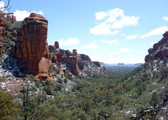
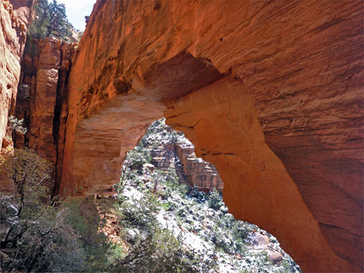
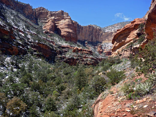
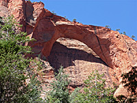
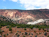
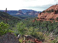
Fay Canyon provides an easy introduction to Sedona hiking, since the ravine is short and scenic, bordered by camera-friendly red cliffs and pinnacles, and the path is straightforward - mostly level and partly shaded, passing a good variety of cacti, flowers and shrubs. One specific attraction en route, viewed by a short, steep side trail, is Fay Canyon Arch, quite a dramatic feature with a 130 foot span, while the far end of the canyon rises a little and allows good, long distance views south, across Dry Creek Valley towards Sedona and Chimney Rock.
The excellent scenery and easy access via a recently paved road make the canyon often rather busy, like the similar but longer Boynton Canyon one mile east, though relatively few continue along a fainter path beyond the end of the official trail, winding through more undulating and overgrown terrain to the top of a small knoll, a viewpoint overlooking the cliff-bound upper end of the canyon.
Fay Canyon topographic map, Sedona location map.
10 views along the Fay Canyon Trail.
The trailhead for the one mile Fay Canyon Trail (#53) is at a large parking area along Boynton Pass Road, until recently a gravel track but now paved to provide reliable, year-round access to a new housing development on the south side of Doe Mountain. This location is 8.5 miles from US 89 in Sedona, part of the Coconino National Forest.
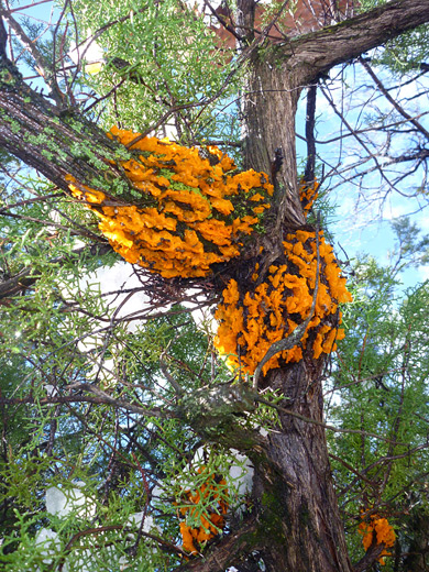
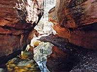
The path starts on the far side of the road, crosses the boundary fence into the Red Rock Secret Mountain Wilderness and enters the wooded surroundings of the canyon floor, staying close to the seasonal stream. Plants include many yucca and opuntia cacti, and a good selection of wildflowers. A narrower, cairned trail forks off to the right after 0.6 miles and climbs quite steeply to the base of Fay Canyon Arch, 200 feet up on the east side of the canyon, made of richly colored orange-red Schnebly Hill sandstone. The arch has formed parallel to the taller cliffs just behind so is not obvious until quite close, though it can be seen from the valley floor. The best views are from underneath, looking back west through the span.
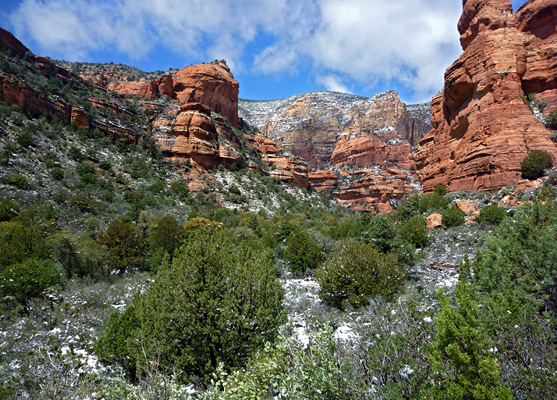
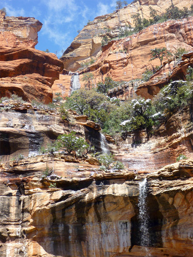
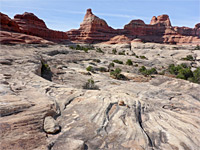
The main path soon reaches the edge of a narrow ridge towards the far end of the canyon, where the drainage splits into two short upper forks, and the regular trail ends here, at a viewpoint a little way up the hillside. A less used path continues a quarter mile up the north fork through oak woodland, climbing and descending a few times and ending with an ascent to the top of a sandstone mound, which gives panoramic views of the surrounding cliffs, rising steeply over 1,000 feet to the summit of Bear Mountain. Several seasonal waterfalls form during the spring snowmelt season, cascading down the red/orange hillside. The enclosing rocks have a great variety of form and texture, especially along the east side of the canyon, where they have eroded into buttes and pinnacles; the general color is deep red, stained black in many places.
The excellent scenery and easy access via a recently paved road make the canyon often rather busy, like the similar but longer Boynton Canyon one mile east, though relatively few continue along a fainter path beyond the end of the official trail, winding through more undulating and overgrown terrain to the top of a small knoll, a viewpoint overlooking the cliff-bound upper end of the canyon.
Maps
Fay Canyon topographic map, Sedona location map.
Photographs
10 views along the Fay Canyon Trail.
Fay Canyon Trailhead
The trailhead for the one mile Fay Canyon Trail (#53) is at a large parking area along Boynton Pass Road, until recently a gravel track but now paved to provide reliable, year-round access to a new housing development on the south side of Doe Mountain. This location is 8.5 miles from US 89 in Sedona, part of the Coconino National Forest.
Fay Canyon Arch
The path starts on the far side of the road, crosses the boundary fence into the Red Rock Secret Mountain Wilderness and enters the wooded surroundings of the canyon floor, staying close to the seasonal stream. Plants include many yucca and opuntia cacti, and a good selection of wildflowers. A narrower, cairned trail forks off to the right after 0.6 miles and climbs quite steeply to the base of Fay Canyon Arch, 200 feet up on the east side of the canyon, made of richly colored orange-red Schnebly Hill sandstone. The arch has formed parallel to the taller cliffs just behind so is not obvious until quite close, though it can be seen from the valley floor. The best views are from underneath, looking back west through the span.
Viewpoints
The main path soon reaches the edge of a narrow ridge towards the far end of the canyon, where the drainage splits into two short upper forks, and the regular trail ends here, at a viewpoint a little way up the hillside. A less used path continues a quarter mile up the north fork through oak woodland, climbing and descending a few times and ending with an ascent to the top of a sandstone mound, which gives panoramic views of the surrounding cliffs, rising steeply over 1,000 feet to the summit of Bear Mountain. Several seasonal waterfalls form during the spring snowmelt season, cascading down the red/orange hillside. The enclosing rocks have a great variety of form and texture, especially along the east side of the canyon, where they have eroded into buttes and pinnacles; the general color is deep red, stained black in many places.
Fay Canyon Trail - Similar Hikes
All Contents © Copyright The American Southwest | Comments and Questions | Contribute | Affiliate Marketing Disclosure | Site Map