Doe Mountain Trail
#60
#60
Short trail up the north side of a flat-topped mesa of red sandstone; good views in all directions from the summit, towards higher mountains in the north, Capitol Butte and downtown Sedona to the south, and the Verde Valley to the west
Length: 0.7 miles
Elevation change: 450 feet
Difficulty: Easy
Type: One way; optional loop around the plateau adds another 0.5 miles
Usage: Medium to high
Season: All year
Trailhead: Along Boynton Pass Road
Rating (1-5): ★★★★★
Elevation change: 450 feet
Difficulty: Easy
Type: One way; optional loop around the plateau adds another 0.5 miles
Usage: Medium to high
Season: All year
Trailhead: Along Boynton Pass Road
Rating (1-5): ★★★★★

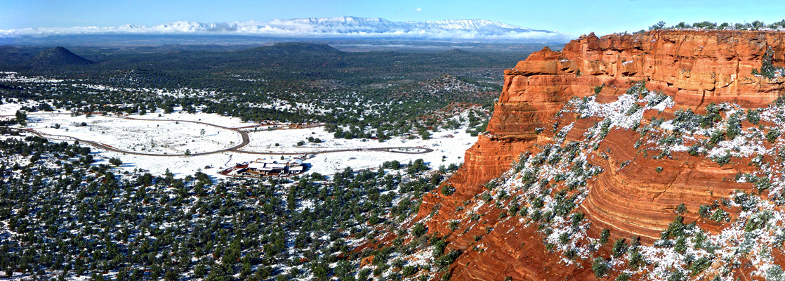
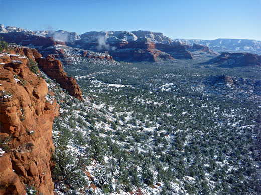
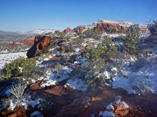
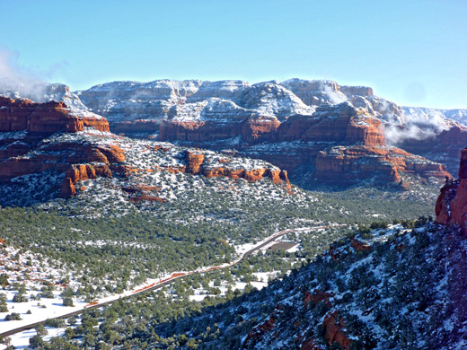
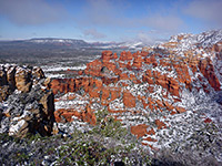
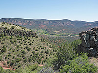
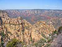
Like Mescal Mountain to the north, flat-topped Doe Mountain rises just 450 feet above its surroundings, but as the land falls away steeply and there are no other peaks nearby, this is high enough for a wide-ranging panorama across the neighboring red rock landscape. The east rim of the mesa looks out over the wide, bushy valley of Dry Creek, towards Capitol Butte and downtown Sedona, while the north edge has views towards Bear Mountain, and many cliffs, ravines and pinnacles in the Red Rock Secret Mountain Wilderness.
The Doe Mountain Trail (#60) is short, just 0.7 miles, but rewarding nonetheless, climbing a sheltered ravine to the plateau top, which gives contrasting views in different directions; a round trip, including a circuit around the edges of the mountain, takes about one hour.
Doe Mountain topographic map, Sedona location map.
8 views along the Doe Mountain Trail.
The Doe Mountain trailhead is along Boynton Pass Road, 5.7 miles from AZ 89A in Sedona, via Dry Creek Road. The latter part of the route used to be a gravel track but was paved a few years ago, and continues a little way southwest to a developing, upmarket residential area known as The Aerie, built between the mountain and another smaller peak to the south (The Coxcomb), and completely surrounded by the Coconino National Forest. The small parking area at the trailhead is shared with the more strenuous Bear Mountain Trail to the north, but the majority of visitors are here for the much easier hike up Doe Mountain.
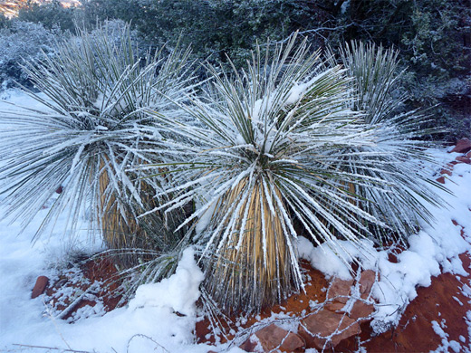
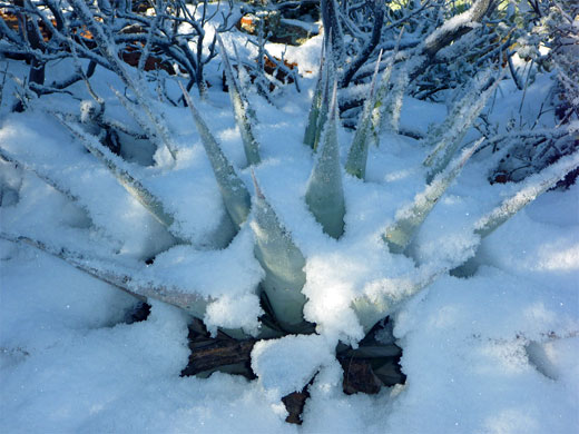
The trail heads south towards the edge of the mesa, crossing slopes that remain in shadow until mid morning, and soon intersects the newly constructed hike/bike/horse Aerie Trail, running between Boynton Canyon and the Rupp Trail to the south; it was created in mitigation for the paving of the road. After the junction, the Doe Mountain Trail becomes steeper, zig zagging through a typical Sedona mixture of oak, manzanita, juniper, opuntia, Parry's agave and soaptree yucca. The route veers south for a while, turns back north and leads up a gully to the completely flat summit, elevation 5,050 feet, then crosses over to the main viewpoint on the south side, overlooking Wilson Mountain, Capitol Butte, Dry Creek and the west edge of Sedona. A fainter path circles some of the rim for alternative views, including north towards the more extensive and taller peaks around Bear Mountain, and southwest towards Verde Valley, the lower end of Sycamore Canyon, and the distant Black Hills.
The Doe Mountain Trail (#60) is short, just 0.7 miles, but rewarding nonetheless, climbing a sheltered ravine to the plateau top, which gives contrasting views in different directions; a round trip, including a circuit around the edges of the mountain, takes about one hour.
Maps
Doe Mountain topographic map, Sedona location map.
Photographs
8 views along the Doe Mountain Trail.
Doe Mountain Trailhead
The Doe Mountain trailhead is along Boynton Pass Road, 5.7 miles from AZ 89A in Sedona, via Dry Creek Road. The latter part of the route used to be a gravel track but was paved a few years ago, and continues a little way southwest to a developing, upmarket residential area known as The Aerie, built between the mountain and another smaller peak to the south (The Coxcomb), and completely surrounded by the Coconino National Forest. The small parking area at the trailhead is shared with the more strenuous Bear Mountain Trail to the north, but the majority of visitors are here for the much easier hike up Doe Mountain.
The Path
The trail heads south towards the edge of the mesa, crossing slopes that remain in shadow until mid morning, and soon intersects the newly constructed hike/bike/horse Aerie Trail, running between Boynton Canyon and the Rupp Trail to the south; it was created in mitigation for the paving of the road. After the junction, the Doe Mountain Trail becomes steeper, zig zagging through a typical Sedona mixture of oak, manzanita, juniper, opuntia, Parry's agave and soaptree yucca. The route veers south for a while, turns back north and leads up a gully to the completely flat summit, elevation 5,050 feet, then crosses over to the main viewpoint on the south side, overlooking Wilson Mountain, Capitol Butte, Dry Creek and the west edge of Sedona. A fainter path circles some of the rim for alternative views, including north towards the more extensive and taller peaks around Bear Mountain, and southwest towards Verde Valley, the lower end of Sycamore Canyon, and the distant Black Hills.
Doe Mountain Trail - Similar Hikes
All Contents © Copyright The American Southwest | Comments and Questions | Contribute | Affiliate Marketing Disclosure | Site Map