Boynton Canyon Trail
#47
#47
Popular route with easy trailhead access, up a canyon that is open and desert-like in the lower reaches, becoming cool and forested higher up. Ends at a viewpoint with high red cliffs on three sides
Length: 3 miles
Elevation change: 500 feet
Difficulty: Easy to moderate
Type: One way
Usage: High
Season: All year, though the lower reaches are exposed and hot in summer
Trailhead: Boynton Pass Road, shortly before Enchantment Resort
Rating (1-5): ★★★★★
Elevation change: 500 feet
Difficulty: Easy to moderate
Type: One way
Usage: High
Season: All year, though the lower reaches are exposed and hot in summer
Trailhead: Boynton Pass Road, shortly before Enchantment Resort
Rating (1-5): ★★★★★

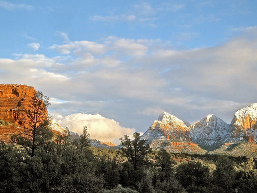
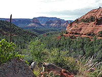
The popularity of the three mile trail up Boynton Canyon is due mainly to the ease of access, this being one of the relatively few canyon hikes near Sedona for which the trailhead is reached by a paved road. The scenery is pretty though not exceptionally so - the first half of the hike is along an open, bushy valley beneath layered red buttes and cliffs, followed by a much more enclosed and sheltered stretch through thick pine woodland - but the final viewpoint is rather more spectacular.
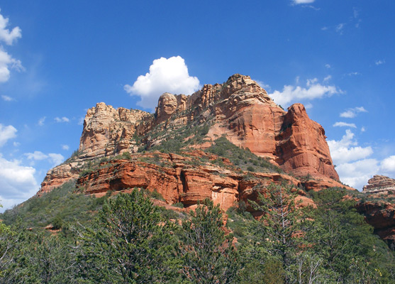
The path finishes at an elevated viewpoint at the end of a box canyon, enclosed on three sides by vertical Coconino sandstone cliffs rising up to 1,200 feet above. The exposed first part of the hike can be very hot in summer (temperatures over 100°F) which is one reason why many visitors walk just a little way along, but even a short distance gives a good introduction to the red rock scenery that makes Sedona famous.
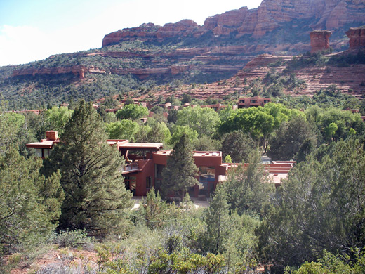
Boynton Canyon is reached by driving 3 miles along the paved Dry Creek Road, which forks of Hwy 89A near the west edge of Sedona, then turning left onto Boynton Pass Road. The trailhead is on the right side after 1.7 miles, shortly before the road ends at Enchantment Resort, an upscale hotel complex that extends for half a mile along the lower end of the canyon. One of the most exclusive resorts in Sedona, this offers five star amenities at rates starting from around $250 per night. Two other paths also begin from the trailhead - a 1.4 mile route to Dead Mans Pass at the edge of Long Canyon, and the short (0.3 mile) Vista Trail that climbs to a fine view point of Mescal Mountain and Sedona, but Boynton Canyon (trail #47) is the destination for most hikers. Another attraction of the Vista Trail is one of Sedona's four main vortexes - centers of spiritual energy; the Boynton Canyon vortex is found a little way along this path, next to a small red summit.
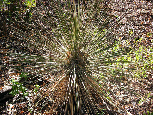
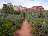
The wide, dusty path along Boynton Canyon starts off with a succession of regulatory notices, including one marking the boundary of the Red Rock Secret Mountain Wilderness Area, beyond which all mechanized transport is prohibited. The trail crosses red, sandy ground covered with a low forest of oak and pine, and stays a little way above the canyon floor on the east side, skirting the edge of Enchantment Resort. This represents the very opposite of wilderness, and the path affords frequent glimpses of manicured lawns, tennis courts, private swimming pools, shady verandas and other luxuries. A connecting path from the resort joins from the left, strictly for guest use only. Shortly after this the route curves round a ravine at the edge of the cliffs then drops down to the canyon floor, and so becomes a little shadier and straighter, passing through mixed vegetation of oaks, manzanita, Arizona cypress, yucca and opuntia cacti. The surroundings are similar for nearly a mile, until the canyon swings round to the west.
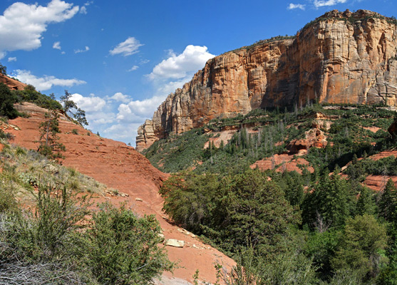
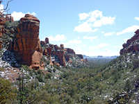
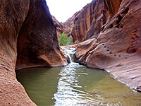
Shapely red and orange rocks rise above the greenery in all directions along the first part of the trail but the views become much more restricted for the second half, which is through a narrower canyon, well shielded from the sun and hence cooler, moister and filled with tall ponderosa pine trees. In early summer many wildflowers grow in clearings in the forest and along the path, part of a very different environment to the desert-like surroundings encountered earlier. The trail follows close to the stony streambed (usually dry), on the south side, climbing only gently until near the end, where it becomes quite steep, ascending to the final viewpoint on open rockface above the trees. A notice cautions against exploring further, though the sheer rock walls all around would make this difficult. The steepest cliffs are to the south and west at the edge of Bear Mountain, the top of which may be reached by a 2.4 mile trail starting along a side track off the road to Boynton Canyon. Another reason for not leaving the path is to protect many ancient sites found higher up the canyon walls, relics of the Sinaguan civilization. Several more accessible cliffs dwellings may be seen nearer the start of the path, along unmarked side trails.
The path finishes at an elevated viewpoint at the end of a box canyon, enclosed on three sides by vertical Coconino sandstone cliffs rising up to 1,200 feet above. The exposed first part of the hike can be very hot in summer (temperatures over 100°F) which is one reason why many visitors walk just a little way along, but even a short distance gives a good introduction to the red rock scenery that makes Sedona famous.
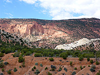
Boynton Canyon Trailhead
Boynton Canyon is reached by driving 3 miles along the paved Dry Creek Road, which forks of Hwy 89A near the west edge of Sedona, then turning left onto Boynton Pass Road. The trailhead is on the right side after 1.7 miles, shortly before the road ends at Enchantment Resort, an upscale hotel complex that extends for half a mile along the lower end of the canyon. One of the most exclusive resorts in Sedona, this offers five star amenities at rates starting from around $250 per night. Two other paths also begin from the trailhead - a 1.4 mile route to Dead Mans Pass at the edge of Long Canyon, and the short (0.3 mile) Vista Trail that climbs to a fine view point of Mescal Mountain and Sedona, but Boynton Canyon (trail #47) is the destination for most hikers. Another attraction of the Vista Trail is one of Sedona's four main vortexes - centers of spiritual energy; the Boynton Canyon vortex is found a little way along this path, next to a small red summit.
Lower Boynton Canyon
The wide, dusty path along Boynton Canyon starts off with a succession of regulatory notices, including one marking the boundary of the Red Rock Secret Mountain Wilderness Area, beyond which all mechanized transport is prohibited. The trail crosses red, sandy ground covered with a low forest of oak and pine, and stays a little way above the canyon floor on the east side, skirting the edge of Enchantment Resort. This represents the very opposite of wilderness, and the path affords frequent glimpses of manicured lawns, tennis courts, private swimming pools, shady verandas and other luxuries. A connecting path from the resort joins from the left, strictly for guest use only. Shortly after this the route curves round a ravine at the edge of the cliffs then drops down to the canyon floor, and so becomes a little shadier and straighter, passing through mixed vegetation of oaks, manzanita, Arizona cypress, yucca and opuntia cacti. The surroundings are similar for nearly a mile, until the canyon swings round to the west.
Upper Boynton Canyon
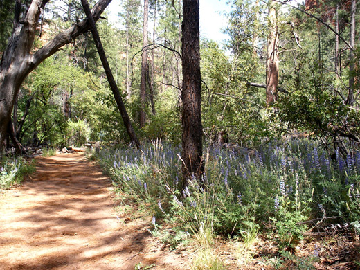
Shapely red and orange rocks rise above the greenery in all directions along the first part of the trail but the views become much more restricted for the second half, which is through a narrower canyon, well shielded from the sun and hence cooler, moister and filled with tall ponderosa pine trees. In early summer many wildflowers grow in clearings in the forest and along the path, part of a very different environment to the desert-like surroundings encountered earlier. The trail follows close to the stony streambed (usually dry), on the south side, climbing only gently until near the end, where it becomes quite steep, ascending to the final viewpoint on open rockface above the trees. A notice cautions against exploring further, though the sheer rock walls all around would make this difficult. The steepest cliffs are to the south and west at the edge of Bear Mountain, the top of which may be reached by a 2.4 mile trail starting along a side track off the road to Boynton Canyon. Another reason for not leaving the path is to protect many ancient sites found higher up the canyon walls, relics of the Sinaguan civilization. Several more accessible cliffs dwellings may be seen nearer the start of the path, along unmarked side trails.
Boynton Canyon Trail - Similar Hikes
All Contents © Copyright The American Southwest | Comments and Questions | Contribute | Affiliate Marketing Disclosure | Site Map