Brins Mesa and Soldier Pass Trails, Sedona
Arizona > Sedona > Hiking > Brins Mesa/Soldier Pass Trails
Brins Mesa and Soldier Pass Trails
#119, #66
#119, #66
Loop hike along two wide valleys (Mormon Canyon and Soldier Wash), climbing up to a high plateau (Brins Mesa), which gives good views of the peaks and cliffs of Red Rock Secret Mountain Wilderness. Route also involves the short Cibola Pass Trail
Length: 5.5 miles
Elevation change: 600 feet
Difficulty: Moderate
Type: Loop, with various other trails branching off along the way
Usage: High to medium
Season: All year, though hot in summer
Trailhead: Parking area at the end of Jordan Road
Rating (1-5): ★★★★★
Elevation change: 600 feet
Difficulty: Moderate
Type: Loop, with various other trails branching off along the way
Usage: High to medium
Season: All year, though hot in summer
Trailhead: Parking area at the end of Jordan Road
Rating (1-5): ★★★★★

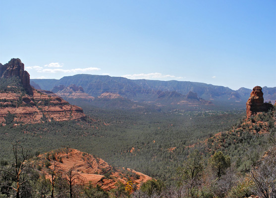
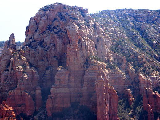
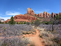
The two backcountry trails closest to Sedona town center are the routes to Soldier Pass and Brins Mesa, together forming an enjoyable 5.5 mile loop, and while the scenery is not quite so impressive as on more remote paths like Secret Canyon or the West Fork of Oak Creek, there are plenty of tall red rocks all around, great views over the town and the hills of the Red Rock Secret Mountain Wilderness, plus a healthy mixture of interesting desert plants. As a result of the proximity to the suburbs, the trails are wide, dusty and often quite busy, but peace and solitude is still quite easy to find.
9 views of the Brins Mesa and Soldier Pass trails.
Brins Mesa/Soldier Pass topographic map, Sedona location map.
The southern terminus of the Brins Mesa Trail (the Jim Thompson Trailhead), is at the end of Jordan Road, which forks off Highway 89 in the middle of the main tourist center in Sedona, near the AZ 179 junction. This road passes through a residential area, becomes a gravel track, crosses a streambed and ends at a newly-enlarged parking area from where several trails begin. The other possible start point for the loop hike is along the fully paved Soldier Pass Road, at the east side of West Sedona. From the two trailheads, which are linked by the 1.2 mile Jordan Trail, the main paths climb northwards into the hills, meeting near Soldier Pass on top of Brins Mesa. The loop involves an elevation gain, then loss, of 600 feet and takes around 2 hours.
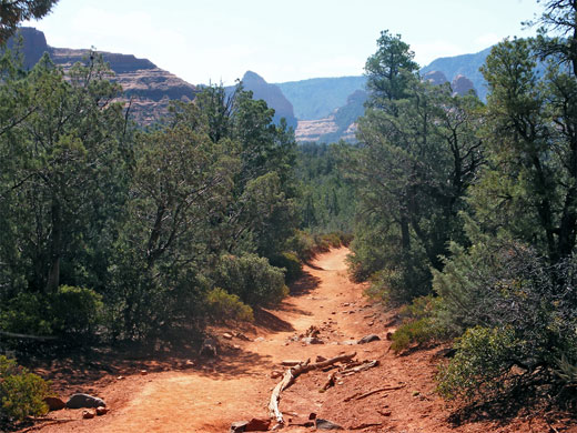
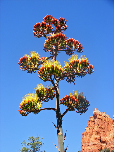
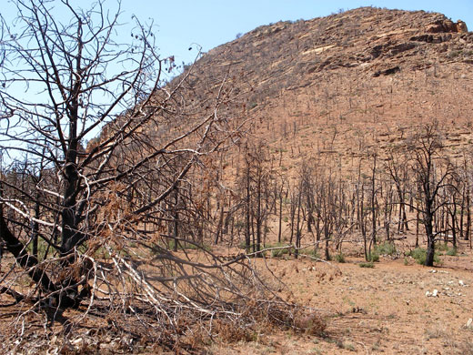
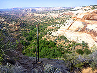
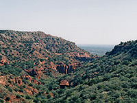
From the Brins Mesa trailhead, the well used, sandy path ascends gradually through well vegetated land, densely covered with pine trees, yucca, juniper, manzanita and opuntia, as it approaches the slopes forming the south edge of the mesa, at the upper end of Mormon Canyon. The gradient increases markedly towards the end though the climb is quite short, and the trail soon flattens out again as the views, already wide-ranging, now expand to include much land to the north as well as the south. The open, grassy top of the mesa and the edges of the surrounding hills were quite severely burned in a fire in the summer of 2006 so are now beginning a slow process of regeneration. Two miles from the carpark, the path arrives at an unsignposted junction with the Soldier Pass Trail - the Brins Mesa route continues northwards for another 1.8 miles, across the plateau then gently down the far side alongside a small creek, ending at the Dry Creek Road.
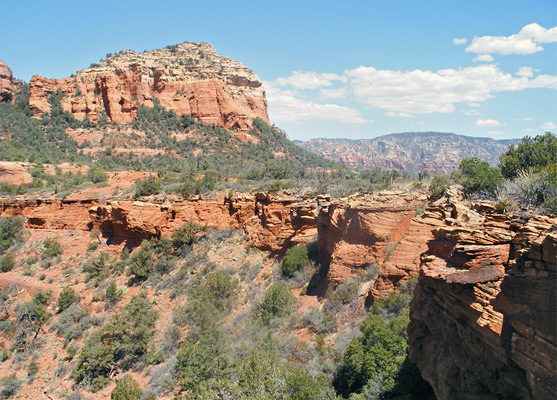
After reaching the edge of the mesa at Soldier Pass, the next section of the loop is similar to the first, but in reverse; a steep but short descent across an open, rocky hillside is followed by a longer trek through the bushes, now with more limited views. The path reaches a junction with a dirt track, and follows close by on the east side through shady woodland to a second junction, beside a section of Soldier Creek containing several deep potholes (the 'Seven Sacred Pools') in the red sandstone rocks, usually filled with water even in dry weather, long after the stream stops flowing.
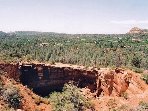
Nearby is a short side road to the Devils Kitchen, a sheer-walled, 50 foot deep sinkhole formed in the 1880s by a collapse in the Schnebly Hill sandstone. Both the sinkhole and the pools are often visited by jeep tours, and the paths here are open for mountain bikers, so the area can become quite congested. The trail passes right by the hole then heads east, around the base of a tall red butte. It soon splits, though both forks lead back to the starting point. The right fork (Jordan Trail) is a little longer, though less steep, and passes close to residences nestled in the trees right on the north edge of Sedona, before ending at the Jordan Road 1/4 mile from the starting point. The other fork is the Cibola Pass Trail, which climbs over a ridge and rejoins the Brins Mesa Trail a short distance from the parking area.
Photographs
9 views of the Brins Mesa and Soldier Pass trails.
Maps
Brins Mesa/Soldier Pass topographic map, Sedona location map.
Start of the Trail
The southern terminus of the Brins Mesa Trail (the Jim Thompson Trailhead), is at the end of Jordan Road, which forks off Highway 89 in the middle of the main tourist center in Sedona, near the AZ 179 junction. This road passes through a residential area, becomes a gravel track, crosses a streambed and ends at a newly-enlarged parking area from where several trails begin. The other possible start point for the loop hike is along the fully paved Soldier Pass Road, at the east side of West Sedona. From the two trailheads, which are linked by the 1.2 mile Jordan Trail, the main paths climb northwards into the hills, meeting near Soldier Pass on top of Brins Mesa. The loop involves an elevation gain, then loss, of 600 feet and takes around 2 hours.
Brins Mesa Trail (#119)
From the Brins Mesa trailhead, the well used, sandy path ascends gradually through well vegetated land, densely covered with pine trees, yucca, juniper, manzanita and opuntia, as it approaches the slopes forming the south edge of the mesa, at the upper end of Mormon Canyon. The gradient increases markedly towards the end though the climb is quite short, and the trail soon flattens out again as the views, already wide-ranging, now expand to include much land to the north as well as the south. The open, grassy top of the mesa and the edges of the surrounding hills were quite severely burned in a fire in the summer of 2006 so are now beginning a slow process of regeneration. Two miles from the carpark, the path arrives at an unsignposted junction with the Soldier Pass Trail - the Brins Mesa route continues northwards for another 1.8 miles, across the plateau then gently down the far side alongside a small creek, ending at the Dry Creek Road.
Soldier Pass Trail (#66)
After reaching the edge of the mesa at Soldier Pass, the next section of the loop is similar to the first, but in reverse; a steep but short descent across an open, rocky hillside is followed by a longer trek through the bushes, now with more limited views. The path reaches a junction with a dirt track, and follows close by on the east side through shady woodland to a second junction, beside a section of Soldier Creek containing several deep potholes (the 'Seven Sacred Pools') in the red sandstone rocks, usually filled with water even in dry weather, long after the stream stops flowing.
Devils Kitchen
Nearby is a short side road to the Devils Kitchen, a sheer-walled, 50 foot deep sinkhole formed in the 1880s by a collapse in the Schnebly Hill sandstone. Both the sinkhole and the pools are often visited by jeep tours, and the paths here are open for mountain bikers, so the area can become quite congested. The trail passes right by the hole then heads east, around the base of a tall red butte. It soon splits, though both forks lead back to the starting point. The right fork (Jordan Trail) is a little longer, though less steep, and passes close to residences nestled in the trees right on the north edge of Sedona, before ending at the Jordan Road 1/4 mile from the starting point. The other fork is the Cibola Pass Trail, which climbs over a ridge and rejoins the Brins Mesa Trail a short distance from the parking area.
Brins Mesa and Soldier Pass - Similar Hikes
All Contents © Copyright The American Southwest | Comments and Questions | Contribute | Affiliate Marketing Disclosure | Site Map