Neck Spring Trail, Canyonlands National Park
Utah > Canyonlands National Park > Island in the Sky > Hiking > Neck Spring Trail
Neck Spring Trail
Well used loop trail past Neck Spring, winding around some upper tributaries of Taylor Canyon, also passing Cabin Spring and some old cattle ranching relics. The path has good views westwards, towards the Green River
Length: 5 miles (loop)
Elevation change: 260 feet
Difficulty: Moderate - a few short, steep sections
Type: Loop
Usage: Medium
Season: All year, though summers are very hot
Trailhead: Shafer Canyon Overlook, just south of the visitor center
Rating (1-5): ★★★★★
Elevation change: 260 feet
Difficulty: Moderate - a few short, steep sections
Type: Loop
Usage: Medium
Season: All year, though summers are very hot
Trailhead: Shafer Canyon Overlook, just south of the visitor center
Rating (1-5): ★★★★★

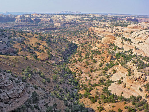
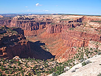
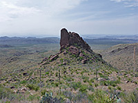
Most trails in the Island in the Sky district of Canyonlands National Park are either short and level, leading to viewpoints on the edge of the plateau, or long and steep, descending 1,300 feet or more to the White Rim. The Neck Spring Trail is an exception, intermediate in both length and elevation change; it crosses several upper branches of Taylor Canyon, a major Green River tributary, passing two seasonal springs and various relics from cattle ranching operations in the mid-20th century, prior to the national park creation.
The views are quite good but not as spectacular or far-reaching as other routes nearby, since the path is about half along shallow ravines and half across a bushy plateau, and yet the hike is still popular, perhaps going to its easily-reached start point near the visitor center, at Shafer Canyon Overlook. The 5 mile circuit can be done in little more than two hours since most is straightforward, with just one steep section about half way along.
Map of the Island in the Sky.
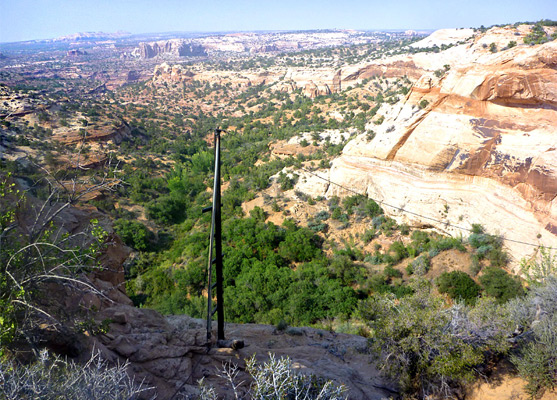
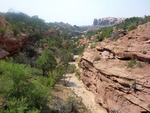
The Neck Spring trailhead shares a parking area with Shafer Canyon Overlook on The Neck, the very narrow strip of land separating the main part of Island in the Sky (Grays Pasture), from the wider plateau to the north. Large cairns lead the trail from the parking lot, across the road and down to the Kayenta sandstone bench below, where it turns back south, traversing flat land at the base of low cliffs of Navajo sandstone. Next is a sandy area, directly below the road, followed by two side drainages, one containing the remains of a wooden water trough constructed in the 1930s, and then a larger drainage, leading to a big curving alcove at the head of the canyon.
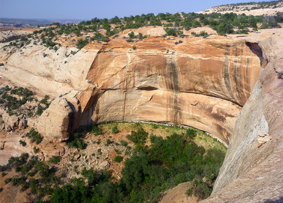
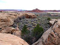
The far upper end is overgrown with bushes and trees, which conceal Neck Spring, reachable only via a short cross-country walk, since the trail crosses to the far side a little way below and heads back north, downstream. It rises slightly across a sandy slope, crosses a few more ravines and basins, and enters the next big drainage. A narrow, prominent arch is visible below, on the far side. The relatively wide canyon is followed southwards for half a mile, past the remains of a wooden cabin, nearly to the sheer-walled alcove at the upper end, before the path crosses the streambed and climbs steeply to the plateau rim, this being the one slightly strenuous section of the hike.
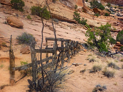
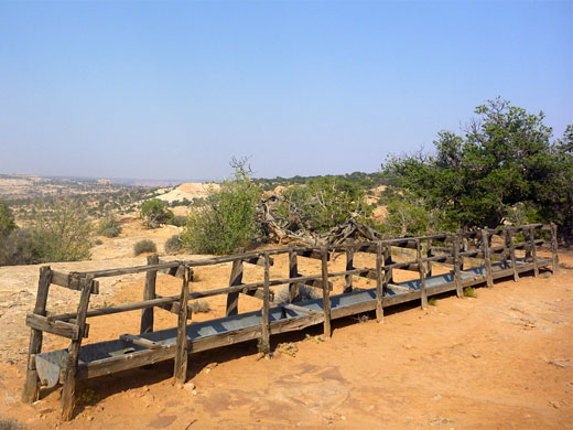
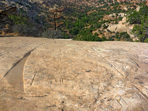
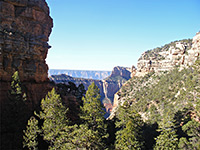
The drainage also contains a seasonal water source (Cabin Spring), and to access the water the cattle ranchers built troughs and a pulley system directly above, the remains of which can be inspected a little further along the trail, as it follows the canyon at rim level. Other evidence of the past use includes deep grooves in the smooth sandstone, cut by moving cables. The last section of the loop trail is flat, over slickrock and sand dunes for nearly a mile, back across the road, along a ridge and down to Shafer Canyon Overlook. The final few hundred feet have good views of the deep gorge below, and east towards the Colorado River.
The views are quite good but not as spectacular or far-reaching as other routes nearby, since the path is about half along shallow ravines and half across a bushy plateau, and yet the hike is still popular, perhaps going to its easily-reached start point near the visitor center, at Shafer Canyon Overlook. The 5 mile circuit can be done in little more than two hours since most is straightforward, with just one steep section about half way along.
Location
Map of the Island in the Sky.
The Trail
The Neck Spring trailhead shares a parking area with Shafer Canyon Overlook on The Neck, the very narrow strip of land separating the main part of Island in the Sky (Grays Pasture), from the wider plateau to the north. Large cairns lead the trail from the parking lot, across the road and down to the Kayenta sandstone bench below, where it turns back south, traversing flat land at the base of low cliffs of Navajo sandstone. Next is a sandy area, directly below the road, followed by two side drainages, one containing the remains of a wooden water trough constructed in the 1930s, and then a larger drainage, leading to a big curving alcove at the head of the canyon.
Neck Spring
The far upper end is overgrown with bushes and trees, which conceal Neck Spring, reachable only via a short cross-country walk, since the trail crosses to the far side a little way below and heads back north, downstream. It rises slightly across a sandy slope, crosses a few more ravines and basins, and enters the next big drainage. A narrow, prominent arch is visible below, on the far side. The relatively wide canyon is followed southwards for half a mile, past the remains of a wooden cabin, nearly to the sheer-walled alcove at the upper end, before the path crosses the streambed and climbs steeply to the plateau rim, this being the one slightly strenuous section of the hike.
Cabin Spring
The drainage also contains a seasonal water source (Cabin Spring), and to access the water the cattle ranchers built troughs and a pulley system directly above, the remains of which can be inspected a little further along the trail, as it follows the canyon at rim level. Other evidence of the past use includes deep grooves in the smooth sandstone, cut by moving cables. The last section of the loop trail is flat, over slickrock and sand dunes for nearly a mile, back across the road, along a ridge and down to Shafer Canyon Overlook. The final few hundred feet have good views of the deep gorge below, and east towards the Colorado River.
Neck Spring Trail - Similar Hikes
All Contents © Copyright The American Southwest | Comments and Questions | Contribute | Affiliate Marketing Disclosure | Site Map