White Rim Overlook Trail, Canyonlands National Park
Utah > Canyonlands National Park > Island in the Sky > Hiking > White Rim Overlook Trail
White Rim Overlook Trail
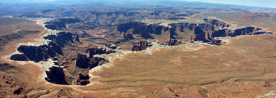
Some of the best views of the White Rim and the spires of Monument Basin are from the end of this short trail along a narrow, eastwards-projecting promontory
Length: 0.9 miles
Elevation change: 140 feet
Difficulty: Easy
Type: One way
Usage: Medium
Season: All year
Trailhead: Near the south end of the scenic drive, along a short picnic loop road
Rating (1-5): ★★★★★
Elevation change: 140 feet
Difficulty: Easy
Type: One way
Usage: Medium
Season: All year
Trailhead: Near the south end of the scenic drive, along a short picnic loop road
Rating (1-5): ★★★★★


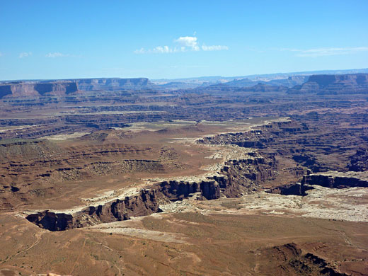
There are three spectacular overlooks along the southern section of the Island in the Sky plateau, all accessed by short trails; Murphy Point in the west, Grand View in the south and White Rim in the east, reached by a level, one mile path that follows a narrowing promontory to its far end, where the cliffs fall away vertically on three sides, giving an expansive panorama of the White Rim, the Colorado River canyon, the spires of Monument Basin to the south and the upper part of Gooseberry Canyon to the north.
The trail crosses flat, little-vegetated terrain and has good views all the way, yet is not too busy, perhaps as the trailhead is not well signposted; the hike begins from a picnic area along a short side road east of the main highway.
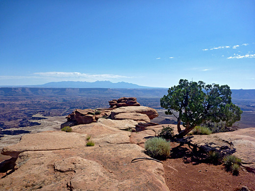
The trail to White Rim Overlook starts half way along the narrow picnic area loop road, at a small parking area with space for about six vehicles. The easy-to-follow route crosses a typical mixture of slickrock and dunes, composed of the Kayenta sandstone that forms the top of the mile-long promontory as it projects eastwards from the Island in the Sky mesa. The path soon passes a junction with the Gooseberry Trail, which is the easiest way to descend to the White Rim, reaching the lower plateau after 3 miles and a drop of 1,500 feet. The overlook trail continues heading east as the land narrows, descending very gradually, and ending at a small flat-topped knoll.
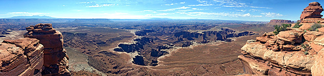
The point has the best views anywhere on the mesa of Gooseberry Canyon and Monument Basin, this latter an enclosed, vertical-walled valley containing isolated spires and narrow mesas, somewhat reminiscent of Monument Valley. Most pinnacles are still topped with the resistant White Rim sandstone but some have lost their caps and are now destined for faster erosion. About 20 miles of the White Rim Road are in view, encircling three sides of the basin, curving around Gooseberry Canyon then heading north past several other branched ravines.
The trail crosses flat, little-vegetated terrain and has good views all the way, yet is not too busy, perhaps as the trailhead is not well signposted; the hike begins from a picnic area along a short side road east of the main highway.
The Trail
The trail to White Rim Overlook starts half way along the narrow picnic area loop road, at a small parking area with space for about six vehicles. The easy-to-follow route crosses a typical mixture of slickrock and dunes, composed of the Kayenta sandstone that forms the top of the mile-long promontory as it projects eastwards from the Island in the Sky mesa. The path soon passes a junction with the Gooseberry Trail, which is the easiest way to descend to the White Rim, reaching the lower plateau after 3 miles and a drop of 1,500 feet. The overlook trail continues heading east as the land narrows, descending very gradually, and ending at a small flat-topped knoll.
The Viewpoint
The point has the best views anywhere on the mesa of Gooseberry Canyon and Monument Basin, this latter an enclosed, vertical-walled valley containing isolated spires and narrow mesas, somewhat reminiscent of Monument Valley. Most pinnacles are still topped with the resistant White Rim sandstone but some have lost their caps and are now destined for faster erosion. About 20 miles of the White Rim Road are in view, encircling three sides of the basin, curving around Gooseberry Canyon then heading north past several other branched ravines.