Confluence Overlook Trail, Canyonlands National Park
Utah > Canyonlands National Park > The Needles > Hiking > Confluence Overlook Trail
Confluence Overlook Trail
Excellent hike across several shallow canyons then over more open country, ending at a high viewpoint of the junction of the Green and Colorado Rivers
Length: 5.5 miles
Elevation change: 200 feet
Difficulty: Moderate
Type: One way
Usage: Medium
Season: Fall, winter, spring are best - summers are hot
Trailhead: Big Spring Canyon Overlook, at the end of the scenic drive
Rating (1-5): ★★★★★
Elevation change: 200 feet
Difficulty: Moderate
Type: One way
Usage: Medium
Season: Fall, winter, spring are best - summers are hot
Trailhead: Big Spring Canyon Overlook, at the end of the scenic drive
Rating (1-5): ★★★★★

The trail towards the confluence of the Green and Colorado rivers, in the middle of Canyonlands National Park, begins at Big Spring Canyon Overlook, at the end of the main road in the Needles section. The 5.5 mile (one-way) route leads up and down several small canyons, passes over slickrock for much of the way and is rather more strenuous than the average maintained NPS trail.
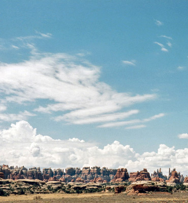
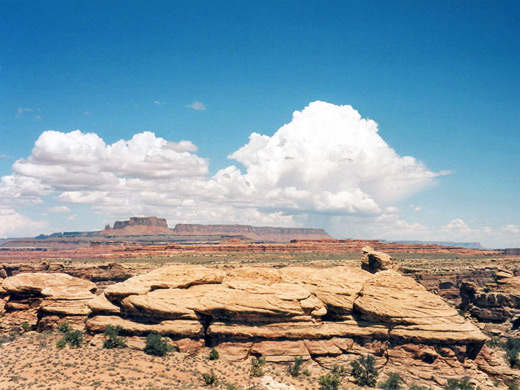
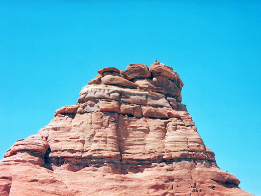
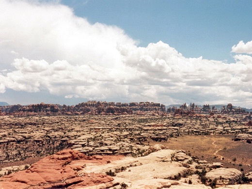
Most of the journey affords good views of the Needles rocks to the south, but the immediate landscape is also spectacular, comprising large orange and white boulders of varying forms. The ground is sparsely covered by small bushes and cacti, harboring lizards of various species which are interesting to observe. Some sections of the trail are quite steep, and a short ladder is installed at one point to surmount a cliff face. Cairns mark the path but it is still easy to get lost, as parts of the path traverse bare rock with no other obvious signs of the way ahead.
Topographic map of the Confluence Overlook Trail.
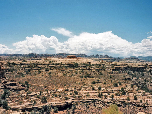
The trail starts by descending into Big Spring Canyon, climbs steeply up the far side, crosses a plateau for 1 mile and follows the course of Elephant Canyon over a short distance. This drainage can be explored downstream to an overlook of the Colorado River, but the main track winds over and around many large ridges and pinnacles for another mile then passes through a flat grassy valley and meets the Devils Lane 4WD road. After another 0.4 miles, a second 4WD road follows the course of Cyclone Canyon towards the Grabens - a series of parallel valleys with near-vertical walls. Both of these routes branch off the Elephant Hill Jeep Trail that begins at the end of a side road starting near the Salt Flat campground.
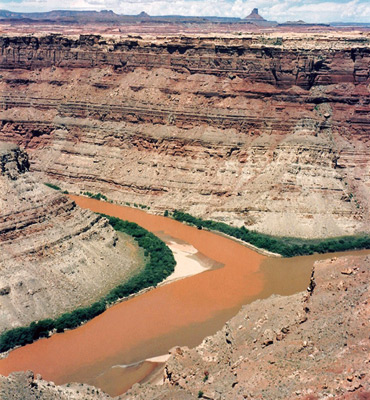
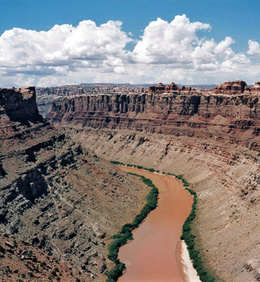
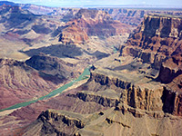
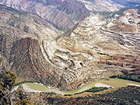
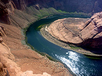
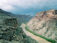
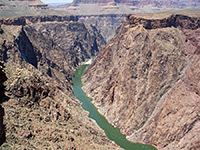
The next short section of the confluence trail is also a spur road off the Cyclone Canyon vehicle track, and ends at a small parking area with pit toilets, about 0.8 miles from the rivers, so it is possible for those unwilling to hike to drive this far instead. The path finally finishes at a pile of boulders with a good view of the river junction. The canyons at this point are moderately deep (850 feet) and the two rivers can be clearly seen, with quite differently colored water. Climbing the cliffs on the north side gives an even better view of the canyons and of a large expanse of rocky wilderness alongside the Colorado.
Overall, the hike is more difficult than might be expected since the terrain is rocky and steep - the trek is especially hard in hot weather and there is no drinking water available along the way. It is very satisfying to get to the end though, to reach the same point where the great explorer John Wesley Powell climbed up from the rivers and remarked:
"What a world of grandeur is spread before us - wherever we look there is but a wilderness of rocks; deep gorges, where the rivers are lost below cliffs and towers and pinnacles; and ten thousand strangely carved forms in every direction; and beyond them, mountains blending with the clouds".
Most of the journey affords good views of the Needles rocks to the south, but the immediate landscape is also spectacular, comprising large orange and white boulders of varying forms. The ground is sparsely covered by small bushes and cacti, harboring lizards of various species which are interesting to observe. Some sections of the trail are quite steep, and a short ladder is installed at one point to surmount a cliff face. Cairns mark the path but it is still easy to get lost, as parts of the path traverse bare rock with no other obvious signs of the way ahead.
Map
Topographic map of the Confluence Overlook Trail.
Elephant Canyon
The trail starts by descending into Big Spring Canyon, climbs steeply up the far side, crosses a plateau for 1 mile and follows the course of Elephant Canyon over a short distance. This drainage can be explored downstream to an overlook of the Colorado River, but the main track winds over and around many large ridges and pinnacles for another mile then passes through a flat grassy valley and meets the Devils Lane 4WD road. After another 0.4 miles, a second 4WD road follows the course of Cyclone Canyon towards the Grabens - a series of parallel valleys with near-vertical walls. Both of these routes branch off the Elephant Hill Jeep Trail that begins at the end of a side road starting near the Salt Flat campground.
The Overlook
The next short section of the confluence trail is also a spur road off the Cyclone Canyon vehicle track, and ends at a small parking area with pit toilets, about 0.8 miles from the rivers, so it is possible for those unwilling to hike to drive this far instead. The path finally finishes at a pile of boulders with a good view of the river junction. The canyons at this point are moderately deep (850 feet) and the two rivers can be clearly seen, with quite differently colored water. Climbing the cliffs on the north side gives an even better view of the canyons and of a large expanse of rocky wilderness alongside the Colorado.
John Wesley Powell
Overall, the hike is more difficult than might be expected since the terrain is rocky and steep - the trek is especially hard in hot weather and there is no drinking water available along the way. It is very satisfying to get to the end though, to reach the same point where the great explorer John Wesley Powell climbed up from the rivers and remarked:
"What a world of grandeur is spread before us - wherever we look there is but a wilderness of rocks; deep gorges, where the rivers are lost below cliffs and towers and pinnacles; and ten thousand strangely carved forms in every direction; and beyond them, mountains blending with the clouds".
Confluence Trail - Similar Hikes
All Contents © Copyright The American Southwest | Comments and Questions | Contribute | Affiliate Marketing Disclosure | Site Map