Lost Canyon and Wooden Shoe Canyon, Canyonlands National Park
Utah > Canyonlands National Park > The Needles > Hiking > Lost Canyon and Wooden Shoe Canyon

Lost Canyon and Wooden Shoe (Squaw) Canyon
Two deep tributaries of Salt Creek, enclosed by red and white cliffs and benches, explored by a loop hike that includes part of the Peekaboo Trail. Lost Canyon is overgrown and often contains a stream, while Wooden Shoe Canyon is drier and more open
Length: 8.7 miles, round trip
Elevation change: 400 feet
Difficulty: Moderate
Type: Partial loop
Usage: Low to medium
Season: Fall, winter, spring are best
Trailhead: Salt Flat campground A
Rating (1-5): ★★★★★
Elevation change: 400 feet
Difficulty: Moderate
Type: Partial loop
Usage: Low to medium
Season: Fall, winter, spring are best
Trailhead: Salt Flat campground A
Rating (1-5): ★★★★★

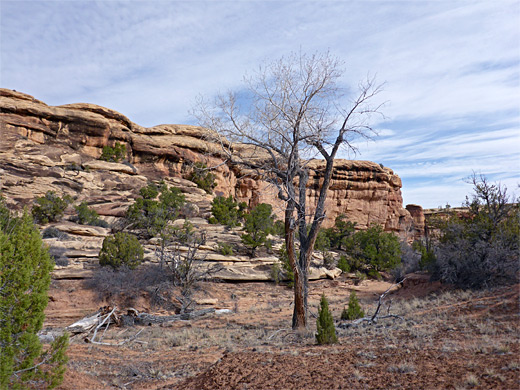
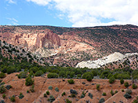
Lost and Wooden Shoe (previously Squaw) are two major west-side tributaries of Salt Creek in the Needles District of Canyonlands National Park, flanked by cliffs and benches of red and white rock (both part of the same formation, Cedar Mesa Sandstone), and the lower reaches may be explored via a loop hike of 6.5 miles, starting 1.1 miles down the Peekaboo Trail, which begins at the Salt Flat (Squaw Flat) Campground. The two drainages are somewhat different in character - Wooden Shoe is quite wide, mostly dry and not too overgrown, while Lost, the more interesting, is at least in part narrower, deeper, more vegetated and more likely to contain flowing water.
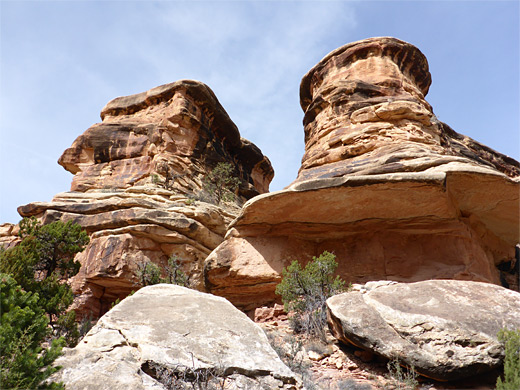
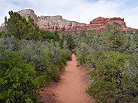
The best part of the hike is the traverse of benches between the two canyons, as here there is virtually no vegetation, just slickrock, fins and cliffs, with extensive views across the Needles. There is also a similar, lower saddle along the Peekaboo Trail between the two canyon, but apart from these two sections, the path is nearly level, partly shaded, well used and easy to follow; it is marked by cairns in the rocky places.
Two options for a longer hike are to continue along the Peekaboo Trail to Salt Creek, or to additionally visit Big Spring Canyon, the next drainage west, which is linked from Wooden Shoe Canyon by a connecting path.
Topographic map of Lost Canyon and Wooden Shoe Canyon.
14 views of Lost Canyon and Wooden Shoe Canyon.
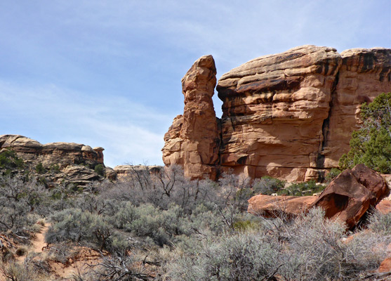
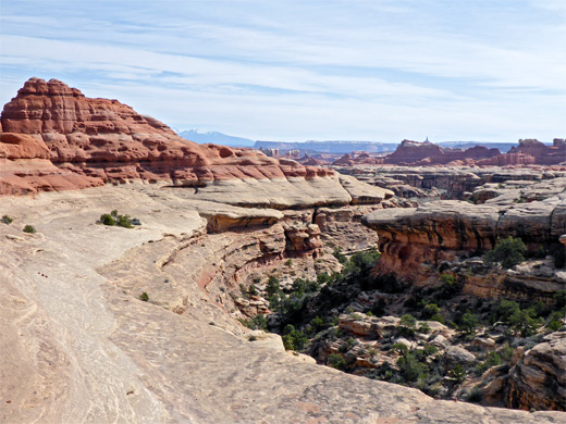
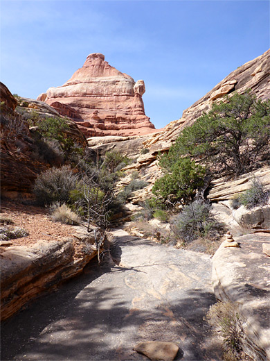
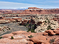
The Peekaboo Trail starts near site A in Salt Flat Campground, crossing open, bushy terrain, rising in the middle to cross a rocky outcrop, and reaching the sandy bed of Wooden Shoe Canyon after 1.1 miles. A junction just before is with the Wooden Shoe Canyon Trail, which heads south into the canyon mouth; ahead, the drainage narrows only very slowly, and the creekbed, usually dry, winds through a wide band of sandbanks, trees and grassy patches. Further south, the canyon is more likely to contain a few residual pools but there is little overall change in the scenery until another junction, 1.5 miles from the start, with the connecting path into Big Spring Canyon, this opposite the SQ2 primitive campsite. Just past this the Wooden Shoe Canyon Trail leaves the valley floor, climbing a narrow, stepped, rocky gully with potholes that may hold residual water, and out to an extensive white slickrock bowl, traversing this just below the upper red sandstone layer to a pass overlooking Lost Canyon, a point which has spectacular views in all directions, including downstream (northeast), across many pinnacles and ridges towards Sixshooter Peak and the distant La Sal Mountains - see panorama.
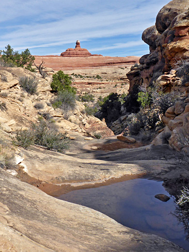
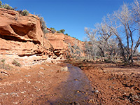
From the divide, a quick descent takes the trail into the narrow confines of Lost Canyon, beside its overgrown creek bed, though the drainage is enclosed for a relatively short distance until the dense bushes and trees are replaced by isolated cottonwoods and patches of long grass, plus some very tall sandbanks. Camp LC3 is passed, just after small tributary on the east, as the canyon widens more. The path follows the creekbed in a few places but mostly rises above, on banks or benches. Some large pools appear, up to three feet deep and lined by boggy ground. The streambed also widens after a while and becomes straight, filled with deep, soft sand, and continues like this to an intersection with the Peekaboo Trail, near a patch of trees, 1.5 miles from the initial junction and 2.6 miles from the trailhead. Turning left (west), this trail leads up another sandy canyon for a little way before climbing above to the north, aided by a short ladder at one point, along a bench below a narrow red ridge, and up to a red saddle which has grand views west, over Salt Flat. From here, a briefly steep descent is followed by several dry washes and groves of trees, and then a big open flat, in the middle of which is the initial junction, at the mouth of Wooden Shoe Canyon.
The best part of the hike is the traverse of benches between the two canyons, as here there is virtually no vegetation, just slickrock, fins and cliffs, with extensive views across the Needles. There is also a similar, lower saddle along the Peekaboo Trail between the two canyon, but apart from these two sections, the path is nearly level, partly shaded, well used and easy to follow; it is marked by cairns in the rocky places.
Two options for a longer hike are to continue along the Peekaboo Trail to Salt Creek, or to additionally visit Big Spring Canyon, the next drainage west, which is linked from Wooden Shoe Canyon by a connecting path.
Map
Topographic map of Lost Canyon and Wooden Shoe Canyon.
Photographs
14 views of Lost Canyon and Wooden Shoe Canyon.

Peekaboo Trail to Wooden Shoe Canyon
The Peekaboo Trail starts near site A in Salt Flat Campground, crossing open, bushy terrain, rising in the middle to cross a rocky outcrop, and reaching the sandy bed of Wooden Shoe Canyon after 1.1 miles. A junction just before is with the Wooden Shoe Canyon Trail, which heads south into the canyon mouth; ahead, the drainage narrows only very slowly, and the creekbed, usually dry, winds through a wide band of sandbanks, trees and grassy patches. Further south, the canyon is more likely to contain a few residual pools but there is little overall change in the scenery until another junction, 1.5 miles from the start, with the connecting path into Big Spring Canyon, this opposite the SQ2 primitive campsite. Just past this the Wooden Shoe Canyon Trail leaves the valley floor, climbing a narrow, stepped, rocky gully with potholes that may hold residual water, and out to an extensive white slickrock bowl, traversing this just below the upper red sandstone layer to a pass overlooking Lost Canyon, a point which has spectacular views in all directions, including downstream (northeast), across many pinnacles and ridges towards Sixshooter Peak and the distant La Sal Mountains - see panorama.
Lost Canyon
From the divide, a quick descent takes the trail into the narrow confines of Lost Canyon, beside its overgrown creek bed, though the drainage is enclosed for a relatively short distance until the dense bushes and trees are replaced by isolated cottonwoods and patches of long grass, plus some very tall sandbanks. Camp LC3 is passed, just after small tributary on the east, as the canyon widens more. The path follows the creekbed in a few places but mostly rises above, on banks or benches. Some large pools appear, up to three feet deep and lined by boggy ground. The streambed also widens after a while and becomes straight, filled with deep, soft sand, and continues like this to an intersection with the Peekaboo Trail, near a patch of trees, 1.5 miles from the initial junction and 2.6 miles from the trailhead. Turning left (west), this trail leads up another sandy canyon for a little way before climbing above to the north, aided by a short ladder at one point, along a bench below a narrow red ridge, and up to a red saddle which has grand views west, over Salt Flat. From here, a briefly steep descent is followed by several dry washes and groves of trees, and then a big open flat, in the middle of which is the initial junction, at the mouth of Wooden Shoe Canyon.
Lost Canyon and Wooden Shoe Canyon - Similar Hikes
All Contents © Copyright The American Southwest | Comments and Questions | Contribute | Affiliate Marketing Disclosure | Site Map