Bear Mountain Trail
#54
#54
Relatively short but quite challenging trail to a flat-topped summit at the edge of the Red Rock Secret Mountain Wilderness - excellent views over Dry Creek Valley and south towards the Verde Valley
Length: 2.4 miles
Elevation change: 1,800 feet
Difficulty: Moderate to strenuous
Type: One way
Usage: Low
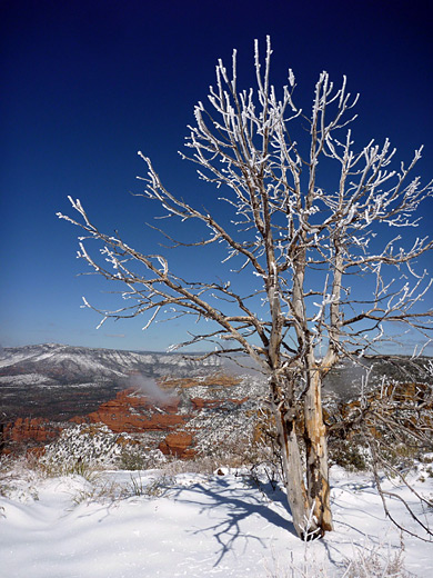
Season: Spring, summer, fall - the summit is snow-covered in winter
Trailhead: Along Boynton Pass Road
Rating (1-5): ★★★★★
Elevation change: 1,800 feet
Difficulty: Moderate to strenuous
Type: One way
Usage: Low
Season: Spring, summer, fall - the summit is snow-covered in winter
Trailhead: Along Boynton Pass Road
Rating (1-5): ★★★★★

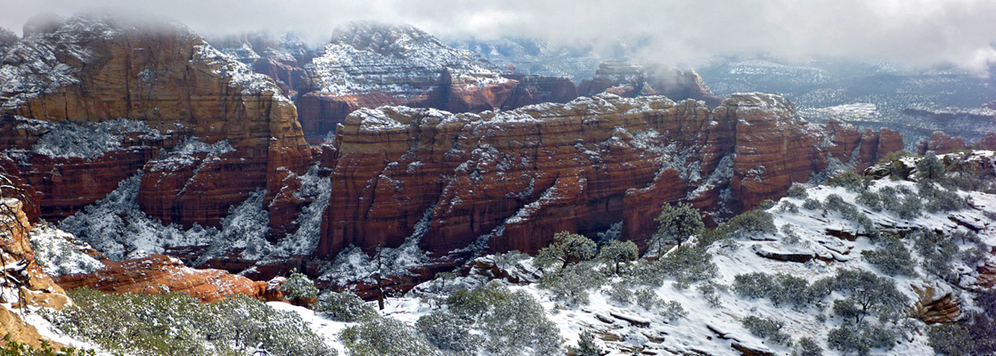
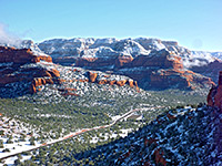
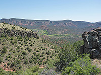
Bear Mountain rises 1,800 feet above the surrounding bushy flats, near the south edge of the Red Rock Secret Mountain Wilderness, and its level summit overlooks a huge area of canyons, cliffs and buttes, extending from Sedona and the lower end of Oak Creek Canyon in the east, south to the Verde Valley and west towards Sycamore Canyon. The hike to the top is relatively short (2.4 miles), but steep in places, climbing a series of cliffs and benches to a viewpoint at the southwest side of the summit plateau, from where another overlook (above the upper end of Boynton Canyon) can be reached by a short walk northeastwards.
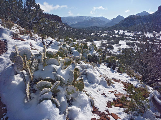
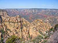
The trail is hiked less frequently than some nearby, less strenuous routes along canyons, in part due to the rather distant trailhead location, 6 miles from Sedona, along a road that was unpaved until a few years ago. Besides the far reaching views of distant landscapes, the path also encounters a good variety of rock formations en route, formed from red Schnebly Hill sandstone in the lower elevations and orange-brown Coconino sandstone higher up.
Bear Mountain topographic map, Sedona location map.
8 views along the Bear Mountain Trail.
The parking area for the Bear Mountain Trail is also used for the shorter and busier path to Doe Mountain, a location 5.7 miles from AZ 89A in Sedona via Dry Creek Road and Boynton Pass Road. All parked vehicles need to display a Red Rock Pass, cost $5 per day.
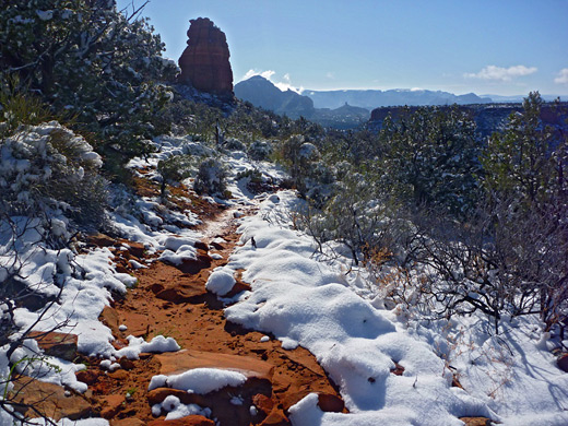
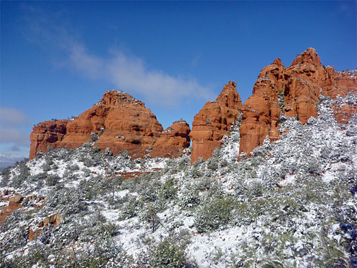
From the parking area on the opposite side of Boynton Pass Road, the trail soon crosses a dry wash, passes the Red Rock Secret Mountain Wilderness boundary fence and a register, while staying fairly flat for a third of a mile, as it winds across sandy land sparsely covered by cacti and yucca, then starts a climb of the steepening hillside beyond - up a bouldery slope and a short gully, to the first bench, which is at the same elevation (5,050 feet) as the top of Doe Mountain to the southeast. The path levels out and traverses westwards a way, into a sheltered basin bordered by a line of red pinnacles on the far side. Following this is one of the steepest sections of the route, switchbacking up to the second bench, after which the gradient lessens again, and the path heads up a sloping ridgeline to a bushy knoll, providing good views all around. It then descends a little to a saddle before resuming the ascent of the ridgeline, a little steeper than before.
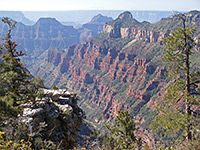
The scenery is especially dramatic to the east, bordering Fay Canyon, as here the cliffs have eroded into a series of spires and ridges, colored various shades of red and orange. The ridge drops down slightly to another saddle, where the ground falls away very steeply to the west, then the path starts the final climb, to another knoll and thence to the summit. The ground on top of the mountain is quite flat, and treeless near the west edge, becoming more wooded further east. The most extensive views are to the south, across the Verde Valley to the Black Hills, and to Casner Mountain in the west. Although the official trail ends here, a narrower path continues to the east side of the plateau, yet neither location is the true summit of the mountain; this lies another mile north, on the far side of an intervening ridge, and requires some quite difficult off-trail hiking to reach.
The trail is hiked less frequently than some nearby, less strenuous routes along canyons, in part due to the rather distant trailhead location, 6 miles from Sedona, along a road that was unpaved until a few years ago. Besides the far reaching views of distant landscapes, the path also encounters a good variety of rock formations en route, formed from red Schnebly Hill sandstone in the lower elevations and orange-brown Coconino sandstone higher up.
Maps
Bear Mountain topographic map, Sedona location map.
Photographs
8 views along the Bear Mountain Trail.
Bear Mountain Trailhead
The parking area for the Bear Mountain Trail is also used for the shorter and busier path to Doe Mountain, a location 5.7 miles from AZ 89A in Sedona via Dry Creek Road and Boynton Pass Road. All parked vehicles need to display a Red Rock Pass, cost $5 per day.
Start of the Path
From the parking area on the opposite side of Boynton Pass Road, the trail soon crosses a dry wash, passes the Red Rock Secret Mountain Wilderness boundary fence and a register, while staying fairly flat for a third of a mile, as it winds across sandy land sparsely covered by cacti and yucca, then starts a climb of the steepening hillside beyond - up a bouldery slope and a short gully, to the first bench, which is at the same elevation (5,050 feet) as the top of Doe Mountain to the southeast. The path levels out and traverses westwards a way, into a sheltered basin bordered by a line of red pinnacles on the far side. Following this is one of the steepest sections of the route, switchbacking up to the second bench, after which the gradient lessens again, and the path heads up a sloping ridgeline to a bushy knoll, providing good views all around. It then descends a little to a saddle before resuming the ascent of the ridgeline, a little steeper than before.
The Summit of Bear Mountain
The scenery is especially dramatic to the east, bordering Fay Canyon, as here the cliffs have eroded into a series of spires and ridges, colored various shades of red and orange. The ridge drops down slightly to another saddle, where the ground falls away very steeply to the west, then the path starts the final climb, to another knoll and thence to the summit. The ground on top of the mountain is quite flat, and treeless near the west edge, becoming more wooded further east. The most extensive views are to the south, across the Verde Valley to the Black Hills, and to Casner Mountain in the west. Although the official trail ends here, a narrower path continues to the east side of the plateau, yet neither location is the true summit of the mountain; this lies another mile north, on the far side of an intervening ridge, and requires some quite difficult off-trail hiking to reach.
Bear Mountain Trail - Similar Hikes
All Contents © Copyright The American Southwest | Comments and Questions | Contribute | Affiliate Marketing Disclosure | Site Map