Cookstove and Harding Springs Trails, Sedona
Arizona > Sedona > Hiking > Cookstove and Harding Springs Trails
Cookstove and Harding Springs Trails
#143 and #51
#143 and #51
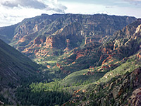
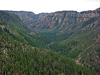
Two short but steep and little-used routes to the eastern rim of Oak Creek Canyon, near its northern end, linked by a path alongside a wooded section of the creek; good views from the top, and an interesting variety of plant species
Length: 2.6 miles, round trip
Elevation change: 800 feet
Difficulty: Moderate - steep in places
Type: Loop
Usage: Low
Season: All year, unless snow-covered in the winter
Trailhead: Verge at the entrance to the Cave Spring campground
Rating (1-5): ★★★★★
Elevation change: 800 feet
Difficulty: Moderate - steep in places
Type: Loop
Usage: Low
Season: All year, unless snow-covered in the winter
Trailhead: Verge at the entrance to the Cave Spring campground
Rating (1-5): ★★★★★

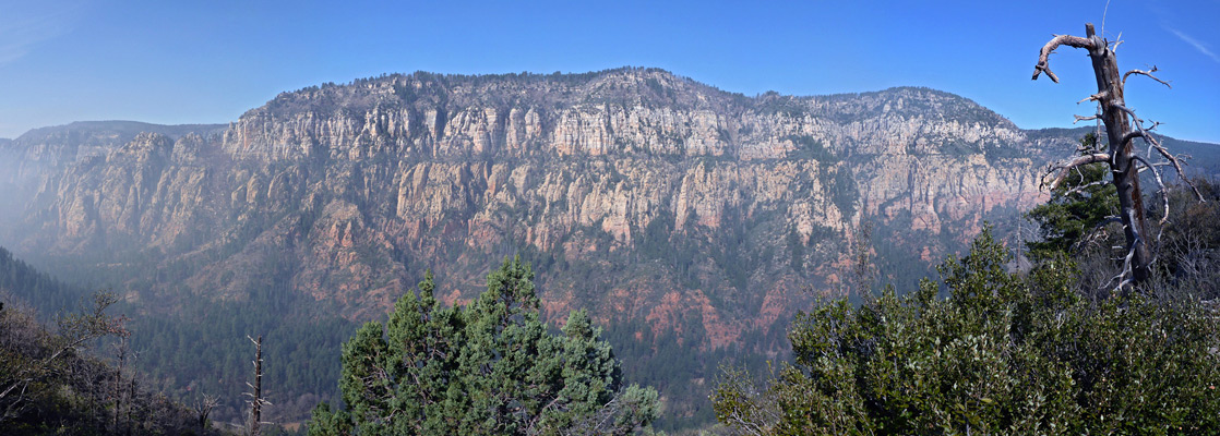
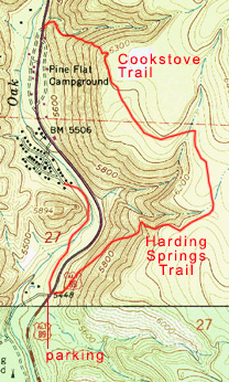
The northernmost hike in Oak Creek Canyon, north of Sedona, is the 0.7 mile Cookstove Trail, which climbs steeply beside a minor drainage (Cookstove Draw), up to a viewpoint on the eastern rim, then meets the Harding Springs Trail, which passes a few seasonal pools and another viewpoint before descending rather less steeply, back to Hwy 89A.
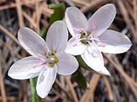
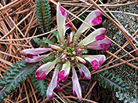
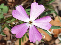
Both routes are very lightly used, since they are not obviously marked, and while the views are in general rather limited because of the tall woodland, there are several other overlooks en route, and a good variety of plant species are in bloom during spring and early summer.
The two trails are separated by 1.2 miles of the highway, and a loop can be made of 2.6 miles, the two trailheads connected by a combination of minor paths, a campground road and a small amount of walking on verges; a round-trip of about 90 minutes. The loop is best in the anticlockwise direction, up Harding Springs and down Cookstove, since the latter path is steeper; the former was originally used by cattlemen, taking stock to and from summer pastures. All this area is part of the Coconino National Forest, and there is no charge to park at the trailhead.
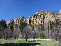
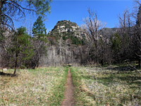
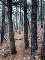
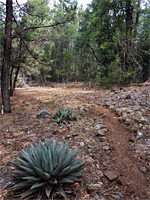
Parking is on a wide verge at the entrance to the Cave Spring campground, on the west side of Hwy 89A; the Harding Springs Trail starts directly opposite, identified only by an old iron sign, in front of a larger sign for the campground. The path rises through a forest of tall trees, not too steeply - a long, diagonal ascent across ground covered by many yellow-flowered rough draba in the spring. Yucca and agave mingle with the mature pines. The trail passes a rocky viewpoint above a steep ravine to the north then cuts bask, giving views of the rim above and, after more climbing, by around 300 feet, reaches the basalt plateau.
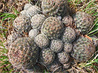
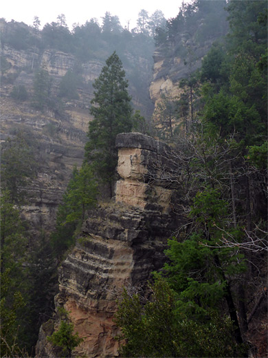
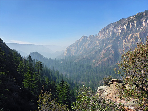
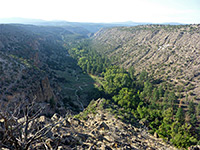
A short spur leads to a fine overlook of Oak Creek Canyon, both up and down. A short distance beyond, another path forks left, northeastwards, just past an old post, presumably once holding a trail notice. The path on the right leads eventually to Thomas Point. The route on the left is faint at first but becomes better defined after a while, crossing flat land, initially lightly wooded, then covered by thicker, shadier forest. It descends slightly across a drainage that may hold a few residual pools, a point approximately at the junction of the Harding Springs and Cookstove trails. The latter route rounds a corner where the ground is rockier and more open, with escobaria vivipara cacti, and shorter trees. A small climb is followed by a final patch of tall trees before the path returns to the canyon rim, and a big cairn marks the start of a very steep descent.
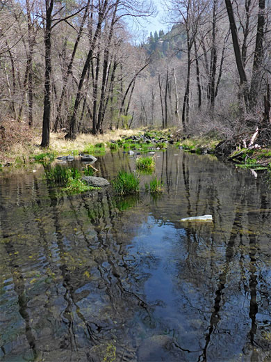
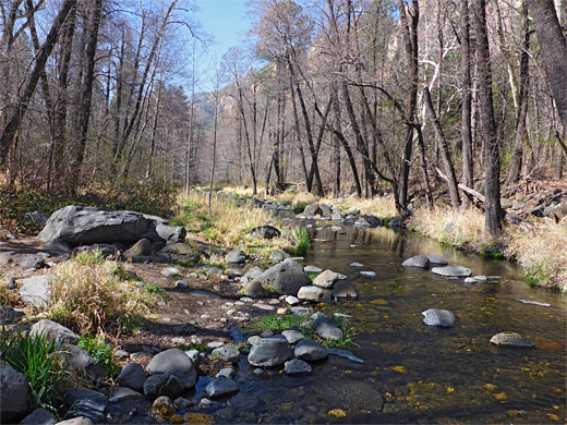
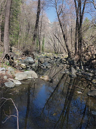
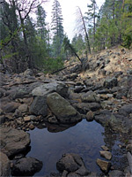
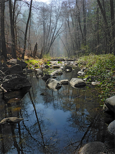
Some short switchbacks take the path down through oaks, conifers and junipers to a viewpoint, mostly downcanyon, after which the path moves along a narrow ridge, quite exposed, and often with big downwards steps, best walked in this downhill direction. The final section of the descent is gentler, meeting the highway just opposite the entrance to the Pine Flat campground. The 1.2 mile walk from here back to the start point is initially along the southern campground road, then a path and a short section of the highway verge, to the side road for Pine Flats, a residential area. Not far away, beyond the southern limit of the houses, after walking either down the creek bed or along the highway, is a faint path on the west side of the stream, somewhat overgrown in places with thorny bushes. This follows the canyon, rising at one point inside a wide bend before descending back to the creek and crossing it via a line of boulders to a grassy meadow containing two stone circles; the path runs through the meadow and emerges from a line of bushes at the entrance to the Cave Spring campground.
Both routes are very lightly used, since they are not obviously marked, and while the views are in general rather limited because of the tall woodland, there are several other overlooks en route, and a good variety of plant species are in bloom during spring and early summer.
The two trails are separated by 1.2 miles of the highway, and a loop can be made of 2.6 miles, the two trailheads connected by a combination of minor paths, a campground road and a small amount of walking on verges; a round-trip of about 90 minutes. The loop is best in the anticlockwise direction, up Harding Springs and down Cookstove, since the latter path is steeper; the former was originally used by cattlemen, taking stock to and from summer pastures. All this area is part of the Coconino National Forest, and there is no charge to park at the trailhead.
Harding Springs Trail to the Rim
Parking is on a wide verge at the entrance to the Cave Spring campground, on the west side of Hwy 89A; the Harding Springs Trail starts directly opposite, identified only by an old iron sign, in front of a larger sign for the campground. The path rises through a forest of tall trees, not too steeply - a long, diagonal ascent across ground covered by many yellow-flowered rough draba in the spring. Yucca and agave mingle with the mature pines. The trail passes a rocky viewpoint above a steep ravine to the north then cuts bask, giving views of the rim above and, after more climbing, by around 300 feet, reaches the basalt plateau.
Path Along the Rim
A short spur leads to a fine overlook of Oak Creek Canyon, both up and down. A short distance beyond, another path forks left, northeastwards, just past an old post, presumably once holding a trail notice. The path on the right leads eventually to Thomas Point. The route on the left is faint at first but becomes better defined after a while, crossing flat land, initially lightly wooded, then covered by thicker, shadier forest. It descends slightly across a drainage that may hold a few residual pools, a point approximately at the junction of the Harding Springs and Cookstove trails. The latter route rounds a corner where the ground is rockier and more open, with escobaria vivipara cacti, and shorter trees. A small climb is followed by a final patch of tall trees before the path returns to the canyon rim, and a big cairn marks the start of a very steep descent.
Cookstove Trail, and Back to the Start
Some short switchbacks take the path down through oaks, conifers and junipers to a viewpoint, mostly downcanyon, after which the path moves along a narrow ridge, quite exposed, and often with big downwards steps, best walked in this downhill direction. The final section of the descent is gentler, meeting the highway just opposite the entrance to the Pine Flat campground. The 1.2 mile walk from here back to the start point is initially along the southern campground road, then a path and a short section of the highway verge, to the side road for Pine Flats, a residential area. Not far away, beyond the southern limit of the houses, after walking either down the creek bed or along the highway, is a faint path on the west side of the stream, somewhat overgrown in places with thorny bushes. This follows the canyon, rising at one point inside a wide bend before descending back to the creek and crossing it via a line of boulders to a grassy meadow containing two stone circles; the path runs through the meadow and emerges from a line of bushes at the entrance to the Cave Spring campground.
Nearby Trails
Topo Map
Cookstove and Harding Springs Trails - Similar Hikes
All Contents © Copyright The American Southwest | Comments and Questions | Contribute | Affiliate Marketing Disclosure | Site Map