James Canyon
Deep, mostly cliff-lined canyon, a tributary of Pumphouse Wash, containing falls, pools and sections of narrows. Most obstacles can be bypassed, otherwise exploration requires swimming and rappelling
Length: 2.1 miles to the last deep pool, 3.4 miles to Pumphouse Wash
Difficulty: Strenuous; wading, route-finding, scrambling
Management: USFS - part of Coconino National Forest
Rocks: Coconino sandstone
Season: Summer and fall - when water levels are low
Trailhead: Kelly Canyon Road; I-17 exit 331
Rating (1-5): ★★★★★
Difficulty: Strenuous; wading, route-finding, scrambling
Management: USFS - part of Coconino National Forest
Rocks: Coconino sandstone
Season: Summer and fall - when water levels are low
Trailhead: Kelly Canyon Road; I-17 exit 331
Rating (1-5): ★★★★★

James Canyon is one of two tributaries of Pumphouse Wash, itself a branch of Oak Creek Canyon, 12 miles north of Sedona. The other, half a mile north is Kelly Canyon, which is completely free of obstructions, unlike James, as this contains four significant falls, some narrow sections and several deep pools over its two mile length.
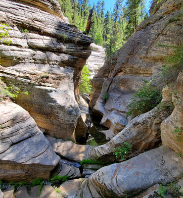
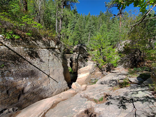
The seasonal stream in James Canyon starts to become enclosed just west of the Interstate 17 crossing, where the bedrock is basalt, and winds westwards becoming up to 400 feet deep, the streambed framed by steep, wooded slopes and sheer cliffs of golden-colored Coconino sandstone. There is no trail anywhere in the canyon, and this location is rarely explored due to the obstacles, which necessitate rappelling and swimming in some places, if descending all the way at creek level, though the most of the obstructions can be bypassed, by short or long climbs up and down the enclosing slopes. The canyon is usually accessible between late spring and fall, once the winter snowmelt season is over.
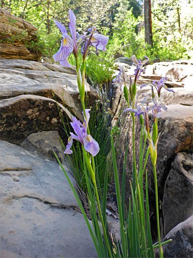
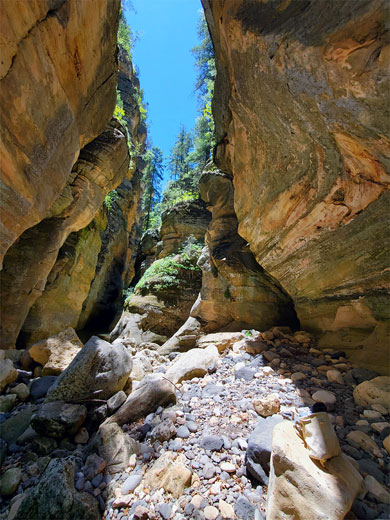
Between the falls and pools, most of the canyon is relatively easy to follow, with a fairly level floor, overgrown in some places but mostly quite open, either slickrock benches or stretches of boulders. All is very pretty, especially in mid summer when a great variety of wildflowers are blooming.
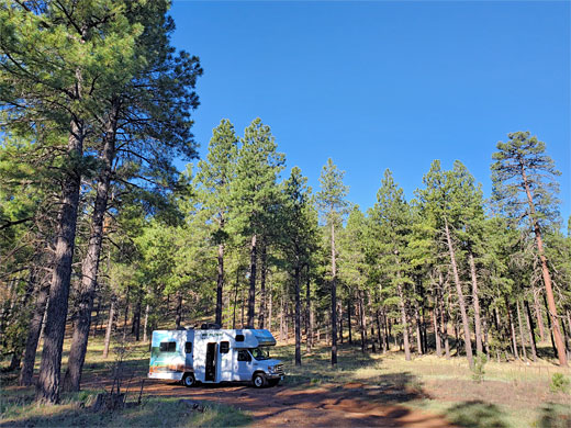
The lower end of James Canyon can be reached by hiking up Pumphouse Wash for 2.3 miles, starting at Hwy 89A, but the usual approach is from the upper end, parking a short distance along the unpaved Kelly Canyon Road (FR 631), off I-17 exit 331 - this is a lightly used but good quality track through the pinewoods, with many fine places for free camping. James Canyon is 0.6 miles south, walking through the open woodland slightly west of due south, gently up to a plateau and down just a bit more sleep steeply into the drainage. The woods are dry but still contain plenty of wildflowers including twincrest onion, King's lupine and Gunnison's mariposa lily.
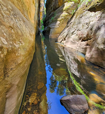
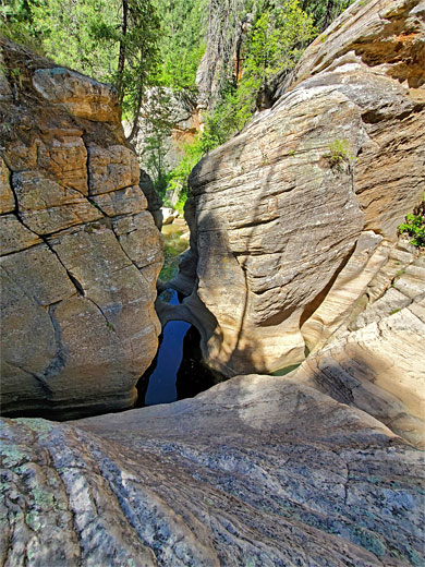
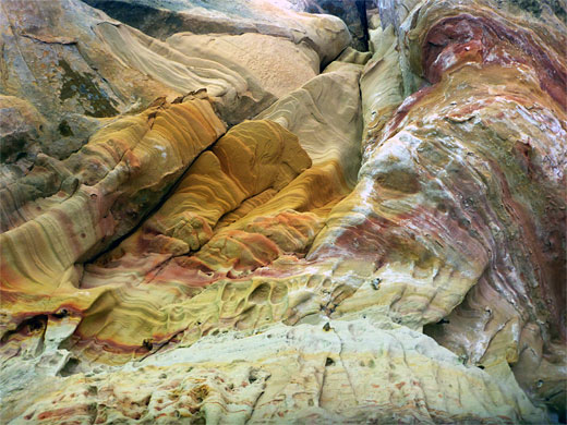
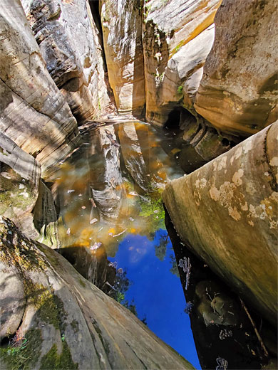
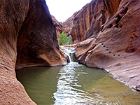
The first few pools in the canyon, where the bedrock is still basalt, are found along a short north-south section, where the streambed is paralleled by some telephone lines; the largest, still fairly shallow, has low cliffs on two sides. The streambed then moves northwestwards and soon encounters the first obstacle, a little slot emptying over an eight foot pour-off into a bigger pool, easily passed on the north side. Round a wide bend is a similar pour-off (known as Keyhole Falls) into another pool, bypassed to the south, and then, soon after, a narrow, sheer-walled passage filled with deep water. This needs a rather longer diversion to pass without wading or swimming - up the slopes to the south, above the head of a gully and down a second gully, back to the streambed in the middle of a pretty section of pools, narrows and sculpted sandstone. More deep wading is needed if continuing downcanyon from here; an alternative is to retrace steps up the gully, traverse a little way further west and descend into a tributary ravine which joins the main drainage just below the enclosed section, after which it is an easy walk for 0.6 miles, up to a large dryfall, since the canyon stays much more open to this point.
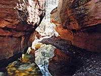
All of the narrow section can also be bypassed on the north side, by climbing a not-too steep slope just before the long narrow pool, all the way back to the open pine forest then following another tributary to rejoin the canyon, meeting it 400 feet below the large drop-off, where the streambed falls 30 feet into a large pool, which is passable with care, if descending the canyon, on the east side.
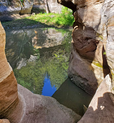
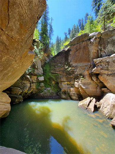
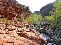
Downstream of the north-side tributary the ravine is green and bushy for a while, with a few small pools, before gradually narrowing, the streambed now covered only by boulders; cliffs rise on each side, somewhat overhanging, and come closer together, framing a pool of deep, cold water, up to 200 feet long, always requiring swimming. This obstacle has no obvious bypass route, and is soon followed by another, shorter swimming pool, then beyond, the final 1.1 miles to the Pumphouse Wash confluence is open once more, with no more falls or significant pools. If continuing to the confluence, three options for a return route are to make an 8 mile loop with Kelly Canyon, to climb the slopes east of Pumphouse then follow a forest track back to the trailhead, or to continue down canyon to Hwy 89A, and use a car shuttle.
The seasonal stream in James Canyon starts to become enclosed just west of the Interstate 17 crossing, where the bedrock is basalt, and winds westwards becoming up to 400 feet deep, the streambed framed by steep, wooded slopes and sheer cliffs of golden-colored Coconino sandstone. There is no trail anywhere in the canyon, and this location is rarely explored due to the obstacles, which necessitate rappelling and swimming in some places, if descending all the way at creek level, though the most of the obstructions can be bypassed, by short or long climbs up and down the enclosing slopes. The canyon is usually accessible between late spring and fall, once the winter snowmelt season is over.
Between the falls and pools, most of the canyon is relatively easy to follow, with a fairly level floor, overgrown in some places but mostly quite open, either slickrock benches or stretches of boulders. All is very pretty, especially in mid summer when a great variety of wildflowers are blooming.
Location
The lower end of James Canyon can be reached by hiking up Pumphouse Wash for 2.3 miles, starting at Hwy 89A, but the usual approach is from the upper end, parking a short distance along the unpaved Kelly Canyon Road (FR 631), off I-17 exit 331 - this is a lightly used but good quality track through the pinewoods, with many fine places for free camping. James Canyon is 0.6 miles south, walking through the open woodland slightly west of due south, gently up to a plateau and down just a bit more sleep steeply into the drainage. The woods are dry but still contain plenty of wildflowers including twincrest onion, King's lupine and Gunnison's mariposa lily.
James Canyon Route Description
The first few pools in the canyon, where the bedrock is still basalt, are found along a short north-south section, where the streambed is paralleled by some telephone lines; the largest, still fairly shallow, has low cliffs on two sides. The streambed then moves northwestwards and soon encounters the first obstacle, a little slot emptying over an eight foot pour-off into a bigger pool, easily passed on the north side. Round a wide bend is a similar pour-off (known as Keyhole Falls) into another pool, bypassed to the south, and then, soon after, a narrow, sheer-walled passage filled with deep water. This needs a rather longer diversion to pass without wading or swimming - up the slopes to the south, above the head of a gully and down a second gully, back to the streambed in the middle of a pretty section of pools, narrows and sculpted sandstone. More deep wading is needed if continuing downcanyon from here; an alternative is to retrace steps up the gully, traverse a little way further west and descend into a tributary ravine which joins the main drainage just below the enclosed section, after which it is an easy walk for 0.6 miles, up to a large dryfall, since the canyon stays much more open to this point.
Bypass Route
All of the narrow section can also be bypassed on the north side, by climbing a not-too steep slope just before the long narrow pool, all the way back to the open pine forest then following another tributary to rejoin the canyon, meeting it 400 feet below the large drop-off, where the streambed falls 30 feet into a large pool, which is passable with care, if descending the canyon, on the east side.
Deep Pool
Downstream of the north-side tributary the ravine is green and bushy for a while, with a few small pools, before gradually narrowing, the streambed now covered only by boulders; cliffs rise on each side, somewhat overhanging, and come closer together, framing a pool of deep, cold water, up to 200 feet long, always requiring swimming. This obstacle has no obvious bypass route, and is soon followed by another, shorter swimming pool, then beyond, the final 1.1 miles to the Pumphouse Wash confluence is open once more, with no more falls or significant pools. If continuing to the confluence, three options for a return route are to make an 8 mile loop with Kelly Canyon, to climb the slopes east of Pumphouse then follow a forest track back to the trailhead, or to continue down canyon to Hwy 89A, and use a car shuttle.
James Canyon Wildflowers
More flowers in the canyon
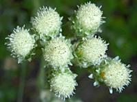 Whitemargin pussytoes |
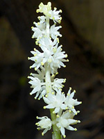 Large false solomon's-seal |
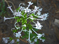 Arizona valerian |
More flowers in the canyon
Nearby Slot Canyons
James Canyon - Similar Hikes
All Contents © Copyright The American Southwest | Comments and Questions | Contribute | Affiliate Marketing Disclosure | Site Map