Bright Angel Point, Grand Canyon National Park
Arizona > Grand Canyon National Park > North Rim > Viewpoints > Bright Angel Point
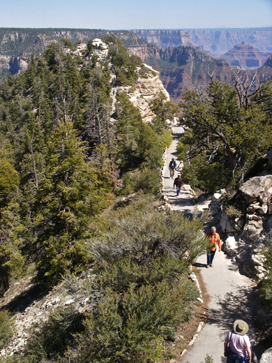
Although paved, the trail is quite steep in a few places, causing some of those unaccustomed to hiking, especially at this high elevation (8,100 feet), to get out of breath. Park rangers patrol the short path on busy summer days, answering questions and offering drinking water to thirsty visitors.

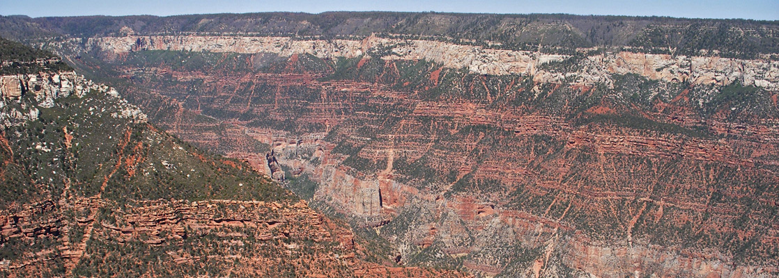
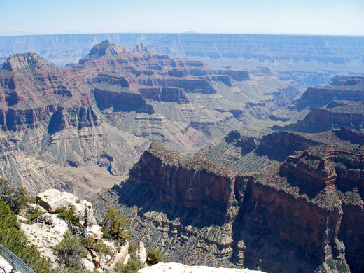
The promontory at Bright Angel tapers to a very narrow ridge with steep drop offs at either side; near the end, the path bridges a few gaps between flat parts of the plateau, though it stops short of the furthest point owing to a deeper ravine. Other rocks ahead and below mean that there are no unobscured views due south, just east and west, and the scene is not quite as spectacular as the furthest North Rim viewpoint at Cape Royal, yet the scene is of course still very impressive. The best observation point is from the top of a small white limestone knoll about ten feet above the end of the path.
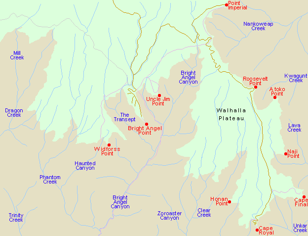
On the west side, Bright Angel Point looks over the end of The Transept, with Oza Butte rising above and Manu Temple just beyond. To the south, most of the foreground contains the lower few miles of Bright Angel Canyon (though the streambed is out of sight) and the jagged ridge bordering it, on top of which are three prominent peaks named after Hindu deities - Deva Temple, Brahma Temple and Zoroaster Temple. A small part of the inner Grand Canyon gorge can be seen, and directly beyond is Garden Creek, course of the Bright Angel Trail up to the south rim. The dead flat Walhalla Plateau occupies most of the eastern aspect, edged by alternating red and white slopes of different sandstone layers, sparsely covered by trees and bushes. Like most North Rim overlooks, the southern horizon at Bright Angel Point is formed by the equally flat Coconino Plateau (14 miles distant and 1,000 feet lower), broken only by the distant outline of the San Francisco Peaks and the closer volcanic cone of Red Butte.
Next Points
West: Widforss Point
East: Uncle Jim Point
All Contents © Copyright The American Southwest | Comments and Questions | Contribute | Affiliate Marketing Disclosure | Site Map