Humphreys Peak Trail
Well-used path to a 12,633 foot summit, the highest point in Arizona; across a floral meadow, up through extensive pine woods, then along a narrow, rocky ridge above the treeline
Length: 4.8 miles
Elevation change: 3,360 feet
Difficulty: Moderate - steep at times, but relatively short
Type: One way
Usage: Medium to high
Season: Summer and early fall
Trailhead: Near the end of Snowbowl Road
Rating (1-5): ★★★★★
Elevation change: 3,360 feet
Difficulty: Moderate - steep at times, but relatively short
Type: One way
Usage: Medium to high
Season: Summer and early fall
Trailhead: Near the end of Snowbowl Road
Rating (1-5): ★★★★★

Unsurprisingly, the path to the top of 12,633 foot Humphreys Peak, the highest point in Arizona, is often rather busy, in part due to the easy trailhead access, at the end of the paved road to the Arizona Snowbowl, a popular skiing facility usually in operation from mid November to late April, the season often extended by use of artificial snow. The 4.8 mile trail is generally wide and easy to follow, and although it has a significant elevation gain, 3,360 feet, much of the hike is not particularly steep, ascending via long, comparatively gentle switchbacks, though one section, up to a saddle linking Humphreys Peak with Agassiz Peak to the south, is rather more strenuous.
The hike is made a little more difficult in some places by lengthy sections of loose stones and exposed roots but nevertheless on fair weather days the 9.6 mile round trip can be done not much more than four hours. As ever with mountain hikes the weather can change unexpectedly and the trip is much more challenging when wet, windy or icy.
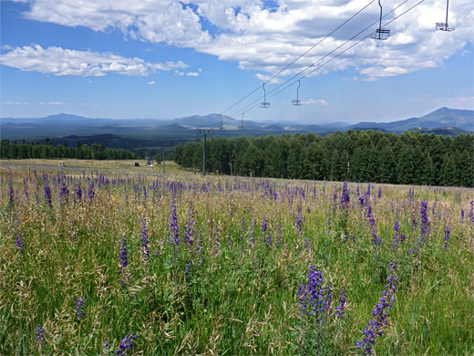
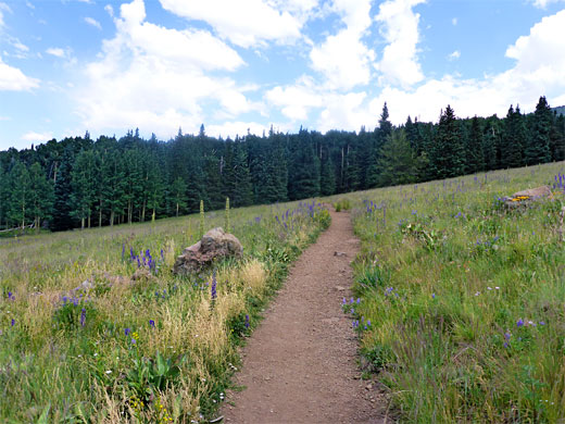
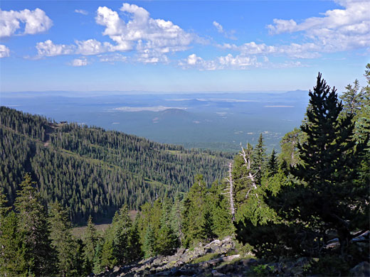
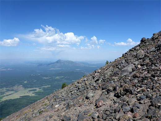
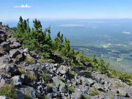
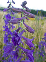
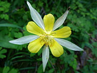
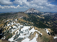
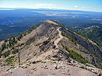
The path begins across a large meadow, filled with abundant wildflowers in summer, but much of the climb, for a distance of 3.5 miles, is all through thick, similar-looking woodland with only occasional long-distance views, so this part of the path is not so interesting. The latter stages though are much better - once above the treeline, on the saddle, the final one mile follows a rocky ridge mostly devoid of vegetation, past three false summits to the peak itself, where the views are of course spectacular, and uninterrupted, extending south beyond the Mogollon Rim, north to the Kaibab Plateau and east towards the White Mountains.
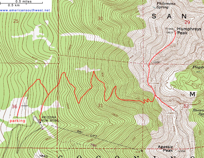
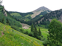
The hike starts 14 miles from downtown Flagstaff at a large parking lot just before the end of the Snowbowl Road, a paved, 6 mile route off US 180, climbing 2,000 feet. Along the way are many No Parking and No Stopping notices, while the few side tracks are closed to vehicles, so although all part of the Coconino National Forest there is no chance for free primitive camping hereabouts - the best place for this is along FR 222, which leaves the highway to the west, 1.3 mile west of the Snowbowl junction. The Humphreys Peak Trail heads north across the meadow, while one other route in the vicinity, the Kachina Trail, starts on the opposite side of the road, and can be used to make a 17 mile loop.
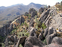
The Humphreys Peak Trail leads through the quarter mile-wide meadow, which harbors such wildflowers as Clark Valley larkspur, nodding ragwort and wheeler's thistle, and passes under two skilift lines, then enters the ponderosa pine forest, where the trees are fairly well separated and the ground moderately overgrown. The wide, sometimes dusty path begins the first of four pairs of long switchbacks, over a little ravine on two occasions and on to a junction with a connecting path from the Snowbowl. The ravine is usually dry by midsummer, as are all the slopes, but in spring the melting snow makes for much wetter conditions. The fifth switchback emerges from the woodland at the edge of a large scree slope before cutting back into the trees, and all the path climbs steadily, crossing the drainage several more times as the trees gradually become slightly more widely spaced, with a few small meadows in clearings.
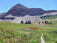
The last switchback section has a tight turn from north to south after which the path straightens and moves more directly up the slope, where smaller trees allow for better views. A notice gives the elevation at 11,400 feet, above which primitive camping is not permitted. Several much shorter switchbacks take the trail to the saddle, on a narrow ridge at 11,780 feet, from where the Humphreys summit is one mile north, and in the other direction, the Weatherford Trail follows the ridge for a while before contouring across slopes beneath Agassiz Peak (this summit is closed to hiking, apart from during the winter) and descending steeply to the Inner Basin, a sheltered valley to the east.
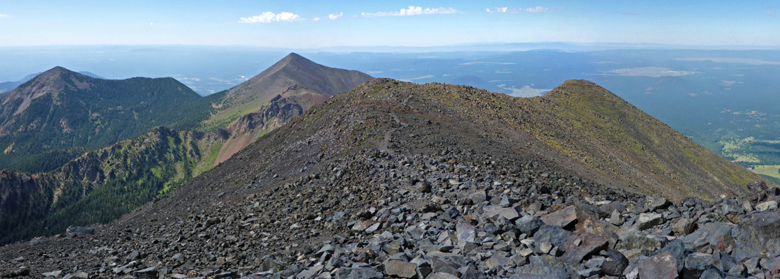
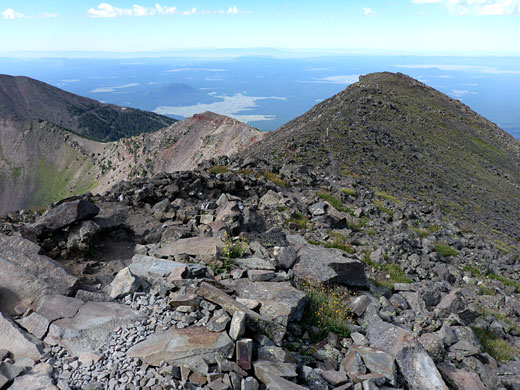
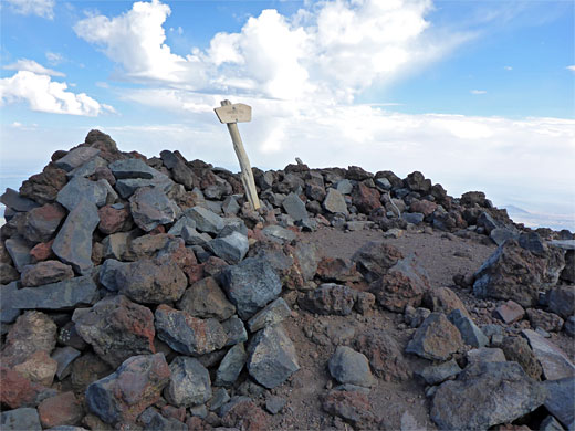
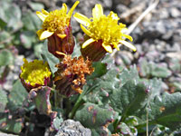
The final one mile of the Humphreys Peak Trail climbs a steepish slope covered by a patch of stunted pine trees, passes just below one intermediate peak and continues to follow the ridgeline, up to another pair of minor highpoints before the last, not-so-steep climb into the actual summit. Along the way are several notices warning against leaving the path in order to protect the delicate tundra plants, though the most of the ground is bare rock rather than earth and plants seem to be neither particularly numerous nor varied. The most abundant species are alpine avens, hoary groundsel, moss campion, pink alumroot, sky pilot, queen's crown and also the San Francisco Peaks ragwort (senecio franciscanus), found only in these mountains, which is similar to hoary groundsel, just rather hairier. The summit is marked by a wooden notice and a rough stone circle, from where a minor path continues a little way down a ridge to the north, though does not link with any official routes below.
The hike is made a little more difficult in some places by lengthy sections of loose stones and exposed roots but nevertheless on fair weather days the 9.6 mile round trip can be done not much more than four hours. As ever with mountain hikes the weather can change unexpectedly and the trip is much more challenging when wet, windy or icy.
The path begins across a large meadow, filled with abundant wildflowers in summer, but much of the climb, for a distance of 3.5 miles, is all through thick, similar-looking woodland with only occasional long-distance views, so this part of the path is not so interesting. The latter stages though are much better - once above the treeline, on the saddle, the final one mile follows a rocky ridge mostly devoid of vegetation, past three false summits to the peak itself, where the views are of course spectacular, and uninterrupted, extending south beyond the Mogollon Rim, north to the Kaibab Plateau and east towards the White Mountains.
Humphreys Peak Trailhead
The hike starts 14 miles from downtown Flagstaff at a large parking lot just before the end of the Snowbowl Road, a paved, 6 mile route off US 180, climbing 2,000 feet. Along the way are many No Parking and No Stopping notices, while the few side tracks are closed to vehicles, so although all part of the Coconino National Forest there is no chance for free primitive camping hereabouts - the best place for this is along FR 222, which leaves the highway to the west, 1.3 mile west of the Snowbowl junction. The Humphreys Peak Trail heads north across the meadow, while one other route in the vicinity, the Kachina Trail, starts on the opposite side of the road, and can be used to make a 17 mile loop.
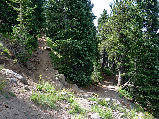
Trail through the Forest
The Humphreys Peak Trail leads through the quarter mile-wide meadow, which harbors such wildflowers as Clark Valley larkspur, nodding ragwort and wheeler's thistle, and passes under two skilift lines, then enters the ponderosa pine forest, where the trees are fairly well separated and the ground moderately overgrown. The wide, sometimes dusty path begins the first of four pairs of long switchbacks, over a little ravine on two occasions and on to a junction with a connecting path from the Snowbowl. The ravine is usually dry by midsummer, as are all the slopes, but in spring the melting snow makes for much wetter conditions. The fifth switchback emerges from the woodland at the edge of a large scree slope before cutting back into the trees, and all the path climbs steadily, crossing the drainage several more times as the trees gradually become slightly more widely spaced, with a few small meadows in clearings.
The Saddle
The last switchback section has a tight turn from north to south after which the path straightens and moves more directly up the slope, where smaller trees allow for better views. A notice gives the elevation at 11,400 feet, above which primitive camping is not permitted. Several much shorter switchbacks take the trail to the saddle, on a narrow ridge at 11,780 feet, from where the Humphreys summit is one mile north, and in the other direction, the Weatherford Trail follows the ridge for a while before contouring across slopes beneath Agassiz Peak (this summit is closed to hiking, apart from during the winter) and descending steeply to the Inner Basin, a sheltered valley to the east.
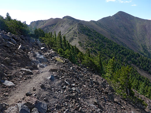
Path to the Summit
The final one mile of the Humphreys Peak Trail climbs a steepish slope covered by a patch of stunted pine trees, passes just below one intermediate peak and continues to follow the ridgeline, up to another pair of minor highpoints before the last, not-so-steep climb into the actual summit. Along the way are several notices warning against leaving the path in order to protect the delicate tundra plants, though the most of the ground is bare rock rather than earth and plants seem to be neither particularly numerous nor varied. The most abundant species are alpine avens, hoary groundsel, moss campion, pink alumroot, sky pilot, queen's crown and also the San Francisco Peaks ragwort (senecio franciscanus), found only in these mountains, which is similar to hoary groundsel, just rather hairier. The summit is marked by a wooden notice and a rough stone circle, from where a minor path continues a little way down a ridge to the north, though does not link with any official routes below.
Topographic Map
Humphreys Peak Trail - Similar Hikes
All Contents © Copyright The American Southwest | Comments and Questions | Contribute | Affiliate Marketing Disclosure | Site Map