Mount Washburn Trail, Yellowstone National Park
Wyoming > Yellowstone National Park > The East > Hiking > Mount Washburn Trail
Mount Washburn
Two wide, well used trails that climb lightly wooded slopes and converge at the top of 10,243 foot Mount Washburn, site of the main fire lookout point in the national park. The summit, and most of the paths, have excellent, long distance views
Length: 2.25 miles (north), 3 miles (south)
Elevation change: 1,500 feet, 1,600 feet
Difficulty: Moderate
Type: One way; path continues to the alternative trailhead
Usage: High
Season: Summer, early fall
Trailhead: Dunraven Pass (south), end of Chittenden Road (north)
Rating (1-5): ★★★★★
Elevation change: 1,500 feet, 1,600 feet
Difficulty: Moderate
Type: One way; path continues to the alternative trailhead
Usage: High
Season: Summer, early fall
Trailhead: Dunraven Pass (south), end of Chittenden Road (north)
Rating (1-5): ★★★★★

There are several reasons why the Mount Washburn Trail is the most popular summit hike in Yellowstone National Park - the route follows an old vehicle track so is relatively easy and not too steep, the views are excellent from the start as there are no other peaks nearby, flowers are particularly abundant on the exposed, grassy slopes, and wildlife is plentiful, including bighorn sheep and bears.
Mount Washburn may be approached from either north or south, along two similar trails; the northern path is a little shorter and steeper, following a long, treeless ridge for all its 2.25 mile length, while the southern route (3 miles) is more winding, switchbacking up the hillside through a mix of forest, meadows and rocky outcrops.
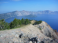
Both trails are equally busy during the three months of snow-free conditions (July to September), and a warm summer's day may see many hundreds of people making the climb. One of Yellowstone's three fire lookout towers is built on top of the mountain, complete with rest rooms, exhibits and an observation deck; from here, the views encompass much of the national park, to Yellowstone Lake, the Grand Canyon of the Yellowstone, the Central Plateau and the Absaroka Range, plus more distant peaks including the Tetons.
Trail map for Yellowstone National Park.
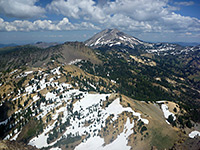
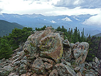
10 views along the Mount Washburn Trail.
The two trailheads for the hike to Mount Washburn are located along the Grand Loop Road between Canyon and Tower, a route usually open from late May to mid October. This is the highest stretch of road in Yellowstone, peaking at 8,878 foot Dunraven Pass, and is plowed in stages, with the southern trailhead (right beside the pass) sometimes being accessible a week or two earlier in the season. The path begins next to the road, at a good-sized parking lot, but even this often fills up completely by lunchtime on a busy day. The northern trailhead is at the end of the 1.3 mile Chittenden Road - unpaved but fine for all vehicles, which parallels the highway while climbing 200 feet above it, along the start of the narrow ridge that provides a route for the trail all the way to the summit.
A much less used third way to reach Mount Washburn branches off 3 miles along the Sevenmile Hole Trail, crossing flat land with scattered hot springs before a steep ascent to the summit, reaching it after 5.5 miles and 2,200 feet of elevation gain. Bear warnings are posted prominently at both the main trailheads, since grizzlies frequent the lower slopes of the mountain, though owing to the large number of visitors in summer, the chance of an encounter in peak season is low. More of a concern might be the frequent afternoon storms in summer, when high winds, heavy rain and lightning may develop quickly on a previously calm day.
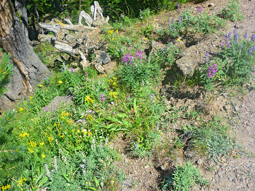
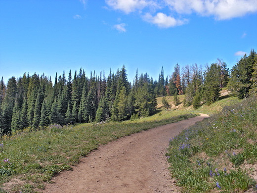
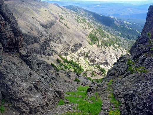
The southerly route to Mount Washburn offers more varied scenery so is generally considered the better option, despite being slightly longer (3 miles vs. 2.25 miles). The trail begins by climbing fairly gently up an open, grassy hillside sprinkled with summer wildflowers of all colors, and overlooking the steep valley of Sulphur Creek to the south. After entering a patch of woodland, the path rounds a promontory and doubles back, leaving the forest briefly and crossing another floral meadow, before re-entering the woods while still climbing quite gradually, up to a saddle at the head of two long ravines. Next are five long switchbacks, each straight and consistently uphill, with nice views at the bends but otherwise enclosed by tall trees.
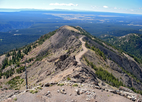
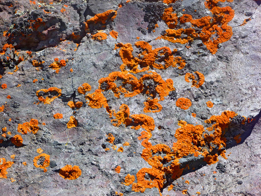
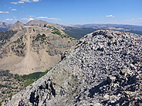
The last section traverses a rocky ridge, devoid of large vegetation, so the views are much better here. The rocks underfoot are dark, volcanic and jagged, but still provide good habitat for wildflowers, and for colorful lichen. Below, the ground slopes down steeply to the woods and scattered hot springs bordering the north rim of the Grand Canyon of the Yellowstone, and it is often possible to spot wildlife in the distance, roaming across the extensive meadows between the trees. As the summit approaches, the trail bends a little to the east, and reaches a four-way intersection with the alternative route from the north, and the lesser-used trail from Sevenmile Hole; from the junction, the hike is completed by a short path that curves around the west side of the peak, up to a flat, concreted area on top.
The short, unpaved Chittenden Road climbs along the west side of a lightly wooded ridge to a parking area at 8,752 feet. The trail then follows the continuation of the road, now closed to vehicles (but open to cycles), and for the most part runs right along the ridgetop which is free of trees, so the views are largely unobstructed - westwards to the valleys of Carnelian Creek and Tower Creek, and east to the Yellowstone River canyon. The last section moves a little west of the crest but stays quite straight, joining the southern route after a climb of 1,500 feet over 2.25 miles.
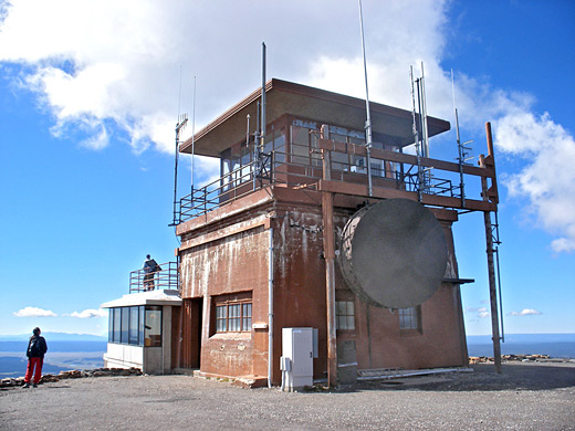
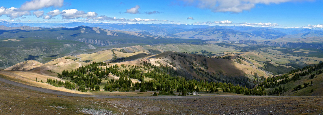
At the top of Mount Washburn is a flat, walled area 100 feet across, on the south side of which stands the three storey fire lookout tower, topped with radio masts. The lowest level has interpretive exhibits and rest rooms; in the middle is an observation deck (enclosed and open air), while the third floor, closed to the public, contains the ranger residence and lookout station. Views from the summit are broadly similar in all directions, since most other major peaks - Tetons, Absaroka Range, etc - are far away, so the landscape is a fairly uniform, grey/green expanse of mountains, ravines and grassland, with a few more distinctive features in the middle distance, including the deeper valleys of Tower Creek and the Yellowstone River, the north end of Yellowstone Lake and steam plumes from the geyser basins in the south.
Mount Washburn may be approached from either north or south, along two similar trails; the northern path is a little shorter and steeper, following a long, treeless ridge for all its 2.25 mile length, while the southern route (3 miles) is more winding, switchbacking up the hillside through a mix of forest, meadows and rocky outcrops.
Both trails are equally busy during the three months of snow-free conditions (July to September), and a warm summer's day may see many hundreds of people making the climb. One of Yellowstone's three fire lookout towers is built on top of the mountain, complete with rest rooms, exhibits and an observation deck; from here, the views encompass much of the national park, to Yellowstone Lake, the Grand Canyon of the Yellowstone, the Central Plateau and the Absaroka Range, plus more distant peaks including the Tetons.
Location
Trail map for Yellowstone National Park.
Photographs
10 views along the Mount Washburn Trail.
Mount Washburn Trailheads
The two trailheads for the hike to Mount Washburn are located along the Grand Loop Road between Canyon and Tower, a route usually open from late May to mid October. This is the highest stretch of road in Yellowstone, peaking at 8,878 foot Dunraven Pass, and is plowed in stages, with the southern trailhead (right beside the pass) sometimes being accessible a week or two earlier in the season. The path begins next to the road, at a good-sized parking lot, but even this often fills up completely by lunchtime on a busy day. The northern trailhead is at the end of the 1.3 mile Chittenden Road - unpaved but fine for all vehicles, which parallels the highway while climbing 200 feet above it, along the start of the narrow ridge that provides a route for the trail all the way to the summit.
Sevenmile Hole Approach
A much less used third way to reach Mount Washburn branches off 3 miles along the Sevenmile Hole Trail, crossing flat land with scattered hot springs before a steep ascent to the summit, reaching it after 5.5 miles and 2,200 feet of elevation gain. Bear warnings are posted prominently at both the main trailheads, since grizzlies frequent the lower slopes of the mountain, though owing to the large number of visitors in summer, the chance of an encounter in peak season is low. More of a concern might be the frequent afternoon storms in summer, when high winds, heavy rain and lightning may develop quickly on a previously calm day.
Mt Washburn South Route
The southerly route to Mount Washburn offers more varied scenery so is generally considered the better option, despite being slightly longer (3 miles vs. 2.25 miles). The trail begins by climbing fairly gently up an open, grassy hillside sprinkled with summer wildflowers of all colors, and overlooking the steep valley of Sulphur Creek to the south. After entering a patch of woodland, the path rounds a promontory and doubles back, leaving the forest briefly and crossing another floral meadow, before re-entering the woods while still climbing quite gradually, up to a saddle at the head of two long ravines. Next are five long switchbacks, each straight and consistently uphill, with nice views at the bends but otherwise enclosed by tall trees.
Path to the Summit
The last section traverses a rocky ridge, devoid of large vegetation, so the views are much better here. The rocks underfoot are dark, volcanic and jagged, but still provide good habitat for wildflowers, and for colorful lichen. Below, the ground slopes down steeply to the woods and scattered hot springs bordering the north rim of the Grand Canyon of the Yellowstone, and it is often possible to spot wildlife in the distance, roaming across the extensive meadows between the trees. As the summit approaches, the trail bends a little to the east, and reaches a four-way intersection with the alternative route from the north, and the lesser-used trail from Sevenmile Hole; from the junction, the hike is completed by a short path that curves around the west side of the peak, up to a flat, concreted area on top.
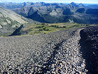
Mt Washburn North Route
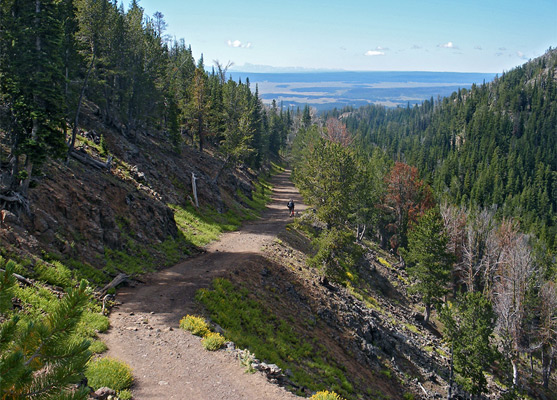
The short, unpaved Chittenden Road climbs along the west side of a lightly wooded ridge to a parking area at 8,752 feet. The trail then follows the continuation of the road, now closed to vehicles (but open to cycles), and for the most part runs right along the ridgetop which is free of trees, so the views are largely unobstructed - westwards to the valleys of Carnelian Creek and Tower Creek, and east to the Yellowstone River canyon. The last section moves a little west of the crest but stays quite straight, joining the southern route after a climb of 1,500 feet over 2.25 miles.

Mount Washburn Summit
At the top of Mount Washburn is a flat, walled area 100 feet across, on the south side of which stands the three storey fire lookout tower, topped with radio masts. The lowest level has interpretive exhibits and rest rooms; in the middle is an observation deck (enclosed and open air), while the third floor, closed to the public, contains the ranger residence and lookout station. Views from the summit are broadly similar in all directions, since most other major peaks - Tetons, Absaroka Range, etc - are far away, so the landscape is a fairly uniform, grey/green expanse of mountains, ravines and grassland, with a few more distinctive features in the middle distance, including the deeper valleys of Tower Creek and the Yellowstone River, the north end of Yellowstone Lake and steam plumes from the geyser basins in the south.
Mount Washburn Trail - Similar Hikes
All Contents © Copyright The American Southwest | Comments and Questions | Contribute | Affiliate Marketing Disclosure | Site Map