There are two main types of canyon in the Southwest, those through sedimentary rocks which tend to have wholly or partially vertical sides, often with horizontal benches at different levels, and those through igneous rock, where the sides are sloping and the ravine V-shaped; these are found mostly in mountainous terrain.
Table of Contents
- Canyons in Arizona
- Canyons in California
- Canyons in Colorado
- Canyons in New Mexico
- Canyons in Texas
- Canyons in Utah
- Canyons in Wyoming
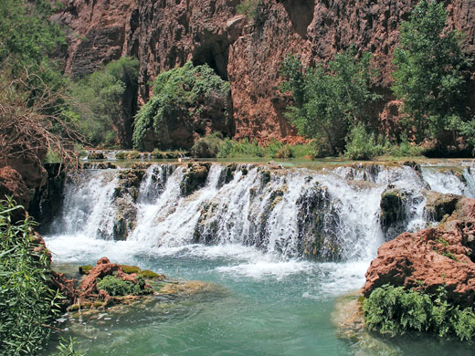
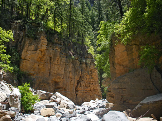
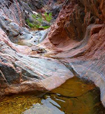
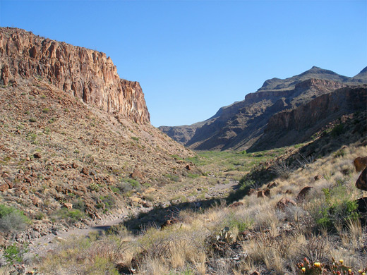
In Arizona, canyons form in the sedimentary rocks of the Colorado Plateau which covers the north and central parts of the state, and in the basin and range terrain of the lower elevation, desert lands further south and east. The most famous example of the former is of course the Grand Canyon of the Colorado, the wide river corridor and its hundreds of tributaries, which extend from remote gorges in the Hualapai Reservation of the west, like the Meriwhitica, Hindu, Peach Springs and Milkweed canyons, to narrower ravines in the northeast, at the far upstream end near Lees Ferry, such as Cathedral Wash, Jackass Creek and Tanner Wash. One particularly beautiful location is Havasu Canyon, on the Havasupai Reservation.
The largest tributary of the Grand Canyon is the Little Colorado River, which cuts deep into a grassy plateau at the edge of the Painted Desert, on the Navajo Reservation. Other notable gorges on the plateau include Coalmine Canyon, Ha Ho No Geh Canyon and other tributaries of Moenkopi Wash, Canyon de Chelly near Chinle, and the red rock canyons around Sedona, formed by Oak Creek and branches such as West Fork, Boynton Canyon, Secret Canyon, Pumphouse Wash and Fay Canyon. Further west, Sycamore Canyon is a more remote version of Oak Creek, while to the east are other deep, watery drainages such as Beaver Creek and West Clear Creek. These drain the edge of the Colorado Plateau, and are part of a belt of steep, wooded land known as the Mogollon Rim.
Arizona gorges with desert surroundings include the following:
- Alamo and Estes canyons, Organ Pipe Cactus National Monument
- Aravaipa Canyon, Galiuro Mountains
- Bear Canyon and Sabino Canyon, near Tucson
- Bill Williams River Canyon, near Lake Havasu
- Fish Creek and La Barge Canyon, in the Superstition Mountains near Phoenix
- Kaiser Spring Canyon and Burro Creek - desert drainages near Wickenburg
- Tonto Creek, south of Payson
California also has numerous desert canyons; some of the most visited include the Indian Canyons near Palm Springs, Borrego Palm, Mountain Palm Springs and Split Mountain canyons in Anza Borrego State Park, Red Rock Canyon near Mojave, and many places within Death Valley National Park such as Golden Canyon/Gower Gulch, Natural Bridge Canyon, Twenty Mule Team Canyon, Willow Canyon and Darwin Canyon. Mountain ravines in California are found all across the vast Sierra Nevada range, most famously in the Yosemite and Kings Canyon national parks, although many of the drainages are relatively wide, resembling a valley more than a canyon.
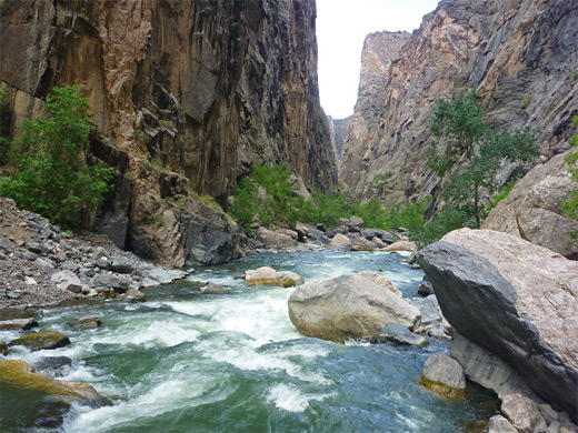
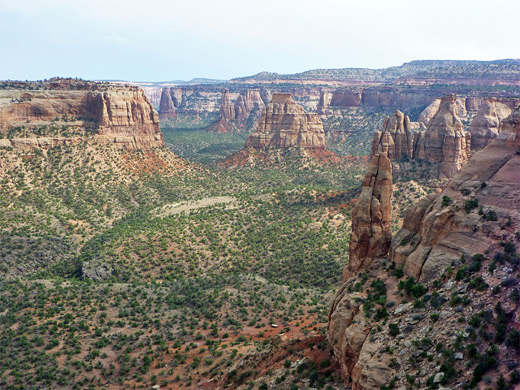
Similarly, the Rocky Mountains of Colorado are split by many deep valleys but there are few true canyons; one of the exceptions is Black Canyon of the Gunnison, towards the west side of the range near Montrose. There are two other NPS preserves featuring sandstone canyons - Colorado National Monument in the southwest, near Grand Junction, and Dinosaur National Monument in the Northwest, which contains Canyon of Lodore, formed by Yampa River.
The one big river in New Mexico is the Rio Grande, but unlike the Colorado this flows through relatively short and shallow canyons, with few tributaries. One popular area is in the north, where the river crosses a volcanic plateau and is enclosed by dark walls of basalt and lava - best seen in Wild Rivers Recreation Area near Taos. A little further south, another section of the river is contained within Bandelier National Monument, reached by a 3 mile hike along Frijoles Canyon.
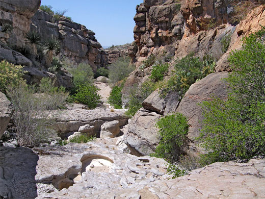
In central and south New Mexico the Rio Grande flows over flat lands and is not enclosed, but it does become more confined as the river enters the deserts of far west Texas, forming a series of remote, spectacular canyons, firstly within Big Bend Ranch State Park and then Big Bend National Park. Three main ravines here include the Santa Elena, Boquillas and Marsical canyons, of which the first two are reached by paved roads, the other only by a long drive on a rough track.
Big Bend Ranch also has a selection of other scenic drainages like the granite narrows of Closed Canyon and the wider, rockwalled Rancherias Canyon. Ravines and valleys also feature in the nearby Guadalupe Mountains National Park, such as riparian McKittrick Canyon, while the other two most well-known canyon systems of west Texas - a predominately flat, low relief region - are Palo Duro Canyon and Caprock Canyons, both near Amarillo in the northern Panhandle.
Big Bend Ranch also has a selection of other scenic drainages like the granite narrows of Closed Canyon and the wider, rockwalled Rancherias Canyon. Ravines and valleys also feature in the nearby Guadalupe Mountains National Park, such as riparian McKittrick Canyon, while the other two most well-known canyon systems of west Texas - a predominately flat, low relief region - are Palo Duro Canyon and Caprock Canyons, both near Amarillo in the northern Panhandle.
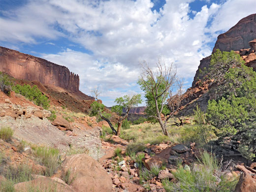
Most Southwest canyons are found in Utah, and indeed the southern portion of the state is known generally as Canyonlands, covering a much bigger area than just the national park of this name. Major canyons are formed by the Colorado, Dirty Devil, Dolores, Escalante, Fremont, Green, Muddy, Paria, San Juan, San Rafael and Virgin rivers, plus hundreds if not thousands of lesser creeks and washes. The largest canyon areas are listed below.
- Bryce Canyon National Park - this very popular and well-known location is not actually a canyon, rather a series of basins eroded along the edge of a high plateau. Nearby Red Canyon has similar scenery on a smaller scale and is a proper ravine
- Canyon Rims - a BLM preserve on the east side of Canyonlands National Park, containing five long drainages (Bodie Canyon, Gypsum Canyon, Harts Draw, Indian Creek and Kane Springs) plus extensive plateau lands
- Canyonlands National Park - the epitome of a Southwest canyon landscape, with two major gorges, formed by the Green and Colorado rivers, and also containing vast areas of red rock wilderness. The easiest accessed tributary canyons are in the Needles District, such as Red Lake, Big Spring and Elephant
- Capitol Reef National Park - a less visited location featuring a huge uplifted ridge running north-south, crossed by one main river (Fremont, which forms a shallow canyon), plus various smaller drainages of which some have a permanent stream (Sulphur Creek, Halls Creek), but most contain only seasonal water, like the slot canyons of Burro Wash, Five Mile Wash and Sheets Gulch
- Cedar Mesa is a wooded plateau cut by many branched ravines, mostly tributaries of Grand Gulch, which form deep and quite impressive canyons, though the main attractions for most visitors are the numerous Anasazi ruins, built in cliff alcoves
- Dark Canyon - a major south side tributary of the Colorado River east of Glen Canyon NRA, with deep, branched drainages cutting through very remote terrain
- Dinosaur National Monument - outside the popular fossil quarry area, this preserve protects a large area of canyons and mesas, centered on the Green and Yampa rivers
- Glen Canyon National Recreation Area - this huge park contains probably the greatest number of canyons on the Colorado Plateau, including 200 miles of the Colorado River, between Canyonlands and Grand Canyon national parks, plus the lower end of the Escalante and San Juan rivers. There are many slot canyons in this area (north, south), including the famous Antelope Canyon (on the adjacent Navajo land)
- Grand Staircase-Escalante National Monument - great expanse of scenic wilderness, with arches, cliffs, eroded rocks and many narrow canyons, based around the Paria and Escalante rivers
- Moab - this bustling town adjoins the Colorado River, which flows through canyons both west (accessed by Potash Road), and east, and has several large tributaries such as Kane Springs Canyon, Mill Creek, and Salt Creek, which enters nearby Arches National Park
- San Rafael Swell - a large, oval-shaped, uplifted area crossed by two main drainages (San Rafael River and Muddy Creek), plus many narrower ravines
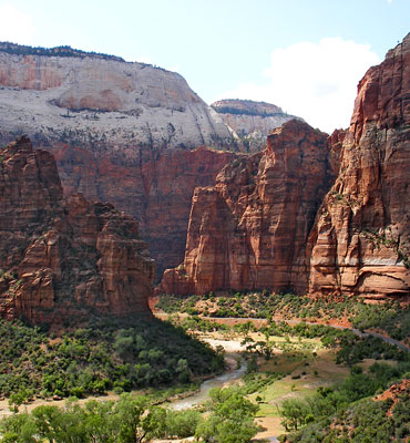
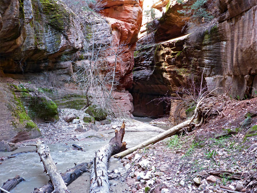
- Zion - perhaps the most immediately spectacular canyon in Utah is Zion Canyon, formed by the North Fork of the Virgin River. The South Fork also forms a deep gorge (Parunuweap Canyon) and both branches have many other tributaries, often forming slot canyons
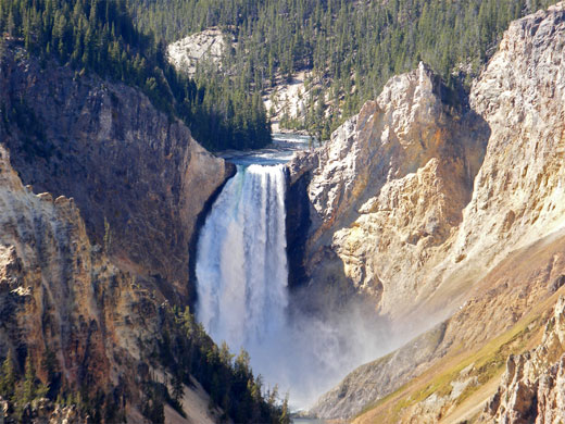
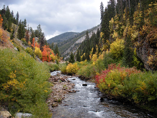
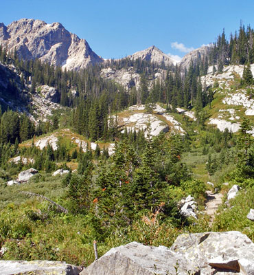
The most spectacular canyon in Wyoming is the Grand Canyon of the Yellowstone River, in the middle of the famous Yellowstone National Park. For 20 miles the river flows through a very deep and narrow V-shaped ravine, between walls partly composed of colorful, volcanic rock. Nearby Grand Teton National Park has more traditional mountain canyons, quite steeply sloping, and several are accessible by long trails, such as Paintbrush Canyon, Cascade Canyon and Death Canyon.
Two other canyon features of note, both further south in the mountains of west Wyoming, are Periodic Spring (a very rare intermittent water source) and the Sinks/the Rise, where a section of the Popo Agie River temporarily disappears below ground.
View all photographs of canyons.
Two other canyon features of note, both further south in the mountains of west Wyoming, are Periodic Spring (a very rare intermittent water source) and the Sinks/the Rise, where a section of the Popo Agie River temporarily disappears below ground.
View all photographs of canyons.
All Contents © Copyright The American Southwest | Comments and Questions | Contribute | Affiliate Marketing Disclosure | Site Map