
Highlights:
Spectacular reservoir (Lake Powell) extending 186 miles along the Colorado River, bordered by red rock cliffs and sandy beaches, with innumerable narrow tributaries. Very popular both for recreation and off-trail exploration. Developed areas are Bullfrog, Halls Crossing, Hite and Page
Nearby town:
Page (AZ)
Management:
Location:
36.935, -111.483 (Glen Canyon Dam)
Seasons:
All year, though summers are very hot
Rating (1-5):
★★★★★

Glen Canyon/Lake Powell is part of the Colorado River, Grand Canyon and Grand Circle itineraries
Featured Hotel
Best Western View of Lake Powell
 Guest rooms at the Best Western offer panoramic vistas over Lake Powell, best of any hotel in the area. Less than a mile from all amenities in the center of Page.
Check Rates
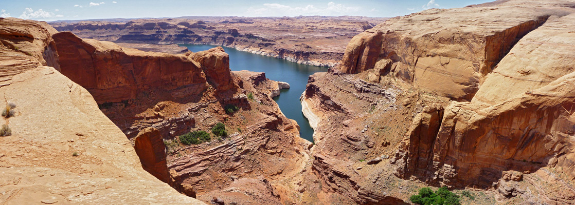
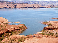
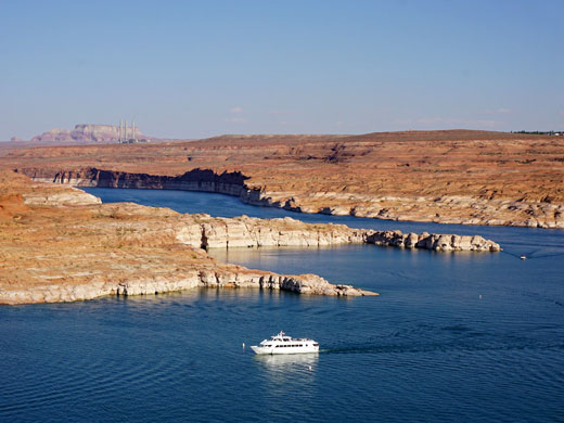
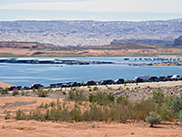
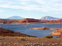
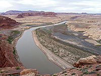
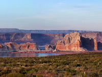
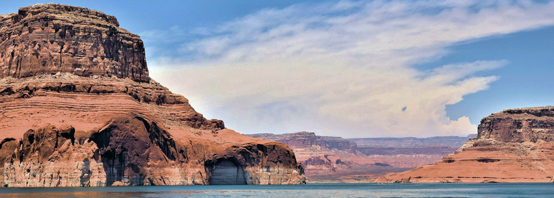
Lake Powell is the second largest man-made lake in the US and without doubt the most scenic, stretching 186 miles across the red rock desert from Page, Arizona to Hite, Utah. It began filling in 1963 following the completion of a dam across the Colorado River near the south end of Glen Canyon, and was not completely full until 1980. In 1972 Lake Powell and the surrounding countryside was incorporated into Glen Canyon National Recreation Area, and since then visitation has increased steadily.
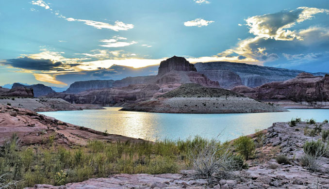
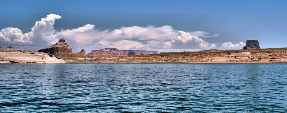
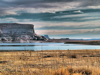
What makes the lake so memorable is the contrast between the deep clear blue waters and the surrounding landscape - stark red sandstone rocks with little or no vegetation, the innumerable steep remote side canyons, and the spires, ridges and buttes that once stood high above the Colorado, but now form cliffs at the lakeside or are semi-submerged as small islands. Lake Powell has become a major center for many leisure activities, principally fishing, water sports, hiking and houseboating.
What makes the lake so memorable is the contrast between the deep clear blue waters and the surrounding landscape - stark red sandstone rocks with little or no vegetation, the innumerable steep remote side canyons, and the spires, ridges and buttes that once stood high above the Colorado, but now form cliffs at the lakeside or are semi-submerged as small islands. Lake Powell has become a major center for many leisure activities, principally fishing, water sports, hiking and houseboating.
Glen Canyon Table of Contents
- Map of the NRA
- Photographs
- Introduction
- Locations, including Page, Hite, Bullfrog and Halls Crossing
- Glen Canyon hiking - maintained trails
- Glen Canyon hiking - off-trail routes, mainly along canyons
Location
Map of Glen Canyon National Recreation Area and Lake Powell.
Photographs
Page, Smoky Mountain Road, Hite, Halls Crossing
All Glen Canyon photographs.
Introduction
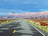
Access to Lake Powell and Glen Canyon by road is very limited. Activities are concentrated at the western edge, near Page, where various beaches, resorts, marinas and campsites are found along the shoreline, with every necessary facility available in town. At the far northeast end of the lake there are basic services and a few tracks leading to the water at Hite, though decreasing water levels in recent years have left this village quite far from the shoreline. The only other paved approach roads are to the Bullfrog and Halls Crossing marinas two thirds of the way up the lake, which are opposite each other and linked by a car ferry.
Apart from these four locations, various long dirt tracks lead to places along the lakeshore but these are generally only suitable for four wheel drive vehicles, although normal cars can drive along the Smoky Mountain Road, north of Lake Powell near the western end. This allows access to some beaches, before the road turns north towards Escalante.
Glen Canyon Locations
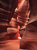
The most visited slot canyon in the Southwest, located on the Navajo Reservation just outside the NRA
Marina, campground and other facilities serving the northeast side of Lake Powell; plenty of shoreline access points
The dam that created Lake Powell in 1963; viewable on free guided tours. Also location of the main NRA visitor center
Remote marina 100 miles from Page, linked to the north shore by a ferry. Surrounded by vast areas of red slickrock
Hite is a tiny village at the far east end of the lake, surrounded by magnificent rocky landscapes
Next to Glen Canyon Dam, Page is the main base for visitors to Lake Powell and has many recreational facilities in town or nearby
Scenic, unpaved road giving access to parts of the north shore of Lake Powell, and to much remote desert country beyond
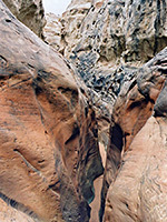
Glen Canyon Hiking
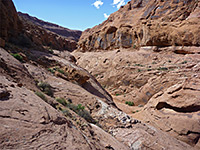
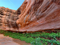
There are very few maintained paths in the 1.25 million acres of Glen Canyon NRA; otherwise, hiking is off-trail, visiting narrow canyons, overlooks of the lake, hoodoos and other eroded formations.
Maintained Paths
Hanging Garden Trail
★★★★★
★★★★★
0.6 miles, 30 feet
Short route that crosses a sandstone plateau with views of Lake Powell, to a shady, north-facing alcove harboring riparian plants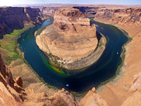
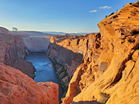
Horseshoe Bend
★★★★★
★★★★★
0.6 miles, 170 feet
Horseshoe Bend, one of the most photographed places in Arizona, is a deeply entrenched meander of the Colorado River, part of the short section of Glen Canyon that remains intact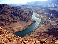
Spencer Trail
★★★★★
★★★★★
2.1 miles, 1600 feet
Relatively short but steep path that climbs the red Kayenta and Navajo sandstone cliffs forming the lower end of Glen Canyon, just north of Lees FerryLake Powell Tours
Glen Canyon Routes
Blue Pool Wash
★★★★★
★★★★★
1.2 miles, 80 feet
Minor drainage with a short narrows section through light colored Entrada sandstone, interrupted by several chokestones and dryfalls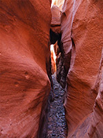
Bullfrog Bay Canyon
★★★★★
★★★★★
0.5 miles, 50 feet
Short, shallow, pebble-floored canyon leading to Bullfrog Bay on the north side of Lake Powell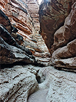
Cathedral Wash
★★★★★
★★★★★
1.5 miles, 300 feet
Short, curving tributary; photogenic passageways through potmarked, multilayered rocks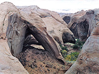
Davis Gulch
★★★★★
★★★★★
2.7 miles, 400 feet
Testing narrows with many chokestones and tight sections requiring downclimbing - at the upper end of a canyon that becomes much wider and deeper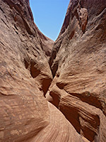
East Sevenmile Canyon
★★★★★
★★★★★
3 miles, 500 feet (round trip)
Remote ravine leading to a fine view of Lake Powell; two forks, both with short slots, dropping off steeply down to the lake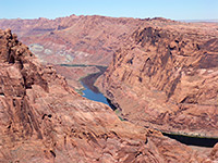
Fall Creek and the Echo Pass Trail
★★★★★
★★★★★
11 miles, 1150 feet (loop)
Rarely explored Glen Canyon tributary on the Navajo Reservation, linking with a disused trail to a pass through the Echo Peaks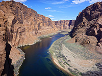
Ferry Swale Canyon
★★★★★
★★★★★
4.6 miles, 500 feet
Red-walled, west-side tributary of the intact section of Glen Canyon (below the dam); forms a short narrows section at the lower end, and gives a fine view of the Colorado River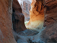
Llewellyn Gulch
★★★★★
★★★★★
6 miles, 650 feet
Beautiful, secluded canyon that starts beneath the red cliffs of Fiftymile Point and meets Lake Powell, forming nice, slot-like passageways in the upper part, and a wider gorge lower down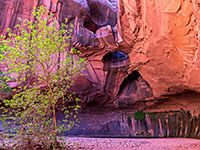
Neon Canyon
★★★★★
★★★★★
4.6 miles, 1100 feet
Long slot canyon, requiring ropes to explore fully, but ending at the more accessible 'Golden Cathedral', a beautiful natural amphitheater formed by overhanging cliffs streaked with desert varnish, containing a triple natural bridge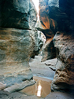
Rock Canyon
★★★★★
★★★★★
5 miles, 300 feet
Fairly short, north-side tributary of the Colorado River/upper Lake Powell; a good deep slot giving way to shallower, less enclosed narrows, before a high dryfall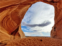
Sand Cave
★★★★★
★★★★★
0.15 miles, 30 feet
Alcove, or shallow cave, at the south edge of a low mesa of Page sandstone, lined by colorful, curving, thin-layered strata, with a sand dune at its base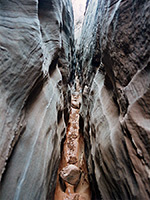
Smith Fork
★★★★★
★★★★★
7.5 miles, 500 feet
Good narrows through Navajo sandstone, in a secluded, rarely visited drainage leading to Lake Powell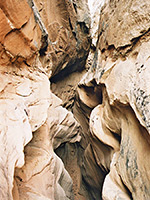
Stateline Canyon
★★★★★
★★★★★
2 miles, 300 feet
Short, shallow but quite photogenic and easily explored slot canyon, reached by a short walk from US 89, and ending at Lake Powell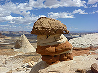
Stud Horse Point
★★★★★
★★★★★
5 miles, 600 feet
Cliff-lined mesa overlooking the west end of Lake Powell, with hoodoos and other eroded rock formations along the rim, and short slot canyons at the base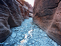
Swett Creek
★★★★★
★★★★★
7.4 miles, 800 feet
The southernmost Trachyte Creek tributary; a long drainage that forms shallow narrows in the upper section, giving way to a deeper gorge lower down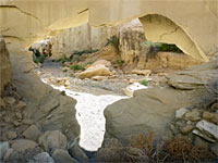
Wiregrass Canyon
★★★★★
★★★★★
0.9 miles, 150 feet, to the bridge; or a 3.2 mile loop including a slot canyon
Wiregrass Canyon contains a natural bridge, and forms attractive narrow passageways through light-colored sandstoneThere are many other narrow canyons close to the NRA, including those near Page, North Wash, Trachyte Creek, White Canyon and the Escalante River.
All Contents © Copyright The American Southwest | Comments and Questions | Contribute | Affiliate Marketing Disclosure | Site Map