Halls Crossing, Glen Canyon National Recreation Area
Utah > Glen Canyon National Recreation Area > Halls Crossing
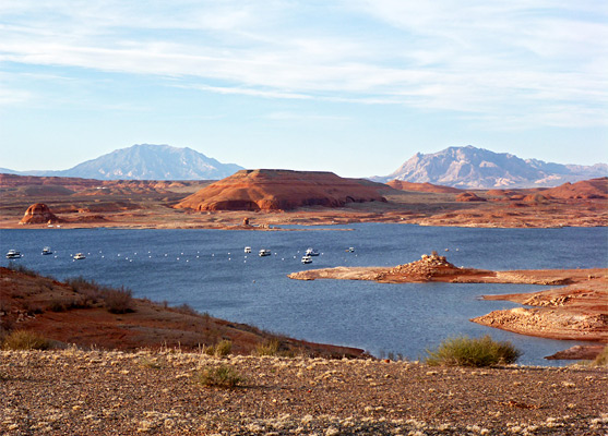

Located 95 river miles upstream from Page and Glen Canyon Dam, Halls Crossing is the site of one of the six marinas on Lake Powell, though like Bullfrog on the opposite side of the lake it is sometimes home to boats moved from the easternmost marina at Hite, which may be closed due to low water levels. The launch ramp at Halls Crossing is usable down to surface elevation of 3,550 feet (140 feet below peak), so should be safe even during extended dry periods.
Besides the launch, facilities are limited to a campground/RV site, grocery store, laundry, showers and service station, but for many it is the scenery that provides a reason to visit, since besides boating activities on the lake itself, the surrounding land has many canyons, beaches, cliffs, dunes and slickrock, all ideal for hiking and photography. As with most developed access points to Lake Powell, an entrance fee of $30 per vehicle (2024) is charged.
Besides the launch, facilities are limited to a campground/RV site, grocery store, laundry, showers and service station, but for many it is the scenery that provides a reason to visit, since besides boating activities on the lake itself, the surrounding land has many canyons, beaches, cliffs, dunes and slickrock, all ideal for hiking and photography. As with most developed access points to Lake Powell, an entrance fee of $30 per vehicle (2024) is charged.

Highway 276
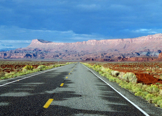
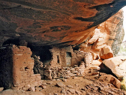
The road to Halls Crossing (UT 276) is scenic and relatively little used, crossing wide-open, completely undeveloped land for 46 miles, starting on UT 95 close to Natural Bridges National Monument. It descends from a pinyon-juniper pine plateau into sandy scrubland beneath a high ridge of Wingate sandstone (Red House Cliffs), at the foot of which is a band of undulating, multicolored badlands formed by the Chine formation. To the south, the ground is flat for many miles though the deep canyon of the San Juan River, the spires of Monument Valley and vast expanses of slickrock are all visible in the distance, with Navajo Mountain even further away to the west. The highway turns a little northwards, climbs through a gap in the cliffs then follows a shallow, bushy, Navajo sandstone-walled canyon, passing several ruins built in cliff alcoves, and occasional petroglyphs on the walls. The canyon fades away after a few miles, replaced by sandy grasslands, dunes and slickrock as the road approaches the lake, now with distant views of features to the north including the Waterpocket Fold and the Henry Mountains.
Halls Crossing Ferry
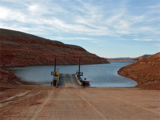
A ferry operates year round (except New Year and Christmas Day), linking Halls Crossing with Bullfrog, 3 miles away on the north side of the lake, from where UT 276 continues another 40 miles past equally impressive scenery, before rejoining UT 95 near North Wash. The journey takes 25 minutes and the ferry departs twice a day in winter, with gradually more sailings up to midsummer when there are 6 trips each way. Fees (2023) start at $25 for vehicles less than 20 feet in length, and the maximum capacity is 22 cars. The ferry may be out of order occasionally for repairs, and may also not run during rough weather, or during the winter. As of 2022 it is not operating, however, due to low water levels.
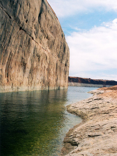
The Shoreline
The shoreline of Lake Powell is easily accessible for a mile or so east and west of the marina, and forms many sheltered bays, small islands, sheer cliffs and sandy beaches, all clean and free of litter. One good place that requires a little cross-country walking to reach is due south of the marina, where an open slickrock slope extends down to the water. Cars may be parked a short distance west of the main road along a track leading to a maintenance depot (a point before the fee station), from where the water's edge is a 0.5 mile walk away.
All Contents © Copyright The American Southwest | Comments and Questions | Contribute | Affiliate Marketing Disclosure | Site Map