Highlights:
Hite is a tiny village at the far east end of Lake Powell, near the confluence of the Colorado and Dirty Devil rivers, surrounded by magnificent rocky landscapes in all directions. The one access road is Hwy 95, approaching via White Canyon to the south and North Wash
Location:
37.872, -110.396 (boat ramp)

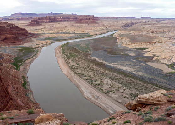
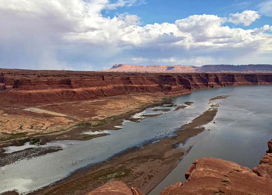
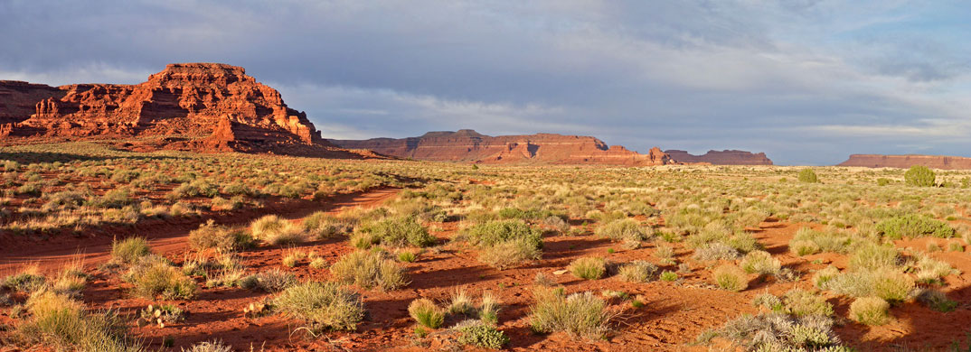
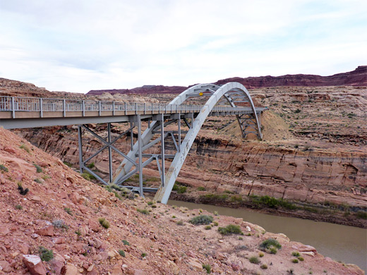
Hite is a tiny community at the northeast end of Lake Powell, close to UT 95. The nearby bridge provides the only road crossing of the Colorado for 300 miles between the Glen Canyon Dam west of Page (139 miles away by boat) and US 191 at Moab. There is little more to Hite besides a ranger station, gas station and a general store, but it is the surrounding scenery for which the area is most renowned - miles of striking, uninterrupted red rock formations with minimal vegetation enclose the lake, which has many beautiful side canyons.
Hite used to have a small marina, but this is now closed due to the low lake levels in recent years, and looks set never to reopen. The best place to observe the village, the rocky surroundings and the confluence of the Colorado-Dirty Devil rivers is from Hite Overlook, an elevated viewpoint on the cliffs on the north side of the lake, reached by a short side road.
In January 2024 it was announced that all services at Hite are suspended, including the store and the gas station, pending awarding of a new concession contract, and construction of a new boat ramp.
Photographs
General views of the Hite area.
Farley Canyon
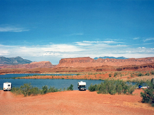
Hite is one of the few places apart from Page where the shoreline of Lake Powell can be easily reached by road. One popular access point a few miles south of the village is a bay (Farley Canyon), which is linked to the main road by a good quality 3 mile gravel track. At roads end is a primitive campground, with good boat launch sites and fabulous views across the lake. A little way along the shore there are many small inlets with smooth slickrock at the edges, ideal places for private swimming and paddling. This used to be one of the best free campsites in Utah. It is so remote and peaceful, away from any artificial light or signs of habitation and in the middle of sublime canyon scenery, although in recent times a fee has been introduced ($12 per night in 2024) and more people stay here, with a consequent increase in noise and litter. Camping is also possible at several nearby lakeside locations - details are available from the Hite ranger station - though the quality of all such sites depends partly on lake levels, as times of drought can leave them some distance from the water. Away from the lake, there are many other possible (free) campsites along side roads off UT 95.
North of Hite
When full, Lake Powell's surface elevation is 3,700 feet, and its waters extend over 20 miles northeast of Hite, along Narrow Canyon of the Colorado River just past the Imperial Canyon tributary, which is 201 river miles from Glen Canyon Dam. But now after several years of low rainfall the lake begins some way downstream of Hite, and the village faces a large, unappealing area of mud flats edged by piles of driftwood and litter, while the Dirty Devil and Colorado Rivers flow through their canyons more or less as they did before the construction of the dam. The flats are however, steadily being reclaimed by vegetation; grass, bushes and even small trees now flourish beside the Colorado. The Dirty Devil is one of two main drainages north of Hite and like the Escalante River system to the east has many narrow side canyons of interest, though access is difficult. The second is North Wash, which provides a route for highway 95. The only other road north of the lake is the unpaved Hite Road (Rec. Road 633), an unpaved but quite good quality track that leaves UT 95 between mileposts 46 and 47, follows close to the Colorado River, winds around some narrow side canyons then heads towards the Maze district of Canyonlands National Park.

White Canyon
South of Hite, UT 95 continues towards Natural Bridges National Monument along White Canyon. This is a colorful two-level canyon, with the road winding across the edge of a wide resistant rock layer between towering white cliffs, while the seasonal river flows lower down in a much thinner gorge in the middle of the main canyon. Adventurous hikers can climb down and follow the lower canyon, which becomes very deep and narrow for a few miles, especially in the section known as the Black Hole, and has permanent pools of cold water. Its east-side tributaries also have many enchanting stretches of narrows.
Canyons near Hite
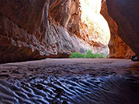
Narrow canyons near Hite and northeast Lake Powell - tributaries of Trachyte Creek, North Wash and White Canyon
All Contents © Copyright The American Southwest | Comments and Questions | Contribute | Affiliate Marketing Disclosure | Site Map