Highlights:
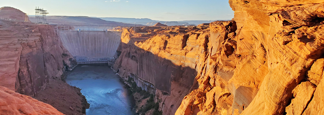
The dam that created Lake Powell in 1963, across a narrow point along the Colorado River canyon; viewable on free guided tours. Also the location of the main Glen Canyon NRA visitor center
Location:

Looking downstream, one can get some impression of what Glen Canyon was like; although construction seemed to be a good idea in 1956, many people now regret the loss of the canyon, which was said to equal the Grand Canyon in its beauty. However, this region was part of the largest roadless area in the continental USA so visitation must have been very small.
Pedestrians can walk over the dam, free of charge, and it can be seen from various places on both banks of the Colorado; the lakeshore to the north is readily accessible, by short walks from the road to Wahweap, on the west, and the gravel track to The Chains, to the east. South of the dam, the main viewpoint is Glen Canyon Dam Overlook, at the end of a short side road off US 89.
Table of Contents
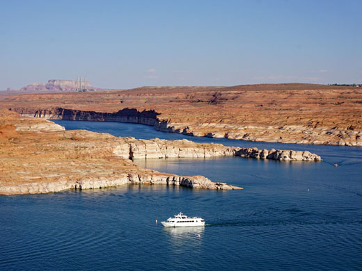
History of Glen Canyon and Lake Powell
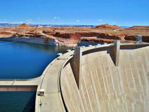
This section of Glen Canyon was selected as the location for the dam following surveys by the Bureau of Reclamation shortly after WW2, owing to the deep, narrow canyon, the stable, homogeneous Navajo sandstone walls, a nearby supply of sand and rock for construction (at Wahweap Creek), and the huge area upstream that could be flooded without disrupting any settlements or roads. The scheme was opposed at the time by environmental organizations such as the Sierra Club, but the need to supply water and electricity to the fast growing cities of the Southwest far outweighed any objections. Initial development required workers to drive nearly 200 miles from one side of the Colorado River to the other but work speeded up once the bridge was completed in 1959. The concrete dam took 3 years to build and began to form Lake Powell in 1963; its basal width is 300 feet, crest width 25 feet, height 583 feet and length 1,560 feet. The next 4 years saw installation of the generating and electricity transmission equipment, before the project was completed in 1966, receiving an official opening by Ladybird Johnson on September 22nd. The maximum surface elevation of 3,700 feet was reached for the first time in 1983. Today, the existence of the dam is still opposed by a small but growing number of people, and proposals have been made to drain the lake and restore Glen Canyon to its natural state. More likely is that operation will eventually be rendered uneconomic by a gradual build up of silt, as this can no longer be carried downstream by the Colorado River.
Tours of Glen Canyon Dam
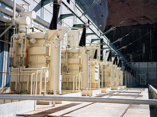
A one hour guided tour into the interior of the dam and the generator rooms is available, free of charge, and there is also a very informative visitor center - the main site for the whole National Recreation Area. The operation of the dam continues to affect the Grand Canyon downstream, as peak power requirements result in a daily variation in the amount of water being released, which causes the level of the Colorado to rise and fall each day. This in turn causes erosion of beaches in the canyon. The situation has recently been improved, but damage continues to occur and it has been suggested that the peak power demands should be met instead by the Hoover Dam, as this has no scenic canyon downstream.
All Contents © Copyright The American Southwest | Comments and Questions | Contribute | Affiliate Marketing Disclosure | Site Map