Tributaries of North Wash
Four popular slot canyon tributaries (Shillelagh, Blarney, Leprechaun, Sandthrax) on the northeast side of North Wash, easily accessed by short walks from UT 95, and increasing in difficulty from west to east. All need rappelling to descend fully but parts of the westernmost three are explorable by regular hiking
Length: ca. 6 miles total, for four separate hikes into the accessible parts of the lower ends of the canyons
Difficulty: Moderate - tight narrows, muddy pools, chokestones
Management: BLM
Rocks: Navajo sandstone
Season: All year
Trailhead: Short track ending beside a BLM noticeboard, near a primitive camping area; there are plenty of other parking places along the road
Rating (1-5): ★★★★★
Difficulty: Moderate - tight narrows, muddy pools, chokestones
Management: BLM
Rocks: Navajo sandstone
Season: All year
Trailhead: Short track ending beside a BLM noticeboard, near a primitive camping area; there are plenty of other parking places along the road
Rating (1-5): ★★★★★

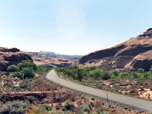
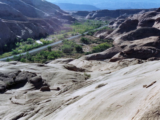
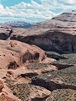
North Wash begins as a sandy creek in the desert beside the Henry Mountains and flows south, cutting through seven different sandstone strata representing 80 million years of history in a course of just 20 miles, and joining Lake Powell opposite Hite by which time the wash has formed quite an impressive gorge 1,200 feet deep. The canyon is wide enough to accommodate a major highway (US 95) and while not offering hiking possibilities itself there are many interesting tributaries, in particular four exceedingly narrow slot canyons that join the northern end of the wash.
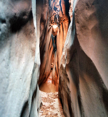
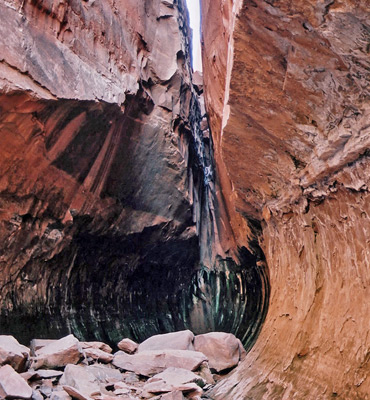
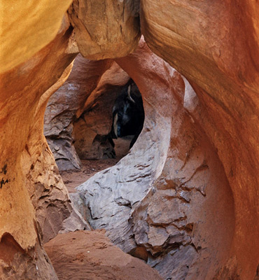
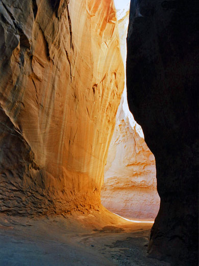
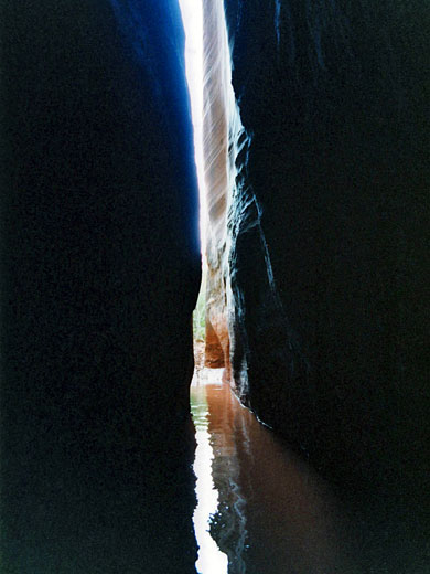
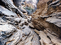
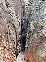
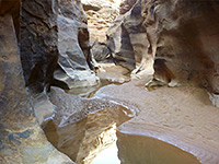
The rock at this point is Navajo sandstone, which is the most conducive to the formation of slot canyons, and the four tributaries, although not very long, do have all the typical features of pools, dryfalls, pretty eroded formations and long stretches of dark narrows. None have official names, though they have received recent appellations (Shillelagh, Blarney, Leprechaun and Sandthrax, known collectively as the Irish Canyons), and all are close to the road, reached by a short walk along a flat streambed. The extent of each drainage that may easily be explored varies, as the canyons become deeper and narrower further south; the last one needs rappelling equipment and considerable canyoneering experience to descend the whole length.
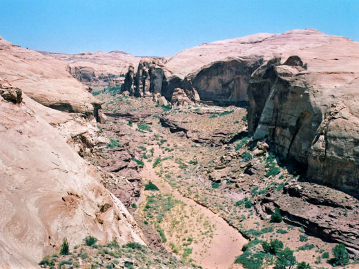
North Wash runs through the center of a vast region of narrow canyons that includes Trachyte Creek to the west and the Dirty Devil River to the east. It flows alongside US 95 from a few miles north of the junction with UT 276 all the way to Lake Powell, and starts to form a canyon just after the junction, where the Navajo sandstone is first exposed. The four slot canyons are found on the northeast side between mileposts 27 and 29; the southwest side is more sheer and has no significant tributaries. Around mile 30 the Navajo is briefly replaced by crumbling ledges of the underlying Kayenta Formation, then the wash deepens quickly as it cuts through the next layer, the cliff-forming Wingate sandstone. Several lengthy branches join here, named canyons being Butler, Stair, Marinus and Hog, and these also have narrow, steeply-descending sections in the upper ends where the Navajo layer reappears. Butler Canyon is most memorable in this respect and has 5 branches of interest, and similar to the North Wash canyons, they are extremely narrow and angle downwards quite a lot, requiring quite strenuous downclimbing and/or rappelling to descend. Another nearby drainage with equally narrow side canyons is Poison Spring Canyon to the north - all these systems cut into Cedar Point, a large Navajo sandstone mesa.
The rock at this point is Navajo sandstone, which is the most conducive to the formation of slot canyons, and the four tributaries, although not very long, do have all the typical features of pools, dryfalls, pretty eroded formations and long stretches of dark narrows. None have official names, though they have received recent appellations (Shillelagh, Blarney, Leprechaun and Sandthrax, known collectively as the Irish Canyons), and all are close to the road, reached by a short walk along a flat streambed. The extent of each drainage that may easily be explored varies, as the canyons become deeper and narrower further south; the last one needs rappelling equipment and considerable canyoneering experience to descend the whole length.
The North Wash Canyons
- Canyon one (Shillelagh, mile 27.4) - the shallowest of the four, this has several forks with fine slot-like sections mixed with more open areas.
- Canyon two (Blarney, mile 27.6) - this has two main branches, one of which becomes quite enclosed and difficult to follow.
- Canyon three (Leprechaun, mile 28.1) - a long tributary with an unusual enclosed approach that narrows abruptly then splits into two main forks, both of which need ropes to explore and are best entered from the top end.
- Canyon four (Sandthrax, mile 28.5) - a comparatively short tributary, but partially flooded and very dark, with long stretches only inches wide but still many yards deep.
Location
North Wash runs through the center of a vast region of narrow canyons that includes Trachyte Creek to the west and the Dirty Devil River to the east. It flows alongside US 95 from a few miles north of the junction with UT 276 all the way to Lake Powell, and starts to form a canyon just after the junction, where the Navajo sandstone is first exposed. The four slot canyons are found on the northeast side between mileposts 27 and 29; the southwest side is more sheer and has no significant tributaries. Around mile 30 the Navajo is briefly replaced by crumbling ledges of the underlying Kayenta Formation, then the wash deepens quickly as it cuts through the next layer, the cliff-forming Wingate sandstone. Several lengthy branches join here, named canyons being Butler, Stair, Marinus and Hog, and these also have narrow, steeply-descending sections in the upper ends where the Navajo layer reappears. Butler Canyon is most memorable in this respect and has 5 branches of interest, and similar to the North Wash canyons, they are extremely narrow and angle downwards quite a lot, requiring quite strenuous downclimbing and/or rappelling to descend. Another nearby drainage with equally narrow side canyons is Poison Spring Canyon to the north - all these systems cut into Cedar Point, a large Navajo sandstone mesa.
Nearby Slot Canyons
North Wash - Similar Hikes
All Contents © Copyright The American Southwest | Comments and Questions | Contribute | Affiliate Marketing Disclosure | Site Map