Tributaries of North Wash - Canyon Two, Blarney
Slot Canyons > North Lake Powell > Tributaries of North Wash > Canyon Two
Blarney Canyon
North Wash canyon with shallow lower narrows and two deeper upper tributaries, one ascending relatively steeply via chokestones and dryfalls, the other forming a deep, dark slot
Length: Around 2 miles, round trip, to explore the accessible parts of the two forks
Difficulty: Easy to moderate
Trailhead: Beside UT 95
Rating (1-5): ★★★★★
Difficulty: Easy to moderate
Trailhead: Beside UT 95
Rating (1-5): ★★★★★

Map
Map of the North Wash tributaries.
Blarney Canyon Route Description
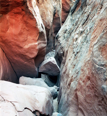
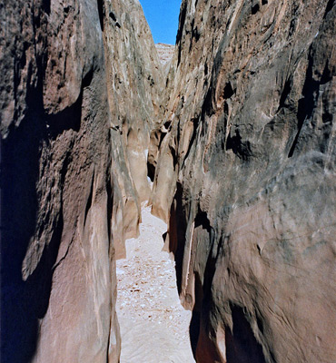
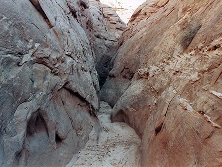
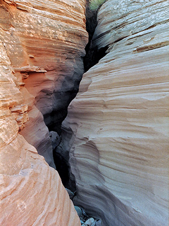
Blarney Canyon, the second North Wash tributary, is similar to the first (Shillelagh Canyon), just deeper and with longer narrows. It meets the highway at mile 27.6 and begins with low cliffs enclosing an area of sandbanks and bushes, then after a walk of 10 minutes upstream the walls become closer and a stony streambed covers all of the canyon floor. Not far beyond is a pretty little section of curving narrows that ends at a chokestone and 10 foot pour-off, above which the slot opens out into a soil-less landscape of Navajo slickrock, with sandstone domes rising high above. The wash continues through alternating stretches of shallow narrows and wider parts then forks, about 3/4 mile from the road. The right branch is somewhat entrenched from the start and gains height steadily with many chokestones and small dryfalls; it is often very narrow and enclosed by high cliffs, especially on the east side. Some parts have nice weathered red strata though most of the rocks are quite dark.
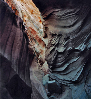
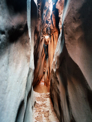
The main (left) fork soon enters an excellent, deep slot canyon, only a foot wide in some places and quite colorful. This has a few tricky obstacles, and requires some chimneying to pass chokestones and a lot of squeezing through tight muddy passages that become steadily narrower and deeper, until a pour-off about 10 feet above a pool puts an end to the hike; the best way to explore this canyon is to climb up the sandstone mounds alongside the slot then enter it from the top end. A round trip to the obstruction takes about 90 minutes.
All Contents © Copyright The American Southwest | Comments and Questions | Contribute | Affiliate Marketing Disclosure | Site Map