Smoky Mountain Road, Glen Canyon National Recreation Area
Utah > Glen Canyon National Recreation Area > Smoky Mountain Road
Highlights:
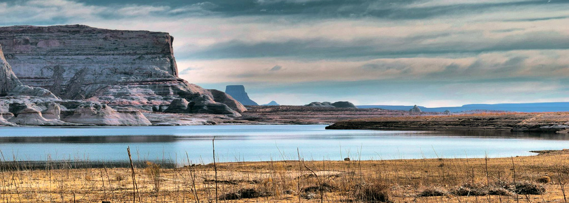
Scenic, unpaved road giving access to parts of the northwest shore of Lake Powell, and to much remote desert country beyond - a 78 mile route between Big Water and Escalante. Some parts require a 4WD vehicle

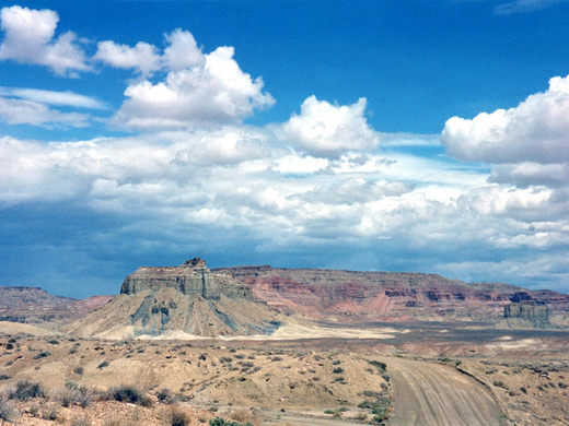
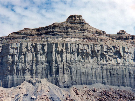
US 89 approaches Lake Powell from the west; this very scenic road is bordered from the north by a spectacularly colored series of cliffs with many contrasting layers of exposed, eroded rock. An even better, close-up view is provided by Rec Road 230, also known as BLM330 or Smoky Mountain Road - which also allows access to remote parts of the lakeshore, before turning north and crossing many miles of the Grand Staircase - Escalante National Monument.
Smoky Mountain Road Table of Contents
Photographs
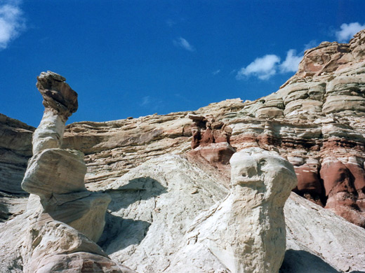
Photographs - 12 views of the road, and Warm Creek Bay.
Big Water
The road forks off US 89 at the small town of Big Water and is paved to begin with, except for a rocky section across the usually dry bed of Wahweap Creek. It crosses a wide open landscape several miles from Lake Powell, with great views of distant multicolored rock layers. After 2 miles, the track changes to gravel but the surface remains good.
Rocks
The landscape becomes amazingly stark and barren but still very colorful. For long stretches there is virtually no vegetation, just rolling mud hills of various shades of grey, brown, gold and white, with the distant blue of the lake at one side and ancient crumbling cliffs on the other. Every so often, the track crosses narrow, layered slot-like canyons that twist downhill towards the water. After 10 miles there is a side track (rec. road 231) along Crosby Canyon towards Warm Creek Bay - the only place along the Smoky Mountain Road where the lake shore is easily reached.
Warm Creek
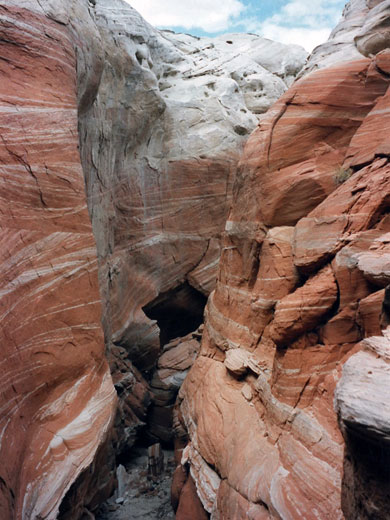
The main road bends north to cross Warm Creek, a major inlet of Lake Powell; soon after the bridge it heads due north into rocky desert lands around Smoky Mountain and the Kaiparowits Plateau, towards Escalante. The strata in the cliffs that surround the junction are especially colorful. Road 230 continues east but becomes narrower and deteriorates somewhat; there are side-tracks that lead to good viewpoints high above the lake but with no vehicular access to the water. The next place where this is possible is from along the Hole-in-the-Rock road, 30 miles further east, which also starts from Escalante.
Crosby Canyon
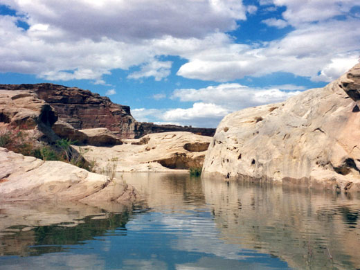
Road 231 winds along and down the ever-deepening Crosby Canyon, a dramatic, twisting gorge with many eroded rock formations and layers of different hardness. The road is narrow in places but passable by 2WD cars. It is a 15 minute drive before the lake is reached - at this point just a shallow, tapering inlet, overgrown with bushes and with quite a lot of litter; however there are nice places to stay along rough tracks at either side, with good elevated views out over the lake, and unspoilt lands a few minutes walk away.
Camping
The soil around the lake is sandy so non-4WD vehicles cannot progress much further. The shoreline has plenty of clean beaches that are ideal for camping; most have to be reached by walking or by boat, as is the case with most Lake Powell features. To better appreciate the surroundings it is necessary to explore on foot - by climbing the cliffs, for example, to the flat plateau above the bay; from the south edge there are countless islands, buttes and bays visible, stretching to the horizon. Climbing can be a little difficult, with loose scree and some vertical rock strata a few meters thick to overcome, but the views are worth the trouble.
The Shoreline
It is easier, and no less rewarding, to walk along the shoreline beneath the cliffs - the west side of the bay is better as the terrain is more interesting. For half a mile the land is sandy, then it becomes more rocky with branched, partially flooded side canyons. Some of these have deep channels with clear water - large fish can often be seen swimming slowly along. Higher up there are several mini slot canyons - narrow, steep-sided water courses, with a variety of other vari-colored eroded rock formations. Good specimens of gypsum are plentiful beneath the surrounding cliffs.
Lake Powell Beaches
At the junction of Crosby Canyon with Warm Creek Bay, the cliffs open out and much more of the lake is visible; there are many small beaches and coves, often with houseboats moored alongside. This part of the lake is only 10 miles from Page and so the waters can be relatively crowded.
All Contents © Copyright The American Southwest | Comments and Questions | Contribute | Affiliate Marketing Disclosure | Site Map