Highlights:
Largest NPS preserve outside Alaska; starkly beautiful desert wilderness centered on a 130 mile long valley, 70 miles of which is below sea level. Includes sand dunes, eroded rocks, slot canyons, historic sites, oases, dry lakes, evaporative salt features and peaks up to 12,000 feet - south, north, west and east
Nearby town:
Management:
Location:
36.831,-117.882 (east entrance) 36.369,-117.616 (west entrance)
Seasons:
Winter and spring are best for hiking. The park is busy even in midsummer, when the extreme heat is a attraction for some visitors
Rating (1-5):
★★★★★
Weather:

Death Valley is part of the California Deserts itinerary
Named features on maps of Death Valley National Park include the Funeral Mountains, Coffin Peak, Hell's Gate, Starvation Canyon and Dead Man Pass - this is clearly a place with a bad history, reflecting the troubles and misfortunes endured by the pioneers who first traversed, inhabited and mined the region during the end of the last century. But despite the foreboding reputation, visitors today will find a place of amazing beauty with many colorful rocks and canyons, miles of pristine sand dunes, unique evaporative salt features and even a diverse range of wildlife.
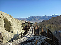
The park also contains many relics from a hundred and fifty years of history, which give an insight into the harsh life of the early settlers - borax and metal ore mines, ghost towns, charcoal kilns and other ruins. Petroglyphs and ancient foot-trails provide evidence of the Shoshone Indians who lived here even earlier.
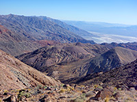
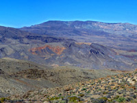
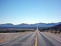
The valley is a long, low depression set in largely barren and unpopulated country of desert plains and rocky ridges, east of the Sierra Nevada Mountains. It is over 130 miles long, but only around 12 miles wide, running roughly north-south near the border with Nevada. From an elevation of 1000 meters at the north end, the land slopes down steadily and for 70 miles the floor is below sea level, reaching a low point of -282 feet (-86 meters) at Badwater, the lowest point in the Western hemisphere. The depth of the depression is partly responsible for the extreme high temperatures, which can exceed 130°F in summer. High, unvegetated mountains of sombre reddish colour flank the narrow valley on both sides; a few are high enough to have snow for many months of the year.
The park also contains many relics from a hundred and fifty years of history, which give an insight into the harsh life of the early settlers - borax and metal ore mines, ghost towns, charcoal kilns and other ruins. Petroglyphs and ancient foot-trails provide evidence of the Shoshone Indians who lived here even earlier.
The valley is a long, low depression set in largely barren and unpopulated country of desert plains and rocky ridges, east of the Sierra Nevada Mountains. It is over 130 miles long, but only around 12 miles wide, running roughly north-south near the border with Nevada. From an elevation of 1000 meters at the north end, the land slopes down steadily and for 70 miles the floor is below sea level, reaching a low point of -282 feet (-86 meters) at Badwater, the lowest point in the Western hemisphere. The depth of the depression is partly responsible for the extreme high temperatures, which can exceed 130°F in summer. High, unvegetated mountains of sombre reddish colour flank the narrow valley on both sides; a few are high enough to have snow for many months of the year.
Death Valley Table of Contents
Location
Map of Death Valley National Park.
Photographs
South, north, west, east; all Death Valley photographs.
Introduction
The protected area, proclaimed a National Monument in 1933, was extended in 1994 (by the Desert Protection Act) to include an additional 1200,000 acres, mainly in the little-visited northwest section, and was upgraded in status to a National Park; this now covers 3 million acres, making it the largest in the US outside Alaska. Nearly 550 square miles are below sea level. There are many interesting sites and viewpoints beside the paved roads, and a good selection of short to moderate trails, but the majority of the area is reachable only by 4WD tracks or long cross-country hikes, this latter possible only during winter and spring owing to the high temperatures and lack of water at other times.
Weather and Climate
Notes about the extreme weather conditions of Death Valley.
Regions of Death Valley
The most visited section of Death Valley, incuding Artist's Palette, Badwater, Dante's View, Devil's Golf Course, Golden Canyon and Zabriskie Point. Facilities are concentrated at Furnace Creek
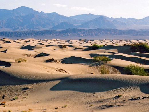
Lonelier, less visited section of the valley but equally scenic as the south. Higher in elevation; sloping up to 3,000 feet at Scotty's Castle. Locations include Ubehebe Crater, Grapevine Springs, Titus Canyon and the Mesquite Flat sand dunes
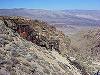
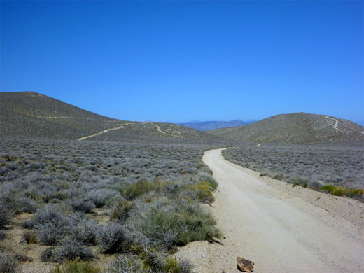
More desert landscapes along the western approaches - Emigrant Pass and Emigrant Canyon. Locations include Aguereberry Point, Skidoo ghost town, Wildrose Peak and the narrow canyons of Tucki Mountain
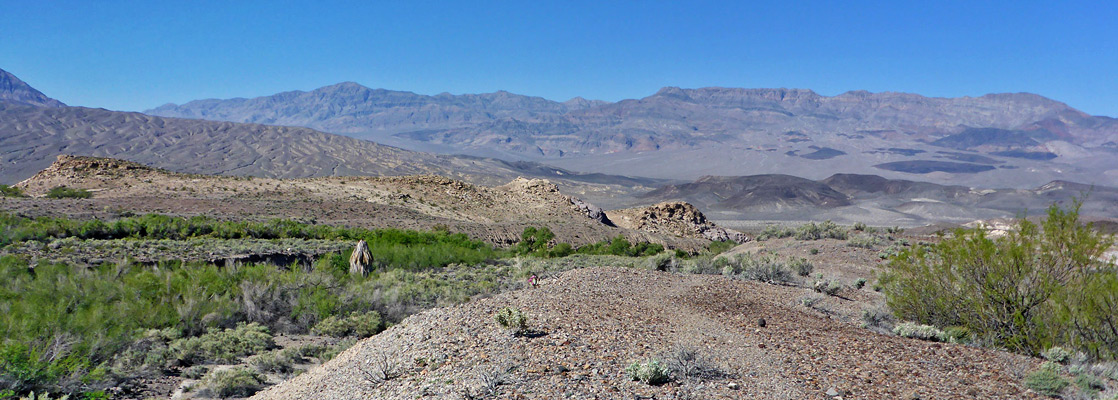
The approach to the national park from Beatty, past the ghost town of Rhyolite - via Hwy 374, which crosses into California at Daylight Pass, near the narrows of Monarch Canyon
Death Valley Tours
Guided tours of the valley, from Las Vegas.
Featured Death Valley Sites and Trails
Sites in the South
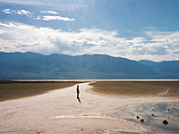
The lowest point in the western hemisphere; probably the most visited location in Death Valley. A roadside overlook provides a viewing point, from where visitors can take short off-trail walks out onto the salt flats
The 80 mile southern approach to Death Valley from Baker, via highways 127 and 178; across Silurian Valley then through the Black Mountains, over Salsberry Pass and Jubilee Pass
Corkscrew Canyon
★★★★★
★★★★★
4.3 miles, 800 feet
Shallow, branched drainage through undulating, yellowish badlands. One fork forms a pretty section of narrows, while another contains an old mine site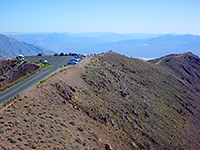
Dantes View
★★★★★
★★★★★
0.4 miles, 300 feet
Dante's View is a spectacular mountain overlook on the west side of Death Valley. A short path leads to a summit (Dante's Peak) a little way north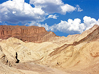
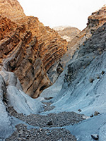
Golden Canyon/Gower Gulch
★★★★★
★★★★★
4.3 miles, 700 feet (loop)
Twisting ravines through fantastically colored badlands below Zabriskie Point, toured by a loop path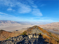
Jubilee Mountain
★★★★★
★★★★★
1.1 miles, 1,252 feet
Off-trail hike to the summit of a peak in the Black Mountains, towards the south end of Death Valley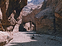
Natural Bridge Canyon
★★★★★
★★★★★
0.8 miles, 500 feet
Ravine through crumbling, greyish conglomerate rocks, containing dryfalls, short narrow sections and a good sized natural bridge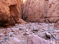
Room Canyon
★★★★★
★★★★★
1.2 miles, 380 feet
Minor drainage in the Black Mountains, with a short narrow section that opens to a dramatic, cliff-lined chamber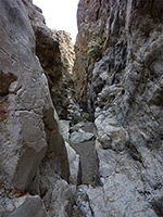
Slit Canyon
★★★★★
★★★★★
1.8 miles, 900 feet
Twisting drainage through colorful rocks at the edge of the Funeral Mountains; contains dryfalls, chokestones, chutes and narrow passageways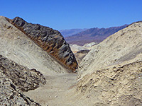
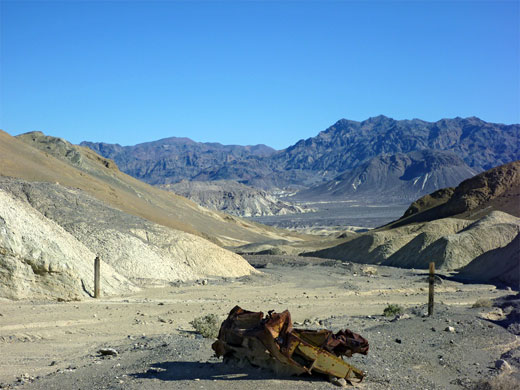
Unpaved, 2.7 mile side road through colorful badlands and narrow ravines. Off-trail hiking reveals narrow tributary canyons, old mine shafts and extensive vistas down to the main valley
Willow Creek
★★★★★
★★★★★
3 miles, 600 feet
Deep, narrow and steeply-sloping canyon containing a stream most of the year, flowing over waterfalls and chutes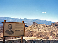
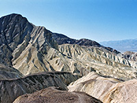
Famous overlook of a colorful, undulating landscape of gullies and mud hills at the edge of the Black Mountains. The landscape can be seen from short walks near the viewpoint, or a longer hike towards Golden Canyon
Sites in the North
Fall Canyon
★★★★★
★★★★★
4.5 miles, 1500 feet
Major drainage leading to 20 foot dryfall, above which are unusual and beautiful narrows through smooth, dark, marble-like strata
Grapevine Springs
★★★★★
★★★★★
5 miles, 650 feet (loop)
Palm tree oases, shallow canyons and hot springs in a rarely-visited area near Scottys Castle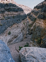
Grey Wall Canyon
★★★★★
★★★★★
5 miles, 1000 feet
Long, twisting ravine through the northern Grapevine Mountains; shallow narrow passageways bordered by banded igneous rocks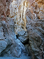
Red Wall Canyon
★★★★★
★★★★★
4.5 miles, 2600 feet
Colorful wilderness gorge, deep in places, bordered by twisted, igneous rocks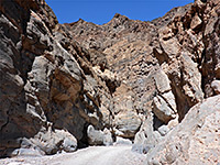
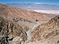
Titus Canyon
★★★★★
★★★★★
2 miles, 680 feet
Hike up the narrow lower section of a major ravine through the Grapevine Mountains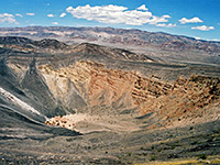
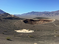
Colorful volcanic crater, around 2,000 years old, near several smaller craters, cinder cones and ash hills - in the far north end of Death Valley, near Scotty's Castle
Sites in the West
Spectacular, remote, high elevation viewpoint on the west side of Death Valley, reached by a 6.5 mile gravel road that also passes ruined buildings and mine relics, associated with the old town of Harrisburg
Darwin Canyon
★★★★★
★★★★★
1.5 miles, 500 feet
One of the highest waterfalls in the national park (80 feet), plus smaller falls and cascades, deep pools and a permanent stream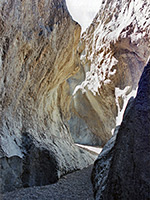
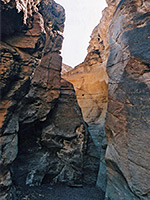
Grotto Canyon
★★★★★
★★★★★
3 miles, 1200 feet
Perhaps the most beautiful narrows in Death Valley - a long succession of enchanting passages through light-colored rocks, polished smooth by floodwaters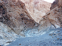
Mosaic Canyon
★★★★★
★★★★★
1.8 miles, 1000 feet
One of many ravines on the north side of Tucki Mountain, containing several sections of shallow but pretty narrows through marble-type rock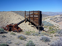
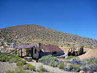
Old townsite, now completely empty, but near several fascinating mining relics, set in remote, deserted terrain on the west side of the Panamint Range, and reached by an 8 mile unpaved road
Stretched Pebble Canyon
★★★★★
★★★★★
2 miles, 1000 feet
Minor, rarely-explored ravine on the west side of Tucki Mountain, with quite a steep upwards gradient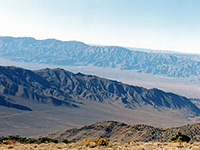
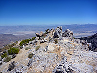
Wildrose Peak Trail
★★★★★
★★★★★
4.2 miles, 2100 feet
High summit in the Panamint Mountains, rising over 9,000 feet on the west side of Death Valley; reached by a steep but straightforward trailSites in the East
Death Valley Buttes
★★★★★
★★★★★
3.5 miles, 1000 feet
Isolated, elongated peak on the east side of Death Valley, near Hells Gate, reached by an unmaintained trail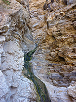
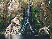
Monarch Canyon
★★★★★
★★★★★
3.5 miles, 1000 feet
Rocky ravine through the Funeral Mountains, containing a spring and a multi-stage, 110 foot waterfall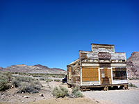
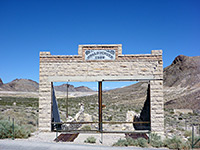
Small but interesting ghost town in the Bullfrog Hills west of Beatty. Today only around a dozen buildings remain, in various stages of disrepair, but the site is evocative and photogenic
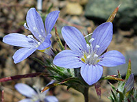
Death Valley Wildflowers
All Contents © Copyright The American Southwest | Comments and Questions | Contribute | Affiliate Marketing Disclosure | Site Map