Highlights:
The approach to Death Valley from the east, from Beatty in Nevada, past the ghost town of Rhyolite. The road, Hwy 374, crosses into California at Daylight Pass, near the narrows of Monarch Canyon

The land east of Death Valley in Nevada is just as empty as the national park, crossed by several other long valleys bordered by barren, rugged mountains. One road passes through this area - US 95 from Las Vegas to Tonopah, and the only significant town along this 206 mile drive is Beatty, which is still quite small with a population of about 1,700.
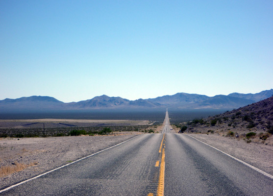
A 20 mile road leaves town and heads southwest - across a wide, flat desert basin then through a range of mountains and down a long winding ravine into the national park. All approaches into the park are dramatic, but this is probably the best - the immediate scenery is interesting and the road provides good, long distance views over many miles of the central valley.
A 20 mile road leaves town and heads southwest - across a wide, flat desert basin then through a range of mountains and down a long winding ravine into the national park. All approaches into the park are dramatic, but this is probably the best - the immediate scenery is interesting and the road provides good, long distance views over many miles of the central valley.
East Death Valley Table of Contents
Location
Map of Death Valley National Park.
Photographs
10 views of Beatty and the eastern approaches, 19 views of Rhyolite.
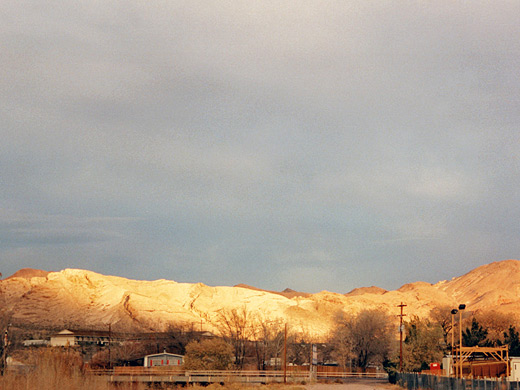
Beatty
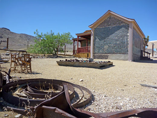
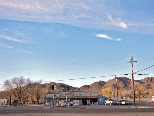
At an elevation of 3,300 feet, Beatty is a little higher than most of the land either side along US 95, and is enclosed by rocky hills with several working mines nearby. The town is quiet and atmospheric, with the appearance of being little changed for many years. It is also a good place to stay - there are several motels offering accommodation much cheaper than in the Park. Other facilities include a rather sleepy casino, several stores and an NPS ranger station. Three miles west of town, Rhyolite is a semi-preserved ghost town that has declined from a busy provincial center in 1908 to a few derelict but evocative buildings now administered by the BLM.
The Approach Road
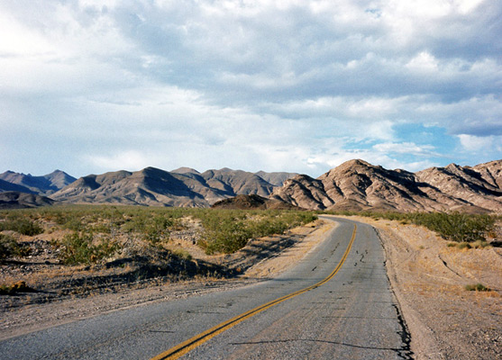
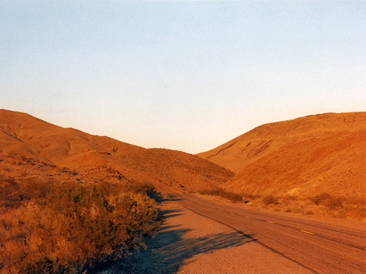
Road 374 crosses the brow of the hills at the edge of town and is then perfectly straight for 9 miles, across the Amargosa Desert and into California, where it is now known as Daylight Pass Road. One side route branches west - the one-way Titus Canyon Drive, which offers an alternative 4WD route into Death Valley; it winds through the Amargosa Mountains and along a deep canyon, emerging a few miles north of the Stovepipe Wells junction. The main road also climbs into the mountains, reaching 4,316 feet at Daylight Pass. Ahead lies a relentless descent to below sea level over the next 14 miles; in summer the corresponding temperature rise is around 20°F.
Hells Gate
Death Valley comes fully into view at the ominously-named Hells Gate (700 feet), where a separate road forks south towards the main visitor facilities at Furnace Creek. The other route runs below an isolated peak, Death Valley Buttes, then continues descending over a vast alluval fan, before the surrounding landscape changes from open flats to a low canyon through rounded clayish hills with many subtle tints of color, similar to the famous badlands of Zabriskie Point further south. After this, the road emerges to the valley floor, joining Scottys Castle Road.
Sites and Trails in the East
Death Valley Buttes
★★★★★
★★★★★
3.5 miles, 1000 feet
Isolated, elongated peak on the east side of Death Valley, near Hells Gate, reached by an unmaintained trail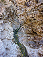
Monarch Canyon
★★★★★
★★★★★
3.5 miles, 1000 feet
Rocky ravine through the Funeral Mountains, containing a spring and a multi-stage, 110 foot waterfall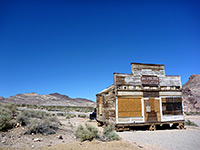
Small but interesting ghost town in the Bullfrog Hills west of Beatty. Today only around a dozen buildings remain, in various stages of disrepair, but the site is evocative and photogenic
All Contents © Copyright The American Southwest | Comments and Questions | Contribute | Affiliate Marketing Disclosure | Site Map