Highlights:
Vast desert area with varied topography, from mountains over 6,000 feet to sand dunes near sea level. Many interesting sites including palm oases, slot canyons, badlands and eroded rock formations. Abundant cacti and spring wildflowers. Popular for primitive camping, 4WD vehicles and off-trail hiking. Three distinct regions; northeast, northwest and south
Nearby town:
Borrego Springs, adjacent
Management:
Location:
33.255, -116.375 (Borrego Springs)
Seasons:
Winter, spring and fall - summer temperatures may reach 120°F
Rating (1-5):
★★★★★
Weather:

Anza Borrego Desert SP is part of the California Deserts itinerary
Featured Hotel
Borrego Springs Resort
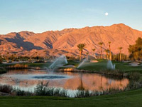 Resort hotel with spa, 18 hole golf course, tennis courts and restaurant, in a rural location off Palm Canyon Drive, southwest of Borrego Springs
Check Rates
Anza-Borrego Desert is the largest state park in the Southwest, covering 600,000 acres of southeast California from the edge of the coastal mountains east to the Salton Sea and south almost to the US/Mexico border, and rivaling the more famous national parks further north for varied, unspoilt desert scenery.
The elevation ranges from 6,200 feet to just 150 feet, and the land beyond the east edge descends to below sea level, hence the temperature can be appropriately extreme, with 120°F not uncommon - the average July maximum is 110°F - and a 30°F difference is possible between the often cloud covered western peaks and the parched deserts far below. Such is the heat in summer that the visitor center is open only at weekends, as far fewer people visit here than in the cooler seasons.
The elevation ranges from 6,200 feet to just 150 feet, and the land beyond the east edge descends to below sea level, hence the temperature can be appropriately extreme, with 120°F not uncommon - the average July maximum is 110°F - and a 30°F difference is possible between the often cloud covered western peaks and the parched deserts far below. Such is the heat in summer that the visitor center is open only at weekends, as far fewer people visit here than in the cooler seasons.
Anza-Borrego Desert Table of Contents
- Location
- Photographs
- Regions of the Anza-Borrego Desert
- Borrego Springs, at the center of the park
- Activities
- Featured trails
- Wildflowers of the Anza-Borrego Desert
- Nearby places
- Similar places
Location
Map of Anza-Borrego Desert State Park.
Photographs
Northeast, northwest, south, wildflowers.
Anza-Borrego Desert - Regions
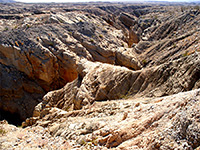
Low desert, badlands and narrow canyons, close to the Salton Sea and crossed by road S22; two main features are the Santa Rosa Mountains
and the Borrego Badlands
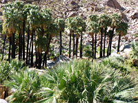
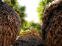
Mountains, valleys and palm oases, approached by roads S22 and Hwy 78. Includes the park headquarters and the most popular trail, to Borrego Palm Canyon
Large and varied desert region, south of road S22, with mountains, valleys, badlands, palm oases and extensive flats
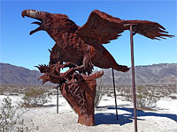
Over 100 iron sculptures in the flat desert around Borrego Springs, created by artist Ricardo Breceda, from 2007 onwards
Borrego Springs
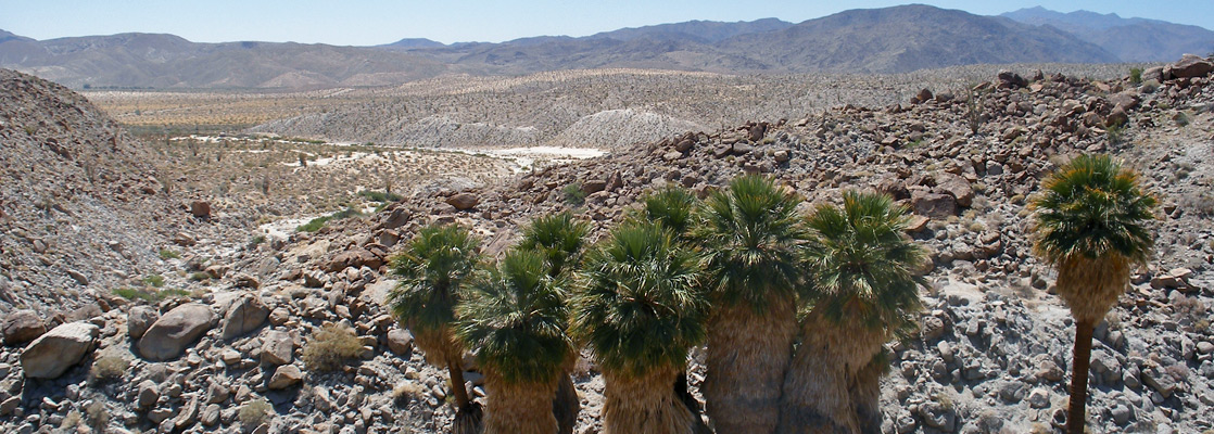
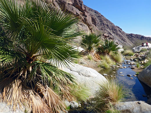
The dispersed town of Borrego Springs lies at the center of the park, which is characterised by one large flat basin bordered on three sides by the mountain ranges. The slopes hide many canyons with palms, cacti and yucca near the basin changing through bushes to pine trees near the summits. Three main roads lead into the park (see map); S22 across the north, CA 78 across the middle and S2 running southeast-northwest, mostly close to the western edge. There are many unpaved tracks leading into the backcountry but the majority require 4WD.
Anza-Borrego Desert Activities
Hiking, backpacking and exploring are the main activities, and entry to Anza-Borrego Desert State Park is good value at $10 (in 2024). Camping is allowed without further charge anywhere away from the main roads though there are several official sites with fees starting from $25 per night. In spring, many people visit just to see the profusion of many different types of wildflowers that cover the park, beginning in the deserts during February to March and progressing up the canyons in early summer. The high country offers plenty of trails, some of which extend into the adjacent Cleveland and San Bernadino National Forest lands to the west and north, and these areas are especially popular in summer when the heat in the lower areas can be too intense. Away from the hills, most of the park is desert - covered by densely growing cacti in some areas but with bare rock and eroded badlands in others, through which run numerous narrow, slot-like canyons and other interesting rocky features.
Featured Anza-Borrego Desert Trails
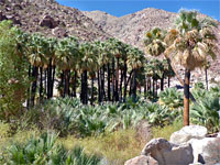
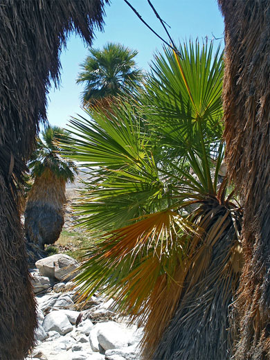
Borrego Palm Canyon
★★★★★
★★★★★
1.5 miles, 500 feet
Popular trail up a ravine at the west edge of Borrego Valley, to a flourishing grove of California fan palms - the third largest oasis in the state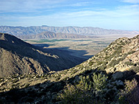
Culp Valley Trail
★★★★★
★★★★★
2.1 miles, 200 feet
Loop past a spring and along a ridge to a fine viewpoint of Borrego Springs. Also a good free camping location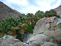
Hellhole Canyon
★★★★★
★★★★★
2.4 miles, 1300 feet
Rocky ravine near Borrego Springs, containing palm groves, an intermittent stream and a seasonal waterfallMountain Palm Springs
★★★★★
★★★★★
3.5 miles, 200 feet
Six groves of California fan palms, in four adjacent ravines at the edge of Carrizo Valley, surrounded by low elevation desert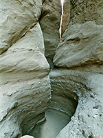
Palm Wash
★★★★★
★★★★★
up to 2 miles
Branched, generally shallow drainage through arid, dusty, conglomerate hills; three main forks, and other tributaries, some forming short slot canyons. Near the site of Calcite Mine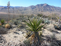
Plum Canyon
★★★★★
★★★★★
4 miles, 800 feet (loop)
Shallow but rather steep drainage with two forks, in the North Pinyon Mountains; followed by a partially unmaintained trail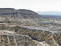
Split Mountain Trail
★★★★★
★★★★★
3.1 miles, 150 feet
Fairly level route along a narrow canyon formed by Fish Creek, cutting through angled, metamorphic strata, and on to some eroded rock formations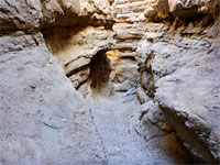
The Slot
★★★★★
★★★★★
0.4 miles, 50 feet
The Slot is a minor drainage in the Borrego Mountains, reached by a dirt track, and notable for about half a mile of quite pretty narrow passages through grey-brown conglomerate rocks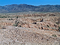
Thimble Trail
★★★★★
★★★★★
3.5 miles, 100 feet
Undulating route through the northern reaches of the Borrego Badlands - extensive views of the stark desert surroundings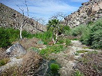
Tubb Canyon Trail
★★★★★
★★★★★
0.9 miles, 120 feet
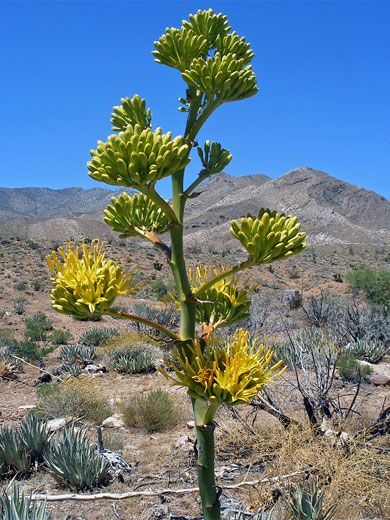
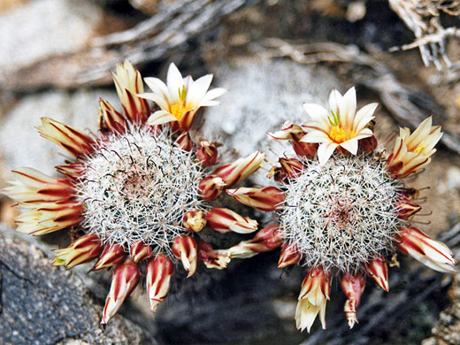
Easy path over grassy flats, a dry wash and a limestone ridge, ending at a large spring that sustains many wildflower speciesAnza-Borrego Desert Wildflowers
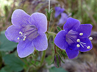
Flowering plants of Anza Borrego - species and habitat descriptions, including cacti, agave and yucca
Anza-Borrego Desert - Nearby Places
- Palm Springs (66 miles) - upscale city surrounded by mountains and desert
- Salton Sea (15 miles) - large, shallow, salty lake at the north end of Imperial Valley
Anza-Borrego Desert - Similar Places
- Joshua Tree National Park, California - scenic desert and unusual plants
- Jacumba Outstanding Natural Area, California - desert and mountains bordering Mexico
- Kofa National Wildlife Refuge, Arizona - little-visited desert area with mountains, cacti and palm trees
All Contents © Copyright The American Southwest | Comments and Questions | Contribute | Affiliate Marketing Disclosure | Site Map