Borrego Palm Canyon, Anza-Borrego Desert State Park
California > Anza-Borrego Desert State Park > The Northwest > Borrego Palm Canyon
Borrego Palm Canyon
Popular trail up a ravine at the west edge of Borrego Valley, partly alongside a flowing stream, to a flourishing grove of California fan palms - the third largest oasis in the state. Many wildflowers in spring
Length: 1.5 miles
Elevation change: 500 feet
Difficulty: Easy
Type: One way. Hiking (off trail) further up the canyon is possible
Usage: High
Season: Spring is best; also good in fall and winter
Trailhead: Far side of the state park campground
Rating (1-5): ★★★★★
Elevation change: 500 feet
Difficulty: Easy
Type: One way. Hiking (off trail) further up the canyon is possible
Usage: High
Season: Spring is best; also good in fall and winter
Trailhead: Far side of the state park campground
Rating (1-5): ★★★★★

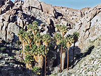
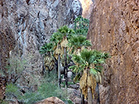
Borrego Palm Canyon is similar to several other east-west ravines at the edge of the mountains in the northwest of Anza-Borrego Desert State Park but by far the most visited, since it is close to the visitor center and has an easy trail running through; this follows a dry wash for 1.5 miles gaining just 500 feet in elevation, past many and varied desert plants to a big group of California fan palm trees - the third largest palm oasis in the state. Hellhole Canyon is a similar drainage, 3 miles south, reached by a rather longer trail, much less used.
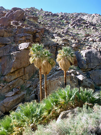
Borrego Palm Canyon begins on the wooded slopes of Hot Springs Mountain, over 6,000 feet, as three forks, North, South and (the longest) Middle, becoming a single drainage at 2,200 feet, shortly before the palm oasis. The main trail ends at a viewpoint above the palms on the north side of the canyon, though an unofficial route continues another 3 miles to the summit of Indianhead Peak, 3,970 feet.
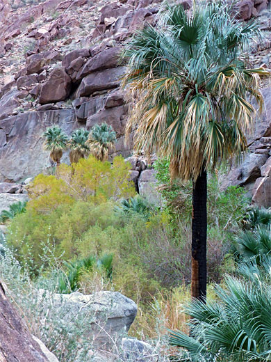
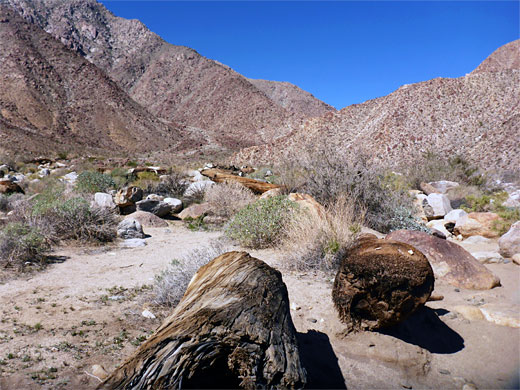
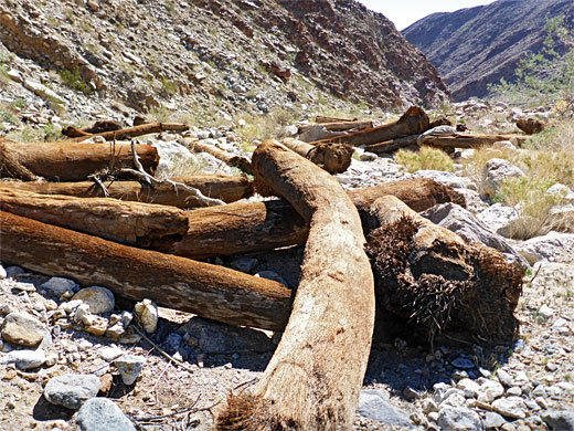
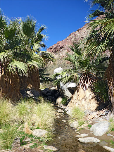
Visitors are requested not to walk around within the palm groves in order to avoid damaging the environment, though such parts are in any case quite overgrown and rather inaccessible. A stream rises from springs within the palms and flows for a quarter of a mile before the waters seep below ground, and a corridor of greenery extends the same distance; above and below, the canyon is completely dry for most of the year, however occasional flash floods do occur, as shown by washed-up palm trunks far downstream.
Map of Anza-Borrego Desert State Park.
23 views of Borrego Palm Canyon.
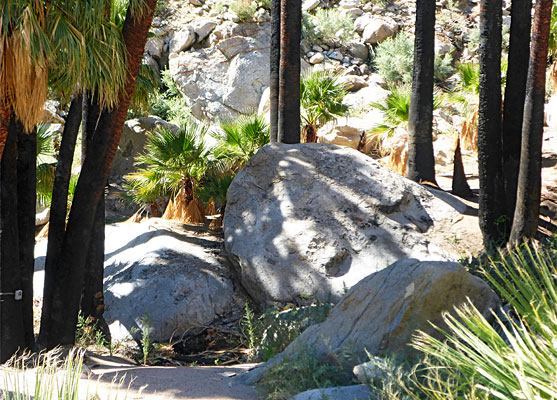
The Borrego Palm Canyon trailhead is at the main 117 site state park campground, reached by a spur road from the visitor center, and enjoying a pleasant setting amongst bushes close to the edge of the hills. The path starts as two branches, both climbing gently up the alluvial fan at the mouth of the canyon. The most used route is to the north; this crosses the various branches of the streamway, through shrubs and boulders, then runs at the foot of the northern valley sides, crossing the drainage again after one mile, and joining the other branch. This latter trail (marked as 'alternative') begins along the south side of the valley before climbing a little way above, crossing boulder-covered slopes, over several small dry washes, then traversing a bench and descending to the junction. The stream is flowing not far ahead; the path crosses one more time, from south to north, near the start of the palm trees, and climbs slightly through an area of huge boulders, to the final viewpoint.
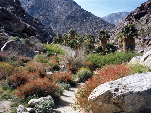
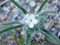
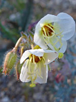
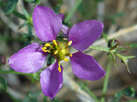
Land along the lower reaches of the canyon is quite open, covered by large and small boulders between which grow flowering bushes, and in spring the valley presents a colorful spectacle of yellow (brittlebush), red (chuparosa) and blue (indigo bush). Also abundant are the spiky, red tipped ocotillo, large barrel cacti, several species of yellow-blossomed opuntia, clusters of mammillaria cacti and a variety of smaller wildflowers. Wildlife that may be seen include lizards, snakes and the elusive bighorn sheep.
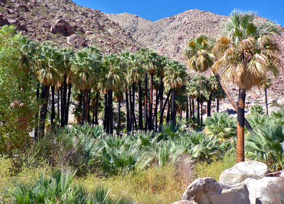
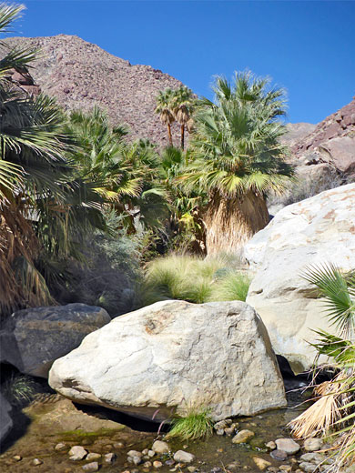
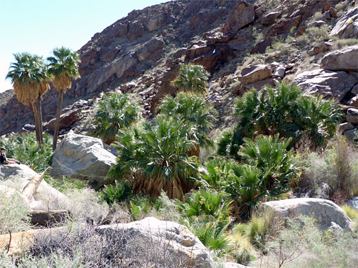
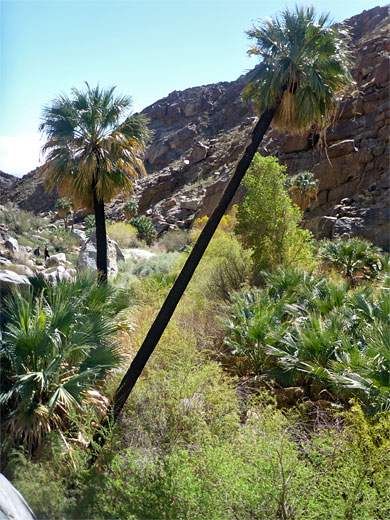
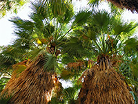
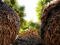
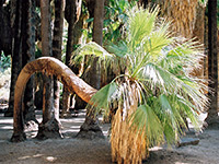
The palms are reached after about 45 minutes walking, and are grouped around the springs in the floor of the valley, which at this point is quite narrow and sheltered. Climbing up the sides of the canyon is fairly easy and allows a rather different view of the palms. Apart from during rainy seasons, the water does not flow far before seeping below ground, but it does provide the year-round source necessary for the trees to flourish, and the cool, moist, shady area beneath the fronds offers a great contrast to the prevailing conditions of the exposed, sunny hike to reach the oasis. This is the end of the official hike but the canyon can be explored for several more miles; it divides not far upstream and the middle branch extends far outside the park, into the adjacent Los Coyotes Indian Reservation. The terrain is more difficult higher up the drainage, with numerous minor obstacles formed by boulders and dense patches of undergrowth.
Other good hikes along palm tree canyons can be found near Palm Springs (the Indian Canyons), Joshua Tree National Park (Fortynine Palms Oasis, Lost Palms Oasis) and Kofa National Wildlife Refuge (Palm Canyon).
Borrego Palm Canyon begins on the wooded slopes of Hot Springs Mountain, over 6,000 feet, as three forks, North, South and (the longest) Middle, becoming a single drainage at 2,200 feet, shortly before the palm oasis. The main trail ends at a viewpoint above the palms on the north side of the canyon, though an unofficial route continues another 3 miles to the summit of Indianhead Peak, 3,970 feet.
Visitors are requested not to walk around within the palm groves in order to avoid damaging the environment, though such parts are in any case quite overgrown and rather inaccessible. A stream rises from springs within the palms and flows for a quarter of a mile before the waters seep below ground, and a corridor of greenery extends the same distance; above and below, the canyon is completely dry for most of the year, however occasional flash floods do occur, as shown by washed-up palm trunks far downstream.
Location
Map of Anza-Borrego Desert State Park.
Photographs
23 views of Borrego Palm Canyon.
The Trail
The Borrego Palm Canyon trailhead is at the main 117 site state park campground, reached by a spur road from the visitor center, and enjoying a pleasant setting amongst bushes close to the edge of the hills. The path starts as two branches, both climbing gently up the alluvial fan at the mouth of the canyon. The most used route is to the north; this crosses the various branches of the streamway, through shrubs and boulders, then runs at the foot of the northern valley sides, crossing the drainage again after one mile, and joining the other branch. This latter trail (marked as 'alternative') begins along the south side of the valley before climbing a little way above, crossing boulder-covered slopes, over several small dry washes, then traversing a bench and descending to the junction. The stream is flowing not far ahead; the path crosses one more time, from south to north, near the start of the palm trees, and climbs slightly through an area of huge boulders, to the final viewpoint.
Wildflowers
Land along the lower reaches of the canyon is quite open, covered by large and small boulders between which grow flowering bushes, and in spring the valley presents a colorful spectacle of yellow (brittlebush), red (chuparosa) and blue (indigo bush). Also abundant are the spiky, red tipped ocotillo, large barrel cacti, several species of yellow-blossomed opuntia, clusters of mammillaria cacti and a variety of smaller wildflowers. Wildlife that may be seen include lizards, snakes and the elusive bighorn sheep.
The Borrego Palms Oasis
The palms are reached after about 45 minutes walking, and are grouped around the springs in the floor of the valley, which at this point is quite narrow and sheltered. Climbing up the sides of the canyon is fairly easy and allows a rather different view of the palms. Apart from during rainy seasons, the water does not flow far before seeping below ground, but it does provide the year-round source necessary for the trees to flourish, and the cool, moist, shady area beneath the fronds offers a great contrast to the prevailing conditions of the exposed, sunny hike to reach the oasis. This is the end of the official hike but the canyon can be explored for several more miles; it divides not far upstream and the middle branch extends far outside the park, into the adjacent Los Coyotes Indian Reservation. The terrain is more difficult higher up the drainage, with numerous minor obstacles formed by boulders and dense patches of undergrowth.
Other good hikes along palm tree canyons can be found near Palm Springs (the Indian Canyons), Joshua Tree National Park (Fortynine Palms Oasis, Lost Palms Oasis) and Kofa National Wildlife Refuge (Palm Canyon).
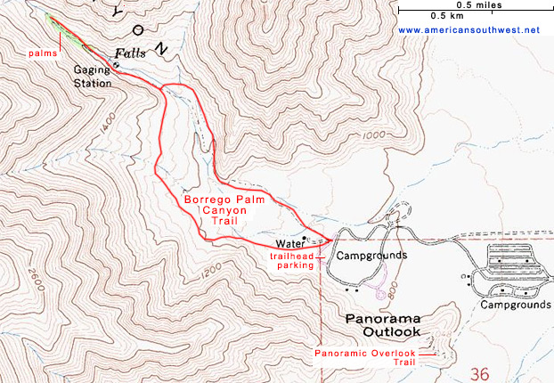
Topographic Map of the Borrego Palm Canyon Trail
Borrego Palm Canyon - Similar Hikes
All Contents © Copyright The American Southwest | Comments and Questions | Contribute | Affiliate Marketing Disclosure | Site Map