Lost Palms Oasis, Joshua Tree National Park
California > Joshua Tree National Park > Hiking > Lost Palms Oasis
Lost Palms Oasis Trail
The only extended trail in the eastern half of the park, crossing very scenic land of dry washes, boulders and abundant Sonoran Desert plants, then descending into a narrow ravine holding over 100 palm trees
Length: 3.6 miles
Elevation change: 450 feet
Difficulty: Moderate
Type: One way. Continuation hikes possible along unmaintained trails to two more remote groves
Usage: Medium
Season: All year, but very hot in summer
Trailhead: Cottonwood Spring
Rating (1-5): ★★★★★
Elevation change: 450 feet
Difficulty: Moderate
Type: One way. Continuation hikes possible along unmaintained trails to two more remote groves
Usage: Medium
Season: All year, but very hot in summer
Trailhead: Cottonwood Spring
Rating (1-5): ★★★★★

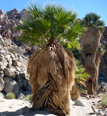
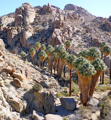
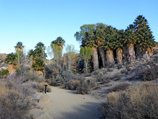
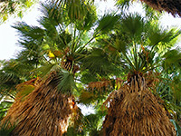
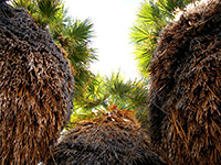
Perhaps the best of the relatively few all-day hikes in Joshua Tree National Park is the 3.6 mile path to Lost Palms Oasis, a sheltered steep-sided ravine that conceals a flourishing group of over 100 California fan palm trees, one of only six such groves in the park. The others are Oasis of Mara, next to the main visitor center in Twentynine Palms, Fortynine Palms Oasis, Munsen Canyon and Victory Palms (both a short distance east of the Lost Palms), and Cottonwood Spring, near the start of the Lost Palms path.
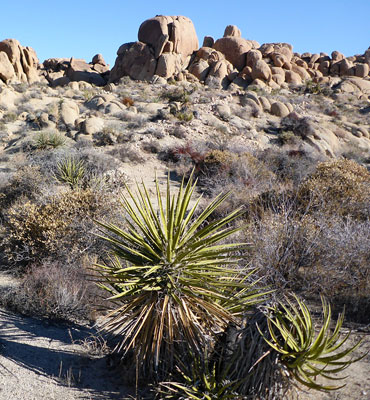
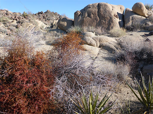
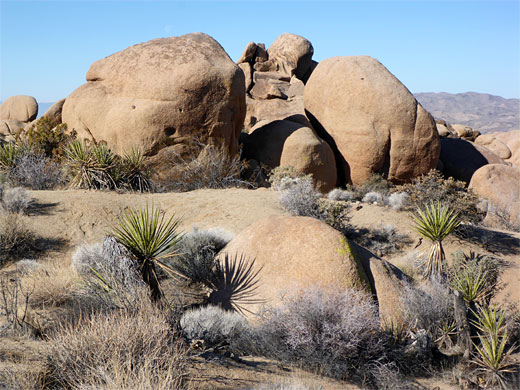
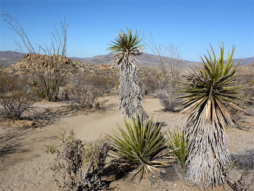
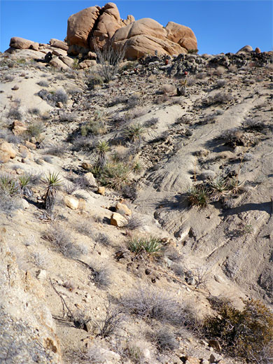
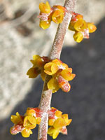
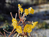
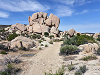
The journey passes over rocky ridges and through narrow sandy washes, passing many cacti, yucca and other distinctive Sonoran Desert plants, and large groups of the imposing monzonite boulders, although no Joshua trees as the elevation is too low. In spring (March and April are the peak months) the landscape is made even more colorful by abundant, varied wildflowers - dozens of species are found in this area.
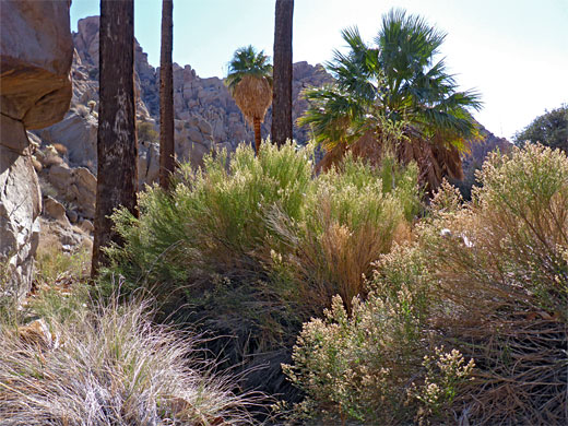
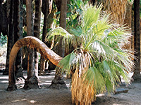
The Lost Palms Oasis hike begins at Cottonwood Spring, close to the visitor center 6 miles inside the southern park boundary. This is a popular area, and the trailhead parking is often full at busy times; later arrivals have to park a little way back, along verges. The spring produces water all year and helps sustain an oasis containing a few dozen palm trees although this is not a natural group, being planted by settlers in the late nineteenth century. Notices caution visitors not to explore the oasis, off-trail, because of metal contamination in the vicinity, leaching from remnants of the Gray Eagle Mill Site, an extinct gold processing operation. Nearby is the Cottonwood Spring Campground and a 3 mile loop trail that passes many types of desert plants, the mill site, and some shafts and other relics from the associated gold mine, on Mastodon Peak. The path to the Lost Palms branches off southeastwards and is essentially straight for the nearly 4 miles to the oasis, with a small overall elevation gain of 450 feet.
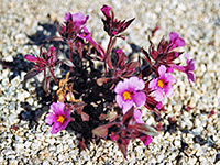
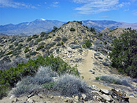
The surroundings are impressive from start to finish - many outcrops of the granitic boulders rise from an undulating landscape of ridges, plateaus, small canyons and rocky washes; between the rocks the ground is covered by coarse whitish sand through which cacti, bushes and wildflowers grow profusely - clean, pristine scenery. In spring, the dry washes are especially pretty as flowers grow in the smooth white sandy streambeds while many more line the edges, intermingled with flowering bushes; most visible of these are red chuparosa, yellow brittlebush and the blue-purple indigo bush. The main species of cacti are echinocereus, ferocactus (California barrel cactus), mammillaria, cholla and other types of opuntia.
Each mile along the well-used trail is marked by a post. For the first mile, the path leads up a shallow rocky canyon, gaining height steadily but not too steeply. The second crosses mostly flat and open land with a few dry washes, while the third is through more up-and-down scenery with ridges and gullies. The final section is similar, ending by following a longer, somewhat deeper canyon past some huge rocks to an overlook on a narrow ridge above the oasis and the palm trees. From here, Lost Palms Canyon stretches away to the southeast, and beyond a huge area of desert hills is visible, as far as the plateau beside the lower Colorado River valley. The middle section of the trail has similarly far-reaching views in the southwest direction - over the Salton Sea, the Jacumba Mountains and other ranges in Mexico, 80 miles away.
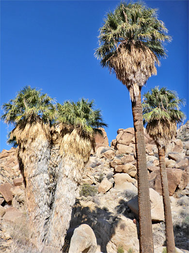
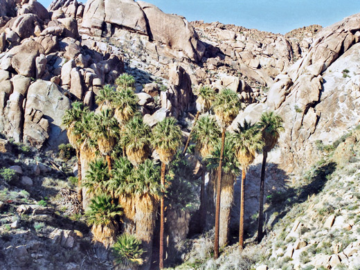
A notice on the ridge overlooking the canyon states 'End of Trail, Proceed at Own Risk', since the viewpoint marks the terminus of the official, maintained path, though a short but steep path, not at all difficult, descends to the oasis, from where a primitive trail/route continues along the streambed for a further 5 miles, meeting a 4WD track outside the park boundary; on the way it passes Victory Palms and Munsen Palms. At the oasis, the palm trees are numerous, large and flourishing - the deep, shaded ravine and water from a permanent spring support a most microclimate that creates ideal growing conditions. More trees can be seen by climbing up large boulders to the head of the canyon, 800 feet north.
The journey passes over rocky ridges and through narrow sandy washes, passing many cacti, yucca and other distinctive Sonoran Desert plants, and large groups of the imposing monzonite boulders, although no Joshua trees as the elevation is too low. In spring (March and April are the peak months) the landscape is made even more colorful by abundant, varied wildflowers - dozens of species are found in this area.
Lost Palms Oasis Trailhead
The Lost Palms Oasis hike begins at Cottonwood Spring, close to the visitor center 6 miles inside the southern park boundary. This is a popular area, and the trailhead parking is often full at busy times; later arrivals have to park a little way back, along verges. The spring produces water all year and helps sustain an oasis containing a few dozen palm trees although this is not a natural group, being planted by settlers in the late nineteenth century. Notices caution visitors not to explore the oasis, off-trail, because of metal contamination in the vicinity, leaching from remnants of the Gray Eagle Mill Site, an extinct gold processing operation. Nearby is the Cottonwood Spring Campground and a 3 mile loop trail that passes many types of desert plants, the mill site, and some shafts and other relics from the associated gold mine, on Mastodon Peak. The path to the Lost Palms branches off southeastwards and is essentially straight for the nearly 4 miles to the oasis, with a small overall elevation gain of 450 feet.
Scenery
The surroundings are impressive from start to finish - many outcrops of the granitic boulders rise from an undulating landscape of ridges, plateaus, small canyons and rocky washes; between the rocks the ground is covered by coarse whitish sand through which cacti, bushes and wildflowers grow profusely - clean, pristine scenery. In spring, the dry washes are especially pretty as flowers grow in the smooth white sandy streambeds while many more line the edges, intermingled with flowering bushes; most visible of these are red chuparosa, yellow brittlebush and the blue-purple indigo bush. The main species of cacti are echinocereus, ferocactus (California barrel cactus), mammillaria, cholla and other types of opuntia.
The Trail
Each mile along the well-used trail is marked by a post. For the first mile, the path leads up a shallow rocky canyon, gaining height steadily but not too steeply. The second crosses mostly flat and open land with a few dry washes, while the third is through more up-and-down scenery with ridges and gullies. The final section is similar, ending by following a longer, somewhat deeper canyon past some huge rocks to an overlook on a narrow ridge above the oasis and the palm trees. From here, Lost Palms Canyon stretches away to the southeast, and beyond a huge area of desert hills is visible, as far as the plateau beside the lower Colorado River valley. The middle section of the trail has similarly far-reaching views in the southwest direction - over the Salton Sea, the Jacumba Mountains and other ranges in Mexico, 80 miles away.
The Palms
A notice on the ridge overlooking the canyon states 'End of Trail, Proceed at Own Risk', since the viewpoint marks the terminus of the official, maintained path, though a short but steep path, not at all difficult, descends to the oasis, from where a primitive trail/route continues along the streambed for a further 5 miles, meeting a 4WD track outside the park boundary; on the way it passes Victory Palms and Munsen Palms. At the oasis, the palm trees are numerous, large and flourishing - the deep, shaded ravine and water from a permanent spring support a most microclimate that creates ideal growing conditions. More trees can be seen by climbing up large boulders to the head of the canyon, 800 feet north.
Lost Palms Oasis - Similar Hikes
All Contents © Copyright The American Southwest | Comments and Questions | Contribute | Affiliate Marketing Disclosure | Site Map