Plum Canyon, Anza-Borrego Desert State Park
California > Anza-Borrego Desert State Park > The Northwest > Plum Canyon
Plum Canyon
Shallow but rather steep drainage in the North Pinyon Mountains. The west fork is followed by a trail, while a loop can be made including the east fork, along a partially off-trail route
Length: 4 miles (loop)
Elevation change: 800 feet
Difficulty: Strenuous
Type: Loop, partially off-trail
Usage: Low
Season: Spring, fall and winter
Trailhead: 1.2 miles along a track, on the south side of Hwy 78
Rating (1-5): ★★★★★
Elevation change: 800 feet
Difficulty: Strenuous
Type: Loop, partially off-trail
Usage: Low
Season: Spring, fall and winter
Trailhead: 1.2 miles along a track, on the south side of Hwy 78
Rating (1-5): ★★★★★

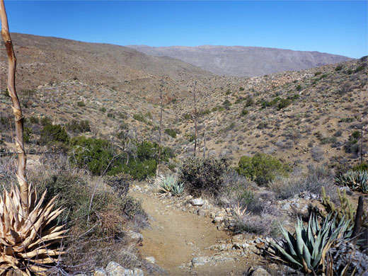
Plum Canyon is one of the innumerable ravines that cut across the mountains of Anza-Borrego Desert State Park, not particularly remarkable but easily-reached and lacking obstructions, so it provides a good hike into the backcountry, passing many and varied desert plants, and rising to a ridge with great views over a large area of the park.
The canyon has two forks, one followed by a semi-maintained path (a section of the long distance California Hiking and Riding Trail), the other by a lesser-used path which fades away in the upper reaches, but a little off-trail hiking enables a loop walk, of about 4 miles depending on the exact route. The canyon has a recognized trailhead, signed along the main road, and the fork in a canyon is the usual start of the loop, this 1.2 miles away along a gravel track which is usually fine for most vehicles.
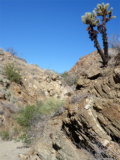
The east fork of Plum Canyon is a little narrower and steeper; both forks end below a ridge, within the North Pinyon Mountains, on the far side of which the land falls away to the flat lands of Shelter Valley, also known as Earthquake Valley. The usual route for the loop, starting up the east fork, is to cross the ridge and descend a short ravine on the far side, meeting with the California Hiking and Riding Trail, then follow this back down the west fork.
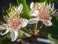
Like nearly all trails in the state park, the terrain is exposed and very hot in summer; the hike is best in spring when the wildflowers are blooming. The loop typically takes 3 to 4 hours. The name of the canyon may refer to the desert apricot, a plum-like shrub that grows alongside the streambed in several locations.
Map of Anza-Borrego Desert State Park.
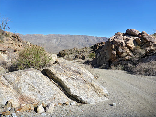
The signed turning for Plum Canyon is along Hwy 78, 9 miles east of Banner and just east of the mouth of Sentenac Canyon. In the vicinity are a few tracks and flat areas, suitable for primitive camping. A good gravel track heads south, beside or in the dry wash from the canyon, for 1.2 miles, to the fork, where the west and east branches meet. Other tracks continue a little way away up both forks but the junction is the obvious place to park for the loop hike.
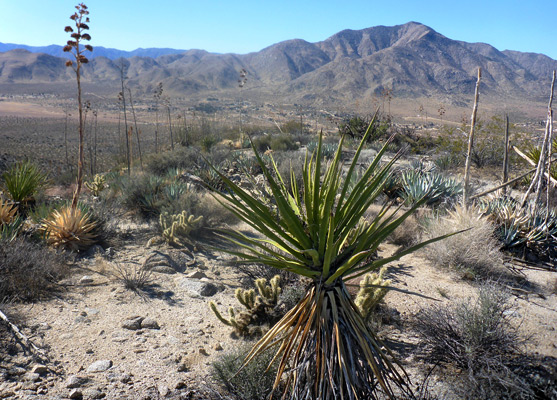
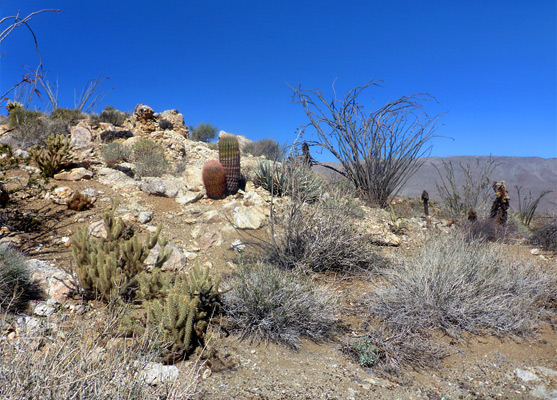
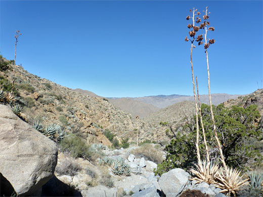
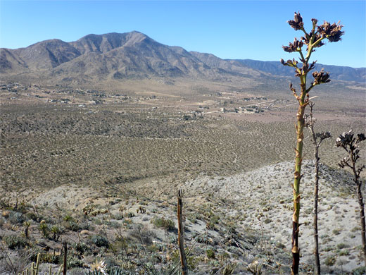
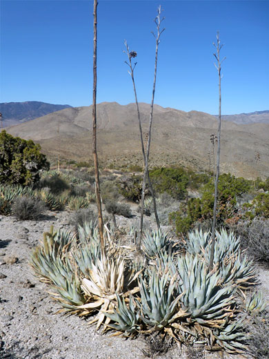
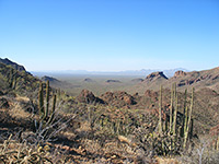
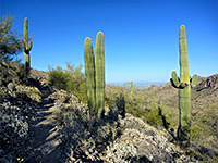
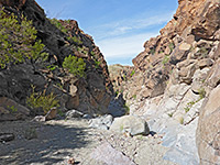
Beyond the parking area at the end of the track down the east fork, the canyon narrows slightly at a dryfall then winds round a few bends, flanked by cacti and flowering bushes. The high ridge at the far end of the canyon comes into view, as the streambed gradually becomes steeper, bendier and rockier. A larger dryfall is easily passed on the left. The uppermost reaches are filled with boulders, then beyond is a steepish slope leading to the ridgeline, covered with many large specimens of agave, ocotillo, yucca, cholla and other cacti. Views to the south extended across Shelter Valley and its scattered homes, to Granite Mountain and beyond.
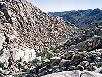
The route is then down the rather steep ravine just beyond, descending 350 feet over a third of a mile, to an intersection with the California Hiking and Riding Trail. This path seems quite well-used, and having traversed the flattish desert to the south, to the north it crosses a wash and rises up a slope, over a low divide and into the very upper end of the west fork of Plum Canyon. A post marks the junction with a minor tributary, indicating the correct direction for upstream hikers. The drainage soon widens, and becomes quite open, the canyon sides not at all steep. A short bouldery stretch leads to a minor dryfall, where the California Trail departs to the west. The fall is easily passed, and another brief passageway leads to the end of the road down this fork of the drainage, from where junction, and the parking area is 0.3 miles further.
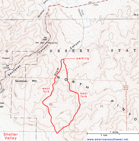
The canyon has two forks, one followed by a semi-maintained path (a section of the long distance California Hiking and Riding Trail), the other by a lesser-used path which fades away in the upper reaches, but a little off-trail hiking enables a loop walk, of about 4 miles depending on the exact route. The canyon has a recognized trailhead, signed along the main road, and the fork in a canyon is the usual start of the loop, this 1.2 miles away along a gravel track which is usually fine for most vehicles.
The east fork of Plum Canyon is a little narrower and steeper; both forks end below a ridge, within the North Pinyon Mountains, on the far side of which the land falls away to the flat lands of Shelter Valley, also known as Earthquake Valley. The usual route for the loop, starting up the east fork, is to cross the ridge and descend a short ravine on the far side, meeting with the California Hiking and Riding Trail, then follow this back down the west fork.
Like nearly all trails in the state park, the terrain is exposed and very hot in summer; the hike is best in spring when the wildflowers are blooming. The loop typically takes 3 to 4 hours. The name of the canyon may refer to the desert apricot, a plum-like shrub that grows alongside the streambed in several locations.
Location
Map of Anza-Borrego Desert State Park.
Plum Canyon Trailhead
The signed turning for Plum Canyon is along Hwy 78, 9 miles east of Banner and just east of the mouth of Sentenac Canyon. In the vicinity are a few tracks and flat areas, suitable for primitive camping. A good gravel track heads south, beside or in the dry wash from the canyon, for 1.2 miles, to the fork, where the west and east branches meet. Other tracks continue a little way away up both forks but the junction is the obvious place to park for the loop hike.
East Fork of Plum Canyon
Beyond the parking area at the end of the track down the east fork, the canyon narrows slightly at a dryfall then winds round a few bends, flanked by cacti and flowering bushes. The high ridge at the far end of the canyon comes into view, as the streambed gradually becomes steeper, bendier and rockier. A larger dryfall is easily passed on the left. The uppermost reaches are filled with boulders, then beyond is a steepish slope leading to the ridgeline, covered with many large specimens of agave, ocotillo, yucca, cholla and other cacti. Views to the south extended across Shelter Valley and its scattered homes, to Granite Mountain and beyond.
West Fork of Plum Canyon
The route is then down the rather steep ravine just beyond, descending 350 feet over a third of a mile, to an intersection with the California Hiking and Riding Trail. This path seems quite well-used, and having traversed the flattish desert to the south, to the north it crosses a wash and rises up a slope, over a low divide and into the very upper end of the west fork of Plum Canyon. A post marks the junction with a minor tributary, indicating the correct direction for upstream hikers. The drainage soon widens, and becomes quite open, the canyon sides not at all steep. A short bouldery stretch leads to a minor dryfall, where the California Trail departs to the west. The fall is easily passed, and another brief passageway leads to the end of the road down this fork of the drainage, from where junction, and the parking area is 0.3 miles further.
Topographic Map of the Plum Canyon Trail
Plum Canyon - Similar Hikes
All Contents © Copyright The American Southwest | Comments and Questions | Contribute | Affiliate Marketing Disclosure | Site Map