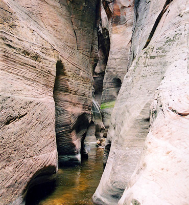
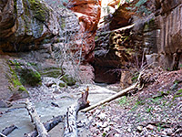
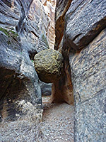
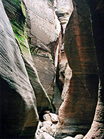
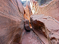
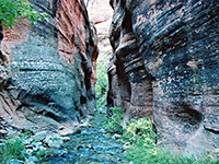
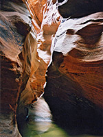
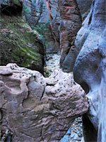
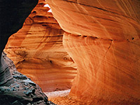
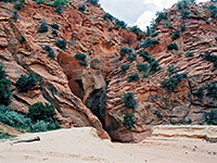
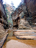
Slot canyons in and around Zion National Park, formed by the Virgin River and its tributaries.


Zion Canyoneering Adventures
Beartrap Canyon
★★★★★
★★★★★
8.8 miles, 1000 feet
Short but very pretty narrows leading to a waterfall; a remote tributary of La Verkin CreekBitter Creek
★★★★★
★★★★★
0.5 miles, 240 feet
Short slot on the southern slopes of the Pine Valley Mountains, west of Zion, containing a few high falls, but most is easily explorable from belowClear Creek
★★★★★
★★★★★
0.5 miles, 50 feet
Long drainage on the east side of Zion National Park, running close to UT 9; not generally very enclosed, but forming good, short stretches of easily-accessed narrowsEcho Canyon
★★★★★
★★★★★
1.6 miles, 1100 feet
Spectacular deep and dark slot canyon with extravagantly sculptured walls, tinged with green moss in many placesElkheart Cliffs Canyon
★★★★★
★★★★★
0.7 miles, 300 feet
Very short slot canyon along an unnamed wash draining the south end of the Elkheart Cliffs; nice passages through stripy rocks, plus a few dryfalls, potholes and possible poolsHidden Canyon
★★★★★
★★★★★
1.1 miles, 800 feet
The lower end of the cool, shady narrows of Hidden Canyon may be reached by a short though quite strenuous trail, part of which involves a traverse of a sheer cliff face with the aid of chains. Dryfalls and other confined sections can be seen by hiking and scrambling further upstream. Currently inaccessibleKanarra Creek
★★★★★
★★★★★
2.9 miles, 800 feet
Beautiful, deep and narrow red rock canyon containing a permanent stream, fairly shallow for most of the year, forming pretty pools, waterfalls and flooded channelsKeyhole Canyon
★★★★★
★★★★★
1.2 miles, 120 feet
Minor drainage on the north side of Clear Creek, containing three narrows sections; shallow upper passages, a short enclosed middle with several moderate obstacles, then a dark slot through reddish black sandstone, where ropes are needed in three placesKolob Creek
★★★★★
★★★★★
2.6 miles, 1800 feet
Major tributary of the Virgin River, flowing through a deep, long slot canyon. Very challenging to explore fully as the upper end has many deep pools and sheer drops, but the lower narrows can be reached by quite a steep hikeMineral Gulch
★★★★★
★★★★★
6.6 miles, 1200 feet
Remote, secluded canyon, a tributary of the East Fork of the Virgin River, joining just after a fairly short but scenic and quite deep slot canyon section through dark red sandstoneMisery Canyon
★★★★★
★★★★★
9 miles, 1400 feet
Mostly shallow drainage of two branches, forming short slots between longer open sections, ending with a 30 foot dryfall into a much deeper and darker canyon, which joins the East Fork of the Virgin RiverNorth Creek, Left Fork
★★★★★
★★★★★
3.4 miles, 1200 feet
Popular, oft-visited narrow canyon that includes The Subway, where the creek flows through a long, tubular passage with only a narrow opening aboveOrderville Canyon
★★★★★
★★★★★
8.4 miles, 1700 feet
Spectacular, long and very deep gorge joining the Zion Narrows. The lower 3 miles are most impressive, and part contains a permanent stream, with pools, waterfalls and several huge chokestonesParunuweap Canyon
★★★★★
★★★★★
3.9 miles, 1400 feet
Typically deep and narrow Zion canyon, formed by the East Fork of the Virgin River, very similar to the famous Zion Narrows but harder to reachPine Creek
★★★★★
★★★★★
0.4 miles, 40 feet
Most popular of Zion's technical slot canyons, deepening rapidly via chokestones and dryfalls that require rappels of up to 60 feet. Hikers may see the very beginning of the slot, and a short narrows section further upstreamPole Canyon
★★★★★
★★★★★
2 miles, 800 feet
Partly wooded ravine on the Kolob Plateau, formed by the seasonal Pine Spring Wash; narrowing gradually to a half-mile section of confined passageways through dark, reddish-gray sandstonePoverty Wash
★★★★★
★★★★★
9 miles, 1200 feet
Hard to reach tributary of Parunuweap Canyon - short stretches of colorful narrows between wider parts, before a 40 foot dryfall and a rather darker and more impressive slot, which gives way to a pleasant gorge containing a small streamRed Canyon (Peek-a-Boo Canyon)
★★★★★
★★★★★
4.5 miles, 450 feet
Half a mile of colorful, medium depth narrows along a minor tributary of Kanab Creek, surrounded by a rolling landscape of sand dunes and small hillsRed Hollow
★★★★★
★★★★★
0.6 miles, 200 feet
Red Hollow, east of Orderville, has narrow, vertical-walled passages through deep red rocks, most of which is hikeable from the lower end though an unclimbable dryfall means that the full length can only be explored from above, using ropesSand Wash
★★★★★
★★★★★
8 miles, 800 feet
Branched drainage beneath the Elkheart Cliffs, east of Zion NP; a sandy wash for most of its length, but forming two good slot sections through richly colored rocksShelf Canyon
★★★★★
★★★★★
0.4 miles, 140 feet
Short, straight drainage, a tributary of Pine Creek, with vertical cliffs and a sandy floor, narrowing to a slot then ending abruptly below a jagged wallSpring Creek Canyon
★★★★★
★★★★★
3 miles, 1000 feet
Conspicuous valley just north of Zion National Park, sheer-walled for over a mile, through colorful red rocks. Not especially narrow but quite pretty, and with several short side canyonsTaylor Creek, Middle Fork
★★★★★
★★★★★
3.1 miles, 700 feet
Most enclosed of the Finger Canyons of the Kolob; a narrowing, vegetation-filled valley containing a small stream, eventually becoming sheer sided, though gaining height steeply via boulders and fallsWater Canyon
★★★★★
★★★★★
2 miles, 1200 feet
Relatively short but steeply-descending canyon on the south side of Canaan Mountain, containing a permanent stream that forms beautiful waterfalls, clear pools and slot-like passagewaysYankee Doodle Hollow
★★★★
★★★★
0.5 miles, 200 feet
Minor drainage through the Pine Valley Mountains, west of Zion, forming a quarter mile slotZion Narrows
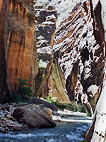
★★★★★
★★★★★
15.6 miles, 1200 feet
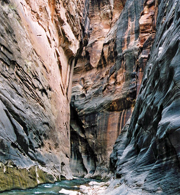
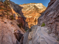
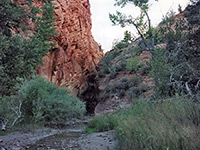
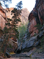
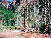
The most famous narrow canyon hike in the Southwest, following the North Fork of the Virgin River past near vertical walls up to 2,000 feet highThe Kolob Terrace is a high forested area at the western edge of the Colorado Plateau into which the Virgin River and many of its tributaries have carved a network of deep canyons, most of which fall within the boundary of Zion National Park. These vary in character and include true slot canyons, steep V-sided ravines with narrow sections, and huge deep valleys like Zion Canyon, the central attraction of the park. In common with all the larger canyons this has year-round flowing water - the North Fork of the Virgin River in this case - which creates many beautiful pools, waterfalls and cascades but also makes exploration more difficult. The most famous narrows hike in the Southwest is along the upper part in Zion Canyon and is only passable for a few months each year due to flash flood danger.
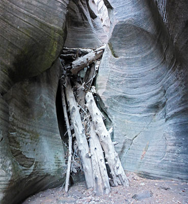
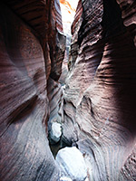
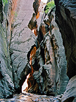
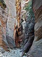
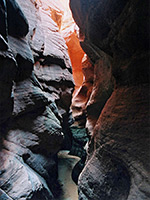
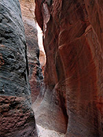
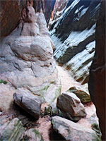
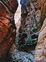
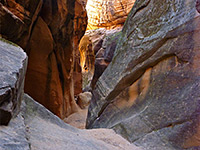
From the Kolob region in the northwest to the far southeast entrance, there are dozens of deep, narrow canyons worth exploring in Zion - a topographical map of the park reveals a maze of densely-contoured branches and tributaries, and it is just as rewarding to select an unknown side canyon as one of the more well-known hikes. The narrower ravines tend to have sheer dryfalls and often require technical climbing with ropes - more so than the Lake Powell slot canyons further east.
From the Kolob region in the northwest to the far southeast entrance, there are dozens of deep, narrow canyons worth exploring in Zion - a topographical map of the park reveals a maze of densely-contoured branches and tributaries, and it is just as rewarding to select an unknown side canyon as one of the more well-known hikes. The narrower ravines tend to have sheer dryfalls and often require technical climbing with ropes - more so than the Lake Powell slot canyons further east.
Related Sections
- Zion National Park - general information
All Contents © Copyright The American Southwest | Comments and Questions | Contribute | Affiliate Marketing Disclosure | Site Map