Pole Canyon
Little-known, partly wooded ravine on the Kolob Plateau, formed by the seasonal Pine Spring Wash; narrowing gradually to a half-mile section of confined but relatively shallow passageways through dark, reddish-gray sandstone
Length: 2 miles, to a dryfall
Difficulty: Moderate; several chokestones to climb, up to eight feet
Management: NPS - within Zion National Park
Rocks: Navajo sandstone
Season: Late spring, summer, fall; lots of snow in the winter
Trailhead: Pullout along Kolob Terrace Road
Rating (1-5): ★★★★★
Difficulty: Moderate; several chokestones to climb, up to eight feet
Management: NPS - within Zion National Park
Rocks: Navajo sandstone
Season: Late spring, summer, fall; lots of snow in the winter
Trailhead: Pullout along Kolob Terrace Road
Rating (1-5): ★★★★★

Pole Canyon is a moderately deep ravine formed by Pine Spring Wash, at the edge of the Upper Kolob Plateau in Zion National Park, elevation around 7,000 feet, and it forms a half mile slot section through dark red/grey Navajo sandstone, initially partly wooded then just bare rock as the drainage constricts further. Although easily accessed, by just a short walk from the Kolob Terrace Road, the canyon seems very little visited, despite its photogenic narrows, explorable by a 4 mile round-trip that takes from 2 to 3 hours.
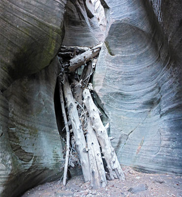
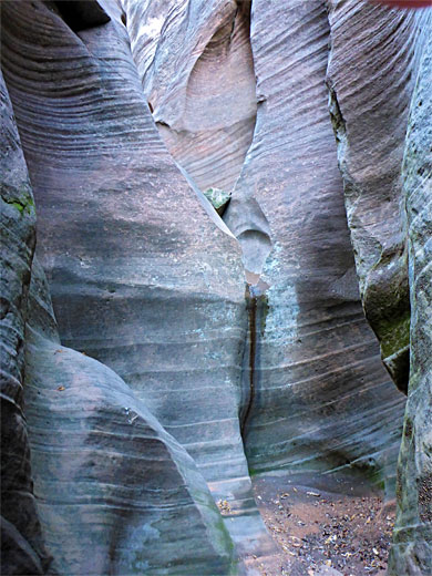
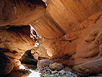
The drainage is orientated north to south so is not well lit by the sun, only around the middle of the day, at other times rather gloomy, yet the passageways have an interesting variety of rock textures including plenty of tafoni, and towards the upper end contain a number of blocking chokestones that provide a moderate challenge to pass. There are many logs and boulders in the narrows, from floods and snow melt, though the creek itself is usually dry, and there are no significant residual pools.
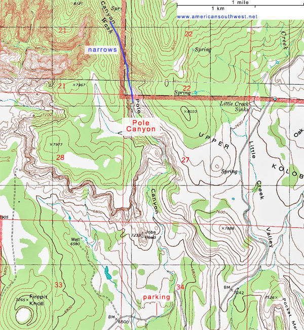
A suitable parking place for Pole Canyon is a pull-out on the north side of Kolob Terrace Road shortly before it starts its final climb to the plateau, right next to the stony streambed of Pine Spring Wash. The surroundings are open, bushy slickrock flats and knolls, with high cliffs close by to the north. South of the road, the wash winds through the grasslands of Lee Valley before eventually meeting the Left Fork of North Creek.
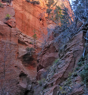
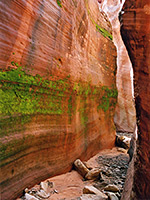
The northwards walk from the parking place is initially over the slickrock, which is attractively colored in shades of pink and yellow, dotted with bushes, cacti and a few groups of ponderosa pines; descending into the streambed of Pine Spring Wash after half a mile, as it starts to become enclosed. To the west is a narrow red ridge (Jobs Head), projecting south off the plateau, while on the other side is a sheer, slightly overhanging cliff below a wooded dome named Windy Peak. Both these features are composed of Navajo sandstone, the same rock that encloses almost all of the drainage, until the far end of the narrows where the strata change to the Temple Cap Formation; initially the Sinawava Member and then the White Throne Member.
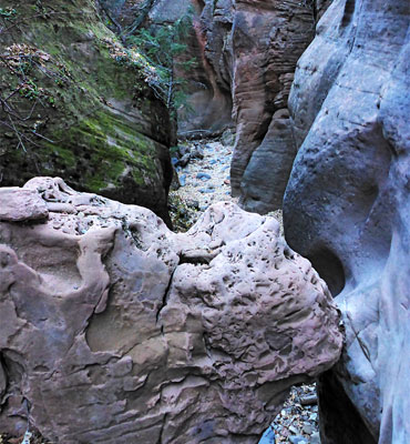
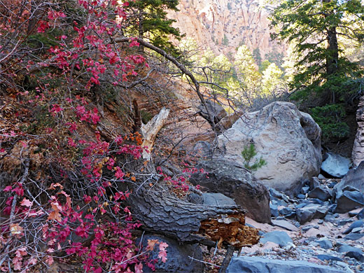
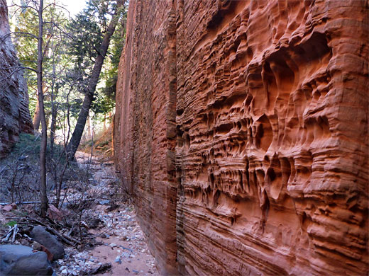
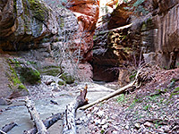
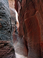
The wash is tree-lined, with pines, oak and canyon maple, quite overgrown though without any obstructions, so walking is easy. A bench provides a shortcut across a bend to the east, after which the streambed cuts back to the west and reaches the first brief narrows - a rock-walled passage, the west side of which is perfectly straight and vertical and is eroded with an extravagant display of tafoni. Beyond is a short narrower channel before the canyon becomes wider, and deeper, the cliffs up to 500 feet above. The valley stays open for a while interrupted by another short, vertical-walled channel followed by a further wider stretch leading to the first extended narrows; medium-width, below attractive cliffs to the west and later, a big wall to the east.
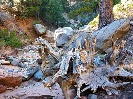
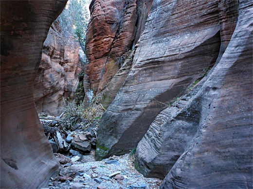
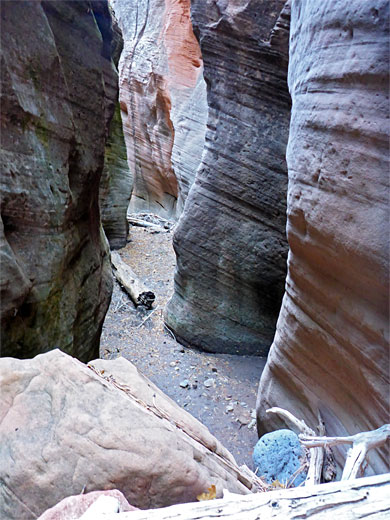
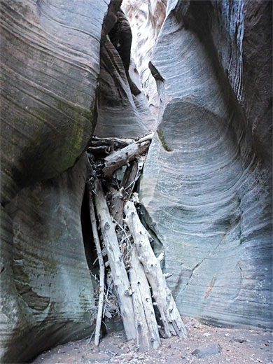
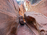
Pole Canyon widens once more then narrows to a slot, which soon contains the first obstacle, two chokestones requiring climbing under the first and over the second. Beyond are other blocking boulders, one rather bigger, passed using a log wedged in a crevice on the left side. A temporarily wider passageway with a grassy sandbank gives way to bare rock with other chokestones at intervals, the tallest maybe eight feet. The streambed contains much debris; rocks, broken branches and larger trunks. Towards the very upper end of the slot is a smooth dryfall of about 10 feet, not so easy to climb, this point around 2 miles from the road.
The drainage is orientated north to south so is not well lit by the sun, only around the middle of the day, at other times rather gloomy, yet the passageways have an interesting variety of rock textures including plenty of tafoni, and towards the upper end contain a number of blocking chokestones that provide a moderate challenge to pass. There are many logs and boulders in the narrows, from floods and snow melt, though the creek itself is usually dry, and there are no significant residual pools.
A suitable parking place for Pole Canyon is a pull-out on the north side of Kolob Terrace Road shortly before it starts its final climb to the plateau, right next to the stony streambed of Pine Spring Wash. The surroundings are open, bushy slickrock flats and knolls, with high cliffs close by to the north. South of the road, the wash winds through the grasslands of Lee Valley before eventually meeting the Left Fork of North Creek.
Topographic Map of Pole Canyon
Rocks
The northwards walk from the parking place is initially over the slickrock, which is attractively colored in shades of pink and yellow, dotted with bushes, cacti and a few groups of ponderosa pines; descending into the streambed of Pine Spring Wash after half a mile, as it starts to become enclosed. To the west is a narrow red ridge (Jobs Head), projecting south off the plateau, while on the other side is a sheer, slightly overhanging cliff below a wooded dome named Windy Peak. Both these features are composed of Navajo sandstone, the same rock that encloses almost all of the drainage, until the far end of the narrows where the strata change to the Temple Cap Formation; initially the Sinawava Member and then the White Throne Member.
The Lower Canyon
The wash is tree-lined, with pines, oak and canyon maple, quite overgrown though without any obstructions, so walking is easy. A bench provides a shortcut across a bend to the east, after which the streambed cuts back to the west and reaches the first brief narrows - a rock-walled passage, the west side of which is perfectly straight and vertical and is eroded with an extravagant display of tafoni. Beyond is a short narrower channel before the canyon becomes wider, and deeper, the cliffs up to 500 feet above. The valley stays open for a while interrupted by another short, vertical-walled channel followed by a further wider stretch leading to the first extended narrows; medium-width, below attractive cliffs to the west and later, a big wall to the east.
Pole Canyon Slot
Pole Canyon widens once more then narrows to a slot, which soon contains the first obstacle, two chokestones requiring climbing under the first and over the second. Beyond are other blocking boulders, one rather bigger, passed using a log wedged in a crevice on the left side. A temporarily wider passageway with a grassy sandbank gives way to bare rock with other chokestones at intervals, the tallest maybe eight feet. The streambed contains much debris; rocks, broken branches and larger trunks. Towards the very upper end of the slot is a smooth dryfall of about 10 feet, not so easy to climb, this point around 2 miles from the road.
Pole Canyon - Similar Hikes
All Contents © Copyright The American Southwest | Comments and Questions | Contribute | Affiliate Marketing Disclosure | Site Map