Rancherias Canyon Trail
Typically scenic and unspoilt Chihuahuan Desert canyon, alternating between enclosed and more open sections, with springs and a short stream towards the lower end
Length: 2.4 miles to the spring, 5 miles to the pour-off
Elevation change: 400 feet, 900 feet
Difficulty: Easy, moderate
Type: One way
Usage: Low
Season: Fall, winter, spring
Trailhead: Parking area along FM 170 (West Rancherias Trailhead)
Rating (1-5): ★★★★★
Elevation change: 400 feet, 900 feet
Difficulty: Easy, moderate
Type: One way
Usage: Low
Season: Fall, winter, spring
Trailhead: Parking area along FM 170 (West Rancherias Trailhead)
Rating (1-5): ★★★★★

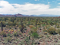
There are many trails in the remote interior of Big Bend Ranch State Park, reached by lengthy drives on bumpy, unpaved tracks, but only a few beside the main highway (FM 170) along the Rio Grande, and just two are (relatively) well used - one enters the shady narrows of Closed Canyon, while the other leads up the much larger drainage of Rancherias Canyon, which heads northwards for many miles into the Bofecillos Mountains. Because of the low park visitation, even this can usually be explored without seeing any other hikers, especially in summer when the weather is consistently hot (up to 110°F), and dry.
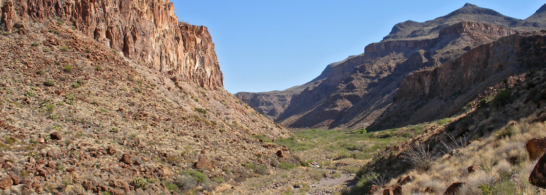
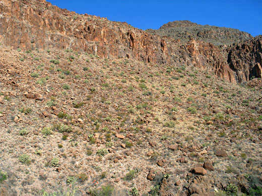
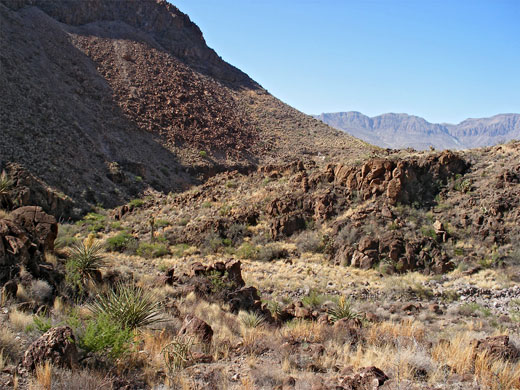
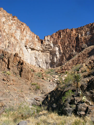
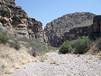
The canyon is for the most part rather wide, cutting through ancient, weathered volcanic rocks covered with abundant Chihuahuan Desert plants but it does have a few narrower sections, including one stretch after 5 miles that ends beneath a 75 foot pour-off, occasionally forming a spectacular waterfall after heavy rainfall. The lower end of Rancherias Canyon contains a year-round spring that supports a short stream, flowing over colorful, polished rock, around which is thicker, riparian vegetation and more wildlife, and while the landscape surrounding the canyon is not outstandingly scenic, the general remoteness and tranquility make the hike worthwhile.
The path begins at the West Rancherias Trailhead, 21 miles west of Lajitas and one mile from the Closed Canyon Trailhead, along the seven mile section of FM 170 that is out-of-sight of the Rio Grande, separated from it by a range of hills. Besides the Rancherias Canyon hike - between 2 and 5 miles one-way (as the turnaround point is somewhat arbitrary), the longer Rancherias Loop also starts here; this 22 mile trail climbs to a plateau on the west side of the canyon, crosses the drainage a little way north of the 75 foot pour-off then returns to FM 170 after a long traverse of mountains and canyons. The loop is more suitable to a backpacking trip, whereas the Rancherias Canyon route is an easy day or half day hike.
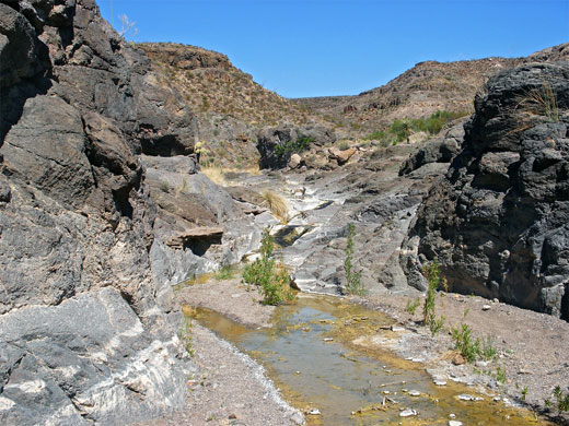
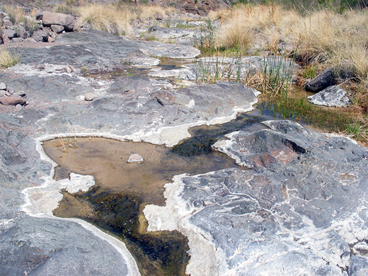
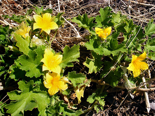
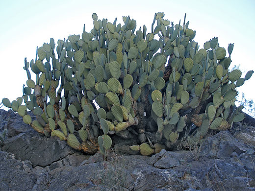
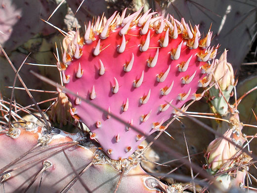
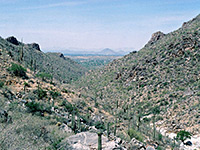
From the parking area beside the highway, the path descends into a narrow, twisting dry wash and follows it eastwards. There are plenty of cacti hereabouts including the distinctive, bluish-green opuntia azurea that in spring produces new pads colored a rich shade of purple-red. The trail soon joins a disused vehicle track, leading up and down over stony, undulating ground while gaining height gradually and giving nice views of the nearby valley. The Rancherias Loop forks left at a junction after a mile, while the right branch drops down into the wide wash of the Rancherias drainage, which winds northwards towards much steeper cliffs. A small stream begins to flow, over smooth, greyish-pink bedrock forming shallow pools and trickling cascades, all lined by yellow/green algae. The creek becomes intermittent, as the waters sink below ground where sand and pebbles overlay the solid rock, though during times of wet weather a larger stream extends all along the canyon.
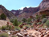
After a few bends, the trail arrives at the source of the water - a series of springs, enclosed by a thicket of willow, cottonwoods and bamboo, then, after snaking through the undergrowth, emerges into a dryer, deeper and less vegetated canyon, bordered by steep sand/soil banks beneath sheer, layered, brownish-colored cliffs, all bearing many cacti and yucca. The canyon moves round a tight S bend then widens, while remaining deep and V-shaped, and is fairly straight for the next 1.5 miles, to the start of the next narrow part, which leads to the seasonal waterfall. This pour-off marks the far end of the hike but other turnaround points, perhaps more appealing in hot dry conditions, would be the spring after 2.4 miles or the start of the wide middle part of the canyon after 3 miles.
The canyon is for the most part rather wide, cutting through ancient, weathered volcanic rocks covered with abundant Chihuahuan Desert plants but it does have a few narrower sections, including one stretch after 5 miles that ends beneath a 75 foot pour-off, occasionally forming a spectacular waterfall after heavy rainfall. The lower end of Rancherias Canyon contains a year-round spring that supports a short stream, flowing over colorful, polished rock, around which is thicker, riparian vegetation and more wildlife, and while the landscape surrounding the canyon is not outstandingly scenic, the general remoteness and tranquility make the hike worthwhile.
Trailhead
The path begins at the West Rancherias Trailhead, 21 miles west of Lajitas and one mile from the Closed Canyon Trailhead, along the seven mile section of FM 170 that is out-of-sight of the Rio Grande, separated from it by a range of hills. Besides the Rancherias Canyon hike - between 2 and 5 miles one-way (as the turnaround point is somewhat arbitrary), the longer Rancherias Loop also starts here; this 22 mile trail climbs to a plateau on the west side of the canyon, crosses the drainage a little way north of the 75 foot pour-off then returns to FM 170 after a long traverse of mountains and canyons. The loop is more suitable to a backpacking trip, whereas the Rancherias Canyon route is an easy day or half day hike.
The Lower Canyon
From the parking area beside the highway, the path descends into a narrow, twisting dry wash and follows it eastwards. There are plenty of cacti hereabouts including the distinctive, bluish-green opuntia azurea that in spring produces new pads colored a rich shade of purple-red. The trail soon joins a disused vehicle track, leading up and down over stony, undulating ground while gaining height gradually and giving nice views of the nearby valley. The Rancherias Loop forks left at a junction after a mile, while the right branch drops down into the wide wash of the Rancherias drainage, which winds northwards towards much steeper cliffs. A small stream begins to flow, over smooth, greyish-pink bedrock forming shallow pools and trickling cascades, all lined by yellow/green algae. The creek becomes intermittent, as the waters sink below ground where sand and pebbles overlay the solid rock, though during times of wet weather a larger stream extends all along the canyon.
The Middle Canyon
After a few bends, the trail arrives at the source of the water - a series of springs, enclosed by a thicket of willow, cottonwoods and bamboo, then, after snaking through the undergrowth, emerges into a dryer, deeper and less vegetated canyon, bordered by steep sand/soil banks beneath sheer, layered, brownish-colored cliffs, all bearing many cacti and yucca. The canyon moves round a tight S bend then widens, while remaining deep and V-shaped, and is fairly straight for the next 1.5 miles, to the start of the next narrow part, which leads to the seasonal waterfall. This pour-off marks the far end of the hike but other turnaround points, perhaps more appealing in hot dry conditions, would be the spring after 2.4 miles or the start of the wide middle part of the canyon after 3 miles.
Nearby Trails
Rancherias Canyon - Similar Hikes
All Contents © Copyright The American Southwest | Comments and Questions | Contribute | Affiliate Marketing Disclosure | Site Map