Closed Canyon Trail
Short route along a deep, enclosed, sheer-walled canyon through dark, metamorphic rocks. The gorge meets the Rio Grande though ropes are needed to overcome a dryfall near the end
Length: 0.8 miles, to the dryfall
Elevation change: level
Difficulty: Easy
Type: One way
Usage: Medium
Season: All year
Trailhead: Parking area along FM 170
Rating (1-5): ★★★★★
Elevation change: level
Difficulty: Easy
Type: One way
Usage: Medium
Season: All year
Trailhead: Parking area along FM 170
Rating (1-5): ★★★★★

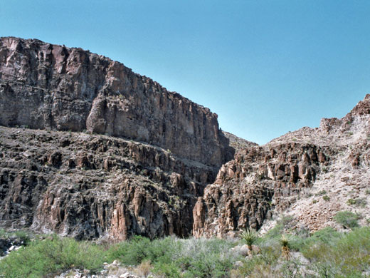
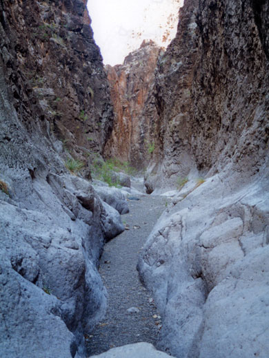
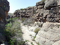
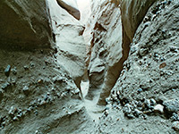
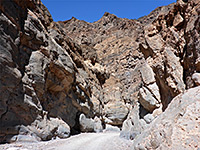
Many parts of FM 170, the River Road through Big Bend Ranch State Park, are actually some distance from the Rio Grande, separated by hills and rocky ridges - such is the case for a 12 mile stretch about one third of the way from Lajitas to Presidio. At one point the road is less than a mile from the river, which is hidden from view behind a cliff face and a plateau several hundred feet high, but a seasonal stream flowing from the desert land beyond has cut a narrow canyon right through, just 10 to 15 feet wide and enclosed by sheer, vertical walls up to 150 feet high. This is Closed Canyon, one of the best features in the state park, and one which is very easy to explore since the entrance is just a few minutes walk from the road and there are no major obstacles until near the end, when the canyon floor has several vertical drops, one requiring a rope to descend safely.
Map of Big Bend Ranch State Park.
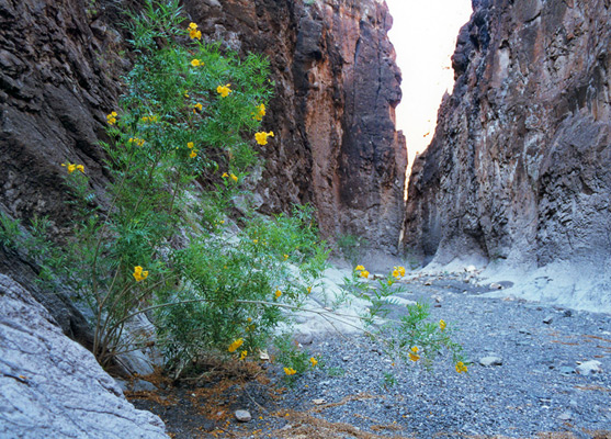
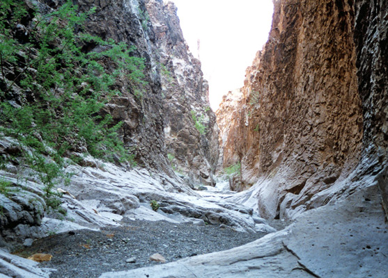
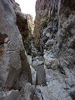
The rock is igneous in origin and dark in color, though worn smooth and whitish grey by the occasional floods that rush down the streamway. The ravine is rather different to the sandstone slot canyons of Arizona and Utah, not as narrow and with more subtle patterns of erosion, but sharing some features in common such as seasonal potholes, chokestones and dryfalls. Doubtless the flash flood danger is just as real during heavy rains, and there are no escape routes once past the entrance. The canyon is signposted from the road, and reached by walking down the stony streambed that leads to its opening. One inside, the temperature drops noticeably and the walls close in abruptly. The course is generally straight with small bends every 50 yards or so. The floor is mostly smooth, bare rock, with only occasional sand banks, bushes or patches of pebbles. The cliffs above are old, dark and weathered; the rocks are sedimentary in origin but seem metamorphosed by time and the harsh climate.
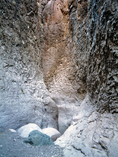
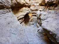
The canyon is generally quite level but has some downward steps of a few feet - these increase in height towards the river. Several have pools beyond, with water that may be 2-3 feet deep. Not far above the confluence, the streambed drops by 10 feet and a rope is needed to continue; an iron peg is driven into the rocks as a belay point to assist when climbing down. This dryfall is about 20 minutes walk from the road.
Location
Map of Big Bend Ranch State Park.
The Canyon
The rock is igneous in origin and dark in color, though worn smooth and whitish grey by the occasional floods that rush down the streamway. The ravine is rather different to the sandstone slot canyons of Arizona and Utah, not as narrow and with more subtle patterns of erosion, but sharing some features in common such as seasonal potholes, chokestones and dryfalls. Doubtless the flash flood danger is just as real during heavy rains, and there are no escape routes once past the entrance. The canyon is signposted from the road, and reached by walking down the stony streambed that leads to its opening. One inside, the temperature drops noticeably and the walls close in abruptly. The course is generally straight with small bends every 50 yards or so. The floor is mostly smooth, bare rock, with only occasional sand banks, bushes or patches of pebbles. The cliffs above are old, dark and weathered; the rocks are sedimentary in origin but seem metamorphosed by time and the harsh climate.
Obstacles
The canyon is generally quite level but has some downward steps of a few feet - these increase in height towards the river. Several have pools beyond, with water that may be 2-3 feet deep. Not far above the confluence, the streambed drops by 10 feet and a rope is needed to continue; an iron peg is driven into the rocks as a belay point to assist when climbing down. This dryfall is about 20 minutes walk from the road.
Nearby Trails
Closed Canyon - Similar Hikes
All Contents © Copyright The American Southwest | Comments and Questions | Contribute | Affiliate Marketing Disclosure | Site Map