Dome Trail
Partial loop over remote terrain of washes and undulating hills in the southeast corner of the state park, reached via the West Main Trail; passes a great variety of desert plants. Also open to mountain bikes, and suitable for shorter hikes, such as to Cinnabar Mine
Length: 2 miles to the start of the loop, which is 7 miles; total 3.6 miles to Cinnabar Mine
Elevation change: 400 feet
Difficulty: Moderate - not steep, but quite long
Type: Partial loop, or a one-way shorter hike
Usage: Low
Season: Fall, winter, spring
Trailhead: Side track off FM 170 (West Contrabando Trailhead)
Rating (1-5): ★★★★★
Elevation change: 400 feet
Difficulty: Moderate - not steep, but quite long
Type: Partial loop, or a one-way shorter hike
Usage: Low
Season: Fall, winter, spring
Trailhead: Side track off FM 170 (West Contrabando Trailhead)
Rating (1-5): ★★★★★

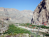
Although most trails in Big Bend Ranch State Park begin from unpaved roads in the park interior and so are relatively hard to access, a few start along the main highway FM 170, including Closed Canyon, Rancherias Canyon, and a variety of routes in the southeast corner, known collectively as the Contrabando Multi-use Trail System, and also open to horses and mountain bikes. The total distance is 25 miles, a combination of mining tracks and constructed trails across generally low relief land of undulating hills, stony badlands, branched ravines and desert flats, though always within sight of higher mountains in the distance, in all directions.
The two principal routes are the West Main Trail and the East Main Trail, starting from two trailheads 7.8 miles apart. The paths meet after about 5 miles and link with several short spurs and one longer loop (the Dome Trail), plus a track that connects with the central section of the park. For hikers, the West Contrabando Trailhead is the recommended place to begin, since the first few miles of the eastern trail are all along a very wide valley, on a disused vehicle track, and the scenery is little changing; also, the western path gives the closest access to the Dome Trail, the best day hike in the area. The round-trip distance for this path, including the 2 mile approach along the West Main Trail, is 11 miles, while a good target for a shorter hike is Cinnabar Mine (3.6 miles, one way), where relics include ruined stone cabins, iron equipment and tunnel openings.
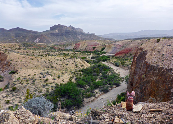
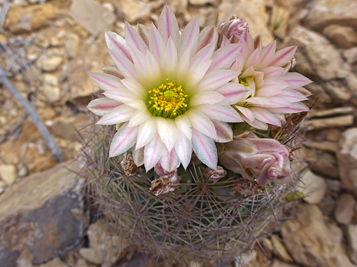
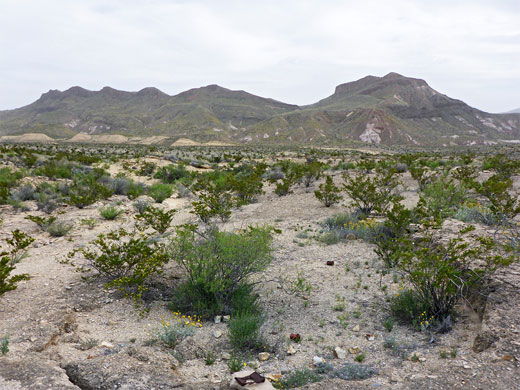
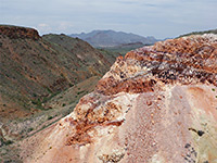
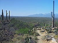
The undulating desert landscape may lack any feature of particular interest, though it does have patches of brightly colored rocks, and several curving streamways which may have pools or flowing water, but the scenery is made more special by the general remoteness, and also by the great array of desert plants, including over 20 cactus species.
Big Bend Ranch State Park location map, Dome Trail topographic map.
The East Contrabando trailhead is along FM 170 on the east side of Lajitas, just a quarter of a mile from the state park visitor center, while the West Contrabando trailhead is along a short track on the north side of the highway, just north of the Contrabando movie set. The day hike parking at this latter location is a good, elevated site on top of a ridge, overlooking a large area of the park, and south across the Rio Grande into Mexico. A little further downhill is a smaller parking place, more sheltered, and a primitive camping area, for which the fee is $8 per night.
The track continues, but is soon fenced off to stop vehicles; the barrier is just after a junction, beside which are some pieces of rusty iron equipment. A disused road runs straight on, bending west after a short distance and crossing the streamway of Fresno Creek, while the West Main Trail starts off to the right, and immediately reaches a second intersection, with the rarely used Fresno Divide Trail (primarily a mountain bike route), which leads north, meeting the far side of the Dome Trail after 3 miles. The main path becomes quite straight, heading back south across a flat, gravelly plain dotted with many cacti, between a drainage to the east and a ridge to the west, on top of which is the access road - the trailhead notice by the main parking area is visible at the top of a little gully, this after 0.7 miles of hiking. A walk cross-country to this point would save 0.4 miles.
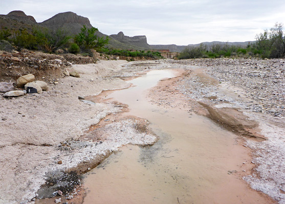
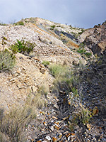
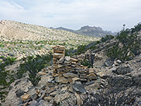
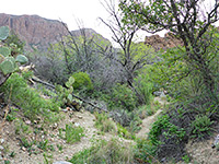
A little way further, the trail bends left (east) at another, unsigned junction with an old track, now closed to hiking. The path descends slightly and crosses the wash (Contrabando Creek) seen earlier - a wide streamway, often containing shallow flowing water. The next section is across a stony plain covered with many low clumps of the very spiny grusonia aggeria cactus, then diagonally across another, tributary drainage, where the route is marked by big cairns. Beyond a short, bushy grove on the far side, the path returns to arid, sparsely-vegetated surroundings, climbing up a minor ravine, home to many more cacti, and passing over some small hills to the next junction, 2 miles from the start; the West Main Trail continues to the right, while the Dome Trail is left.
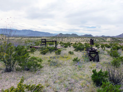
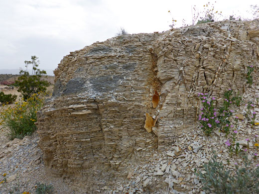
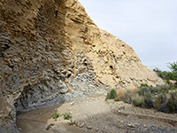
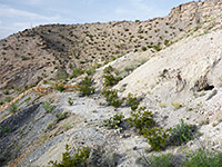
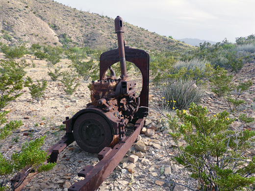
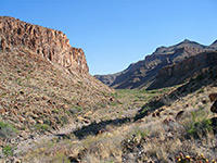
The Dome Trail heads northwest over undulating, stony hills, past a notice about Big Bend ranchers Homer Wilson and Harris Smith, who drilled many shafts into the bedrock in the 1930s looking for cinnabar (mercury ore), though none was found. After here the hills become rocker, still covered by numerous cacti, as the path moves west, down across a little wash then into a bigger drainage, lined by red, pink and yellow cliffs. The streamway is followed for a short distance, before the path climbs above, later crossing again a couple of times and reaching the site of Cinnabar Mine, a more extensive operation though also unsuccessful. A few pieces of iron equipment and the remains of some stone cabins can be seen close to the path, whilst tailings piles and mine openings are 500 feet east, on the far side of the drainage. There are several adits and one main tunnel, closed by iron railings. A pipe protruding from the earth marks the site of a closed shaft - a stone dropped into the pipe falls for three seconds, landing into water.
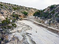
Beyond the mine are a series of ridges and mounds as the land gradually rises. The trail follows close to the drainage for another 1.2 miles, past another intersection with the Fresno Divide Trail and coming close to a high escarpment to the north. Yet another junction is with a connecting path towards Fresno Canyon, while the Dome Trail bends back south, across somewhat flatter land, and eventually to another intersection with the West Main Trail, from where the start of the loop is 1.7 miles west. One interesting feature in this section is Contrabando Waterhole where Contrabando Creek flows over a natural pour-off, creating a permanent pool at the base, overlooked by a ruined, multi-room stone building on the south side.
The two principal routes are the West Main Trail and the East Main Trail, starting from two trailheads 7.8 miles apart. The paths meet after about 5 miles and link with several short spurs and one longer loop (the Dome Trail), plus a track that connects with the central section of the park. For hikers, the West Contrabando Trailhead is the recommended place to begin, since the first few miles of the eastern trail are all along a very wide valley, on a disused vehicle track, and the scenery is little changing; also, the western path gives the closest access to the Dome Trail, the best day hike in the area. The round-trip distance for this path, including the 2 mile approach along the West Main Trail, is 11 miles, while a good target for a shorter hike is Cinnabar Mine (3.6 miles, one way), where relics include ruined stone cabins, iron equipment and tunnel openings.
The undulating desert landscape may lack any feature of particular interest, though it does have patches of brightly colored rocks, and several curving streamways which may have pools or flowing water, but the scenery is made more special by the general remoteness, and also by the great array of desert plants, including over 20 cactus species.
Maps
Big Bend Ranch State Park location map, Dome Trail topographic map.
Trailheads
The East Contrabando trailhead is along FM 170 on the east side of Lajitas, just a quarter of a mile from the state park visitor center, while the West Contrabando trailhead is along a short track on the north side of the highway, just north of the Contrabando movie set. The day hike parking at this latter location is a good, elevated site on top of a ridge, overlooking a large area of the park, and south across the Rio Grande into Mexico. A little further downhill is a smaller parking place, more sheltered, and a primitive camping area, for which the fee is $8 per night.
West Main Trail
The track continues, but is soon fenced off to stop vehicles; the barrier is just after a junction, beside which are some pieces of rusty iron equipment. A disused road runs straight on, bending west after a short distance and crossing the streamway of Fresno Creek, while the West Main Trail starts off to the right, and immediately reaches a second intersection, with the rarely used Fresno Divide Trail (primarily a mountain bike route), which leads north, meeting the far side of the Dome Trail after 3 miles. The main path becomes quite straight, heading back south across a flat, gravelly plain dotted with many cacti, between a drainage to the east and a ridge to the west, on top of which is the access road - the trailhead notice by the main parking area is visible at the top of a little gully, this after 0.7 miles of hiking. A walk cross-country to this point would save 0.4 miles.

Dome Trail Junction
A little way further, the trail bends left (east) at another, unsigned junction with an old track, now closed to hiking. The path descends slightly and crosses the wash (Contrabando Creek) seen earlier - a wide streamway, often containing shallow flowing water. The next section is across a stony plain covered with many low clumps of the very spiny grusonia aggeria cactus, then diagonally across another, tributary drainage, where the route is marked by big cairns. Beyond a short, bushy grove on the far side, the path returns to arid, sparsely-vegetated surroundings, climbing up a minor ravine, home to many more cacti, and passing over some small hills to the next junction, 2 miles from the start; the West Main Trail continues to the right, while the Dome Trail is left.
Cinnabar Mine
The Dome Trail heads northwest over undulating, stony hills, past a notice about Big Bend ranchers Homer Wilson and Harris Smith, who drilled many shafts into the bedrock in the 1930s looking for cinnabar (mercury ore), though none was found. After here the hills become rocker, still covered by numerous cacti, as the path moves west, down across a little wash then into a bigger drainage, lined by red, pink and yellow cliffs. The streamway is followed for a short distance, before the path climbs above, later crossing again a couple of times and reaching the site of Cinnabar Mine, a more extensive operation though also unsuccessful. A few pieces of iron equipment and the remains of some stone cabins can be seen close to the path, whilst tailings piles and mine openings are 500 feet east, on the far side of the drainage. There are several adits and one main tunnel, closed by iron railings. A pipe protruding from the earth marks the site of a closed shaft - a stone dropped into the pipe falls for three seconds, landing into water.
Remainder of the Loop
Beyond the mine are a series of ridges and mounds as the land gradually rises. The trail follows close to the drainage for another 1.2 miles, past another intersection with the Fresno Divide Trail and coming close to a high escarpment to the north. Yet another junction is with a connecting path towards Fresno Canyon, while the Dome Trail bends back south, across somewhat flatter land, and eventually to another intersection with the West Main Trail, from where the start of the loop is 1.7 miles west. One interesting feature in this section is Contrabando Waterhole where Contrabando Creek flows over a natural pour-off, creating a permanent pool at the base, overlooked by a ruined, multi-room stone building on the south side.
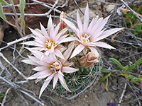
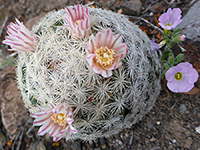
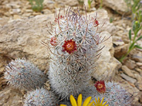
Dome Trail Wildflowers
More plants along the trail
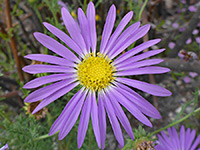 Tansyleaf aster |
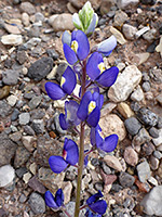 Big bend bluebonnet |
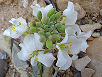 Bicolored fan-mustard |
More plants along the trail
Nearby Trails
Dome Trail - Similar Hikes
All Contents © Copyright The American Southwest | Comments and Questions | Contribute | Affiliate Marketing Disclosure | Site Map