Tanque Verde Ridge Trail, Saguaro National Park
Arizona > Saguaro National Park > East > Hiking > Tanque Verde Ridge Trail
Tanque Verde Ridge Trail
Main route into the high elevation backcountry of Saguaro National Park, climbing steadily through several vegetation zones. Path stays close to the crest of a sloping ridge for most of the journey and so has good views all the way
Length: 11 miles, to Cowhead Saddle
Elevation change: 3,900 feet
Difficulty: Moderate
Type: One way; gives access to several other remote trails
Usage: Medium
Season: Best from fall to spring
Trailhead: Javelina picnic area, along the Cactus Forest Drive
Rating (1-5): ★★★★★
Elevation change: 3,900 feet
Difficulty: Moderate
Type: One way; gives access to several other remote trails
Usage: Medium
Season: Best from fall to spring
Trailhead: Javelina picnic area, along the Cactus Forest Drive
Rating (1-5): ★★★★★

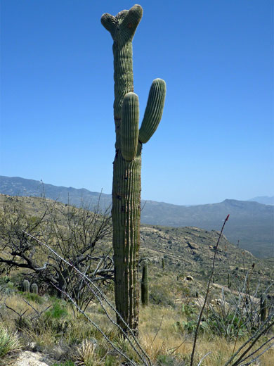
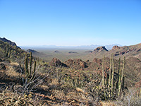
Tanque Verde Ridge is a prominent arm of the Rincon Mountains, sloping steadily upwards from 3,100 feet at its western end to 8,666 foot Mica Mountain, where the environment is cool and forested, quite different to the hot, cactus desert around the lower reaches. The ridge is visible all across Tucson and it dominates the eastern section of Saguaro National Park, also providing the principal hiking route into the high elevation backcountry: the 11 mile Tanque Verde Ridge Trail climbs nearly 4,000 feet before descending to a junction (Cowhead Saddle) at 6,100 feet, from where two continuation routes lead further into the mountains and a third (Douglas Spring Trail) winds northwards down to an alternative trailhead in the lowlands.
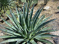
The main path ascends quickly at the start and experiences several distinct changes in vegetation over the first few miles, from cholla, prickly pear and dense forests of saguaro at first, through colonies of ocotillo, agave and yucca, then into open grassland, followed by pinyon-juniper trees around 5,500 feet (including Juniper Basin, location of a primitive campsite), and ponderosa pine forests at the highest elevations. The varying vegetation is one appeal of the hike; the other is the long distance panorama, over deep valleys to the north and south, higher mountains beyond, and across the Tucson Basin to many other distant ranges to the west.
Just walking two or three miles along the trail is enough to experience both these aspects, but for longer trips taking all day, two possible destinations are Juniper Basin after 7 miles or 7,049 foot Tanque Verde Peak after 9 miles. All the route is exposed and some places are quite steep, so the trip is not recommended for the hot summer months, but during cooler times the hike is relatively easy.
Map of the east section of Saguaro National Park.
The trailhead is located at the Javelina picnic area, at the end of a spur road accessed by the short two-way section of Cactus Forest Drive, 1.8 miles from the Saguaro National Park entrance station along the Old Spanish Trail. Even from this distance the change in vegetation with elevation of the ridge is evident, as the thick cactus forests on the foothills give way to grassy, rocky slopes, above which the ground becomes noticeably darker, due to the covering of bushes and trees.
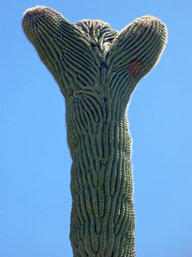
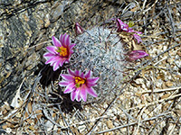
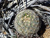
The path is quite popular and easy to follow; a few places that cross slickrock are marked by cairns, but most of the upper reaches are over earthen ground where the route is obvious. The first mile traverses gently undulating terrain on the north side of the ridge, past a few rocky outcrops and the densest cactus groves: the most prolific species are saguaro, Engelmann prickly pear, pancake prickly pear, cholla (jumping, staghorn, teddy bear), Arizona fishhook cactus and several species of hedgehog cactus. The trail climbs a little ravine beneath the first of many small summits, to a bench which gives the first views of lands to the southeast, then ascends further to the main ridgeline, which is followed for the remainder of the hike, generally staying just north of the crest. Next is a long succession of steepish climbs to other intermediate summits, followed by less steep or briefly level sections on the far side.
Cholla are the first cacti to fade away, and all are eventually replaced by yucca, agave, nolina and sotol, as the surroundings become generally more grassy. One section of the trail right on the ridgetop and so with views both north and south, comes within sight of an unusual cristate saguaro, at the foot of which are some less common escobaria vivipara cacti; this location is towards the upper edge of the saguaro belt, about 4,000 foot elevation (4 miles). Half a mile past here, the hillsides are more sparsely vegetated and the ground is mostly covered only by short grass, dotted with scattered bushes, and hence less interesting in terms of plant life. To the south the ridge is now bordered by a deep valley (Box Canyon), which gradually narrows and becomes shallower; towards its upper end the path drops 150 feet, climbs again on the far side and soon reaches somewhat flatter surroundings where pine and oak trees start to grow. The route descends slightly again, into the drainage that feeds Box Canyon, and reaches the primitive campsite at Juniper Basin, which is one suitable target for a day hike.
The main path ascends quickly at the start and experiences several distinct changes in vegetation over the first few miles, from cholla, prickly pear and dense forests of saguaro at first, through colonies of ocotillo, agave and yucca, then into open grassland, followed by pinyon-juniper trees around 5,500 feet (including Juniper Basin, location of a primitive campsite), and ponderosa pine forests at the highest elevations. The varying vegetation is one appeal of the hike; the other is the long distance panorama, over deep valleys to the north and south, higher mountains beyond, and across the Tucson Basin to many other distant ranges to the west.
Just walking two or three miles along the trail is enough to experience both these aspects, but for longer trips taking all day, two possible destinations are Juniper Basin after 7 miles or 7,049 foot Tanque Verde Peak after 9 miles. All the route is exposed and some places are quite steep, so the trip is not recommended for the hot summer months, but during cooler times the hike is relatively easy.
Location
Map of the east section of Saguaro National Park.
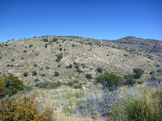
Tanque Verde Ridge Trailhead
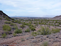
The trailhead is located at the Javelina picnic area, at the end of a spur road accessed by the short two-way section of Cactus Forest Drive, 1.8 miles from the Saguaro National Park entrance station along the Old Spanish Trail. Even from this distance the change in vegetation with elevation of the ridge is evident, as the thick cactus forests on the foothills give way to grassy, rocky slopes, above which the ground becomes noticeably darker, due to the covering of bushes and trees.

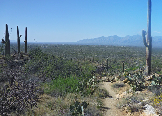
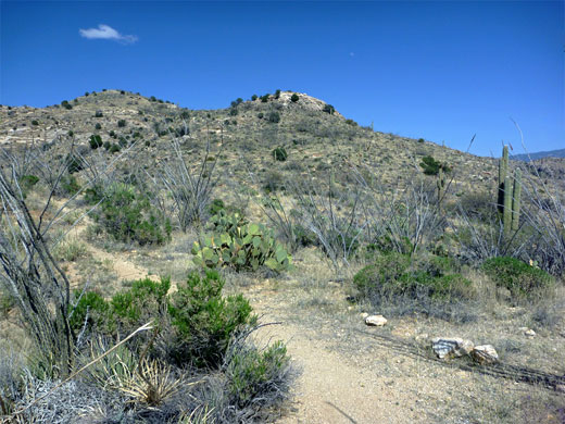
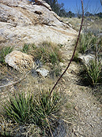
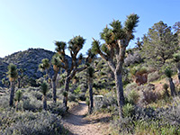
Start of the Trail
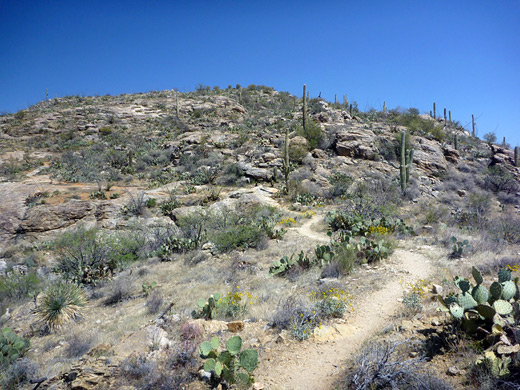
The path is quite popular and easy to follow; a few places that cross slickrock are marked by cairns, but most of the upper reaches are over earthen ground where the route is obvious. The first mile traverses gently undulating terrain on the north side of the ridge, past a few rocky outcrops and the densest cactus groves: the most prolific species are saguaro, Engelmann prickly pear, pancake prickly pear, cholla (jumping, staghorn, teddy bear), Arizona fishhook cactus and several species of hedgehog cactus. The trail climbs a little ravine beneath the first of many small summits, to a bench which gives the first views of lands to the southeast, then ascends further to the main ridgeline, which is followed for the remainder of the hike, generally staying just north of the crest. Next is a long succession of steepish climbs to other intermediate summits, followed by less steep or briefly level sections on the far side.
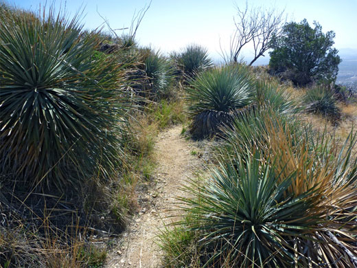
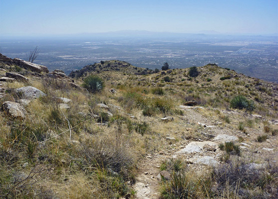
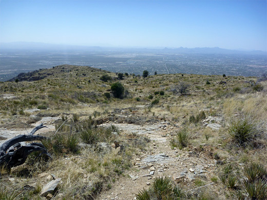
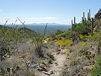
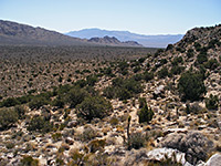
The Ridge
Cholla are the first cacti to fade away, and all are eventually replaced by yucca, agave, nolina and sotol, as the surroundings become generally more grassy. One section of the trail right on the ridgetop and so with views both north and south, comes within sight of an unusual cristate saguaro, at the foot of which are some less common escobaria vivipara cacti; this location is towards the upper edge of the saguaro belt, about 4,000 foot elevation (4 miles). Half a mile past here, the hillsides are more sparsely vegetated and the ground is mostly covered only by short grass, dotted with scattered bushes, and hence less interesting in terms of plant life. To the south the ridge is now bordered by a deep valley (Box Canyon), which gradually narrows and becomes shallower; towards its upper end the path drops 150 feet, climbs again on the far side and soon reaches somewhat flatter surroundings where pine and oak trees start to grow. The route descends slightly again, into the drainage that feeds Box Canyon, and reaches the primitive campsite at Juniper Basin, which is one suitable target for a day hike.
Tanque Verde Ridge - Similar Hikes
All Contents © Copyright The American Southwest | Comments and Questions | Contribute | Affiliate Marketing Disclosure | Site Map