Highlights:
Management:
Location:
32.273, -111.2188 (west), 32.180, -110.737 (east)
Seasons:
All year, but longer hikes are best avoided during the hot summer months
Rating (1-5):
★★★★★
Weather:

Saguaro NP is part of the Arizona Deserts itinerary
Saguaro NP - Regions
West Section (Tucson Mountain) - easily accessible area with many visitor facilities and viewpoints
Hiking - all trails in the west
Hiking - all trails in the west
East Section (Rincon Mountain) - large region with extensive mountain wilderness and backcountry trails
Hiking - all trails in the east
Hiking - all trails in the east
Featured Hotel
Holiday Inn Express Tucson
 Affordable north Tucson hotel offering free breakfast and an outdoor pool, overlooking the course of the Santa Cruz River, beside exit 256 of Interstate 10
Check Rates
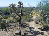
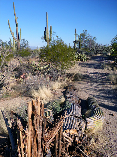
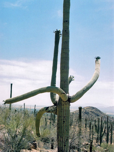
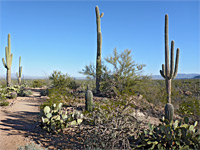
The saguaro cactus (Carnegiea Gigantea) is the state symbol of Arizona, appearing on all car license plates, and provides a universally recognized image of the Southwest. It is the largest and one of the slowest growing of all cacti, reaching up to 15 meters high and living for several centuries. Plants can weigh up to 8 tons, partly because of the large amount of water the stems can hold - after rainfall the cactus can absorb hundreds of gallons in a short time. The saguaro may be only 6 inches high after 10 years, and the characteristic branched appearance is reached only after around 80 years.
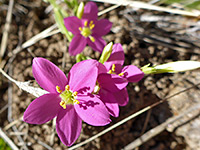
The cactus is widespread across southern Arizona, extreme southeast California and Sonora, north Mexico - see map below. Distribution is related to latitude and altitude - it is most commonly found between 1,000 & 3,000 feet, and because the saguaro can tolerate temperatures as low as 24°F (-4°C), it survives further north than any of the other species of large cactus. In the spring, the saguaro produce white flowers on the upper stems of mature plants so this is an especially good time to visit. Later, sweet edible red fruit appear, traditionally used by the local Native American tribes as food and also to make wine.
The cactus is widespread across southern Arizona, extreme southeast California and Sonora, north Mexico - see map below. Distribution is related to latitude and altitude - it is most commonly found between 1,000 & 3,000 feet, and because the saguaro can tolerate temperatures as low as 24°F (-4°C), it survives further north than any of the other species of large cactus. In the spring, the saguaro produce white flowers on the upper stems of mature plants so this is an especially good time to visit. Later, sweet edible red fruit appear, traditionally used by the local Native American tribes as food and also to make wine.
Saguaro Table of Contents
Saguaro NP Location
Maps of Saguaro National Park; east, west.
Photographs
All Saguaro NP photographs
Regions
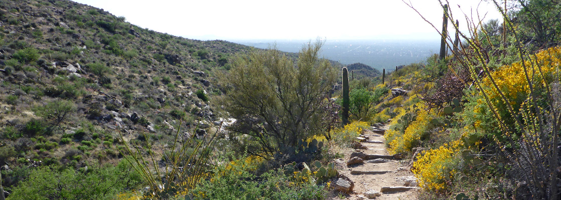
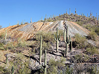
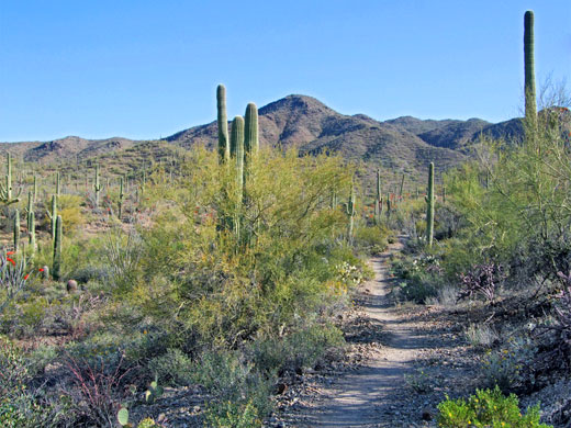
There are many densely forested regions in the Southwest but two areas of the Sonoran Desert either side of Tucson have been selected and preserved as Saguaro National Park - the Tucson Mountain (west) and Rincon Mountain (east) districts. The park was upgraded in status from a national monument in 1994, and besides the ever-present saguaro, also preserves a large variety of other cacti and desert plants, plus much interesting wildlife, although the majority is only active during the night. In 2020 the fees were increased to $25 per vehicle, good for seven days.
Of the two regions of the national park, the western section is about half plains, and half mountains, up to 4,687 feet (Wasson Peak), and is generally more visited than the larger eastern section, of which a relatively small area is flat lowlands, crossed by most of the trails; the majority of the land is higher ground, including several peaks over 8,000 feet. The general character of the two sections are similar, however, and a visit to either is just as rewarding. Organ Pipe Cactus National Monument also has many saguaros, together with other more unusual columnar cacti, and is more remote and less visited.
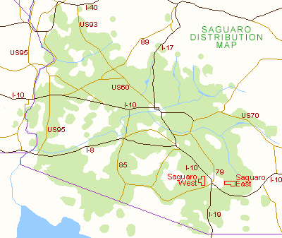
Saguaro Cactus Distribution Map
Featured Saguaro National Park Trails
Saguaro West Trails (Tucson Mountain)
Cactus Wren and Manville Trails
★★★★★
★★★★★
4 miles, 200 feet
Loop over fairly level ground densely covered with large saguaro cacti and other Sonoran Desert plants, with long distance views towards distant mountainsGould Mine Trail
★★★★★
★★★★★
1.1 miles, 260 feet
Path up a cactus-studded ravine to the remains of an old mine; combined with parts of two adjacent trails to form a circular route of 2.5 miles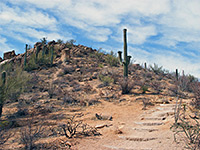
Hugh Norris Trail
★★★★★
★★★★★
4.9 miles, 2,130 feet
Longest trail in the park, following a ridge of increasing height all the way to a high summit, for unsurpassed views of the surrounding mountains and desert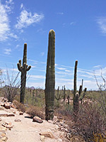
Signal Hill Trail
★★★★★
★★★★★
0.2 miles, 50 feet
Popular route to a low, boulder-covered summit, where many of the rocks are adorned with petroglyphsSaguaro East Trails (Rincon Mountain)
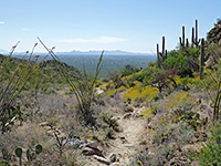
Douglas Spring Trail
★★★★★
★★★★★
8.8 miles, 3,550 feet
Long path ascending steadily past different types of vegetation, passing several small streams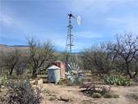
Hope Camp Trail
★★★★★
★★★★★
2.8 miles, level
Old vehicle track across open terrain, past many cacti, to the remains of two cattle stations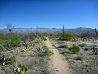
Loma Verde/Squeeze Pen Trails
★★★★★
★★★★★
3 miles, 120 feet
Loop through gentle terrain of small washes and low plateaus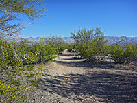
Mica View Trail
★★★★★
★★★★★
1 miles, 40 feet
Wide, level path through open terrain with saguaro and bushes; views of the Santa Catalina Mountains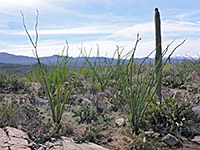
Ridge View Trail
★★★★★
★★★★★
1.1 miles, 330 feet
Easy route to a small hill; unobstructed views over Rincon Valley and Tanque Verde Ridge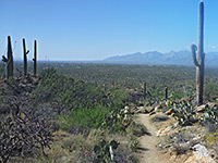
Tanque Verde Ridge Trail
★★★★★
★★★★★
11 miles, 3,900 feet
Main route into the high elevation backcountry, climbing steadily through several vegetation zonesSaguaro Wildflowers
Wildflowers
Photographs and descriptions of flowering plants found in Saguaro National Park, including cacti
Photographs and descriptions of flowering plants found in Saguaro National Park, including cacti
Saguaro - Nearby Places
- Coronado National Memorial (81 miles S of Tucson) - historic mountains bordering Mexico
- Ironwood Forest National Monument (25 miles W of Tucson) - mountainous part of the Sonoran Desert
Saguaro - Similar Places
- Cabeza Prieta National Wildlife Refuge - hottest and most remote desert region in Arizona
- Kofa Wildlife Refuge - desert region with a distinct sense of isolation
- Sonoran Desert National Monument - saguaro wilderness southwest of Phoenix
All Contents © Copyright The American Southwest | Comments and Questions | Contribute | Affiliate Marketing Disclosure | Site Map