Signal Hill Trail, Saguaro National Park
Arizona > Saguaro National Park > West > Hiking > Signal Hill Trail
Signal Hill Trail
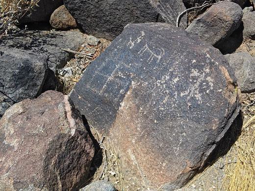
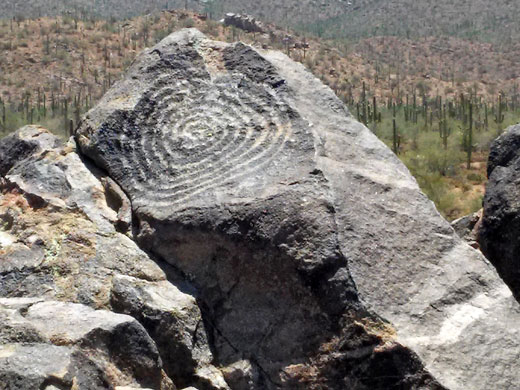
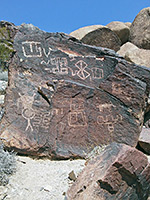
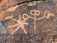
Very short path to a low summit covered with dark igneous boulders, on which are carved dozens of petroglyphs, dating from the Hohokam period of the 13 and 14th centuries. The summit also has excellent views over the surrounding deserts
Length: 0.2 miles
Elevation change: 50 feet
Difficulty: Easy
Type: One way
Usage: Medium to high
Season: All year
Trailhead: Parking/picnic area at the end of a spur off Golden Gate Road
Rating (1-5): ★★★★★
Elevation change: 50 feet
Difficulty: Easy
Type: One way
Usage: Medium to high
Season: All year
Trailhead: Parking/picnic area at the end of a spur off Golden Gate Road
Rating (1-5): ★★★★★

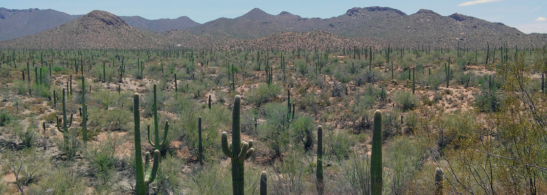
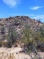
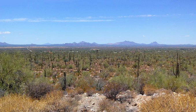
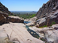
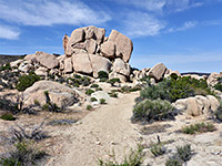
Signal Hill is a minor summit in the northwest corner of the Tucson Mountain district of Saguaro National Park, rising just 50 feet above the surrounding, gently sloping plains, and is mostly covered by large boulders of granodiorite, an igneous rock similar to granite. The top of the hill has excellent views, extending over 20 miles in some directions, but the main point of interest here are dozens of petroglyphs carved on the surface of the grey and brown rocks, dating from the Hohokam period that peaked in the 13th and 14th centuries, possibly left here during hunting expeditions, as the low hill would have enabled a place to hide when looking out for prey.
Information about the Hohokam, and the local area, is given by interpretive notices along the way, and although the place can be visited in just 20 minutes or so, continuation hikes are possible along the linked Cactus Wren Trail. Most people just walk to the summit, however, and perhaps enjoy lunch at the adjacent picnic area.
Map of the west section of Saguaro National Park.
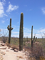
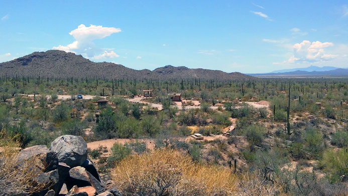
The trailhead for the Signal Hill and Cactus Wren trails is at the north end of a short spur off Golden Gate Road; both routes are unpaved, but good for all vehicles. The spur crosses fairly open, flattish land covered by the usual range of cacti including a fair few saguaro, ending in a loop parking area with restrooms and picnic tables, some covered. Signal Hill can be seen close by to the north, rising above a line of palo verde trees.
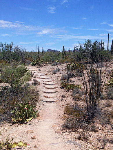
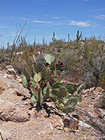
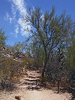
Two trails leave from the north side of the parking area, descending slightly via some rock steps, alongside stony ground covered with opuntia, cholla and ocotillo. One of the paths passes another picnic ramada and then joins the other, just before crossing of a gravelly wash, usually bone dry. More steps on the far side take the trail to the base of the hill, and around the east face to a railing-protected viewing area on the north side, where many petroglyphs are in view. Several notices encourage visitors not to leave the path in order to protect the inscriptions. Many of the designs are faint due to centuries of weathering, but a reasonable number are crisp and legible. Designs are mostly animals, plants, human-like figures and geometric shapes, including several intricate spirals. Also often glimpsed hereabouts are rattlesnakes, as the cool crevices between the boulders are ideal habitat.
Signal Hill is a popular destination, but few hikers continue beyond, along the Cactus Wren Trail which forks off to the north just before the summit of the hill; a sign gives distances as Encinas Trail 0.9 miles, Manville Trail 1.3 miles, and Rudasill Road access 1.7 miles. Another junction is passed soon after the start of the Cactus Wren Trail, with the southern end of the Manville Trail, while the main path proceeds northwards, over sandy flats and a number of dry washes, eventually leading to the monument boundary along Sandario Road, by the junction with Rudasill Road. From here, the 2.5 mile Manville Trail provides an alternative route back, and both routes intersect the Encinas Trail, which allows a shorter loop, 3 miles instead of 4.5 miles. However, the views along the paths are little changing, and the west side of the loop is close to Sandario Road and so affected by traffic noise; trails further east, nearer the Tucson Mountains, offer a better option for longer hikes in this section of the national monument.
Information about the Hohokam, and the local area, is given by interpretive notices along the way, and although the place can be visited in just 20 minutes or so, continuation hikes are possible along the linked Cactus Wren Trail. Most people just walk to the summit, however, and perhaps enjoy lunch at the adjacent picnic area.
Location
Map of the west section of Saguaro National Park.
Signal Hill Trailhead
The trailhead for the Signal Hill and Cactus Wren trails is at the north end of a short spur off Golden Gate Road; both routes are unpaved, but good for all vehicles. The spur crosses fairly open, flattish land covered by the usual range of cacti including a fair few saguaro, ending in a loop parking area with restrooms and picnic tables, some covered. Signal Hill can be seen close by to the north, rising above a line of palo verde trees.

Signal Hill Trail
Two trails leave from the north side of the parking area, descending slightly via some rock steps, alongside stony ground covered with opuntia, cholla and ocotillo. One of the paths passes another picnic ramada and then joins the other, just before crossing of a gravelly wash, usually bone dry. More steps on the far side take the trail to the base of the hill, and around the east face to a railing-protected viewing area on the north side, where many petroglyphs are in view. Several notices encourage visitors not to leave the path in order to protect the inscriptions. Many of the designs are faint due to centuries of weathering, but a reasonable number are crisp and legible. Designs are mostly animals, plants, human-like figures and geometric shapes, including several intricate spirals. Also often glimpsed hereabouts are rattlesnakes, as the cool crevices between the boulders are ideal habitat.
Other Trails
Signal Hill is a popular destination, but few hikers continue beyond, along the Cactus Wren Trail which forks off to the north just before the summit of the hill; a sign gives distances as Encinas Trail 0.9 miles, Manville Trail 1.3 miles, and Rudasill Road access 1.7 miles. Another junction is passed soon after the start of the Cactus Wren Trail, with the southern end of the Manville Trail, while the main path proceeds northwards, over sandy flats and a number of dry washes, eventually leading to the monument boundary along Sandario Road, by the junction with Rudasill Road. From here, the 2.5 mile Manville Trail provides an alternative route back, and both routes intersect the Encinas Trail, which allows a shorter loop, 3 miles instead of 4.5 miles. However, the views along the paths are little changing, and the west side of the loop is close to Sandario Road and so affected by traffic noise; trails further east, nearer the Tucson Mountains, offer a better option for longer hikes in this section of the national monument.
Signal Hill Trail - Similar Hikes
All Contents © Copyright The American Southwest | Comments and Questions | Contribute | Affiliate Marketing Disclosure | Site Map