The American Southwest
Home | Parks | Trails | Plants | Canyons
Maps | Landscapes | Site Map | Whats New? |
More...
Follow americansouthwest.net on Facebook
×
General Pages
Home
Parks
Trails
Plants
Slot Canyons
Maps
Landscapes
Itineraries
Site Map
What's New?
More pages...

States
Arizona
California
Colorado
Idaho
Nevada
New Mexico
Oregon
Texas
Utah
Wyoming


ARIZONA
CALIFORNIA
COLORADO
IDAHO
NEVADA
NEW MEXICO
OREGON
TEXAS
UTAH
WYOMING
ARIZONA
MAPS | PARKS | TRAILS | HOTELS

Map of the Tucson Mountain District, Saguaro National Park


Arizona > Saguaro National Park > West > Map
Map of the Tucson Mountain District, Saguaro National Park


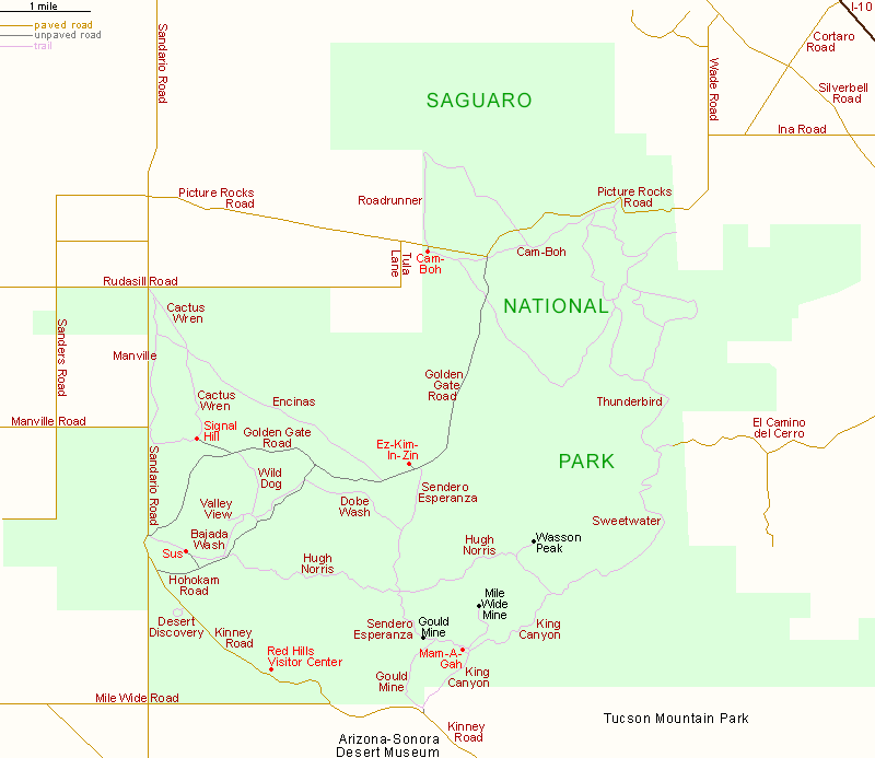
Access routes to the Tucson Mountain District of Saguaro National Park are Picture Rocks Road from Tucson and I-10, Kinney Road from the southeast and Sandario Road from the west.

PDFPDF format map of the Tucson Mountain district, from the National Park Service.

Map of the Rincon Mountain District

Back to Top
Arizona | California | Colorado | Idaho | Nevada | New Mexico | Oregon | Texas | Utah | Wyoming | Slot Canyons | Travelogue | SOUTHWEST

All Contents © Copyright The American Southwest | Comments and Questions | Contribute | Affiliate Marketing Disclosure | Site Map