Loma Verde and Squeeze Pen Trails, Saguaro National Park
Arizona > Saguaro National Park > East > Hiking > Loma Verde and Squeeze Pen Trails
Loma Verde and Squeeze Pen Trails
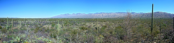
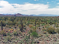
Loop through gentle terrain of small washes and low plateaus, past flourishing cacti including many giant saguaro and ferocacti, with long distance views of the surrounding mountains, especially from Pink Hill, a minor summit
Length: 3 miles
Elevation change: 120 feet
Difficulty: Easy
Type: Loop
Usage: Low to medium
Season: Best from fall to spring
Trailhead: Pull-out along the Cactus Forest Drive
Rating (1-5): ★★★★★
Elevation change: 120 feet
Difficulty: Easy
Type: Loop
Usage: Low to medium
Season: Best from fall to spring
Trailhead: Pull-out along the Cactus Forest Drive
Rating (1-5): ★★★★★

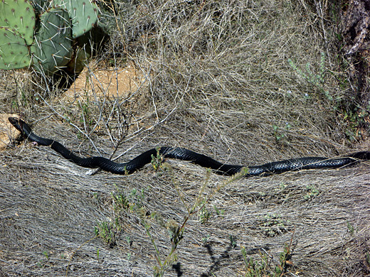
The Mica View Trail offers a good introduction to the lowland scenery of Saguaro National Park's Rincon Mountain district, but for a more peaceful and varied hike, a better choice is one of the loops further east, such as the 3 mile circuit of the Loma Verde, Pink Hill and Squeeze Pen trails. Besides the flourishing and abundant Sonoran Desert vegetation, attractions include an old mine site, a minor summit that gives a 360 degree panoramic view, and a section of rockier, slightly higher ground right at the foot of Tanque Verde Ridge, where the plants are subtly different.
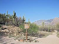
The route is relatively little used, especially the easternmost section along the Squeeze Pen Trail. The start point is at the Loma Verde trailhead, 3.5 miles along the one-way (clockwise) section of the Cactus Forest Drive. There are many junctions along trails in this region of the national park, but all are well signposted.
Map of the east section of Saguaro National Park.
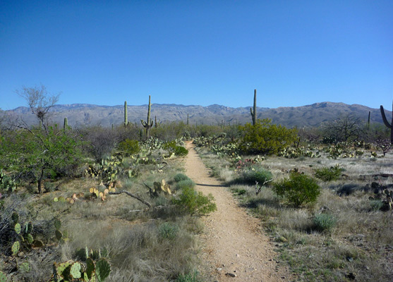
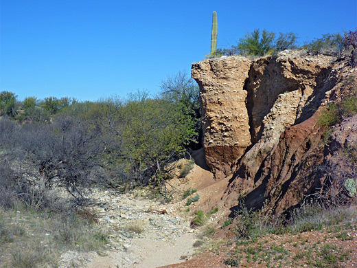
The Loma Verde ('green hill') trailhead is surrounded by mesquite woodland, mixed with large, isolated saguaros and a few aged barrel cacti (ferocactus wislizeni). The path starts off northwards, soon passing a junction on the left with the Mesquite Trail (which links with the Cactus Forest Trail after 1 mile), then descends slightly to the stony stream bed of Monument Wash. Next is a second junction, with the Squeeze Pen Trail, the return section of the loop. The Loma Verde Trail continues north across another wash which is edged in places by low conglomerate cliffs, and climbs to the plateau on the far side, where the trees are replaced by bushes and more abundant cacti. A little way further, on the left, are the remains of Loma Verde Mine (established in 1901), once site of a 350 foot shaft where copper ore was excavated, but now all that remains are a few reddish spoil heaps with occasional traces of green minerals.
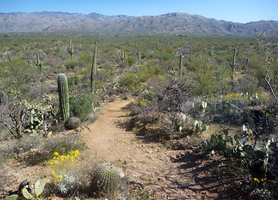
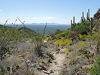
A long, straight section of the path leads to the next junction, where the Pink Hill Trail joins from the right (east); after taking this path, and staying right at another junction soon after (with the Saguaro Trail) as the ground becomes a little more undulating, the next point of interest is Pink Hill itself, reached by a short spur. This low summit gives mostly unobscured views of the surroundings, across to the Tanque Verde and Santa Catalina ranges.
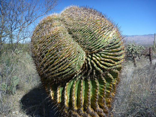
The Pink Hill Trail continues eastwards, across a big wash and a bushy area to yet another junction, with the Squeeze Pen Trail, now close to the edge of Tanque Verde Ridge. Turning south, the path runs along the foothills, where vegetation includes ocotillo, reflecting the slightly higher elevation and better drainage. Another point of interest is an unusual cristate ferocactus, just off trail to the west. Towards the far end the path veers westwards, now through grassier, less rocky and more wooded terrain, the trees sheltering a sprinkling of very large, healthy, multi-branched saguaros. The land drops down slightly to a wash and meets the south end of the Loma Verde Trail, 0.2 miles from the start point along Cactus Forest Drive.
The route is relatively little used, especially the easternmost section along the Squeeze Pen Trail. The start point is at the Loma Verde trailhead, 3.5 miles along the one-way (clockwise) section of the Cactus Forest Drive. There are many junctions along trails in this region of the national park, but all are well signposted.
Location
Map of the east section of Saguaro National Park.
Loma Verde Trail
The Loma Verde ('green hill') trailhead is surrounded by mesquite woodland, mixed with large, isolated saguaros and a few aged barrel cacti (ferocactus wislizeni). The path starts off northwards, soon passing a junction on the left with the Mesquite Trail (which links with the Cactus Forest Trail after 1 mile), then descends slightly to the stony stream bed of Monument Wash. Next is a second junction, with the Squeeze Pen Trail, the return section of the loop. The Loma Verde Trail continues north across another wash which is edged in places by low conglomerate cliffs, and climbs to the plateau on the far side, where the trees are replaced by bushes and more abundant cacti. A little way further, on the left, are the remains of Loma Verde Mine (established in 1901), once site of a 350 foot shaft where copper ore was excavated, but now all that remains are a few reddish spoil heaps with occasional traces of green minerals.
Pink Hill Trail
A long, straight section of the path leads to the next junction, where the Pink Hill Trail joins from the right (east); after taking this path, and staying right at another junction soon after (with the Saguaro Trail) as the ground becomes a little more undulating, the next point of interest is Pink Hill itself, reached by a short spur. This low summit gives mostly unobscured views of the surroundings, across to the Tanque Verde and Santa Catalina ranges.
Squeeze Pen Trail
The Pink Hill Trail continues eastwards, across a big wash and a bushy area to yet another junction, with the Squeeze Pen Trail, now close to the edge of Tanque Verde Ridge. Turning south, the path runs along the foothills, where vegetation includes ocotillo, reflecting the slightly higher elevation and better drainage. Another point of interest is an unusual cristate ferocactus, just off trail to the west. Towards the far end the path veers westwards, now through grassier, less rocky and more wooded terrain, the trees sheltering a sprinkling of very large, healthy, multi-branched saguaros. The land drops down slightly to a wash and meets the south end of the Loma Verde Trail, 0.2 miles from the start point along Cactus Forest Drive.
Loma Verde and Squeeze Pen Trails - Similar Hikes
All Contents © Copyright The American Southwest | Comments and Questions | Contribute | Affiliate Marketing Disclosure | Site Map