Highlights:
Popular park containing a section of the Superstition Mountain foothills bordering Apache Junction, offering a campground, picnic area and a few short trails into the saguaro desert landscapes
Nearby town:
Apache Junction, 4 miles
Management:
Arizona State Parks. Trails continue into USFS land
Location:
Seasons:
Winter, spring and fall are best, as summers are very hot
Rating (1-5):
★★★★★
Weather:


Featured Hotel
Best Western Apache Junction Inn
 Popular, affordable hotel built in the traditional Southwest adobe style, along the Apache Trail just six miles from the entrance to the state park
Check Rates
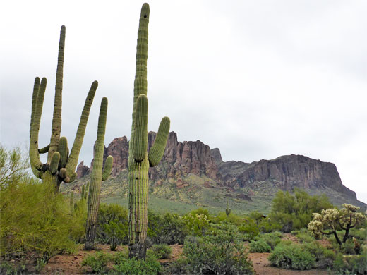
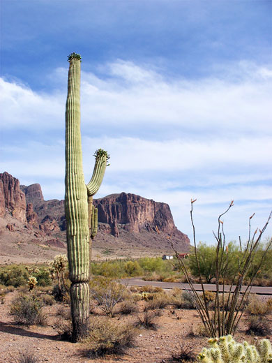
On the east side of Apache Junction, and right at the edge of the greater Phoenix metropolis, Lost Dutchman State Park is an ideal place to first experience the plants and wildlife of the Sonoran Desert. Although the saguaro-studded scenery is no different to the untouched desert on either side, the park has a few easy trails, picnic areas and a campground - a nice place for an overnight stay, and useful since primitive camping is not allowed on land bordering the nearby Apache Trail through the Tonto National Forest, at least not along the paved part of that road.
Lost Dutchman is named after a legendary gold mine, supposedly started by a local family in 1840, and then developed by a Dutch immigrant (Jacob Waltz), who left no records of its location. Many people have tried but failed to find the mine and nearby caches of gold, all of which are believed to be somewhere around Weaver's Needle, in the Superstition Mountains a few miles east of the state park.
Lost Dutchman is named after a legendary gold mine, supposedly started by a local family in 1840, and then developed by a Dutch immigrant (Jacob Waltz), who left no records of its location. Many people have tried but failed to find the mine and nearby caches of gold, all of which are believed to be somewhere around Weaver's Needle, in the Superstition Mountains a few miles east of the state park.
Lost Dutchman Table of Contents
- Map of Lost Dutchman State Park
- Photographs
- The state park
- Tours of the Apache Trail
- Trails of Lost Dutchman State Park
- Siphon Draw Trail; best hike in the park
- Nearby places
- Similar places
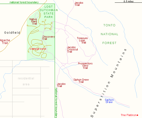
Map of Lost Dutchman State Park
Photographs
14 views of Lost Dutchman State Park.
The State Park
Lost Dutchman State Park is located along AZ 88, the Apache Trail, 5 miles northeast of the junction with US 60 (the Superstition Highway), and is almost the last developed site before the national forest boundary. Just opposite is the restored but overly commercial 'ghost town' of Goldfield. Entry to the state park (2024) is $10 per vehicle, or $7 in summer (June to late September), when the hotter temperatures discourage most tourists. The visitor center is unmanned during this period. The short park road soon forks - left are the Saguaro and Cholla day use areas, each with shaded picnic tables and rest rooms; right is the 69 site campground.
Apache Trail Tours
Trails of Lost Dutchman State Park
Several easy, intersecting trails cross the small park, and extend into the neighboring national forest so all are numbered according to the Tonto NF route system with the exception of the short Discovery Trail, a self-guiding 0.5 mile nature path with a few informative notices. Others are 2.4 mile Treasure Loop, #56, that ascends 500 feet into the foothills, and Prospector's View, #57, a 0.7 mile route connecting #56 with #53, the Siphon Draw Trail, which climbs much higher into the mountains.
Siphon Draw Trail
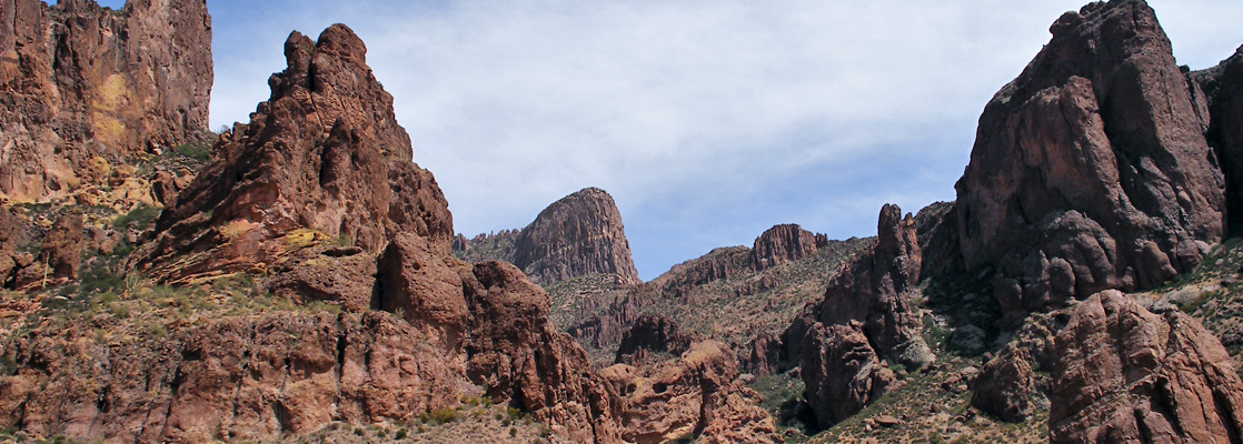
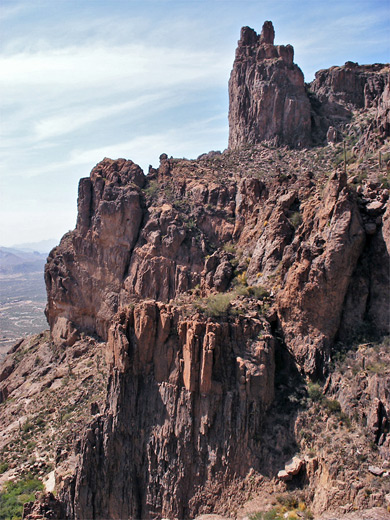
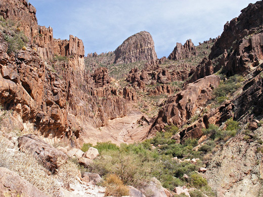
The Siphon Draw Trail passes the best scenery. The first part is along the Discovery Trail then the route turns southeast, passing close to the campground and some houses from a residential area, and begins to climb into the foothills of the Superstition Mountains, as the gradient gradually increases. It passes through two gates, one marking the boundary of the state park, the next, after two other paths (the Jacobs Trail) branch off, the start of the Superstition Wilderness. The cactus forest fades away above 2,100 feet, replaced by open, grassy slopes which become rockier at the edge of the mountains and the mouth of the enclosed section of Siphon Draw. The path then follows close to the north side of the streamway, winding between large boulders, as the cliffs draw in - mostly bare rock but with scattered saguaro growing in crevices. The streamway becomes overgrown around an intermittent spring that marks the end of the main trail, from where the view extends for many miles over the parallel streets of Apache Junction, across to the Goldfield Mountains and upwards to the weathered rocks of the Superstitions, which become increasing jagged higher up. This point is 1,000 feet above the trailhead. Just above the end of the path is an unusual slickrock bowl ('The Basin'), formed at the junction of two drainages. The curved rock walls enclosing the basin rise to higher cliffs to the north, east and south, and it is easy enough to climb above, and follow a choice of routes further uphill. One target is The Flatiron, a summit 1,800 feet higher, so a walk here would be a strenuous all day hike, and not recommended in summer, but the well trodden path to the basin is fine all year.
Lost Dutchman - Nearby Places
- Fish Creek (20 miles) - watery canyon in the Superstition Mountains
- Tonto National Monument (48 miles) - 700 year old cliff dwellings
Lost Dutchman - Similar Places
- Picacho Peak State Park - volcanic peak surrounded by cactus desert
- Sabino Canyon - permanent stream through a rocky canyon, in the foothills of the Santa Catalina Mountains
All Contents © Copyright The American Southwest | Comments and Questions | Contribute | Affiliate Marketing Disclosure | Site Map