Highlights:
Largest and most varied of Arizona's six national forests, containing Sonoran Desert plains, abundant cacti, narrow canyons, lakes and mountains up to 7,400 feet
Nearby towns:
Management:
Location:
34.229, -111.324 (Payson)
Seasons:
All year
Rating (1-5):
★★★★★

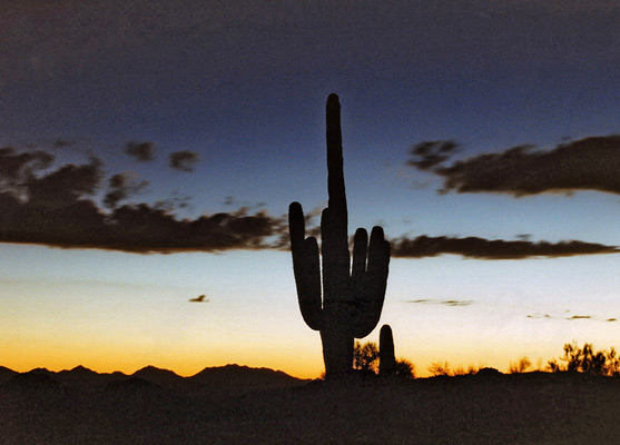
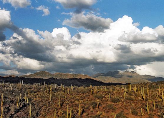
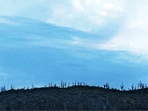
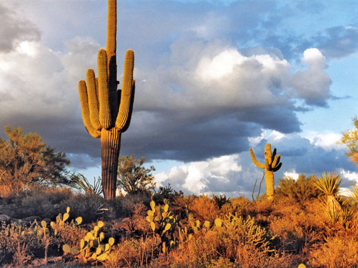
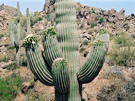
At 2,969,602 acres, Tonto is by some distance the largest of the six national forests in Arizona, and has the most interesting, diverse scenery, with terrain and elevation ranging from the Sonoran Desert (1,400 feet) to the Mogollon Rim (7,400 feet). Besides desert and mountains it contains lakes - mostly artificially created, fertile river valleys, rocky canyons and flat plains. Much of the area is covered by cacti, in particular the familiar giant saguaro, but there are also dozens of smaller species.
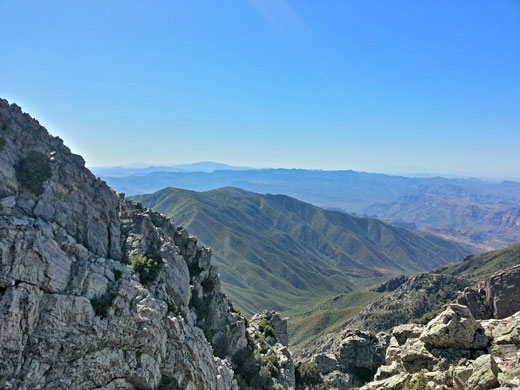
The cactus colonies merge with bushes, chaparral and grasslands above 4,000 feet, while the higher hills to the north support varied woodland habitats including juniper, mixed fir and ponderosa pine. Tonto National Forest contains eight separate wilderness areas, all of which have quite limited access as the land is generally steep and rough, without many trails, and experiences harsh weather for most of the year.
The cactus colonies merge with bushes, chaparral and grasslands above 4,000 feet, while the higher hills to the north support varied woodland habitats including juniper, mixed fir and ponderosa pine. Tonto National Forest contains eight separate wilderness areas, all of which have quite limited access as the land is generally steep and rough, without many trails, and experiences harsh weather for most of the year.
Tonto National Forest Table of Contents
Photographs
18 general views of the Tonto National Forest.
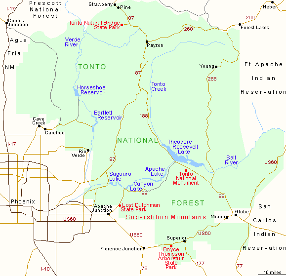
Tonto National Forest Boundaries
To the southwest, the Tonto National Forest boundary follows close to the edge of the Superstition and New River Mountains - beyond stretches the low, flat desert, the ever-expanding city of Phoenix and the 'Valley of the Sun'. From Phoenix, I-17 runs north through the Agua Fria River valley, with the edge of the forest a few miles to the east; this extends for about 40 miles, past Agua Fria National Monument as far as Cordez Junction. Tonto is then bordered to the north by the Prescott, Coconino and Apache-Sitgreaves National Forests, and to the east by the Fort Apache and San Carlos Indian Reservations. The northern boundary is defined by the Mogollon Rim, a 2,000 to 3,000 foot high escarpment that forms the southern edge of the great Colorado Plateau, which stretches for over 100 miles across central Arizona.
Roads in the Tonto National Forest
Few paved roads penetrate this vast area; just AZ 260 across the north, US 60 across the south, AZ 87 from Phoenix to Payson and AZ 188 from Globe to AZ 87. There are a selection of lesser roads, most well known being the Apache Trail between Mesa and Theodore Roosevelt Lake, through the Superstition Mountains. Roosevelt is the largest of the man made lakes; others are the Saguaro, Canyon and Apache Lakes, Bartlett and Horseshoe Reservoirs.
Tonto National Forest - Hiking
Camp Creek Falls Trail
★★★★★
★★★★★
1.4 miles, 380 feet
Short hike down a tributary (Blue Wash) and upstream along Camp Creek to a seasonal waterfall, over granite cliffs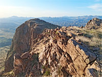
Picketpost Mountain
★★★★★
★★★★★
2.3 miles, 1,980 feet
Ascent of an isolated, desert peak, initially along a trail, through the grassy foothills, then a difficult scrambling route
Sears-Kay Ruins
★★★★★
★★★★★
1 mile, 220 feet (loop)
Hike past rocky outcrops and scattered saguaro cacti to the fragmentary remains of an 11th century Hohokam settlementPlaces of Interest in the Tonto National Forest
- Apache Trail - dramatic, partly unpaved road through the Superstition Mountains, from Phoenix to Roosevelt Lake
- Bartlett Reservoir - artificial lake surrounded by pristine desert and mountain scenery
- Boyce Thompson Arboretum - 323 acre botanical gardens near Superior, containing many desert plants and other species from across the world
- Lost Dutchman State Park - small section of the Superstition Mountain foothills bordering Apache Junction
- Superstition Mountains - rugged hills east of Phoenix, crossed by many hiking trails
- Theodore Roosevelt Lake - desert lake along Tonto Creek and the Salt River, in the hills northeast of Phoenix
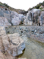
- Tonto Creek - beautiful desert stream through a rugged canyon
- Tonto National Monument - two well-preserved cliff dwellings high above Roosevelt Lake
- Tonto Natural Bridge State Park - largest travertine bridge in the world
All Contents © Copyright The American Southwest | Comments and Questions | Contribute | Affiliate Marketing Disclosure | Site Map