Picketpost Mountain Trail, Tonto National Forest
Arizona > Tonto National Forest > Picketpost Mountain Trail
Picketpost Mountain
Ascent of an isolated, desert peak, initially along a trail, through the grassy foothills, then a difficult scrambling route, up to the extensive summit plateau, and across to the highpoint on the far side
Length: 2.3 miles
Elevation change: 1,980 feet
Difficulty: Strenuous
Type: One way; in places a route rather than a trail
Usage: Medium
Season: Fall, winter, spring
Trailhead: Parking area along Saddleridge Trail, 1.1 miles from US 60
Rating (1-5): ★★★★★
Elevation change: 1,980 feet
Difficulty: Strenuous
Type: One way; in places a route rather than a trail
Usage: Medium
Season: Fall, winter, spring
Trailhead: Parking area along Saddleridge Trail, 1.1 miles from US 60
Rating (1-5): ★★★★★

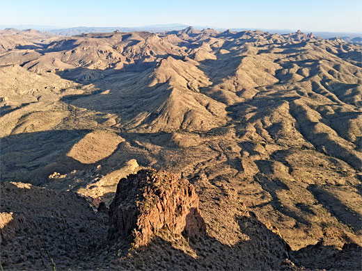
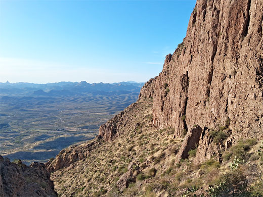
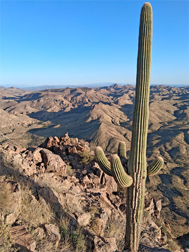
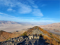
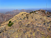
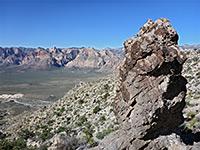
Picketpost Mountain is an isolated peak near the south edge of the Tonto National Forest, close to Superior along US 60, and it has a flat summit almost half a mile across, the high point 4,375 feet, rising 2,000 feet above the desert surroundings, so the views from the top are very extensive; to the Superstition Mountains in the north, west to Phoenix and the Valley of the Sun, and south across countless lesser hills to the Catalina Mountains near Tucson. The peak was originally known as Tordillo Mountain, renamed after the establishment of a military picket post camp at its base, in 1870.
A maintained path, 7 miles, circles all around the mountain, while the summit may be reached by a strenuous hike of 2.3 miles, climbing 1,980 feet, initially on a recognisable trail, later a scrambling route, up many little cliffs and gullies, where the way ahead is marked by red or yellow arrows painted on the bedrock, as it would otherwise not be obvious. A path resumes on the summit plateau, crossing to the highpoint on the far side.
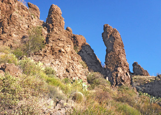
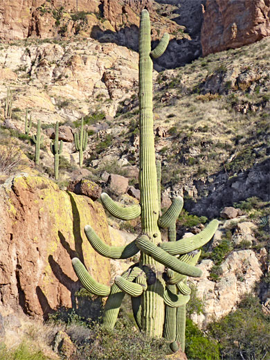
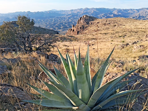
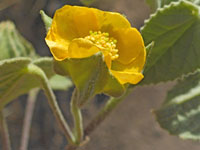
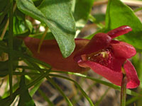
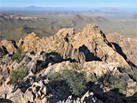
The route is similar to the Flatiron in the Superstition Mountains; both are considered amongst the top hikes in Arizona. Vegetation is typical of the Sonoran Desert, with plenty of cacti including saguaro, growing all across the slopes and at the summit. Rocks of most of the foothills are light-colored tuff, while the summit plateau and the upper slopes are composed of quartz latite.
The hike to Picketpost Mountain, and other places, starts from a large parking area just south of US 60, reached by a drive of 1.1 miles on a smooth dirt road (Uno Trail/Saddleridge Trail). This location is 2 miles from Boyce Thompson Arboretum, one of the best places in the country to view desert plants. It seems that free primitive camping is allowed at the trailhead, and along the nearby tracks. All this area is grazed by cattle.
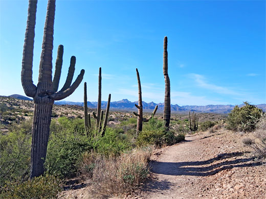
A sign at the parking place lists various hiking destinations, with distances, though not the peak, since that lies along an unofficial route. The main path, passing through from north to south, is the cross-state Arizona Trail, and the Picketpost hike begins along here, to the south; over a dry wash, keeping right at a junction then left at the next intersection soon after, at the start of the route to the peak, where the path starts to climb, through grassy hills sprinkled with large saguaro. The trail switchbacks to a ridge/saddle, briefly level again, passing through a grove of teddy bear cholla. It follows the ridgeline, ascending once more, into rockier terrain where the first yellow trail marker appears.
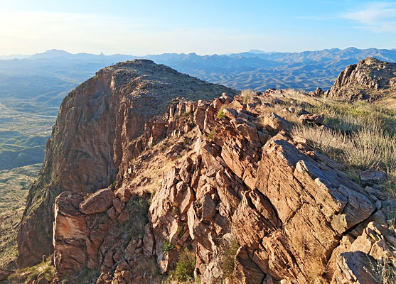
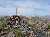
Soon after is the first bare rockface to climb, followed by a stony slope, after which the path cuts right a way, to the south, towards a sheer cliff on the far side of a boulder-filled ravine. The path climbs several more steep rocky places, later moving slightly away from the cliff, up another slickrock slope, a natural water chute in wet weather, then into an area of loose stones, followed by bushier terrain, now towards the upper end of the ravine. The gradient gradually lessens as the trail leads up a shallower valley, to the flat mountaintop, continuing southeast over the plateau for half a mile to the high point, on the south side. The long-distance views are framed by few saguaro growing right on the rim, here close to the upper limit of their elevation range.
A maintained path, 7 miles, circles all around the mountain, while the summit may be reached by a strenuous hike of 2.3 miles, climbing 1,980 feet, initially on a recognisable trail, later a scrambling route, up many little cliffs and gullies, where the way ahead is marked by red or yellow arrows painted on the bedrock, as it would otherwise not be obvious. A path resumes on the summit plateau, crossing to the highpoint on the far side.
The route is similar to the Flatiron in the Superstition Mountains; both are considered amongst the top hikes in Arizona. Vegetation is typical of the Sonoran Desert, with plenty of cacti including saguaro, growing all across the slopes and at the summit. Rocks of most of the foothills are light-colored tuff, while the summit plateau and the upper slopes are composed of quartz latite.
Trailhead
The hike to Picketpost Mountain, and other places, starts from a large parking area just south of US 60, reached by a drive of 1.1 miles on a smooth dirt road (Uno Trail/Saddleridge Trail). This location is 2 miles from Boyce Thompson Arboretum, one of the best places in the country to view desert plants. It seems that free primitive camping is allowed at the trailhead, and along the nearby tracks. All this area is grazed by cattle.
Start of the Hike
A sign at the parking place lists various hiking destinations, with distances, though not the peak, since that lies along an unofficial route. The main path, passing through from north to south, is the cross-state Arizona Trail, and the Picketpost hike begins along here, to the south; over a dry wash, keeping right at a junction then left at the next intersection soon after, at the start of the route to the peak, where the path starts to climb, through grassy hills sprinkled with large saguaro. The trail switchbacks to a ridge/saddle, briefly level again, passing through a grove of teddy bear cholla. It follows the ridgeline, ascending once more, into rockier terrain where the first yellow trail marker appears.
The Summit
Soon after is the first bare rockface to climb, followed by a stony slope, after which the path cuts right a way, to the south, towards a sheer cliff on the far side of a boulder-filled ravine. The path climbs several more steep rocky places, later moving slightly away from the cliff, up another slickrock slope, a natural water chute in wet weather, then into an area of loose stones, followed by bushier terrain, now towards the upper end of the ravine. The gradient gradually lessens as the trail leads up a shallower valley, to the flat mountaintop, continuing southeast over the plateau for half a mile to the high point, on the south side. The long-distance views are framed by few saguaro growing right on the rim, here close to the upper limit of their elevation range.
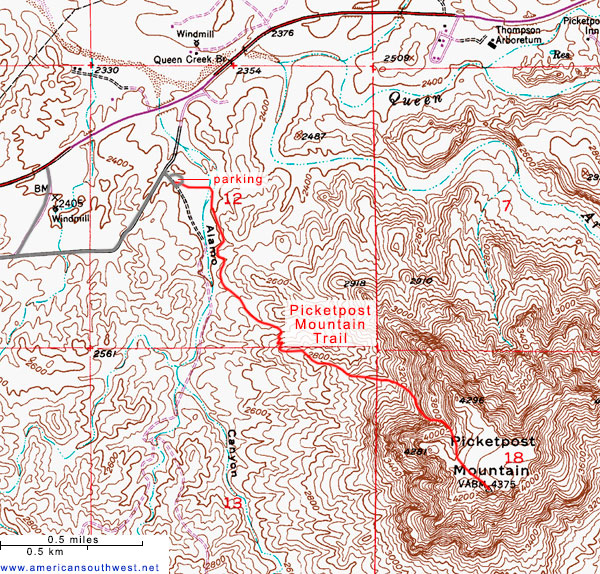
Topo Map of the Picketpost Mountain Trail

Picketpost Mountain - Similar Hikes
All Contents © Copyright The American Southwest | Comments and Questions | Contribute | Affiliate Marketing Disclosure | Site Map