Mount Ajo Peak Trail, Organ Pipe Cactus National Monument
Arizona > Organ Pipe Cactus National Monument > Mount Ajo Peak
Mount Ajo Peak Trail
Unofficial continuation trail from Bull Pasture to the highest peak in the park, ascending steeply over colorful, rocky volcanic slopes, then following a ridge to the summit
Length: 4 miles, including the path to Bull Pasture
Elevation change: 2,430 feet
Difficulty: Moderate to strenuous
Type: One way, partly unofficial trail
Usage: Low
Season: Fall, winter, spring; hot and exposed in summer
Trailhead: 11 miles along Ajo Mountain Drive
Rating (1-5): ★★★★★
Elevation change: 2,430 feet
Difficulty: Moderate to strenuous
Type: One way, partly unofficial trail
Usage: Low
Season: Fall, winter, spring; hot and exposed in summer
Trailhead: 11 miles along Ajo Mountain Drive
Rating (1-5): ★★★★★

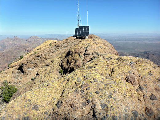
At 4 miles, the trail to the top of 4,808 foot Mount Ajo is the longest hike in Organ Pipe Cactus National Monument, and has the greatest elevation gain, 2,430 feet. The first 1.4 miles is along a maintained path, to a viewpoint at the edge of a grassy bowl, Bull Pasture, then the reminder is on a narrower, unofficial and much less traveled route which winds across the south edge of the pasture then rises steeply up successive layers of cliffs and benches to the mountain crest, which is followed northwards for a mile to the summit, site of some solar panels and communications equipment.
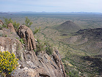
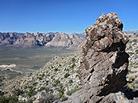
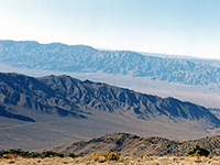
Views from top all are of course spectacular, since there are no higher peaks for many miles in all directions, and the views extend across a vast area of the Sonoran Desert including a long way south, in Mexico.
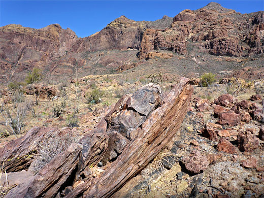
The peak has over 2,000 feet of prominence, one of 73 such summits in the state. All the rocks are volcanic, including latite, dacite, andesite, rhyolite (the most common) and tuff breccia on the summit - and are colored muted shades of red, yellow and brown, often extensively covered with lichen in bright greens and yellows.
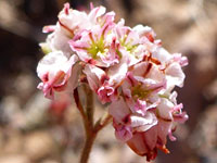
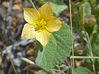
The hike should not be attempted during the hotter times of year; it is best in spring, when most of the wildflowers and cacti are in bloom.
Organ Pipe Cactus National Monument map, topographic map of Mount Ajo.
22 views of the Mount Ajo Peak Trail.
The Ajo Peak hike starts from the Estes Canyon trailhead/picnic area, about half way (11 miles) along the unpaved, one way Ajo Mountain Drive; it takes about half an hour to get here from the highway. This location is relatively popular, and there will usually be a few vehicles parked here during the day. Two paths depart to the east - to Bull Pasture and Estes Canyon, together forming a 3.5 mile loop; the Bull Pasture route is preferred if hiking to Mount Ajo, as the distance is slightly less.
The 1.4 mile path to Bull Pasture follows a short rocky ravine, ascending its northern slope, then passes over a saddle, climbing more steeply to a second ridge and finally turning south, to an open, flat area with sign and trailhead register, the end of the official trail. The continuation route, still quite evident, heads into the main part of Bull Pasture, initially descending a little, curving around the southern edge of the large grassy basin, and over a dry drainage, before turning to the northeast, still traversing relatively gentle terrain, in shadow until mid morning.
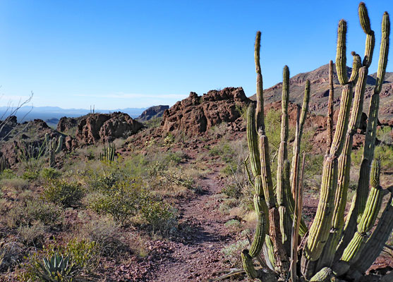
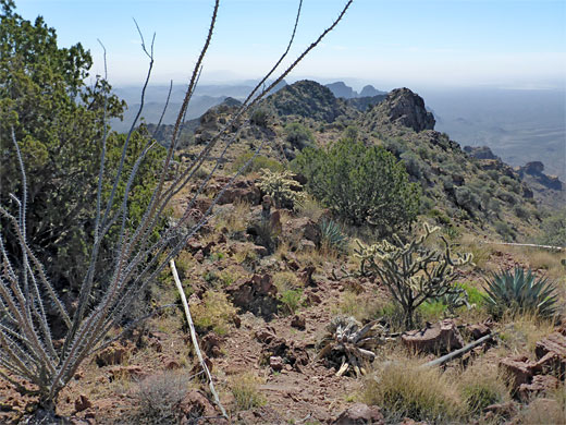
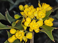
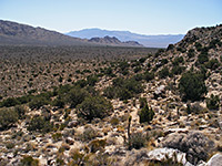
The route gradually steepens as it moves to and along the base of a towering rocky ridge, winding in and out of various little gullies, becoming rather overgrown, in places with loose rock underfoot. The bowl marks the upper elevation limit of the organ pipe cacti, while the saguaro, although fewer in number, persist a little way higher. The trail next has a two stage steeper ascent - firstly up to a saddle near a reddish rock formation, formerly an arch, then again to a second saddle, opposite a group of colorful pinnacles. After a brief descent, through an area of yellow flowered bushes (oak gooseberry and kofa barberry), the trail commences a long traverse northwards, now rising only gently over open slopes, the rocks blanketed by abundant yellow and green lichen. It crests the ridgeline, allowing the first views eastwards, over the vast empty plains of the Tohono O'odham Reservation, some of the least-visited terrain in Arizona.
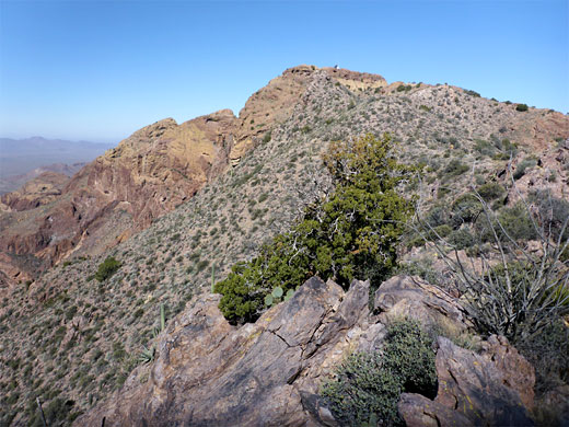
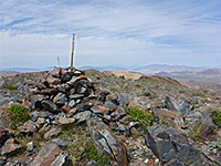
The gradient increases briefly as the trail skirts to the right of an intermediate summit, and it then stays directly on the ridgeline, passing over a minor high point, soon after curving westwards, over a bowl and up a low cliff to the Mount Ajo summit. On here is one communications tower and several other installations, all surrounded by smooth breccia rock marked with bright yellow lichen, and scattered pineapple milkweed plants. A trail register in a metal box suggests that just one or two groups per week reach this point.
Views from top all are of course spectacular, since there are no higher peaks for many miles in all directions, and the views extend across a vast area of the Sonoran Desert including a long way south, in Mexico.
The peak has over 2,000 feet of prominence, one of 73 such summits in the state. All the rocks are volcanic, including latite, dacite, andesite, rhyolite (the most common) and tuff breccia on the summit - and are colored muted shades of red, yellow and brown, often extensively covered with lichen in bright greens and yellows.
The hike should not be attempted during the hotter times of year; it is best in spring, when most of the wildflowers and cacti are in bloom.
Location
Organ Pipe Cactus National Monument map, topographic map of Mount Ajo.
Photographs
22 views of the Mount Ajo Peak Trail.
Mount Ajo Trailhead
The Ajo Peak hike starts from the Estes Canyon trailhead/picnic area, about half way (11 miles) along the unpaved, one way Ajo Mountain Drive; it takes about half an hour to get here from the highway. This location is relatively popular, and there will usually be a few vehicles parked here during the day. Two paths depart to the east - to Bull Pasture and Estes Canyon, together forming a 3.5 mile loop; the Bull Pasture route is preferred if hiking to Mount Ajo, as the distance is slightly less.

Bull Pasture
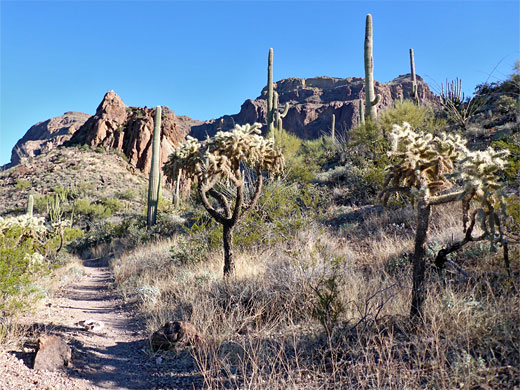
The 1.4 mile path to Bull Pasture follows a short rocky ravine, ascending its northern slope, then passes over a saddle, climbing more steeply to a second ridge and finally turning south, to an open, flat area with sign and trailhead register, the end of the official trail. The continuation route, still quite evident, heads into the main part of Bull Pasture, initially descending a little, curving around the southern edge of the large grassy basin, and over a dry drainage, before turning to the northeast, still traversing relatively gentle terrain, in shadow until mid morning.

Climb to the Mountain Crest
The route gradually steepens as it moves to and along the base of a towering rocky ridge, winding in and out of various little gullies, becoming rather overgrown, in places with loose rock underfoot. The bowl marks the upper elevation limit of the organ pipe cacti, while the saguaro, although fewer in number, persist a little way higher. The trail next has a two stage steeper ascent - firstly up to a saddle near a reddish rock formation, formerly an arch, then again to a second saddle, opposite a group of colorful pinnacles. After a brief descent, through an area of yellow flowered bushes (oak gooseberry and kofa barberry), the trail commences a long traverse northwards, now rising only gently over open slopes, the rocks blanketed by abundant yellow and green lichen. It crests the ridgeline, allowing the first views eastwards, over the vast empty plains of the Tohono O'odham Reservation, some of the least-visited terrain in Arizona.

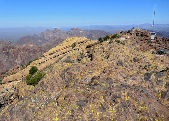
Ridgeline to the Summit
The gradient increases briefly as the trail skirts to the right of an intermediate summit, and it then stays directly on the ridgeline, passing over a minor high point, soon after curving westwards, over a bowl and up a low cliff to the Mount Ajo summit. On here is one communications tower and several other installations, all surrounded by smooth breccia rock marked with bright yellow lichen, and scattered pineapple milkweed plants. A trail register in a metal box suggests that just one or two groups per week reach this point.
Mount Ajo Peak Trail - Similar Hikes
All Contents © Copyright The American Southwest | Comments and Questions | Contribute | Affiliate Marketing Disclosure | Site Map