Ajo Mountain Drive, Organ Pipe Cactus National Monument
Arizona > Organ Pipe Cactus National Monument > Ajo Mountain Drive
Ajo Mountain Drive
Unpaved loop road, the main backcountry route in the national monument, crossing cactus flats then winding through mountain foothills. Along the way are two trailheads, for Arch Canyon and Bull Pasture
Length: 21 miles
Season: All year
Start Point: Hwy 85, near the visitor center
Season: All year
Start Point: Hwy 85, near the visitor center

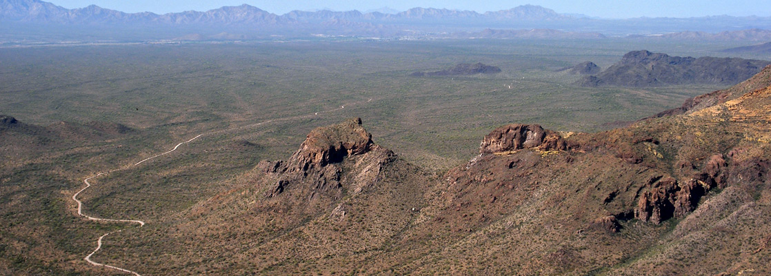
Since most of the Puerto Blanco Drive was closed in 2006, and although reopened has in the intervening years become much rougher, the main backcountry scenic route in Organ Pipe Cactus National Monument is now the Ajo Mountain Drive, a mostly unpaved loop that heads towards the foothills of the Ajo Range, the high, rocky ridge which forms the eastern boundary of the preserve.
Although only 21 miles in length the drive still takes around 90 minutes (without stops) since the road is often narrow and very bumpy - so is not recommended for RVs or caravans, but the scenery is magnificent, comprising extensive cactus plains separated by imposing volcanic mountains also covered with many and varied desert plants, all with no sign of civilisation. Two trails start along the way; the Bull Pasture/Estes Canyon loop, perhaps the best hike in the national monument, and a one mile path up a short side canyon to the base of a natural arch.
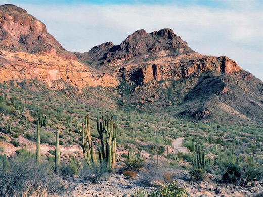
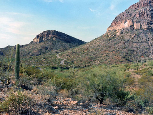
The drive starts along AZ 85 opposite the visitor center, and is two-way for a few miles then narrows and changes to one-way (clockwise) at the start of the loop section. The surface is bumpy but not too bad at first, as the road crosses a flat plain filled with countless saguaro and rather fewer organ pipes. It climbs gradually towards Diablo Canyon at the edge of the Diablo Mountains, and becomes paved for a couple of miles to ease passage over a series of short, steep, up-and-down sections across dry washes. There is one picnic area in the mountains, and another a couple of miles further at the mouth of Arch Canyon, from where begins the short path to the eponymous arch.
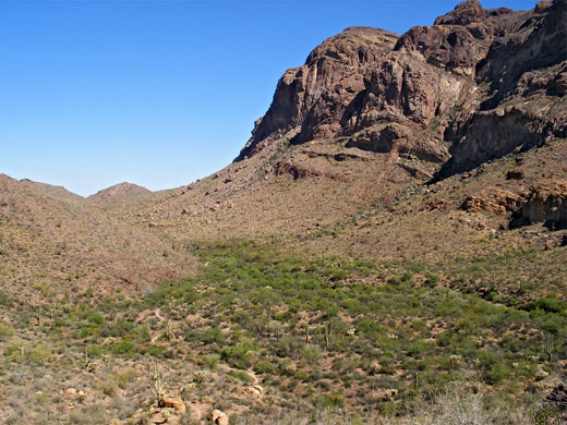
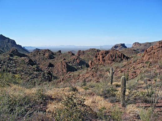
The Ajo Mountains approach to the east as the road turns due south, passes over a low ridge and reaches a third picnic area, next to Estes Canyon. The excellent loop path up to Bull Pasture begins opposite, while the remainder of the Ajo Mountain Drive follows the widening canyon further south, curves round the southern edge of the Diablo Mountains and traverses a vast plain (Sonoyta Valley) back to the start of the two-way section. This part of the route is rather rougher and more bumpy than the first half, despite being mainly straight and relatively level. The desert plain is covered by densely-growing saguaro, some particularly large, and the road has excellent views south for many miles, as far as the Cubabi Mountains in Mexico.
Although only 21 miles in length the drive still takes around 90 minutes (without stops) since the road is often narrow and very bumpy - so is not recommended for RVs or caravans, but the scenery is magnificent, comprising extensive cactus plains separated by imposing volcanic mountains also covered with many and varied desert plants, all with no sign of civilisation. Two trails start along the way; the Bull Pasture/Estes Canyon loop, perhaps the best hike in the national monument, and a one mile path up a short side canyon to the base of a natural arch.
The Road
The drive starts along AZ 85 opposite the visitor center, and is two-way for a few miles then narrows and changes to one-way (clockwise) at the start of the loop section. The surface is bumpy but not too bad at first, as the road crosses a flat plain filled with countless saguaro and rather fewer organ pipes. It climbs gradually towards Diablo Canyon at the edge of the Diablo Mountains, and becomes paved for a couple of miles to ease passage over a series of short, steep, up-and-down sections across dry washes. There is one picnic area in the mountains, and another a couple of miles further at the mouth of Arch Canyon, from where begins the short path to the eponymous arch.
Ajo Mountains
The Ajo Mountains approach to the east as the road turns due south, passes over a low ridge and reaches a third picnic area, next to Estes Canyon. The excellent loop path up to Bull Pasture begins opposite, while the remainder of the Ajo Mountain Drive follows the widening canyon further south, curves round the southern edge of the Diablo Mountains and traverses a vast plain (Sonoyta Valley) back to the start of the two-way section. This part of the route is rather rougher and more bumpy than the first half, despite being mainly straight and relatively level. The desert plain is covered by densely-growing saguaro, some particularly large, and the road has excellent views south for many miles, as far as the Cubabi Mountains in Mexico.
All Contents © Copyright The American Southwest | Comments and Questions | Contribute | Affiliate Marketing Disclosure | Site Map