Ragged Top Peak, Ironwood Forest National Monument
Arizona > Ironwood Forest National Monument > Ragged Top Peak
Ragged Top Peak
Isolated, rhyolite peak, an outlier of the Silver Bell Mountains, reached by a partly off-trail hike, across a cactus plain and up increasingly steep and rocky slopes
Length: 1.9 miles
Elevation change: 1,600 feet
Difficulty: Moderate
Type: One way
Usage: Low
Season: All year, though very hot in summer
Trailhead: Parking place along Silverbell Road, or along a lesser track to the south
Rating (1-5): ★★★★★
Elevation change: 1,600 feet
Difficulty: Moderate
Type: One way
Usage: Low
Season: All year, though very hot in summer
Trailhead: Parking place along Silverbell Road, or along a lesser track to the south
Rating (1-5): ★★★★★

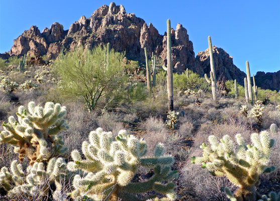
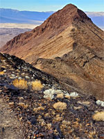
There are few maintained trails in Ironwood Forest National Monument but plenty of opportunities for off trail hiking, the obvious targets being the dozen or more peaks that rise above the desert flats. One such mountain, easy reached from Silverbell Road, is 3,907-foot Ragged Top, so-named for its irregular profile, topped by jagged pinnacles and domes of dark-colored rhyolite; a relatively isolated peak, though adjacent to a lesser hill, Wolcott Peak (3,327 feet), and close to the main section of the Silver Bell Mountains to the south.
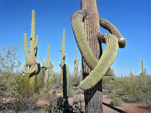
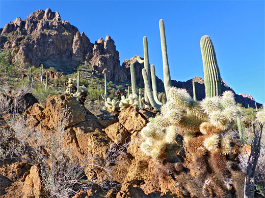
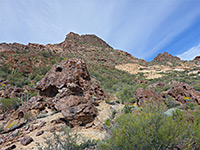
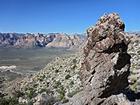
Some parts of the mountain are lined with vertical cliffs, and it looks quite imposing from afar, however a ravine on the north side provides a relatively easy route to the summit, through the rhyolite; lower down are less steep slopes, of granite and andesite, still with many rocky outcrops, and smoothly merging with the desert plains below, which are liberally covered by the common cacti of the Sonoran Desert, including many large, branched saguaro.
The hike is 1.9 miles in length, gaining 1,600 feet, starting from Silverbell Road, though high clearance vehicles can drive up to 1.4 miles south along a lesser track, making the walking distance less than a mile.
24 views along the trail.
Ironwood Forest map.
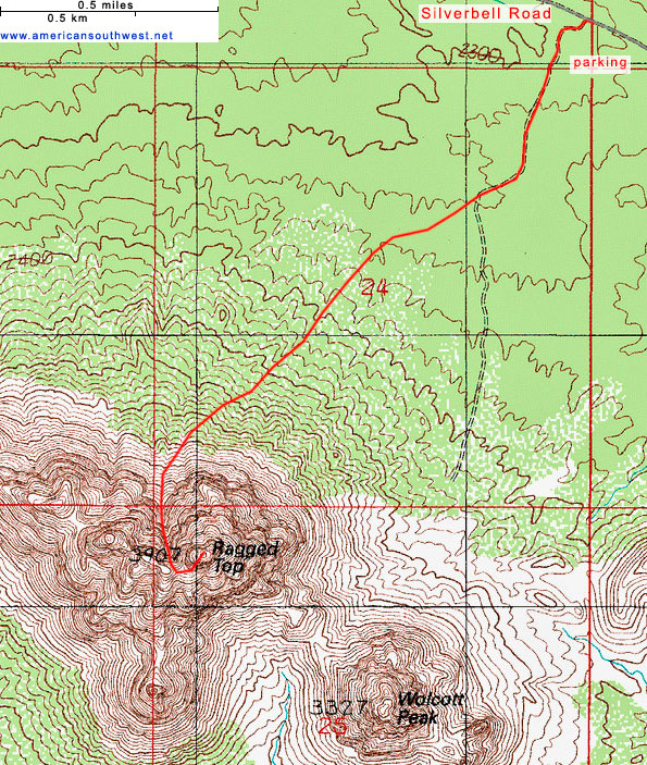
The approach to Ragged Top is from the east on Silverbell Road, which is paved until just after Red Hill Road then gravel or sand, still good for all vehicles, wide and smooth. After 3.6 miles of the unpaved section, the road passes a parking place just before a cattle grid and turn off for the narrower track to the south, which is signed as a camping area, quite popular at cooler times of the year. The hike can begin from the roadside parking place, or anywhere along the track.
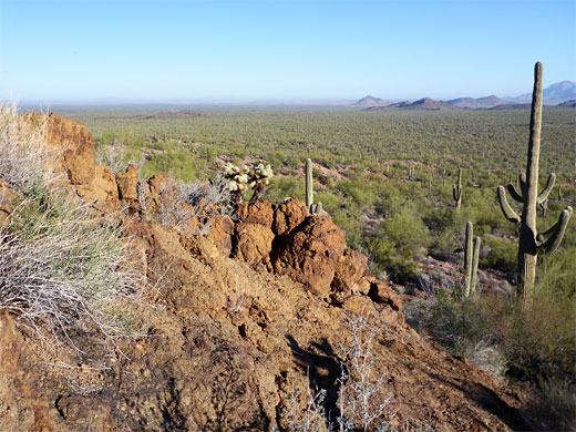
From Silverbell Road, the most direct route to the peak is along the southwards track for half a mile, to a bend, then cross country, southeastwards over gently rising terrain through many cacti, which are in general quite well separated, and there are no particular difficulties. The desert plants are large and impressive, including prickly pear, cholla, saguaro, desert ironwood and palo verde. The land rises more steeply, becoming rockier, with fewer plants, so the hike remains straightforward. Ahead, several steep, narrow ravines can be seen, through the upper parts of the mountain, and the target is the one on the west side of the central portion of the peak; an obvious gap.
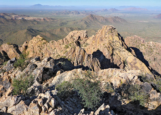
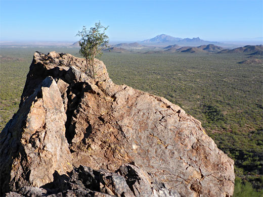
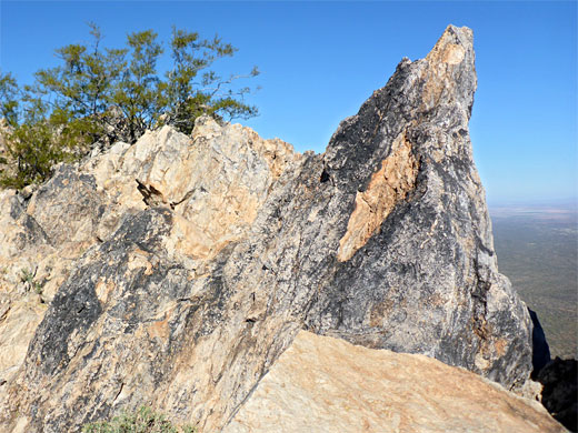
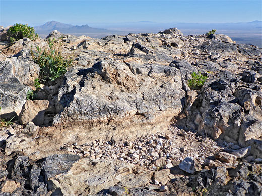
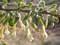
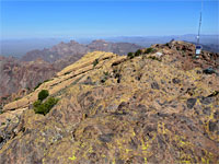
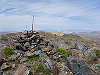
Once close to the ravine it can be seen to have two separate components, a steep and narrow gully to the left and a wider, less steep channel to the right, and that provides a course for the climb. A fairly obvious path climbs all the way, and an arrow on a cliff at one point marks a route around a minor drop off. Further up, the trail traverses a slope for a while joining another path, and then rises some more to a high saddle, close to the summit; the first place were land to the south comes into view. A final short ascent reaches the flat summit, on which is a trail register; entries suggest that only about one person per day makes the hike in cooler times of the year. The views are of course spectacular, extending over 50 miles in all directions. A few interesting wildflower species grow in crevices around the summit including pineneedle milkweed and wedgeleaf goldenbush, this being a fine example of a 'sky island', giving home to different plants to those of the lowlands.
Some parts of the mountain are lined with vertical cliffs, and it looks quite imposing from afar, however a ravine on the north side provides a relatively easy route to the summit, through the rhyolite; lower down are less steep slopes, of granite and andesite, still with many rocky outcrops, and smoothly merging with the desert plains below, which are liberally covered by the common cacti of the Sonoran Desert, including many large, branched saguaro.
The hike is 1.9 miles in length, gaining 1,600 feet, starting from Silverbell Road, though high clearance vehicles can drive up to 1.4 miles south along a lesser track, making the walking distance less than a mile.
Photographs
24 views along the trail.
Location
Ironwood Forest map.
Approach
The approach to Ragged Top is from the east on Silverbell Road, which is paved until just after Red Hill Road then gravel or sand, still good for all vehicles, wide and smooth. After 3.6 miles of the unpaved section, the road passes a parking place just before a cattle grid and turn off for the narrower track to the south, which is signed as a camping area, quite popular at cooler times of the year. The hike can begin from the roadside parking place, or anywhere along the track.
Start of the Hike
From Silverbell Road, the most direct route to the peak is along the southwards track for half a mile, to a bend, then cross country, southeastwards over gently rising terrain through many cacti, which are in general quite well separated, and there are no particular difficulties. The desert plants are large and impressive, including prickly pear, cholla, saguaro, desert ironwood and palo verde. The land rises more steeply, becoming rockier, with fewer plants, so the hike remains straightforward. Ahead, several steep, narrow ravines can be seen, through the upper parts of the mountain, and the target is the one on the west side of the central portion of the peak; an obvious gap.
The Summit
Once close to the ravine it can be seen to have two separate components, a steep and narrow gully to the left and a wider, less steep channel to the right, and that provides a course for the climb. A fairly obvious path climbs all the way, and an arrow on a cliff at one point marks a route around a minor drop off. Further up, the trail traverses a slope for a while joining another path, and then rises some more to a high saddle, close to the summit; the first place were land to the south comes into view. A final short ascent reaches the flat summit, on which is a trail register; entries suggest that only about one person per day makes the hike in cooler times of the year. The views are of course spectacular, extending over 50 miles in all directions. A few interesting wildflower species grow in crevices around the summit including pineneedle milkweed and wedgeleaf goldenbush, this being a fine example of a 'sky island', giving home to different plants to those of the lowlands.
Topo Map of Ragged Top Peak
Ragged Top Wildflowers
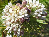 Pineneedle milkweed |
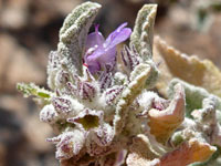 Desert lavender |
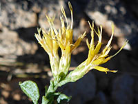 Wedgeleaf goldenbush |
 Arizona desert-thorn |
Ragged Top - Similar Hikes
All Contents © Copyright The American Southwest | Comments and Questions | Contribute | Affiliate Marketing Disclosure | Site Map